Turnagain Pass Avalanche Forecast
|
![]() ![]() |
The avalanche danger is MODERATE above 1,000′ on all aspects. Human triggered avalanches remain possible. Watch for shallow wind slabs on wind loaded slopes and cross-loaded gullies. Additionally, weak layers deeper in the snowpack may still be triggered, creating a larger avalanche. Evaluate snow and terrain carefully.
The danger is LOW below 1,000′ where triggering an avalanche is unlikely.
Signal Word | Size (D scale) | Simple Descriptor |
Small | 1 | Unlikely to bury a person |
Large | 2 | Can bury a person |
Very Large | 3 | Can destroy a house |
Historic | 4 & 5 | Can destroy part or all of a village |
Triggering a large persistent slab avalanche up to 2′ or more in depth remains possible across the region today. Below the storm snow and recent wind crusts/slabs sits the Jan 21st buried surface hoar that we have been talking about for a few weeks. This layer is roughly 1-2′ below the surface. With the recent wind and snowfall adding stress, a person skiing or on a machine may tip the balance and initiate a larger slab avalanche. Triggering a smaller wind slab or a cornice fall may also activate this layer. The snowpack is now at a point where no signs of instability are likely to be present before one of these avalanches is triggered. Assessing the terrain and the potential outcome of an avalanche breaking deeper in the pack is key. Are there terrain traps below you? Cliffs? Are your partners watching and rescue ready?
Snowpit near the Johnson Pass area that clearly shows the January 21st buried surface hoar.
Snowmachine triggered avalanche observed in the Johnson Pass area that likely occurred in the last week.
Signal Word | Size (D scale) | Simple Descriptor |
Small | 1 | Unlikely to bury a person |
Large | 2 | Can bury a person |
Very Large | 3 | Can destroy a house |
Historic | 4 & 5 | Can destroy part or all of a village |
Monday night and Tuesday morning, North and West winds wreaked havoc on much of the terrain around Turnagain, Summit Lake, Portage and the Girdwood Valley. Wind scalloped many snow surfaces, scoured some ridgelines to the rocks and sastrugi was reported on Tincan. Along with the winds, no natural avalanche activity was seen in the Turnagain area, but the Summit Lake region saw several shallow natural wind slab avalanches along with one on Fresno that appeared to step down into an older weak layer. Watch for wind slabs lurking intermixed with the variable surface conditions on the steeper slopes. Pay attention to where the snow feels stiff, looks pillowed, sounds or feels hollow and watch for shooting cracks. Hard wind slabs tend to break when you are out onto the slope and often fracture above you. Be aware of wind loading patterns in the terrain, especially cross-loaded gullies.
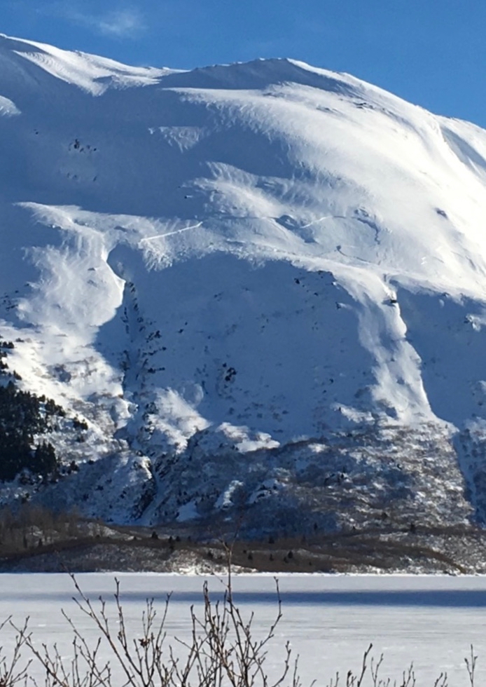
Wind effect and a wind slab on Maynard Mountain in Portage observed Tuesday.
Above 3,000′ in the Alpine zones, several old weak layers of facets and buried surface hoar sit near the ground and in the mid-pack. This structure is most pronounced in areas with a thin overall snow cover, such as the South end of Turnagain Pass and the Summit Lake area. As you plan your day, keep in mind that there are deeper persistent layers that could ‘wake up’ if you find the wrong spot.
Yesterday was partly cloudy with very light evening snow showers in Girdwood. Temperatures were in the 20Fs and winds were easterly 5-15 mph with a few gusts into the 20s and 30s. Overnight temperatures were in the low 20Fs.
Today will be mostly sunny with temperatures in the low to mid 20Fs. There may be some valley fog. Winds will be northerly 5-15 mph with gusts into the 20s. Temperatures will drop into the teens overnight and skies will become partly cloudy.
Tomorrow will be partly to mostly cloudy. It is forecast to clear again for Saturday and then cloud up again Sunday. There is uncertainty about what next week will bring with either high pressure or a chance for snow in the forecast!
Temp Avg (F) | Snow (in) | Water (in) | Snow Depth (in) | |
Center Ridge (1880′) | 32 | 0 | 0 | 64 |
Summit Lake (1400′) | 25 | 0 | 0 | 25 |
Alyeska Mid (1700′) | 28 | trace | 0.02 | 59 |
Temp Avg (F) | Wind Dir | Wind Avg (mph) | Wind Gust (mph) | |
Sunburst (3812′) | 22 | E | 5 | 23 |
Seattle Ridge (2400′) | 24 | SE | 8 | 32 |
Date | Region | Location | Observer |
---|---|---|---|
04/21/21 | Turnagain | Observation: Sunburst | Schauer/ Behney Forecaster |
04/19/21 | Turnagain | Avalanche: Triangle, Seattle creek | Will Morrison |
04/18/21 | Turnagain | Avalanche: Turnagain Pass Road Obs | Andy Moderow |
04/18/21 | Turnagain | Observation: Seattle Ridge, approximately 300 yards south of the up track | Brent Byrne |
04/17/21 | Turnagain | Avalanche: Road obs | Johnston-Bloom / Moderow Forecaster |
04/16/21 | Turnagain | Avalanche: Seattle Ridge | Wendy Wagner Forecaster |
04/16/21 | Turnagain | Avalanche: Turnagain Pass, non-motorized side seen from Seattle Ridge | CNFAIC Staff Forecaster |
04/16/21 | Turnagain | Observation: Sunburst | Lance breeding |
04/15/21 | Turnagain | Observation: Tincan | Schauer/ Rothman Forecaster |
04/13/21 | Turnagain | Observation: Turnagain Pass Road Obs | A Schauer Forecaster |
Status of riding areas across the Chugach NF is managed by the Glacier and Seward Ranger Districts, not avalanche center staff. Riding area information is posted as a public service to our users and updated based on snow depth and snow density to prevent resource damage at trailhead locations. Riding area questions contact: mailroom_r10_chugach@fs.fed.us
Area | Status | Weather & Riding Conditions |
---|---|---|
Glacier District |
Subscribe to Turnagain Pass
Avalanche Forecast by Email
This is a general backcountry avalanche advisory issued for Turnagain Arm with Turnagain Pass as the core advisory area. This advisory does not apply to highways, railroads or operating ski areas.