Turnagain Pass Avalanche Forecast
|
![]() ![]() |
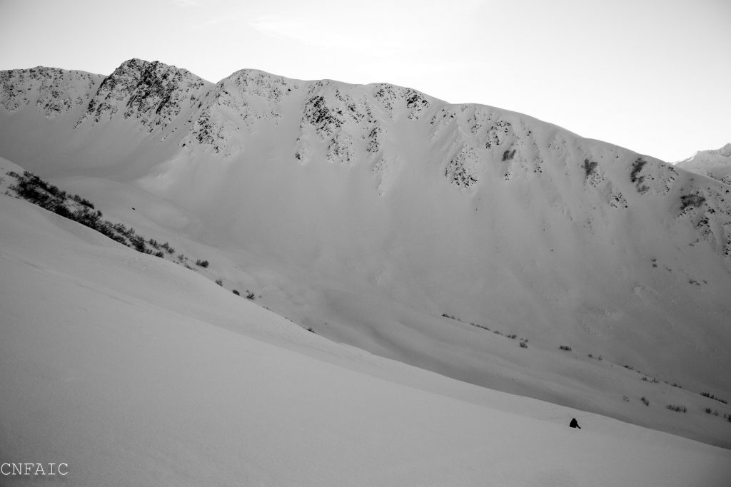
There is a MODERATE avalanche danger today in the alpine, above 3,000′ where triggering a large and dangerous deep slab avalanche is possible due to weak snow near the ground. Additionally triggering a hard wind slab is still possible on leeward, steep, unsupported slopes in the alpine. Evaluate snow and terrain carefully.
The avalanche danger is LOW at Treeline. LOW danger does not mean NO danger. Pockets of unstable snow are not out of the question on isolated terrain features below 2500′.
There is no hazard rating below 1,000′ due to a lack of snow.
*Please remember your safe travel practices! This includes, exposing one person at a time in avalanche terrain, watching your partners, being rescue ready and having an escape route planned.
If you are headed to Hatcher Pass be aware that avalanche activity has been observed every day since Christmas Eve. Check out the most recent observations HERE.
If this is your first day reading the advisory this winter it is important to know that deep slab avalanches have been a concern in the advisory now for two weeks. If you have been following along all season we are not trying sound like a broken record but the message is the same. This snow pack set-up continues to warrant elevated caution and respect. It is a high consequence avalanche problem that is impossible to outsmart. The ingredients for a deep slab avalanches have been found in the upper elevations of our forecast zone, above 3000’ on slopes that did not avalanche in the early December storm cycle. There is a hard slab, 3-5+ feet thick sitting on top of weak sugary snow (basal facets) near the ground. Observations over the last few weeks indicate this poor structure is widespread across our region in the alpine elevations.
When dealing with a deep slab avalanche problem, keep in mind:
An avalanche on the NW face of Pastoral was triggered one week ago by a party of two skies traveling on the low angle terrain below. They were very lucky and were able to get out of the way of the debris. This avalanche also triggered a second avalanche on an adjacent slope over 1000 feet away. Deep slabs can linger for long periods of time and warrants extra caution in places that have not avalanched.
A view of the North facing terrain of Corn Biscuit taken yesterday from Magnum. Some old debris can be seen on looker right side, lower North Chutes, but much of the upper elevation terrain of Corn Biscuit and Super Bowl are still intact and didn’t have evidence of much avalanche activity from mid December.
As we move further away from a wind event that ended on Dec.24th wind slabs are becoming more difficult to trigger. Cold temperatures are making the snow more brittle, and instead of seeing high energy shooting cracks we’re seeing wind boards crumble underfoot. Triggering an old wind slab is still possible in very steep terrain with more potential in the alpine zone. Places you might trigger an old wind slab will be in steep couloirs, large unsupported terrain features, or in thin rocky areas. Triggering a wind slab in the Treeline zone is becoming less likely, but isn’t out of the question on isolated features. The tricky part about this problem is that it will be hard to evaluate a steep slope before committing to it. The other big risk is the possibility of initiating a much larger and more dangerous avalanche if you are above 3000’. Identify features that have fat, smooth, pillow-type shapes and be suspect of any slope that may harbor a more dangerous deep slab problem.
Steep wind loaded gullies adjacent to thin rocky areas on a SE aspect on Seattle Ridge. This is one example of where triggering a wind slab is possible.
Yesterday skies were clear and temperatures along ridgetops averaged in the teens with pockets of single digit (F) temps found at valley bottoms. Winds were light from the East. No precipitation was recorded.
Today looks similar with mostly clear skies, light and variable winds, and temperatures averaging in the teens to low 20F’s. No precip is expected.
A pattern change is in the forecast for this weekend beginning Sunday with a series of low pressure systems moving into our region. This storms should bring warmer temperatures, precipitation (snow and possible rain) and strong winds. At this point it is uncertain how these storms will track across the region, but stay tuned for more info as we move closer to the weekend.
*This 1″ recorded at Summit Lake is likely from ice crystals in the air and not from snow falling from the atmosphere.
Temp Avg (F) | Snow (in) | Water (in) | Snow Depth (in) | |
Center Ridge (1880′) | 20 | 0 | 0 | 30 |
Summit Lake (1400′) | 5 | *1 | *0.1 | 12 |
Alyeska Mid (1700′) | 21 | 0 | 0 | 25 |
Temp Avg (F) | Wind Dir | Wind Avg (mph) | Wind Gust (mph) | |
Sunburst (3812′) | 16 | ENE | 5 | 17 |
Seattle Ridge (2400′) | 21 | SE | 7 | 17 |
Date | Region | Location | Observer |
---|---|---|---|
01/31/23 | Turnagain | Observation: Johnson Pass area | Megan Guinn / W Wagner Forecaster |
01/29/23 | Turnagain | Observation: Tincan Backdoor | AAS-Level 1 1/27-1/30 |
01/28/23 | Turnagain | Observation: Sunburst | Brooke Edwards |
01/28/23 | Turnagain | Avalanche: Seattle Ridge | W Wagner |
01/28/23 | Turnagain | Observation: Tincan Common | Tony Naciuk |
01/27/23 | Turnagain | Observation: Sunburst | John Sykes |
01/27/23 | Turnagain | Avalanche: Lynx Creek | Megan Guinn / W Wagner |
01/25/23 | Turnagain | Observation: Cornbiscuit | John Sykes Forecaster |
01/22/23 | Turnagain | Avalanche: Tincan | Schauer/ Guinn |
01/21/23 | Turnagain | Avalanche: Seattle Ridge | Elias Holt |
Status of riding areas across the Chugach NF is managed by the Glacier and Seward Ranger Districts, not avalanche center staff. Riding area information is posted as a public service to our users and updated based on snow depth and snow density to prevent resource damage at trailhead locations. Riding area questions contact: mailroom_r10_chugach@fs.fed.us
Area | Status | Weather & Riding Conditions |
---|---|---|
Glacier District |
Subscribe to Turnagain Pass
Avalanche Forecast by Email
This is a general backcountry avalanche advisory issued for Turnagain Arm with Turnagain Pass as the core advisory area. This advisory does not apply to highways, railroads or operating ski areas.