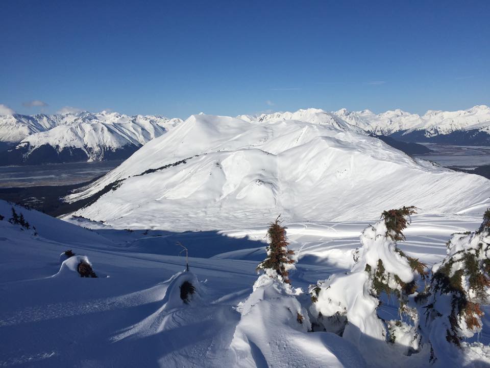
Turnagain Pass RSS

Archives
ARCHIVED - Forecasts expire after 24 hours.
Issued
Mon, April 10th, 2017 - 7:00AM
Expires
Tue, April 11th, 2017 - 7:00AM
Forecaster
Heather Thamm
Avalanche risk The Bottom Line

The avalanche danger is expected to increase to CONSIDERABLE  above 1000′ due to spring time warming. Human triggered avalanches 2-6+ feet deep will become more likely  in the afternoon  on slopes steeper than 35 degrees that haven’t avalanche already. Triggering a wet loose avalanche or cornice will also be more likely in the afternoon. Careful snowpack evaluation, cautious route-finding and conservative decision-making are essential.  

Below 1000′ a MODERATE avalanche danger exists where triggering a wet avalanche will be possible during the heat of the day.  Watch for changing conditions.

Hiking in Portage Valley and on summer trails around the Advisory area (including the Turnagain Arm Trail a.k.a the bike path).  Avalanches occurring at the higher elevations in this last storm sent large amounts of debris into valley bottoms and covered snow-free hiking trails. Continue to avoid trails that cross under avalanche paths such as Byron Glacier or portions of the Trail of Blue Ice and Crow Pass. The Turnagain Arm Trail between Bird and Girdwood remains  CLOSED for the winter.

Summit Lake:  An active avalanche cycle has occurred in Summit Lake this week and ELEVATED  CAUTION is advised.  Read the  Saturday Summit Summary  HERE  and observations from the last few days  HERE.

Mon, April 10th, 2017
Alpine
Above 2,500'
3 - Considerable
Avalanche risk
Treeline
1,000'-2,500'
3 - Considerable
Avalanche risk
Below Treeline
Below 1,000'
2 - Moderate
Avalanche risk
0 - No Rating
1 - Low
2 - Moderate
3 - Considerable
4 - High
5 - Extreme
Avalanche risk Avalanche risk Avalanche risk Avalanche risk Avalanche risk
Travel Advice Generally safe avalanche conditions. Watch for unstable snow on isolated terrain features. Heightened avalanche conditions on specific terrain features. Evaluate snow and terrain carefully; identify features of concern. Dangerous avalanche conditions. Careful snowpack evaluation, cautious route-finding, and conservative decision-making essential. Very dangerous avalanche conditions. Travel in avalanche terrain not recommended. Extraordinarily dangerous avalanche conditions. Avoid all avalanche terrain.
Likelihood of Avalanches Natural and human-triggered avalanches unlikely. Natural avalanches unlikely; human-triggered avalanches possible. Natural avalanches possible; human-triggered avalanches likely. Natural avalanches likely; human-triggered avalanches very likely. Natural and human-triggered avalanches certain.
Avalanche Size and Distribution Small avalanches in isolated areas or extreme terrain. Small avalanches in specific areas; or large avalanches in isolated areas. Small avalanches in many areas; or large avalanches in specific areas; or very large avalanches in isolated areas. Large avalanches in many areas; or very large avalanches in specific areas. Very large avalanches in many areas.
Avalanche Problem 1
  • Persistent Slabs
    Persistent Slabs
Persistent Slabs
Persistent Slab avalanches are the release of a cohesive layer of snow (a slab) in the middle to upper snowpack, when the bond to an underlying persistent weak layer breaks. Persistent layers include: surface hoar, depth hoar, near-surface facets, or faceted snow. Persistent weak layers can continue to produce avalanches for days, weeks or even months, making them especially dangerous and tricky. As additional snow and wind events build a thicker slab on top of the persistent weak layer, this avalanche problem may develop into a Deep Persistent Slab.
More info at Avalanche.org

The snowpack is in a tricky stage right now following a 10-day spring storm cycle that caused widespread avalanche activity throughout our region. On Friday and Saturday there were several human triggered avalanches in the Seattle Creek area that were large enough to kill or cause serious injury. Details about these incidents remain unclear, but it appears that folks got really lucky! Saturday afternoon’s sunny skies and warm temperatures also caused two large natural avalanches on Southerly aspects. One in Portage that ran over 3000’ vertical feet and a second avalanche on Pete’s South that triggered a wet avalanche in the mid elevations. 

There are several weak layers within our snowpack, the most noteable a reactive and widespread layer of buried surface hoar. There are also varying amounts of snow sitting on these weak layers throughout our region and slab depths range from 2-6+’ thick with Portage and Placer Valley on the deeper side. To complicate the situation spring time conditions and daily warming in the afternoon will increase the likelihood of triggering. This includes shaded slopes with drier snow. Yesterday’s ridgetop winds (10-20mph) helped keep the surface cooler in the Alpine, but today this may not be the case. As we move away from the storm that created our current snowpack, slabs will become harder to trigger and it may not be the first person on the slope. Ease into terrain and avoid terrain traps. Follow safe travel protocols and pay attention to other parties in the area. Obvious clues like whumpfing, shooting cracks, and recent avalanches may not be present.

Location 1st Bowl – The looker left avalanche was reported as a human triggered avalanche and the lookers right slides may be natural or remotely triggered. Photo credit: Eddy Monteil


Buried surfad hoar found in multiple locations on Sunburst on Saturday and was reactive


Avalanche Problem 2
  • Wet Loose
    Wet Loose
Wet Loose
Wet Loose avalanches are the release of wet unconsolidated snow or slush. These avalanches typically occur within layers of wet snow near the surface of the snowpack, but they may quickly gouge into lower snowpack layers. Like Loose Dry Avalanches, they start at a point and entrain snow as they move downhill, forming a fan-shaped avalanche. Other names for loose-wet avalanches include point-release avalanches or sluffs. Loose Wet avalanches can trigger slab avalanches that break into deeper snow layers.
More info at Avalanche.org

Last weeks storm caused widespread wet avalanche activity due to above freezing temperatures and rain below 2700’. Now that the storm has passed and we are in a melt/freeze cycle of sorts – solar heating during the day and overnight cooling are the biggest factors that play into the possibility of wet avalanche activity. Last night temperatures hovered around 31F and cloud cover may have trapped some of the day time heat. This may allow today’s solar heating to melt surface crusts a little quicker than the past few days. Temperatures are forecasted to rise into 40F’s, but may reach the 50F’s near sea level. This means solar heating is certain, either through thin clouds or direct sun light. In the morning with freezing temperatures, the snowpack will be more stable, but as this crust starts to degrade in the afternoon, this is when human triggered wet loose avalanches will become likely on Southerly slopes steeper than 35 degrees. This daily warming will also increase the potential for triggering a deeper slab in drier layers in the alpine, on ALL ASPECTS! Pay attention to changing surface conditions if you start sinking into wet snow on your skis or snowmachine avoid steep slopes.

Roller balls on a South aspect of Tincan and storm triggered slabs in the lower elevations from the end of a 10 day storm cycle. 

Additional Concern
  • Cornice
    Cornice
Cornice
Cornice Fall is the release of an overhanging mass of snow that forms as the wind moves snow over a sharp terrain feature, such as a ridge, and deposits snow on the downwind (leeward) side. Cornices range in size from small wind drifts of soft snow to large overhangs of hard snow that are 30 feet (10 meters) or taller. They can break off the terrain suddenly and pull back onto the ridge top and catch people by surprise even on the flat ground above the slope. Even small cornices can have enough mass to be destructive and deadly. Cornice Fall can entrain loose surface snow or trigger slab avalanches.
More info at Avalanche.org

Strong winds throughout the storm cycle combined with heavy snow have created large cornices overhanging leeward slopes. Daytime warming and solar heating will be adding stress to Cornices. Avoid travel on or underneath these backcountry bombs and remember that they often break further back on a ridge than expected. Triggering a cornice has the potential to initiate a large avalanche on the slope below. 


Weather
Mon, April 10th, 2017

Yesterday was a mix of showery weather and partial clearing. Light rain and snow was experienced intermittently through out the day as well as sun shining through patches of clouds. Ridge top winds were from the East, 10-20mph. Day time highs were in the low to mid 40F’s. Overnight there have been varying amounts of cloud cover and scattered showers, but temperatures have dipped slightly below freezing.  

A similar showery regime with a mix of clouds and patches of sun is expected. Day time highs may reach the upper 40F’s to low 50F’s near sea level. Scattered snow/rain showers are possible today with up to an 1 € of snow in the alpine (0.1 € of rain.) Rain/snow line is expected to be around 1600′. Light ridge top winds are expected to diminish to calm conditions. Overnight lows should dip below freezing again tonight.  

Tomorrow isolated showers are expected, and skies may start to clear by late Tuesday evening into Wed as high pressure settles over Southcentral, AK. Diurnal daily temps swings could range from 25F to mid 50F’s this week.  

PRECIPITATION 24-hour data (6am – 6am)

  Temp Avg (F) Snow (in) Water (in) Snow Depth (in)
Center Ridge (1880′) 36   rain   0.1   73
Summit Lake (1400′) 33   0   0   25  
Alyeska Mid (1700′) 33   trace   0.07   67  

RIDGETOP 24-hour data (6am – 6am)

  Temp Avg (F) Wind Dir Wind Avg (mph) Wind Gust (mph)
Sunburst (3812′) 23   ENE   8   26  
Seattle Ridge (2400′) 26   ESE   11   24  
Observations
Recent Observations for Turnagain Pass
Date Region Location
03/28/24 Turnagain Observation: Sunburst
03/27/24 Turnagain Observation: Tincan Trees
03/26/24 Turnagain Observation: Cornbiscuit
03/25/24 Turnagain Observation: Tincan
03/22/24 Turnagain Avalanche: Magnum Northwest Aspect
03/21/24 Turnagain Observation: Sunburst
03/21/24 Turnagain Observation: Tincan Proper North Aspect
03/20/24 Turnagain Avalanche: Seattle Creek Drainage
03/19/24 Turnagain Observation: Tincan CFR
03/18/24 Turnagain Avalanche: Tincan – Eddies – Seattle Ridge
Riding Areas

The riding areas page has moved. Please click here & update your bookmarks.


Subscribe to Turnagain Pass
Avalanche Forecast by Email

This is a general backcountry avalanche advisory issued for Turnagain Arm with Turnagain Pass as the core advisory area. This advisory does not apply to highways, railroads or operating ski areas.