Turnagain Pass RSS

Archives
ARCHIVED - Forecasts expire after 24 hours.
Issued
Sat, February 27th, 2016 - 7:00AM
Expires
Sun, February 28th, 2016 - 7:00AM
Forecaster
Wendy Wagner
Avalanche risk The Bottom Line

A CONSIDERABLE  avalanche danger remains at all elevations above 1,000′. This means  human  triggered avalanches are likely on slopes 30 degrees and steeper and natural avalanches are still possible. Cornices are huge and could fall, glide cracks are still releasing and storm snow/wet snow avalanches remain concerns. Elevated caution is recommended. Very cautious route finding and conservative decision-making are important if venturing into the mountains today.  

The danger is  MODERATE  below 1,000′ where debris from an avalanche above may run into channeled terrain.

Dangerous avalanche conditions also exist in  the Summit Lake area. See this morning’s  Summit Lake Summary  and click  HERE  for recent observations from the last few days.

Special Announcements

A special thanks to everyone who attended the 2nd annual Snowball last night at the Taproot!! This was a  joint fundraiser between the Alaska Avalanche School and the Friends-CNFAIC and all proceeds directly support avalanche information and education in Alaska!  

CLOSE CALL IN THE SOUTH FORK OF EAGLE RIVER Thursday, Feb 25th:
We received a report about a large avalanche triggered in the Harp Mountain area (Eagle River, South Fork) on Thursday, February 25th. This slide caught and carried a skier and buried and killed a dog. Please read the account from one of the members of the party HERE. We are very thankful the people involved are ok and are thankful they are willing to share their story.  

Sat, February 27th, 2016
Alpine
Above 2,500'
3 - Considerable
Avalanche risk
Treeline
1,000'-2,500'
3 - Considerable
Avalanche risk
Below Treeline
Below 1,000'
2 - Moderate
Avalanche risk
0 - No Rating
1 - Low
2 - Moderate
3 - Considerable
4 - High
5 - Extreme
Avalanche risk Avalanche risk Avalanche risk Avalanche risk Avalanche risk
Travel Advice Generally safe avalanche conditions. Watch for unstable snow on isolated terrain features. Heightened avalanche conditions on specific terrain features. Evaluate snow and terrain carefully; identify features of concern. Dangerous avalanche conditions. Careful snowpack evaluation, cautious route-finding, and conservative decision-making essential. Very dangerous avalanche conditions. Travel in avalanche terrain not recommended. Extraordinarily dangerous avalanche conditions. Avoid all avalanche terrain.
Likelihood of Avalanches Natural and human-triggered avalanches unlikely. Natural avalanches unlikely; human-triggered avalanches possible. Natural avalanches possible; human-triggered avalanches likely. Natural avalanches likely; human-triggered avalanches very likely. Natural and human-triggered avalanches certain.
Avalanche Size and Distribution Small avalanches in isolated areas or extreme terrain. Small avalanches in specific areas; or large avalanches in isolated areas. Small avalanches in many areas; or large avalanches in specific areas; or very large avalanches in isolated areas. Large avalanches in many areas; or very large avalanches in specific areas. Very large avalanches in many areas.
Avalanche Problem 1
  • Storm Slabs
    Storm Slabs
Storm Slabs
Storm Slab avalanches are the release of a cohesive layer (a slab) of new snow that breaks within new snow or on the old snow surface. Storm-slabs typically last between a few hours and few days (following snowfall). Storm-slabs that form over a persistent weak layer (surface hoar, depth hoar, or near-surface facets) may be termed Persistent Slabs or may develop into Persistent Slabs.
More info at Avalanche.org

Today will be the 6th day of stormy weather along Turnagain Pass and the surrounding region. We have seen the rain/snow line fluctuating between 500′ and 2,000′ and a total precipitation (water) for this six day period of 10″ at the Center Ridge SNOTEL station!! That equates to over 10′ of snow in less than six days at the upper elevations. That said, our snowpack is well above average at 2,000′ – it’s just a bit damp. For today, we are expecting a slight break in precipitation before another wave moves in tonight. Around 3-5″ of snow is forecast above 1,800′ today with rain below and 5-10″ of snow tonight above 1,400′, again with rain below.

As the stormy weather continues, so do our avalanche problems. Although most of the avalanche activity we have seen occurred the first day of the storm cycle (Sunday 2/21), we are still seeing a few large slides pull out here and there. The most notable was a glide avalanche on Seattle Ridge yesterday morning. Things to keep in mind if you are headed out today:

Cornices: Natural cornice fall activity is possible and could trigger an avalanche on the slope below. This is something you want to avoid traveling on or underneath. Cornices will be tender and could break farther back than expected. As Aleph said yesterday, falling down the slope with a refrigerator to school bus sized chunk of snow on your snowmachine or skis would be terrible, if not deadly.

Storm Slabs: Fluctuating temperatures and snowfall may combine to create storm slabs as new layers of snow are deposited. Pay attention to how well the new snow bonds to the snow below. 

Wind Slabs: Winds today will continue to add stress to very large wind slabs in leeward terrain. Triggering one of these could be very dangerous due to the depth of slab. Avoid steep wind-loaded slopes. 

Glide and Wet Avalanches: See below.

Avalanche Problem 2
  • Glide Avalanches
    Glide Avalanches
Glide Avalanches
Glide Avalanches are the release of the entire snow cover as a result of gliding over the ground. Glide avalanches can be composed of wet, moist, or almost entirely dry snow. They typically occur in very specific paths, where the slope is steep enough and the ground surface is relatively smooth. They are often proceeded by full depth cracks (glide cracks), though the time between the appearance of a crack and an avalanche can vary between seconds and months. Glide avalanches are unlikely to be triggered by a person, are nearly impossible to forecast, and thus pose a hazard that is extremely difficult to manage.
More info at Avalanche.org

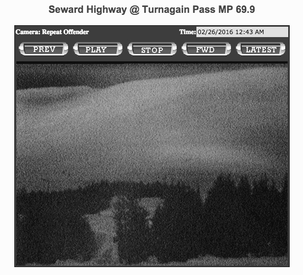
Glide avalanches still remain a real concern in the area. The many cracks that littler the mid-elevations are hard to see now with the snow filling them in, but there is no mistaking this brown streak on Seattle Ridge. This slide released early yesterday morning and was caught on the RWIS Turnagain Pass camera. Another reason to give avalanche terrain a break for this storm cycle.

Photo: Glide avalanche on Seattle Ridge – uncomfortably close to the motorized up-track…


Photos below are of the RWIS camera before and after the glide release


Additional Concern
  • Wet Loose
    Wet Loose
Wet Loose
Wet Loose avalanches are the release of wet unconsolidated snow or slush. These avalanches typically occur within layers of wet snow near the surface of the snowpack, but they may quickly gouge into lower snowpack layers. Like Loose Dry Avalanches, they start at a point and entrain snow as they move downhill, forming a fan-shaped avalanche. Other names for loose-wet avalanches include point-release avalanches or sluffs. Loose Wet avalanches can trigger slab avalanches that break into deeper snow layers.
More info at Avalanche.org

Rain on the snowpack up to 1,800′ today will keep wet avalanche concerns in the forecast. Natural wet loose and wet slab avalanches will be possible in the mid elevation bands and human triggered avalanches are likely in steep terrain. Watch for areas with wet, saturated and unsupportable snow, that is an indication that the snow is losing strength and avoid terrain traps. Wet snow can be very hazardous especially if it gets moving and stuffs you into a bad spot.

Weather
Sat, February 27th, 2016

Skies were patchy yesterday with showery precipitation along Turnagain Arm. Snow fell above 1,500′ with rain below. We picked up roughly 1-1.5″ of water through the region with a foot or so of heavy wet snow above treeline. Winds have remained strong out of a generally East direction, in the 20-40mph range along the ridgetops. Temperatures were warm, up to 40F at 1,000’…

For today, we have .3-.5″ of rain on tap below 1,500′ and 3-5″ of snow above 1,800′ (snow/rain mix between these elevations). Skies should be mostly cloudy and temperatures warming up through the day after dropping to 32F at 1,000′ overnight. Ridgetop winds are slated to remain strong, 30-40mph averages with higher gusts from the East. Tonight precipitation should increase with 1-1.5″ of water forecast and a rain/snow line dropping slightly to 1,400′.  

This wet and stormy pattern looks to remain through tomorrow with a ‘possible’ break on Monday.

PRECIPITATION 24-hour data (6am – 6am)

  Temp Avg (F) Snow (in) Water (in) Snow Depth (in)
Center Ridge (1880′) 33   4   1.4   136  
Summit Lake (1400′) 34   0   0.1   42  
Alyeska Mid (1700′) 33   4   1.1   105  

RIDGETOP 24-hour data (6am – 6am)

  Temp Avg (F) Wind Dir Wind Avg (mph) Wind Gust (mph)
Sunburst (3812′) 26   NE   29   81  
Seattle Ridge (2400′) 27   –    – –  
Observations
Recent Observations for Turnagain Pass
Date Region Location
04/16/24 Turnagain Observation: Cornbiscuit
04/15/24 Turnagain Observation: Taylor Pass
04/15/24 Turnagain Observation: Seward Highway – Tern Lake to Portage
04/14/24 Turnagain Observation: Sunburst
04/14/24 Turnagain Observation: Turnagain Pass Snomo
04/13/24 Turnagain Observation: Spokane Creek
04/11/24 Turnagain Observation: Tincan
04/10/24 Turnagain Avalanche: Seattle Ridge
04/10/24 Turnagain Observation: Cornbiscuit South Face
04/10/24 Turnagain Avalanche: Tincan
Riding Areas

The riding areas page has moved. Please click here & update your bookmarks.


Subscribe to Turnagain Pass
Avalanche Forecast by Email

This is a general backcountry avalanche advisory issued for Turnagain Arm with Turnagain Pass as the core advisory area. This advisory does not apply to highways, railroads or operating ski areas.