Turnagain Pass RSS

Archives
ARCHIVED - Forecasts expire after 24 hours.
Issued
Mon, February 1st, 2016 - 7:00AM
Expires
Tue, February 2nd, 2016 - 7:00AM
Forecaster
Wendy Wagner
Avalanche risk The Bottom Line

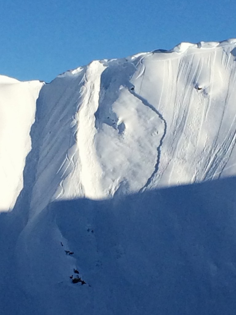
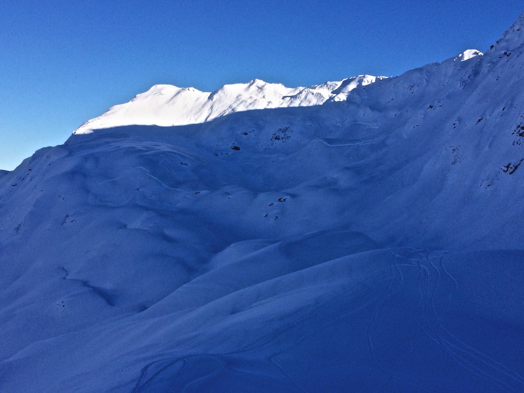
Although a generally  LOW  avalanche danger continues in most areas of the Turnagain Pass region, we have enough exceptions that combine for a MODERATE  overall hazard at all elevations. These exceptions are: 1) Shallow fresh wind slabs may form today with a bump in winds at the higher elevations. 2) Cornices remain prime to fall and may trigger a slab avalanche below. 3) Glide avalanches are still releasing at the mid-elevations. 4) Large avalanches are possible in areas just South of Turnagain Pass where buried weak layers may exist.

*If you are thinking of going South of Turnagain Pass or to the Summit Lake area, be aware that different  avalanche problems can exist and weak layers may be found within the snowpack. Click  HERE  to read Saturday morning’s Summit Lake Summary.  

Special Announcements

Girdwood Nordic Ski Club partnered up with the USFS and groomed a 2.8K cross-country ski loop near Center Ridge in Turnagain Pass on Friday. Groomed trails can be accessed just beyond the outhouses on the non-motorized parking area. For information on becoming a member and supporting the Girdwood Nordic Ski Club click  HERE.

Mon, February 1st, 2016
Alpine
Above 2,500'
2 - Moderate
Avalanche risk
Treeline
1,000'-2,500'
2 - Moderate
Avalanche risk
Below Treeline
Below 1,000'
0 - No Rating
Avalanche risk
0 - No Rating
1 - Low
2 - Moderate
3 - Considerable
4 - High
5 - Extreme
Avalanche risk Avalanche risk Avalanche risk Avalanche risk Avalanche risk
Travel Advice Generally safe avalanche conditions. Watch for unstable snow on isolated terrain features. Heightened avalanche conditions on specific terrain features. Evaluate snow and terrain carefully; identify features of concern. Dangerous avalanche conditions. Careful snowpack evaluation, cautious route-finding, and conservative decision-making essential. Very dangerous avalanche conditions. Travel in avalanche terrain not recommended. Extraordinarily dangerous avalanche conditions. Avoid all avalanche terrain.
Likelihood of Avalanches Natural and human-triggered avalanches unlikely. Natural avalanches unlikely; human-triggered avalanches possible. Natural avalanches possible; human-triggered avalanches likely. Natural avalanches likely; human-triggered avalanches very likely. Natural and human-triggered avalanches certain.
Avalanche Size and Distribution Small avalanches in isolated areas or extreme terrain. Small avalanches in specific areas; or large avalanches in isolated areas. Small avalanches in many areas; or large avalanches in specific areas; or very large avalanches in isolated areas. Large avalanches in many areas; or very large avalanches in specific areas. Very large avalanches in many areas.
Avalanche Problem 1
  • Cornice
    Cornice
Cornice
Cornice Fall is the release of an overhanging mass of snow that forms as the wind moves snow over a sharp terrain feature, such as a ridge, and deposits snow on the downwind (leeward) side. Cornices range in size from small wind drifts of soft snow to large overhangs of hard snow that are 30 feet (10 meters) or taller. They can break off the terrain suddenly and pull back onto the ridge top and catch people by surprise even on the flat ground above the slope. Even small cornices can have enough mass to be destructive and deadly. Cornice Fall can entrain loose surface snow or trigger slab avalanches.
More info at Avalanche.org

It was a busy sunny weekend at Turnagain Pass to round out the final days of January. Tracks can be seen for miles along the ridgelines and slopes. We had some interesting avalanche activity but luckily no one was caught up in any of it. We had one very large snowmachiner triggered slide just South of Turnagain Pass on Saturday, more on this below. There were also several cornice falls (some of which triggered slabs below) and a glide avalanche.

In the heart of our forecast zone at Turnagain Pass, cornice falls seemed to be the main event. Check out this photo of a large cornice that is thought to have released sometime Saturday night. This cornice triggered a slab avalanche below taking out three sets of tracks from the day before. Read short report HERE. Photo credit: Susan Goodwin.


Avalanche concerns in the dry snow above 2,500′ today:

WIND SLABS:
Winds along the ridgetops have picked up to the 15mph range overnight with stronger gusts from the East. These winds are forecast to remain, and possibly increase, throughout the day. This is just strong enough to transport snow and form shallow wind slabs. Watch for fresh wind drifted snow and active loading. Any fresh wind slab is suspect to be touchy and on slopes ~35 and steeper could avalanche.

CORNICE FALLS:
As seen in the photo above, these monsters are still falling (both naturally and human triggered) and have the chance for triggering an avalanche below. Limiting time under these, as well as giving them a wide berth above, is key terrain management.

SLUFFS:
With the clear skis and cool temperatures loosening the surface, sluffs on steep slopes can be expected.

Avalanche Problem 2
  • Glide Avalanches
    Glide Avalanches
Glide Avalanches
Glide Avalanches are the release of the entire snow cover as a result of gliding over the ground. Glide avalanches can be composed of wet, moist, or almost entirely dry snow. They typically occur in very specific paths, where the slope is steep enough and the ground surface is relatively smooth. They are often proceeded by full depth cracks (glide cracks), though the time between the appearance of a crack and an avalanche can vary between seconds and months. Glide avalanches are unlikely to be triggered by a person, are nearly impossible to forecast, and thus pose a hazard that is extremely difficult to manage.
More info at Avalanche.org

Hundreds of glide cracks litter the mountains and a few of these continue to pop out and avalanche where people are recreating. One these was on Cornbiscuit over the weekend. Whether or not a crack will release is completely unpredictable and is why limiting time spent under these will be a message as long as the cracks continue to slowly open.

Glide avalanche on Cornbiscuit that released sometime in the past 36 hours. More on this HERE. Photo credit: Mike Loso.

Additional Concern
  • Persistent Slabs
    Persistent Slabs
Persistent Slabs
Persistent Slab avalanches are the release of a cohesive layer of snow (a slab) in the middle to upper snowpack, when the bond to an underlying persistent weak layer breaks. Persistent layers include: surface hoar, depth hoar, near-surface facets, or faceted snow. Persistent weak layers can continue to produce avalanches for days, weeks or even months, making them especially dangerous and tricky. As additional snow and wind events build a thicker slab on top of the persistent weak layer, this avalanche problem may develop into a Deep Persistent Slab.
More info at Avalanche.org

Yesterday a report came in of a large avalanche triggered off the Johnson Pass trail in the Groundhog Creek drainage on Saturday, January 30th. We were able to investigate the slide and it was indeed very large, 3′ deep and 2500-3000′ wide. See photo and video’s below. The weak layer was buried surface hoar that sits roughtly 3′ deep in the pack in this area. We have not seen this layer anywhere else in the forecast zone. It is most likely that the surface hoar was deposited in a short break in storms on 1/26 just prior to the 3+’ of new snow that fell from 1/27-1/29. More details HERE.

We are suspect that other areas south of our core Turnagain Pass forecast area may harbor this or other weak layers.

Photo of the basin that avalanched (4,000′, West aspect).

Video taken by party that triggered slide on Saturday January 30th.

Video taken the next day by forecasters.

Weather
Mon, February 1st, 2016

Yesterday saw clear skies, light easterly winds and temperatures in the 20’s F above treeline. Valleys stayed relatively cool and in the teens.

For today we could see some cloud cover stream as a weak frontal band stretches over us associated with a large trough in the Gulf. Winds picked up overnight from the East along the ridgetops to the 15mph range and may increase to the 20mph range today. Temperatures will be in the 20’s F from the valley’s to 3,500′ with only a shallow inversion in place this morning. There is a slight chance for a flurry or two late in the day.

For Tuesday night through Wednesday another system moves in that should bring snow as low as 500′. Stay tuned.

PRECIPITATION 24-hour data (6am – 6am)

  Temp Avg (F) Snow (in) Water (in) Snow Depth (in)
Center Ridge (1880′) 23   0   0   93  
Summit Lake (1400′)  16  0 0   27  
Alyeska Mid (1700′) 25   0   0   71  

RIDGETOP 24-hour data (6am – 6am)

  Temp Avg (F) Wind Dir Wind Avg (mph) Wind Gust (mph)
Sunburst (3812′)  22  East 9   26  
Seattle Ridge (2400′) 23   N/A   N/A     N/A    
Observations
Recent Observations for Turnagain Pass
Date Region Location
04/16/24 Turnagain Observation: Cornbiscuit
04/15/24 Turnagain Observation: Taylor Pass
04/15/24 Turnagain Observation: Seward Highway – Tern Lake to Portage
04/14/24 Turnagain Observation: Sunburst
04/14/24 Turnagain Observation: Turnagain Pass Snomo
04/13/24 Turnagain Observation: Spokane Creek
04/11/24 Turnagain Observation: Tincan
04/10/24 Turnagain Avalanche: Seattle Ridge
04/10/24 Turnagain Observation: Cornbiscuit South Face
04/10/24 Turnagain Avalanche: Tincan
Riding Areas

The riding areas page has moved. Please click here & update your bookmarks.


Subscribe to Turnagain Pass
Avalanche Forecast by Email

This is a general backcountry avalanche advisory issued for Turnagain Arm with Turnagain Pass as the core advisory area. This advisory does not apply to highways, railroads or operating ski areas.