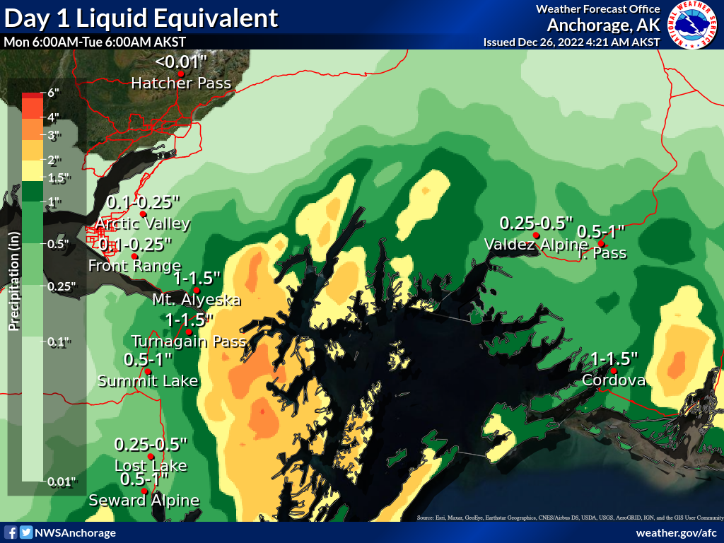
Turnagain Pass RSS

Archives
ARCHIVED - Forecasts expire after 24 hours.
Issued
Mon, December 26th, 2022 - 7:00AM
Expires
Tue, December 27th, 2022 - 7:00AM
Forecaster
Andrew Schauer
High Avalanche Danger
Travel in avalanche terrain is not recommended. Avoid being on or beneath all steep slopes.
Avalanche risk The Bottom Line

The avalanche danger is HIGH as a warm, wet, and windy system continues to impact the area today. Heavy snowfall and strong winds are overloading a snowpack with multiple weak layers. Natural avalanches failing 1-3′ deep in new and wind-drifted snow are likely, and human-triggered avalanches are very likely. Avalanche conditions are very dangerous and travel in and below avalanche terrain is not recommended.


* Roof Avalanches: Continued rain and above-freezing temperatures will make roof avalanches likely through today. Be sure to keep an eye on children and pets, and be careful where you park your vehicles.

Special Announcements

The National Weather Service has issued a Special Weather Statement for this storm in our advisory area. There are additional weather advisories in effect in the Anchorage area, which you can find on this NWS page.

Become a Member in December! If you haven’t done so already, please consider becoming a member of our non-profit Friends group. Memberships start at just $20, and every member who joins or renews will be entered to win one of the fabulous prizes from our sponsors. This could be that Holiday gift idea you’ve been waiting for! Click here for more info.

Mon, December 26th, 2022
Alpine
Above 2,500'
4 - High
Avalanche risk
Treeline
1,000'-2,500'
4 - High
Avalanche risk
Below Treeline
Below 1,000'
4 - High
Avalanche risk
0 - No Rating
1 - Low
2 - Moderate
3 - Considerable
4 - High
5 - Extreme
Avalanche risk Avalanche risk Avalanche risk Avalanche risk Avalanche risk
Travel Advice Generally safe avalanche conditions. Watch for unstable snow on isolated terrain features. Heightened avalanche conditions on specific terrain features. Evaluate snow and terrain carefully; identify features of concern. Dangerous avalanche conditions. Careful snowpack evaluation, cautious route-finding, and conservative decision-making essential. Very dangerous avalanche conditions. Travel in avalanche terrain not recommended. Extraordinarily dangerous avalanche conditions. Avoid all avalanche terrain.
Likelihood of Avalanches Natural and human-triggered avalanches unlikely. Natural avalanches unlikely; human-triggered avalanches possible. Natural avalanches possible; human-triggered avalanches likely. Natural avalanches likely; human-triggered avalanches very likely. Natural and human-triggered avalanches certain.
Avalanche Size and Distribution Small avalanches in isolated areas or extreme terrain. Small avalanches in specific areas; or large avalanches in isolated areas. Small avalanches in many areas; or large avalanches in specific areas; or very large avalanches in isolated areas. Large avalanches in many areas; or very large avalanches in specific areas. Very large avalanches in many areas.
Recent Avalanches

Prior to this storm, the last recorded avalanche activity was during the NE wind event three days ago. It is likely there are natural avalanches happening right now, but we won’t know until we are able to get an eye on avalanche paths.

Avalanche Problem 1
  • Storm Slabs
    Storm Slabs
  • Aspect/Elevation
  • Certain
    Very Likely
    Likely
    Possible
    Unlikely
    Likelihood
  • Historic (D4-5)
    Very Large (D3)
    Large (D2)
    Small (D1)
    Size
Storm Slabs
Storm Slab avalanches are the release of a cohesive layer (a slab) of new snow that breaks within new snow or on the old snow surface. Storm-slabs typically last between a few hours and few days (following snowfall). Storm-slabs that form over a persistent weak layer (surface hoar, depth hoar, or near-surface facets) may be termed Persistent Slabs or may develop into Persistent Slabs.

Aspect/Elevation of the Avalanche Problem
Specialists develop a graphic representation of the potential distribution of a particular avalanche problem across the topography. This aspect/elevation rose is used to indicate where the particular avalanche problem is thought to exist on all elevation aspects. Areas where the avalanche problem is thought to exist are colored grey, and it is less likely to be encountered in areas colored white.

Likelihood of Avalanches
Terms such as "unlikely", "likely", and "certain" are used to define the scale, with the chance of triggering or observing avalanches increasing as we move up the scale. For our purposes, "Unlikely" means that few avalanches could be triggered in avalanche terrain and natural avalanches are not expected. "Certain" means that humans will be able to trigger avalanches on many slopes, and natural avalanches are expected.

Size of Avalanches
Avalanche size is defined by the largest potential avalanche, or expected range of sizes related to the problem in question. Assigned size is a qualitative estimate based on the destructive classification system and requires specialists to estimate the harm avalanches may cause to hypothetical objects located in the avalanche track (AAA 2016, CAA 2014). Under this schema, "Small" avalanches are not large enough to bury humans and are relatively harmless unless they carry people over cliffs or through trees or rocks. Moving up the scale, avalanches become "Large" enough to bury, injure, or kill people. "Very Large" avalanches may bury or destroy vehicles or houses, and "Historic" avalanches are massive events capable of altering the landscape.

Signal Word Size (D scale) Simple Descriptor
Small 1 Unlikely to bury a person
Large 2 Can bury a person
Very Large 3 Can destroy a house
Historic 4 & 5 Can destroy part or all of a village
More info at Avalanche.org

A warm, wet, and windy storm continues to impact the area today, overloading multiple weak layers in our snowpack and making for very dangerous avalanche conditions. As of now, this storm has brought 1-1.5″ precipitation to the mountains near Girdwood and Turnagain Pass. This has fallen mostly as rain or freezing rain at elevations up to around 1900′, and should amount to 10-15″ snow at higher elevations. Easterly winds have been blowing 20-50 mph since yesterday morning, with gusts at 70-75 mph overnight. This storm is expected to continue today, bringing another 0.5-0.75″ precipitation (equaling 4-8″ snow above 2000′) with continued strong easterly winds.

This is a significant loading event, and it is likely there are going to be some big avalanches today. All of this new and wind-loaded snow is falling on weak surfaces, which will make for very dangerous avalanche conditions today. In addition to these new snow instabilities, this will be the biggest loading event so far to test the weak snow now buried 3-5′ deep on top of the Thanksgiving crust. More on this in problem 2 below.

If you are planning on throwing on the Gore-Tex and getting outside today, be aware that travel in avalanche terrain is NOT recommended. This is the kind of day for dinking around in low-angle terrain far away from steeper overhead slopes.

We’ve already received 1-1.5″ precipitation, and another 1-1.5″ is on the way today and tonight. About half of that or maybe a little more should fall during the day today, with the rain line dropping to around 1000′. Graphic courtesy of NWS Anchorage. 12.26.2022

Avalanche Problem 2
  • Persistent Slabs
    Persistent Slabs
  • Aspect/Elevation
  • Certain
    Very Likely
    Likely
    Possible
    Unlikely
    Likelihood
  • Historic (D4-5)
    Very Large (D3)
    Large (D2)
    Small (D1)
    Size
Persistent Slabs
Persistent Slab avalanches are the release of a cohesive layer of snow (a slab) in the middle to upper snowpack, when the bond to an underlying persistent weak layer breaks. Persistent layers include: surface hoar, depth hoar, near-surface facets, or faceted snow. Persistent weak layers can continue to produce avalanches for days, weeks or even months, making them especially dangerous and tricky. As additional snow and wind events build a thicker slab on top of the persistent weak layer, this avalanche problem may develop into a Deep Persistent Slab.

Aspect/Elevation of the Avalanche Problem
Specialists develop a graphic representation of the potential distribution of a particular avalanche problem across the topography. This aspect/elevation rose is used to indicate where the particular avalanche problem is thought to exist on all elevation aspects. Areas where the avalanche problem is thought to exist are colored grey, and it is less likely to be encountered in areas colored white.

Likelihood of Avalanches
Terms such as "unlikely", "likely", and "certain" are used to define the scale, with the chance of triggering or observing avalanches increasing as we move up the scale. For our purposes, "Unlikely" means that few avalanches could be triggered in avalanche terrain and natural avalanches are not expected. "Certain" means that humans will be able to trigger avalanches on many slopes, and natural avalanches are expected.

Size of Avalanches
Avalanche size is defined by the largest potential avalanche, or expected range of sizes related to the problem in question. Assigned size is a qualitative estimate based on the destructive classification system and requires specialists to estimate the harm avalanches may cause to hypothetical objects located in the avalanche track (AAA 2016, CAA 2014). Under this schema, "Small" avalanches are not large enough to bury humans and are relatively harmless unless they carry people over cliffs or through trees or rocks. Moving up the scale, avalanches become "Large" enough to bury, injure, or kill people. "Very Large" avalanches may bury or destroy vehicles or houses, and "Historic" avalanches are massive events capable of altering the landscape.

Signal Word Size (D scale) Simple Descriptor
Small 1 Unlikely to bury a person
Large 2 Can bury a person
Very Large 3 Can destroy a house
Historic 4 & 5 Can destroy part or all of a village
More info at Avalanche.org

As mentioned above, this will be the biggest loading event so far to test the layer of faceted snow associated with the Thanksgiving crust. This is more of an afterthought today since the potential for large storm snow avalanches is so high, but it is worth keeping in mind- especially for the next few days after this storm. This heavy load will be pushing these weak layers closer to their breaking point, and will hopefully give us some indication as to just how reactive these layers still are. For today, this deeper problem is just one more reason why avoiding avalanche terrain is the name of the game.

Weather
Mon, December 26th, 2022

Yesterday: Strong easterly winds started blowing 20-30 mph yesterday morning, increasing to 30-50 mph overnight with gusts to 76 mph at the Sunburst station. The mountains picked up 1-1.5″ precipitation, falling mostly as rain or freezing rain up to around 1900′, and an estimated 10-15″ snow at higher elevations. Temperatures climbed from the mid teens to the mid 30’s F under cloudy skies.

Today: Heavy precipitation is expected to continue through mid-day, with another 0.5-0.75″ precipitation expected today, and 0.5″ tonight. Rain levels are expected to start dropping, getting down to around 1000′ later today. Temperatures are expected to hover in the low 30’s F today through tonight, with strong easterly winds continuing at 25-50 mph and gusts of 50-70 mph.

Tomorrow: The storm is looking like it will taper off early in the morning tomorrow, but moderate winds and light precipitation will continue into the day. We may pick up 1-3″ more snow, with easterly winds slowly backing down from around 30 mph overnight to 15-20 mph during the day. The rain level is expected to continue dropping, making it down to around 200′ as the storm wraps up. Skies will be mostly cloudy with temperatures in the upper 20’s to low 30’s F.

PRECIPITATION 24-hour data (6am – 6am)

Temp Avg (F) Snow (in) Water (in) Snow Depth (in)
Center Ridge (1880′) 33 4 1.2 43
Summit Lake (1400′) 29 2 0.8 29
Alyeska Mid (1700′) 29 3 1.2 40
Bear Valley – Portage (132′) 30 0 0.9

RIDGETOP 24-hour data (6am – 6am)

Temp Avg (F) Wind Dir Wind Avg (mph) Wind Gust (mph)
Sunburst (3812′) 26 ENE 28 76
Seattle Ridge (2400′) 28 ESE 11 45
Observations
Recent Observations for Turnagain Pass
Date Region Location
03/28/24 Turnagain Observation: Sunburst
03/27/24 Turnagain Observation: Tincan Trees
03/26/24 Turnagain Observation: Cornbiscuit
03/25/24 Turnagain Observation: Tincan
03/22/24 Turnagain Avalanche: Magnum Northwest Aspect
03/21/24 Turnagain Observation: Sunburst
03/21/24 Turnagain Observation: Tincan Proper North Aspect
03/20/24 Turnagain Avalanche: Seattle Creek Drainage
03/19/24 Turnagain Observation: Tincan CFR
03/18/24 Turnagain Avalanche: Tincan – Eddies – Seattle Ridge
Riding Areas

The riding areas page has moved. Please click here & update your bookmarks.


Subscribe to Turnagain Pass
Avalanche Forecast by Email

This is a general backcountry avalanche advisory issued for Turnagain Arm with Turnagain Pass as the core advisory area. This advisory does not apply to highways, railroads or operating ski areas.