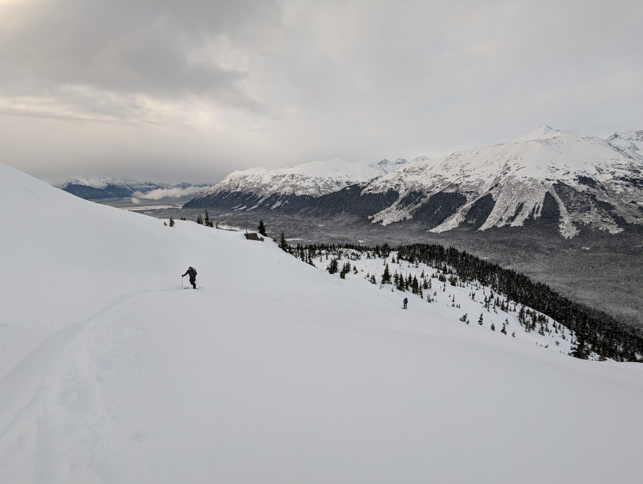
Turnagain Pass RSS

Archives
ARCHIVED - Forecasts expire after 24 hours.
Issued
Sat, December 24th, 2022 - 7:00AM
Expires
Sun, December 25th, 2022 - 7:00AM
Forecaster
John Sykes
Avalanche risk The Bottom Line

The avalanche danger is MODERATE above 1000′ today. It is possible for a person to trigger an avalanche on a layer of facets buried 2-4′ deep. Wind slabs 2-3′ deep in areas exposed to strong NE winds are also possible for human triggering and most likely at upper elevations. Below 1000′ the avalanche danger is LOW.

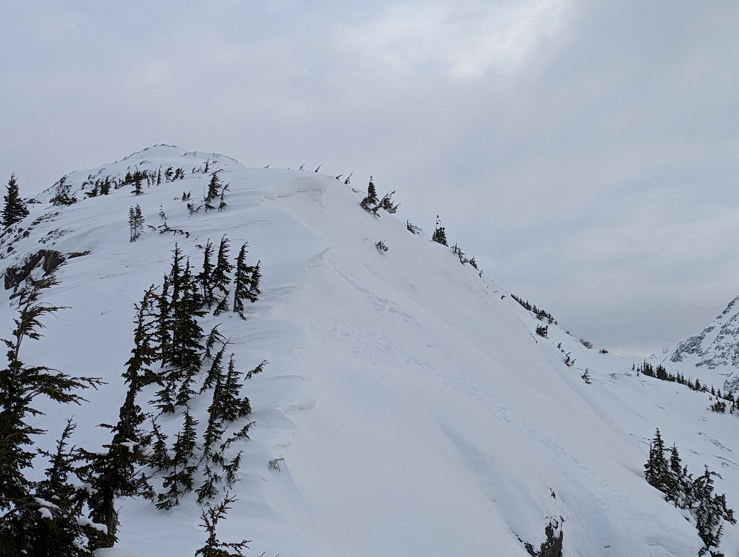
SEWARD/LOST LAKE: The current NE outflow winds are favoring this area and it is more likely to find wind slab avalanches at upper elevations. Keep an eye out for signs of recent wind loading, shooting cracks, or hollow feeling snow to identify and avoid wind slabs, especially along ridgelines and cross loaded gullies.

Special Announcements

Become a Member in December! If you haven’t done so already, please consider becoming a member of our non-profit Friends group. Memberships start at just $20, and every member who joins or renews will be entered to win one of the fabulous prizes from our sponsors. This could be that Holiday gift idea you’ve been waiting for! Click here for more info.

Sat, December 24th, 2022
Alpine
Above 2,500'
2 - Moderate
Avalanche risk
Treeline
1,000'-2,500'
2 - Moderate
Avalanche risk
Below Treeline
Below 1,000'
1 - Low
Avalanche risk
0 - No Rating
1 - Low
2 - Moderate
3 - Considerable
4 - High
5 - Extreme
Avalanche risk Avalanche risk Avalanche risk Avalanche risk Avalanche risk
Travel Advice Generally safe avalanche conditions. Watch for unstable snow on isolated terrain features. Heightened avalanche conditions on specific terrain features. Evaluate snow and terrain carefully; identify features of concern. Dangerous avalanche conditions. Careful snowpack evaluation, cautious route-finding, and conservative decision-making essential. Very dangerous avalanche conditions. Travel in avalanche terrain not recommended. Extraordinarily dangerous avalanche conditions. Avoid all avalanche terrain.
Likelihood of Avalanches Natural and human-triggered avalanches unlikely. Natural avalanches unlikely; human-triggered avalanches possible. Natural avalanches possible; human-triggered avalanches likely. Natural avalanches likely; human-triggered avalanches very likely. Natural and human-triggered avalanches certain.
Avalanche Size and Distribution Small avalanches in isolated areas or extreme terrain. Small avalanches in specific areas; or large avalanches in isolated areas. Small avalanches in many areas; or large avalanches in specific areas; or very large avalanches in isolated areas. Large avalanches in many areas; or very large avalanches in specific areas. Very large avalanches in many areas.
Recent Avalanches

Active wind loading near Alyeska yesterday was producing large natural wind slab avalanches 2-3′ deep. Otherwise it has been about 9 days since we have observed avalanche activity on the layer of facets buried about 1.5-2′ deep.

Avalanche Problem 1
  • Persistent Slabs
    Persistent Slabs
  • Aspect/Elevation
  • Certain
    Very Likely
    Likely
    Possible
    Unlikely
    Likelihood
  • Historic (D4-5)
    Very Large (D3)
    Large (D2)
    Small (D1)
    Size
Persistent Slabs
Persistent Slab avalanches are the release of a cohesive layer of snow (a slab) in the middle to upper snowpack, when the bond to an underlying persistent weak layer breaks. Persistent layers include: surface hoar, depth hoar, near-surface facets, or faceted snow. Persistent weak layers can continue to produce avalanches for days, weeks or even months, making them especially dangerous and tricky. As additional snow and wind events build a thicker slab on top of the persistent weak layer, this avalanche problem may develop into a Deep Persistent Slab.

Aspect/Elevation of the Avalanche Problem
Specialists develop a graphic representation of the potential distribution of a particular avalanche problem across the topography. This aspect/elevation rose is used to indicate where the particular avalanche problem is thought to exist on all elevation aspects. Areas where the avalanche problem is thought to exist are colored grey, and it is less likely to be encountered in areas colored white.

Likelihood of Avalanches
Terms such as "unlikely", "likely", and "certain" are used to define the scale, with the chance of triggering or observing avalanches increasing as we move up the scale. For our purposes, "Unlikely" means that few avalanches could be triggered in avalanche terrain and natural avalanches are not expected. "Certain" means that humans will be able to trigger avalanches on many slopes, and natural avalanches are expected.

Size of Avalanches
Avalanche size is defined by the largest potential avalanche, or expected range of sizes related to the problem in question. Assigned size is a qualitative estimate based on the destructive classification system and requires specialists to estimate the harm avalanches may cause to hypothetical objects located in the avalanche track (AAA 2016, CAA 2014). Under this schema, "Small" avalanches are not large enough to bury humans and are relatively harmless unless they carry people over cliffs or through trees or rocks. Moving up the scale, avalanches become "Large" enough to bury, injure, or kill people. "Very Large" avalanches may bury or destroy vehicles or houses, and "Historic" avalanches are massive events capable of altering the landscape.

Signal Word Size (D scale) Simple Descriptor
Small 1 Unlikely to bury a person
Large 2 Can bury a person
Very Large 3 Can destroy a house
Historic 4 & 5 Can destroy part or all of a village
More info at Avalanche.org

It has been about 9 days since the last significant snowfall in our forecast region, but yesterday on Notch Mountain in Girdwood we were still able to trigger a large collapse in a weak layer of facets above the Thanksgiving melt freeze crust. This is pretty surprising since it has been a long time since that layer has been stressed with additional snow load and is an indication that human triggered avalanches 2-4′ deep are still possible on this persistent weak layer. The Girdwood valley and the southern end of Turnagain Pass seem to have weaker snowpack structure and be producing more concerning test results on the layer of facets compared to the rest of the forecast area. However, this weak layer exists across the forecast area.

Managing persistent slab avalanche problems requires patience and careful terrain management. These layers can easily last for weeks and even though the likelihood of triggering an avalanche is relatively low the consequences could be high because of the potential for triggering a very large avalanche. We recommend paying close attention for any collapses or whumphing in the area you are travelling and sticking to smaller terrain features and lower angle slopes. Remote triggering is also possible with persistent slabs, which means you can trigger an avalanche from low angle terrain adjacent to steeper slopes. Snowpit tests can be unreliable for deeply buried persistent weak layers, so just because you get no results from a stability test doesn’t mean there is no chance of triggering an avalanche.

Snowpack structure in the area where we triggered the collapse. A thick layer of facets about 1.5′ deep collapsed on top of the very strong layer of melt freeze crust. Photo 12.23.22

Spacing out on the uphill and only exposing 1 person at a time to avalanche terrain is a great way to mitigate the risk from persistent slab avalanches. Photo 12.23.22


Avalanche Problem 2
  • Wind Slabs
    Wind Slabs
  • Aspect/Elevation
  • Certain
    Very Likely
    Likely
    Possible
    Unlikely
    Likelihood
  • Historic (D4-5)
    Very Large (D3)
    Large (D2)
    Small (D1)
    Size
Wind Slabs
Wind Slab avalanches are the release of a cohesive layer of snow (a slab) formed by the wind. Wind typically transports snow from the upwind sides of terrain features and deposits snow on the downwind side. Wind slabs are often smooth and rounded and sometimes sound hollow, and can range from soft to hard. Wind slabs that form over a persistent weak layer (surface hoar, depth hoar, or near-surface facets) may be termed Persistent Slabs or may develop into Persistent Slabs.

Aspect/Elevation of the Avalanche Problem
Specialists develop a graphic representation of the potential distribution of a particular avalanche problem across the topography. This aspect/elevation rose is used to indicate where the particular avalanche problem is thought to exist on all elevation aspects. Areas where the avalanche problem is thought to exist are colored grey, and it is less likely to be encountered in areas colored white.

Likelihood of Avalanches
Terms such as "unlikely", "likely", and "certain" are used to define the scale, with the chance of triggering or observing avalanches increasing as we move up the scale. For our purposes, "Unlikely" means that few avalanches could be triggered in avalanche terrain and natural avalanches are not expected. "Certain" means that humans will be able to trigger avalanches on many slopes, and natural avalanches are expected.

Size of Avalanches
Avalanche size is defined by the largest potential avalanche, or expected range of sizes related to the problem in question. Assigned size is a qualitative estimate based on the destructive classification system and requires specialists to estimate the harm avalanches may cause to hypothetical objects located in the avalanche track (AAA 2016, CAA 2014). Under this schema, "Small" avalanches are not large enough to bury humans and are relatively harmless unless they carry people over cliffs or through trees or rocks. Moving up the scale, avalanches become "Large" enough to bury, injure, or kill people. "Very Large" avalanches may bury or destroy vehicles or houses, and "Historic" avalanches are massive events capable of altering the landscape.

Signal Word Size (D scale) Simple Descriptor
Small 1 Unlikely to bury a person
Large 2 Can bury a person
Very Large 3 Can destroy a house
Historic 4 & 5 Can destroy part or all of a village
More info at Avalanche.org

Isolated portions of the forecast area are receiving strong NE outflow winds, with gusts reaching 50 mph at the Alyeska summit weather station yesterday and lots of active wind loading. These fresh wind slabs were releasing naturally yesterday and could be possible for a person to trigger 2-3′ deep today in areas that have received recent wind loading. Luckily our weather stations indicate that the winds did not impact the majority of the forecast region, but it is worth being aware of the potential for lingering wind slabs at upper elevations along ridgelines and cross loaded gullies.

Small wind slab on the SW aspect of Notch. Much larger wind slabs are possible at higher elevations where the wind transport was significant in some areas yesterday. Photo 12.23.22

Weather
Sat, December 24th, 2022

Yesterday: Mostly cloudy with occasional periods of partly clear skies. Localized NE winds with averages of 15-20 mph and gusts to 50 mph in favored areas (Alyeska). Trace of new snow at several weather stations from the past 24 hours but no real accumulation. Temperatures decreased throughout the day starting in the teens Friday morning and dropping to single digits during the day.

Today: Partly clouds with temperatures remaining in the negative and positive single digits. Mostly light winds in the 0-10 mph range are expected but some areas may experience higher wind speeds based on the terrain channeling of the NE outflow winds. Yesterday areas around Alyeska and Seward were strongly favored with higher wind speeds. Those outflow winds should start to diminish during the day today.

Tomorrow: Our next storm system is expected to start on Sunday and bring significant snowfall to the forecast area, but there is still a fair bit of uncertainty in exact timing and snowfall totals. From Sunday morning to Monday morning 8-12″ of new snow is expected for Turnagain Pass and Girdwood with higher totals in coastal areas. The snow line is expected to move up to 1300′ on Sunday evening and Monday with rain expected below that elevation. Temperatures should increase into the 20s at upper elevations. Strong E winds will accompany the snowfall with averages of 20-30 mph and gusts of 50 mph. Snowfall is expected to continue through early next week.

PRECIPITATION 24-hour data (6am – 6am)

Temp Avg (F) Snow (in) Water (in) Snow Depth (in)
Center Ridge (1880′) 9 trace 0 39
Summit Lake (1400′) 1 trace 0 NA
Alyeska Mid (1700′) 9 trace 0 38
Bear Valley – Portage (132′) 12 trace 0

RIDGETOP 24-hour data (6am – 6am)

Temp Avg (F) Wind Dir Wind Avg (mph) Wind Gust (mph)
Sunburst (3812′) 2 NE 6 22
Seattle Ridge (2400′) 4 NE 3 14
Observations
Recent Observations for Turnagain Pass
Date Region Location
04/23/24 Turnagain Observation: Turnagain Sunny Side
04/21/24 Turnagain Observation: Bertha Creek
04/20/24 Turnagain Avalanche: Spokane Creek
04/16/24 Turnagain Observation: Cornbiscuit
04/15/24 Turnagain Observation: Taylor Pass
04/15/24 Turnagain Observation: Seward Highway – Tern Lake to Portage
04/14/24 Turnagain Observation: Sunburst
04/14/24 Turnagain Observation: Turnagain Pass Snomo
04/13/24 Turnagain Observation: Spokane Creek
04/11/24 Turnagain Observation: Tincan
Riding Areas

The riding areas page has moved. Please click here & update your bookmarks.


Subscribe to Turnagain Pass
Avalanche Forecast by Email

This is a general backcountry avalanche advisory issued for Turnagain Arm with Turnagain Pass as the core advisory area. This advisory does not apply to highways, railroads or operating ski areas.