Turnagain Pass Avalanche Forecast
|
![]() ![]() |
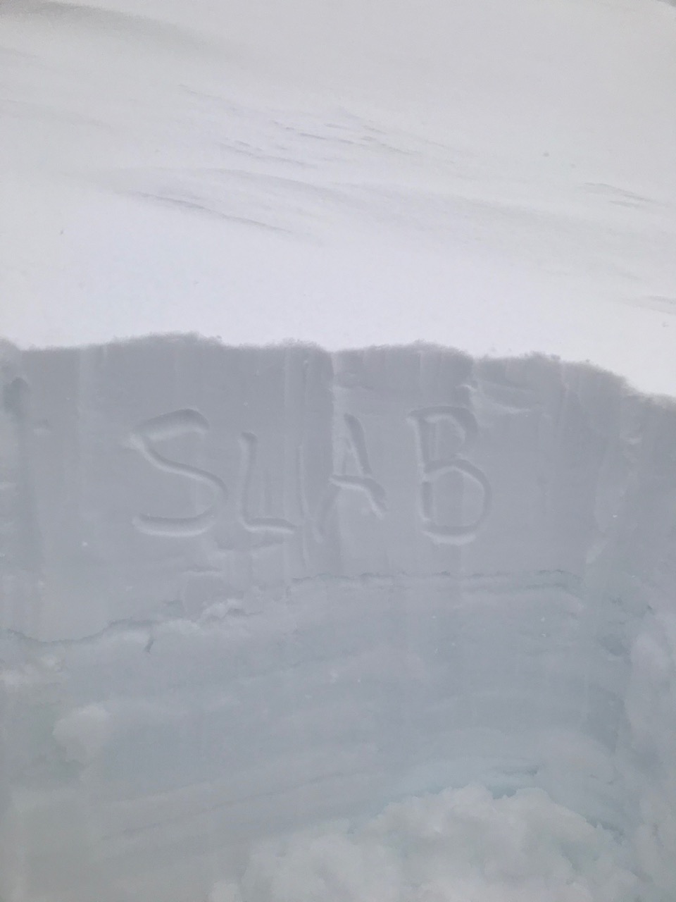
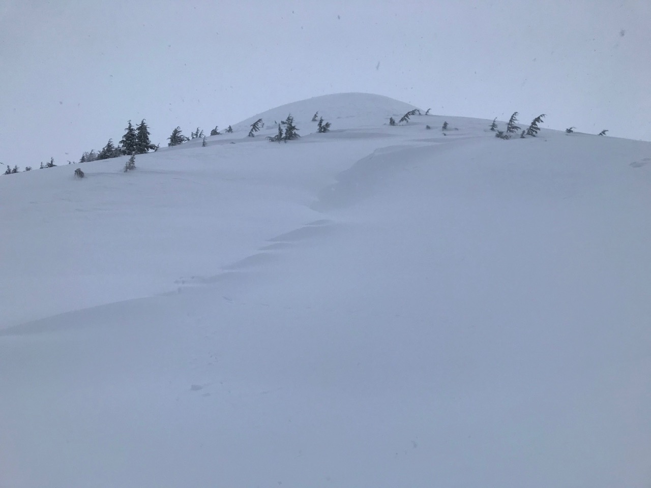
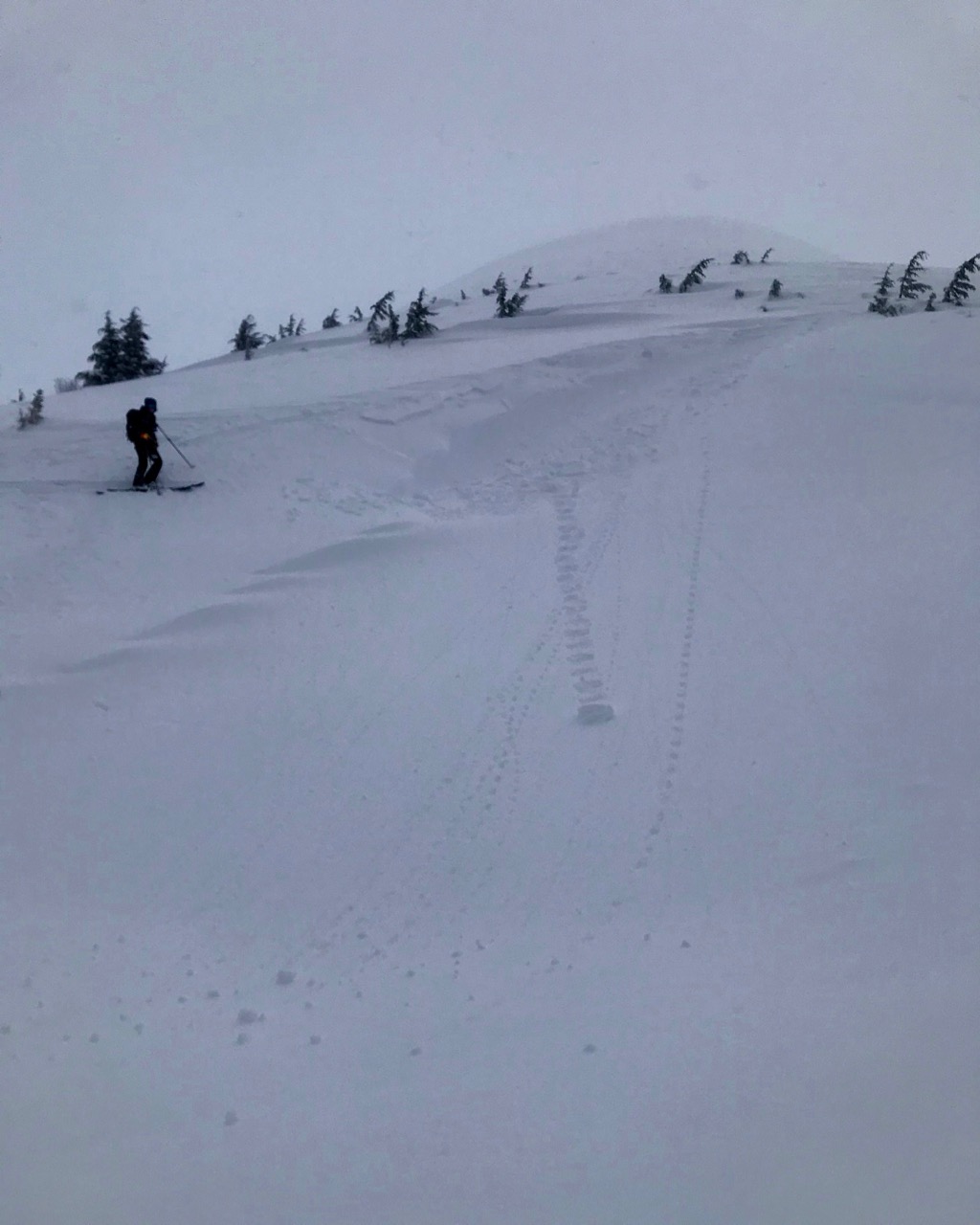
The avalanche danger is MODERATE above 1000′. Human triggered wind slabs and cornice falls remain possible on steep leeward slopes and gullies. Look for signs of obvious wind effect and choose terrain carefully.
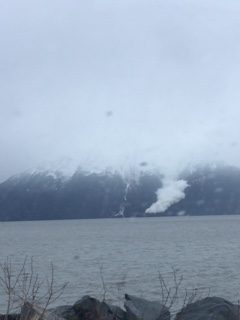
***There is virtually no snow below 1000′. However, there have been a two reported natural avalanches since Friday that have run from the Alpine to sea level in channeled terrain. This is not expected today but important to keep in mind when using summer hiking trails with overhead hazard.
Tonight! Join CNFAIC Forecaster Aleph Johnston-Bloom at Blue & Gold Boardshop from 7:00-8:30 for a FREE evening avalanche discussion on patterns in Alaskan avalanche accidents with practical takeaways to use this season. There will also be an avalanche gear demo outside in the snow (weather permitting).
Signal Word | Size (D scale) | Simple Descriptor |
Small | 1 | Unlikely to bury a person |
Large | 2 | Can bury a person |
Very Large | 3 | Can destroy a house |
Historic | 4 & 5 | Can destroy part or all of a village |
Yesterday the mountains received another half an inch to close to an inch of water with precipitation favoring Turnagain Pass. Above around 1800′ this fell as snow. This added to the 1-3′ that fell at upper elevations over the past few days. The winds continued to be easterly 20-40mph, gusting into the 50s. Observers in the field noted wind transport and tender wind slab conditions in wind exposed terrain. Today wind speeds are forecast to slowly decrease and overall snowfall should be light but wind slabs will still be possible in steep leeward terrain. It will be important to look for signs of wind effect and pay attention to blowing snow. What direction is the drifting? Does the slope or gully look fat and pillowed? Feel for stiffer snow over softer snow, look for cracking and listen for hollow sounds. Is there cornice overhanging the slope you want to ski?
Cornices: Continue to develop – give them plenty of space to prevent triggering from above, and limit exposure when traveling in the runout.
Signal Word | Size (D scale) | Simple Descriptor |
Small | 1 | Unlikely to bury a person |
Large | 2 | Can bury a person |
Very Large | 3 | Can destroy a house |
Historic | 4 & 5 | Can destroy part or all of a village |
Stay on the lookout for glide cracks and glide avalanches. There was a glide cycle in the Girdwood Valley at the end of last week and a few cracks opening on Tincan. If you do come across glide cracks give them a wide berth and limit time underneath. Glide avalanches are highly unpredictable. Sometimes cooling temperatures are associated with release.
Keep in mind that in the Summit Lake area and in parts of the advisory area that have an overall shallower snowpack in the Alpine, we are concerned about weak faceted snow that sits under the new snow from the past week. This is above 3000′, where the snow is dryer. Before the storm cycles, faceted snow existed at the base of the snowpack and other layers of facets/crusts. We have limited recent data from upper elevation terrain.
Yesterday: Cloudy skies with rain/snow showers throughout the day. Rain/snow line was around 1800′. Easterly winds were 20-40 mph gusting into the 50s. Temperatures were in the 40Fs at sea level and in the mid 20Fs at 3000′. Overnight skies remained cloudy with minimal precipitation and temperatures dropped slightly in the early morning.
Today: Cloudy skies and light rain/showers. Rain/snowline around 1700′ and 1-6″ of snow in the forecast. Temperatures will be in the high 30Fs at sea level and high 20Fs at ridgetops. Winds will be easterly 10-20 mph gusting into the 30s. Overnight temperatures are forecast to drop into the 20Fs, light snow showers will continue and winds will remain easterly and ease off.
Tomorrow: Continuing cloudy skies and rain/snow showers. Light east winds and temperatures in the low 30Fs to mid 20Fs. There is a cooling trend for the week with this quote in the National Weather Service long term discussion this morning, “At this point, Saturday looks brutally cold for Southcentral“. Stay tuned!
PRECIPITATION 24-hour data (6am – 6am)
Temp Avg (F) | Snow (in) | Water (in) | Snow Depth (in) | |
---|---|---|---|---|
Center Ridge (1880′) | 34 | 3 | 0.8 | 32 |
Summit Lake (1400′) | 34 | 0 | 0.1 | 7 |
Alyeska Mid (1700′) | 34 | 1 | 0.3 | 17 |
RIDGETOP 24-hour data (6am – 6am)
Temp Avg (F) | Wind Dir | Wind Avg (mph) | Wind Gust (mph) | |
---|---|---|---|---|
Sunburst (3812′) | 24 | NE | 26 | 60 |
Seattle Ridge (2400′) | NA* | NA* | NA* | NA* |
*Seattle Ridge weather station is down and as soon as the weather clears we will get it up and running!
Date | Region | Location | Observer |
---|---|---|---|
05/22/23 | Turnagain | Avalanche: Tincan | Nick D'Alessio |
05/12/23 | Turnagain | Avalanche: Tincan, Sunburst, Magnum, Cornbiscuit | Heather Thamm |
05/07/23 | Turnagain | Observation: Tincan – Bear Tracks | CNFAIC Staff |
05/05/23 | Turnagain | Observation: Seattle Ridge | AS/ WW Forecaster |
05/02/23 | Turnagain | Observation: Cornbiscuit | Schauer/ Sturgess Forecaster |
05/02/23 | Turnagain | Observation: Seward Hwy Turnagain Pass | Joel Curtis |
04/30/23 | Turnagain | Observation: Magnum | Ayla, Kit Crosby, Barton |
04/29/23 | Turnagain | Observation: Tincan | John Sykes |
04/28/23 | Turnagain | Avalanche: Taylor Pass/Pastoral | Schauer/ Creighton Forecaster |
04/28/23 | Turnagain | Avalanche: Tincan | Andy Moderow |
Status of riding areas across the Chugach NF is managed by the Glacier and Seward Ranger Districts, not avalanche center staff. Riding area information is posted as a public service to our users and updated based on snow depth and snow density to prevent resource damage at trailhead locations. Riding area questions contact: mailroom_r10_chugach@fs.fed.us
Area | Status | Weather & Riding Conditions |
---|---|---|
Glacier District |
Subscribe to Turnagain Pass
Avalanche Forecast by Email
This is a general backcountry avalanche advisory issued for Turnagain Arm with Turnagain Pass as the core advisory area. This advisory does not apply to highways, railroads or operating ski areas.