Turnagain Pass RSS

Archives
ARCHIVED - Forecasts expire after 24 hours.
Issued
Mon, December 14th, 2020 - 7:00AM
Expires
Tue, December 15th, 2020 - 7:00AM
Forecaster
Aleph Johnston-Bloom
Avalanche risk The Bottom Line

Today the avalanche danger is MODERATE above 1000′. Human triggered wind slab avalanches, 1-2’ deep are possible on steep, leeward slopes and in cross-loaded gullies. Be on the lookout for active wind transport, shooting cracks and stiff hollow sounding snow. As always, give cornices a wide berth.

The avalanche danger remains LOW  below 1000′.

SUMMIT LAKE: The snowpack in the Summit Lake area is generally thinner and weaker, making it easier to trigger a deep slab avalanche near the ground. This issue is particularly concerning above 2500′. Be cautious with your terrain choices, and avoid steep, rocky terrain where these avalanches will be most likely.

Special Announcements
Mon, December 14th, 2020
Alpine
Above 2,500'
2 - Moderate
Avalanche risk
Treeline
1,000'-2,500'
2 - Moderate
Avalanche risk
Below Treeline
Below 1,000'
1 - Low
Avalanche risk
0 - No Rating
1 - Low
2 - Moderate
3 - Considerable
4 - High
5 - Extreme
Avalanche risk Avalanche risk Avalanche risk Avalanche risk Avalanche risk
Travel Advice Generally safe avalanche conditions. Watch for unstable snow on isolated terrain features. Heightened avalanche conditions on specific terrain features. Evaluate snow and terrain carefully; identify features of concern. Dangerous avalanche conditions. Careful snowpack evaluation, cautious route-finding, and conservative decision-making essential. Very dangerous avalanche conditions. Travel in avalanche terrain not recommended. Extraordinarily dangerous avalanche conditions. Avoid all avalanche terrain.
Likelihood of Avalanches Natural and human-triggered avalanches unlikely. Natural avalanches unlikely; human-triggered avalanches possible. Natural avalanches possible; human-triggered avalanches likely. Natural avalanches likely; human-triggered avalanches very likely. Natural and human-triggered avalanches certain.
Avalanche Size and Distribution Small avalanches in isolated areas or extreme terrain. Small avalanches in specific areas; or large avalanches in isolated areas. Small avalanches in many areas; or large avalanches in specific areas; or very large avalanches in isolated areas. Large avalanches in many areas; or very large avalanches in specific areas. Very large avalanches in many areas.
Avalanche Problem 1
  • Wind Slabs
    Wind Slabs
  • Certain
    Very Likely
    Likely
    Possible
    Unlikely
    Likelihood
  • Historic (D4-5)
    Very Large (D3)
    Large (D2)
    Small (D1)
    Size
Wind Slabs
Wind Slab avalanches are the release of a cohesive layer of snow (a slab) formed by the wind. Wind typically transports snow from the upwind sides of terrain features and deposits snow on the downwind side. Wind slabs are often smooth and rounded and sometimes sound hollow, and can range from soft to hard. Wind slabs that form over a persistent weak layer (surface hoar, depth hoar, or near-surface facets) may be termed Persistent Slabs or may develop into Persistent Slabs.

Likelihood of Avalanches
Terms such as "unlikely", "likely", and "certain" are used to define the scale, with the chance of triggering or observing avalanches increasing as we move up the scale. For our purposes, "Unlikely" means that few avalanches could be triggered in avalanche terrain and natural avalanches are not expected. "Certain" means that humans will be able to trigger avalanches on many slopes, and natural avalanches are expected.

Size of Avalanches
Avalanche size is defined by the largest potential avalanche, or expected range of sizes related to the problem in question. Assigned size is a qualitative estimate based on the destructive classification system and requires specialists to estimate the harm avalanches may cause to hypothetical objects located in the avalanche track (AAA 2016, CAA 2014). Under this schema, "Small" avalanches are not large enough to bury humans and are relatively harmless unless they carry people over cliffs or through trees or rocks. Moving up the scale, avalanches become "Large" enough to bury, injure, or kill people. "Very Large" avalanches may bury or destroy vehicles or houses, and "Historic" avalanches are massive events capable of altering the landscape.

Signal Word Size (D scale) Simple Descriptor
Small 1 Unlikely to bury a person
Large 2 Can bury a person
Very Large 3 Can destroy a house
Historic 4 & 5 Can destroy part or all of a village
More info at Avalanche.org

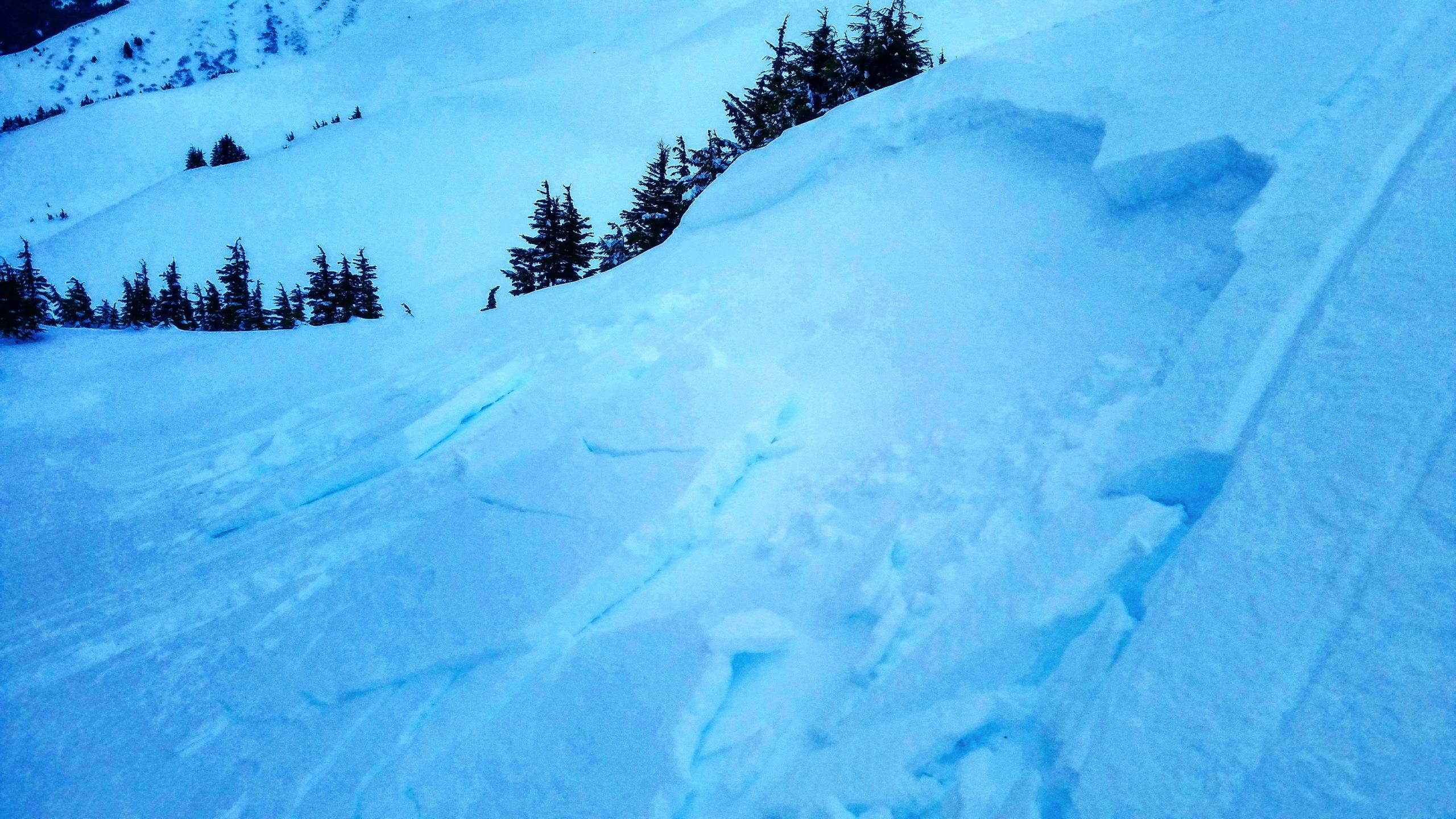
Triggering wind slabs 1-2′ deep in steep wind-loaded terrain remains the concern today. Observers on Saturday noted touchy snow and triggering small wind slabs. Yesterday through last night the winds continued to be the main show. Observers out during the day reported strong easterly winds above treeline transporting snow and variable wind affected surface snow. Ridgetop weather stations showed the strongest winds yesterday afternoon. Today east winds are forecast to continue blowing, 10-20 mph with gusts into the 30s and 40s, before easing off this afternoon. In upper elevation terrain in Girdwood there are already a few of inches of new snow this morning to blow around. If choosing to travel in avalanche terrain watch for blowing snow and active loading. Look for and avoid convex pillows of wind-drifted snow on the lee side of ridges and in gully features. Wind slabs may have a chalky look and feel, can be very hard, and may present a hollow drum like sound as you traverse across slope. Watch for shooting cracks from your machine or skis. As we move into day 3 of our wind event the slightly older, more developed wind slabs may be a bit stubborn and let you get out onto the slope before they fail.

Cornices: Sustained winds winds continue building cornices and could make them more prone to break and fall today. If you are traveling along a ridge, be sure to give them a wide berth. Cornices often break farther back than expected. In addition, minimize time spent below as they can release naturally and unexpectedly.

Sunburst weather station at 3812′. Wind speed profile for the last couple days. Note the duration of the elevated winds and the peak yesterday afternoon. 

Small skier triggered wind slab on Eddies, 12.12.20. Photo: Kakiko Ramos-Leon.

Avalanche Problem 2
  • Deep Persistent Slabs
    Deep Persistent Slabs
  • Certain
    Very Likely
    Likely
    Possible
    Unlikely
    Likelihood
  • Historic (D4-5)
    Very Large (D3)
    Large (D2)
    Small (D1)
    Size
Deep Persistent Slabs
Deep Persistent Slab avalanches are the release of a thick cohesive layer of hard snow (a slab), when the bond breaks between the slab and an underlying persistent weak layer deep in the snowpack. The most common persistent weak layers involved in deep, persistent slabs are depth hoar or facets surrounding a deeply buried crust. Deep Persistent Slabs are typically hard to trigger, are very destructive and dangerous due to the large mass of snow involved, and can persist for months once developed. They are often triggered from areas where the snow is shallow and weak, and are particularly difficult to forecast for and manage.

Likelihood of Avalanches
Terms such as "unlikely", "likely", and "certain" are used to define the scale, with the chance of triggering or observing avalanches increasing as we move up the scale. For our purposes, "Unlikely" means that few avalanches could be triggered in avalanche terrain and natural avalanches are not expected. "Certain" means that humans will be able to trigger avalanches on many slopes, and natural avalanches are expected.

Size of Avalanches
Avalanche size is defined by the largest potential avalanche, or expected range of sizes related to the problem in question. Assigned size is a qualitative estimate based on the destructive classification system and requires specialists to estimate the harm avalanches may cause to hypothetical objects located in the avalanche track (AAA 2016, CAA 2014). Under this schema, "Small" avalanches are not large enough to bury humans and are relatively harmless unless they carry people over cliffs or through trees or rocks. Moving up the scale, avalanches become "Large" enough to bury, injure, or kill people. "Very Large" avalanches may bury or destroy vehicles or houses, and "Historic" avalanches are massive events capable of altering the landscape.

Signal Word Size (D scale) Simple Descriptor
Small 1 Unlikely to bury a person
Large 2 Can bury a person
Very Large 3 Can destroy a house
Historic 4 & 5 Can destroy part or all of a village
More info at Avalanche.org

We sound like a broken record because we are still talking about the weak layer of facets on the ground. However, these deep persistent weak layers are tricky, and although it has been over a week since our last recorded avalanche on this layer, we still cannot rule it out entirely. This layer is most concerning in areas with thinner snowpack. We have been noting a thinner snowpack as you head south from Turnagain pass towards the Summit Lake area, and have also found thin coverage in Crow Creek. This issue is less concerning at elevations below 2500’, where a rain crust makes it very unlikely a human could trigger an avalanche deep in the snowpack.  For now the chance of triggering a Deep Persistent Slab avalanche is still an issue for elevations above 2500’, where that buried crust is not present. Avoid traveling on steep slopes with a thinner coverage, around rocky outcroppings, and be aware that although unlikely, if you were to trigger an avalanche on this layer it could be big.

Weather
Mon, December 14th, 2020

Yesterday: Skies were overcast with temperatures in the high 30°Fs to low 40°Fs at lower elevations and low 30°Fs to mid 20°Fs at upper elevations. Winds were easterly blowing 15-35 mph with gusts into the 40s and 50s. The was no measurable precipitation during the day. Early this morning light rain/snow showers started, favoring Girdwood, with rain/snow line around 500′. Overnight easterly winds were 10-20 mph with gusts into the 30s and 40s.  Temperatures at sea level were in the 30°Fs and in the 20°Fs in the Alpine.

Today: Rain and snow showers today with rain/snow line forecast to be around 700′ and 1-6″ of snow. East winds 10-25 mph with gusts into the 30s  and 40s becoming light and shifting to the southeast in the afternoon. Temperatures will be in the high 30°Fs to mid 20°Fs decreasing with elevation. Overnight light snow showers continue with snow falling to sea level and temperatures in the 20°Fs. Winds will remain light and swing around to the northwest.

Tomorrow: Light snow showers on and off throughout the day with light west winds and temperatures in the 20°Fs to low 30°Fs. Skies look to clear up for Wednesday and then shift back to clouds and snow later in the week. From the NWS discussion this morning, ‘The weather pattern from late week through next weekend continues to look quite dynamic’. 

PRECIPITATION 24-hour data (6am – 6am)

Temp Avg (F) Snow (in) Water (in) Snow Depth (in)
Center Ridge (1880′) 33 0 0 59
Summit Lake (1400′) 33 0 0 24
Alyeska Mid (1700′) 33 4 0.29 58

RIDGETOP 24-hour data (6am – 6am)

Temp Avg (F) Wind Dir Wind Avg (mph) Wind Gust (mph)
Sunburst (3812′) 23 NE 24 64
Seattle Ridge (2400′) 27 SE 12 28
Observations
Recent Observations for Turnagain Pass
Date Region Location
03/16/24 Turnagain Observation: Seattle Ridge front side
03/16/24 Turnagain Observation: TinCan Backdoor/ Center Ridge/ Sunburst Backdoor
03/16/24 Turnagain Observation: Turnagain Front Side
03/15/24 Turnagain Avalanche: Main Bowl
03/14/24 Turnagain Avalanche: Tincan
03/14/24 Turnagain Avalanche: Sunburst South Face
03/14/24 Turnagain Avalanche: Tincan common
03/14/24 Turnagain Avalanche: Seattle Ridge – avalanches on the front and back side
03/13/24 Turnagain Observation: Turnagain Flats
03/12/24 Turnagain Observation: Tincan
Riding Areas

The riding areas page has moved. Please click here & update your bookmarks.


Subscribe to Turnagain Pass
Avalanche Forecast by Email

This is a general backcountry avalanche advisory issued for Turnagain Arm with Turnagain Pass as the core advisory area. This advisory does not apply to highways, railroads or operating ski areas.