Turnagain Pass Avalanche Forecast RSS

Archives
ARCHIVED FORECAST - All forecasts expire after 24 hours from the posting date/time.
Issued
Sun, December 5th, 2021 - 7:00AM
Expires
Mon, December 6th, 2021 - 7:00AM
Forecaster
Andrew Schauer
Avalanche risk The Bottom Line

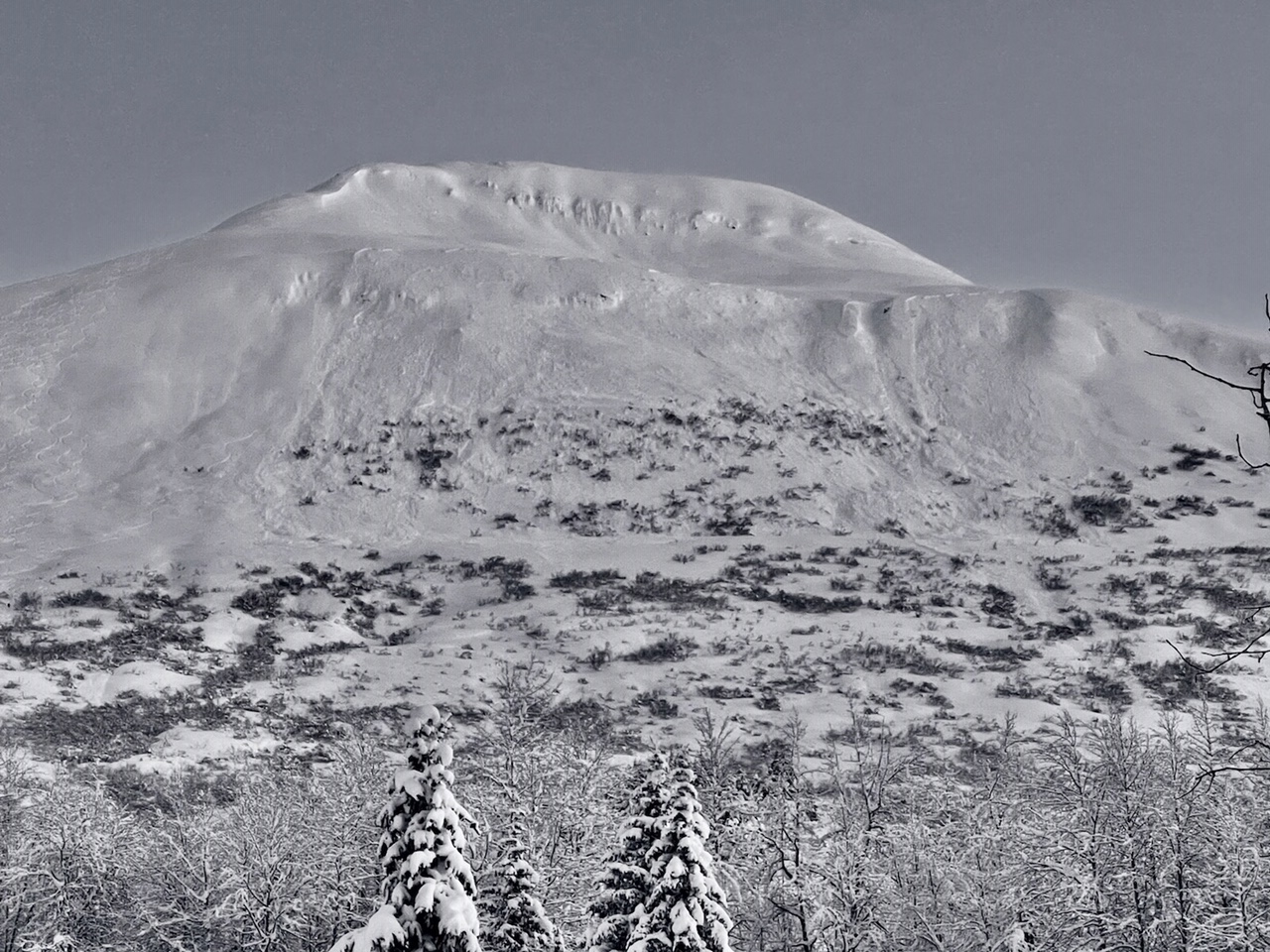
The avalanche danger will be CONDSIDERABLE at all elevations as active weather begins to load an already dangerous snowpack. Strong winds will arrive today ahead of an approaching storm, building sensitive wind slabs that will be easily triggered by a person and will possibly release naturally. It is likely even a small wind slab around a foot deep triggered near the surface could step down to persistent weak layers buried 2-4′ deep, creating large avalanches. Be cautious with your terrain choices today, sticking to low-angle terrain. Be aware that you can trigger an avalanche from above, adjacent to, or below steeper terrain.

Portage/Placer Valley: These areas are expected to see heavier snowfall than Turnagain Pass and Girdwood. Expect dangerous avalanche conditions as the wind blows and snow starts to stack up.

Summit Lake: The approaching storm will load a snowpack with multiple weak layers. This area has not been tested by a major loading event in over a month, and we expect to see dangerous avalanche conditions as the storm develops.

Snug Harbor/Lost Lake/Seward: The storm is expected to arrive earlier in the southern areas, with heavy snowfall expected today. The mountains near Seward could see 2-4′ snow by the end of the day tomorrow, with 3-5′ possible by Tuesday at upper elevations. All of this snow is going to fall on a weak snowpack, making for very dangerous avalanche conditions. Travel in and below avalanche terrain is not recommended.

Special Announcements

The National Weather Service has issued a Winter Storm Warning for tonight through Tuesday morning for Girdwood, Whittier, Moose Pass and Seward.

Thanks to our sponsors!
Sun, December 5th, 2021
Alpine
Above 2,500'
Considerable (3)
Avalanche risk
Treeline
1,000'-2,500'
Considerable (3)
Avalanche risk
Below Treeline
Below 1,000'
Considerable (3)
Avalanche risk
Alpine
Above 2,500'
Avalanche risk
Considerable (3)
Treeline
1,000'-2,500'
Avalanche risk
Considerable (3)
Below Treeline
Below 1,000'
Avalanche risk
Considerable (3)
Danger Scale:
No Rating (0)
Low (1)
Moderate (2)
Considerable (3)
High (4)
Extreme (5)
Recent Avalanches

After seeing reports of 11 human-triggered avalanches on Thursday and Friday, we are happy to say there were no known avalanches yesterday. You can visit our observations page for more details of all of the activity from the past few days. These events include several very large avalanches and one full burial. Luckily nobody was injured or worse during that period of activity.

Avalanche Problem 1
  • Wind Slabs
    Wind Slabs
  • Almost Certain
    Very Likely
    Likely
    Possible
    Unlikely
    Likelihood
  • Historic (D4-5)
    Very Large (D3)
    Large (D2)
    Small (D1)
    Size
Wind Slabs
Wind Slab avalanches are the release of a cohesive layer of snow (a slab) formed by the wind. Wind typically transports snow from the upwind sides of terrain features and deposits snow on the downwind side. Wind slabs are often smooth and rounded and sometimes sound hollow, and can range from soft to hard. Wind slabs that form over a persistent weak layer (surface hoar, depth hoar, or near-surface facets) may be termed Persistent Slabs or may develop into Persistent Slabs.

Likelihood of Avalanches
Terms such as "unlikely", "likely", and "certain" are used to define the scale, with the chance of triggering or observing avalanches increasing as we move up the scale. For our purposes, "Unlikely" means that few avalanches could be triggered in avalanche terrain and natural avalanches are not expected. "Certain" means that humans will be able to trigger avalanches on many slopes, and natural avalanches are expected.

Size of Avalanches
Avalanche size is defined by the largest potential avalanche, or expected range of sizes related to the problem in question. Assigned size is a qualitative estimate based on the destructive classification system and requires specialists to estimate the harm avalanches may cause to hypothetical objects located in the avalanche track (AAA 2016, CAA 2014). Under this schema, "Small" avalanches are not large enough to bury humans and are relatively harmless unless they carry people over cliffs or through trees or rocks. Moving up the scale, avalanches become "Large" enough to bury, injure, or kill people. "Very Large" avalanches may bury or destroy vehicles or houses, and "Historic" avalanches are massive events capable of altering the landscape.

Signal Word Size (D scale) Simple Descriptor
Small 1 Unlikely to bury a person
Large 2 Can bury a person
Very Large 3 Can destroy a house
Historic 4 & 5 Can destroy part or all of a village
More info at Avalanche.org

Active weather returns today, and we are expecting to see dangerous avalanche conditions. The approaching storm will start off with strong easterly winds blowing 15-30 mph and gusts at 40-50 mph during the day. While we do not expect to see heavy snowfall until later tonight, these winds already have plenty of snow to move around, with around 2′ of soft snow on the ground. It is likely a person will be able to trigger an avalanche on a freshly wind loaded slope, and we may see some avalanches releasing naturally. Given the already dangerous snowpack, this is not your typical wind slab problem. There are multiple layers of weak facets and surface hoar buried 2-3′ deep that have proven to be capable of producing large avalanches in the past few days (more on this in problem 2 below). A relatively small wind slab avalanche triggered near the surface has the potential to step down to these weak layers and propagate widely across a slope, creating a very large avalanche.

Given the dangerous snowpack setup, we need to treat wind slabs with even more caution than normal today. If you plan on getting out, be careful with your route finding. While the strongest winds will be up at the ridgetops, it is looking like we will see enough wind for slab-building even at and below treeline today. We have been stressing the importance of sticking to low slope angles (below 30 degrees) for the past few days, and that will be increasingly important today.

Predicted storm totals by Tuesday morning. We may get a few inches during the day today, but snowfall is expected to ramp up tonight.

Avalanche Problem 2
  • Persistent Slabs
    Persistent Slabs
  • Almost Certain
    Very Likely
    Likely
    Possible
    Unlikely
    Likelihood
  • Historic (D4-5)
    Very Large (D3)
    Large (D2)
    Small (D1)
    Size
Persistent Slabs
Persistent Slab avalanches are the release of a cohesive layer of snow (a slab) in the middle to upper snowpack, when the bond to an underlying persistent weak layer breaks. Persistent layers include: surface hoar, depth hoar, near-surface facets, or faceted snow. Persistent weak layers can continue to produce avalanches for days, weeks or even months, making them especially dangerous and tricky. As additional snow and wind events build a thicker slab on top of the persistent weak layer, this avalanche problem may develop into a Deep Persistent Slab.

Likelihood of Avalanches
Terms such as "unlikely", "likely", and "certain" are used to define the scale, with the chance of triggering or observing avalanches increasing as we move up the scale. For our purposes, "Unlikely" means that few avalanches could be triggered in avalanche terrain and natural avalanches are not expected. "Certain" means that humans will be able to trigger avalanches on many slopes, and natural avalanches are expected.

Size of Avalanches
Avalanche size is defined by the largest potential avalanche, or expected range of sizes related to the problem in question. Assigned size is a qualitative estimate based on the destructive classification system and requires specialists to estimate the harm avalanches may cause to hypothetical objects located in the avalanche track (AAA 2016, CAA 2014). Under this schema, "Small" avalanches are not large enough to bury humans and are relatively harmless unless they carry people over cliffs or through trees or rocks. Moving up the scale, avalanches become "Large" enough to bury, injure, or kill people. "Very Large" avalanches may bury or destroy vehicles or houses, and "Historic" avalanches are massive events capable of altering the landscape.

Signal Word Size (D scale) Simple Descriptor
Small 1 Unlikely to bury a person
Large 2 Can bury a person
Very Large 3 Can destroy a house
Historic 4 & 5 Can destroy part or all of a village
More info at Avalanche.org

After two scary days of large human-triggered avalanches on Thursday and Friday, we were really happy not to receive any reports of activity yesterday. That lack of activity yesterday says a lot more about people making smart decisions than it does about the snowpack. Persistent weak layers can take a really long time to heal, and our current setup is primed to produce large avalanches. As strong winds build slabs on top of this dangerous setup, they will be loading those weak layers and pushing them closer to their breaking point. We saw evidence of large natural avalanches during the most recent wind event early last week, and we can expect to see similar activity today.

Conditions will become more dangerous as the weather gets more interesting. Conservative decision making will be the key to coming home safe at the end of the day. Keep in mind these persistent weak layers have shown they are capable of being triggered remotely. This means you can trigger an avalanche from above, to the side of, or below a steep slope. We’ve also seen large avalanches on slopes that have multiple older sets of tracks on them. Persistent slab problems are challenging and they really just require patience. Depending on how this approaching storm unfolds, we may see quite a show. As the weather picks up today, it will be important to stick to low angle slopes and be aware of what is going on above you.

Large skier-triggered avalanche on Magnum from Thursday. Avalanches like this are still possible today, and likelihood will increase as winds continue to load the snowpack and snowfall picks up later in the day. 12.02.2021

Large natural avalanches on Orca that occurred during the last significant wind event (11/29-11/30). Similar activity will be possible today. 12.02.2021

Additional Concern
  • Glide Avalanches
    Glide Avalanches
Glide Avalanches
Glide Avalanches are the release of the entire snow cover as a result of gliding over the ground. Glide avalanches can be composed of wet, moist, or almost entirely dry snow. They typically occur in very specific paths, where the slope is steep enough and the ground surface is relatively smooth. They are often proceeded by full depth cracks (glide cracks), though the time between the appearance of a crack and an avalanche can vary between seconds and months. Glide avalanches are unlikely to be triggered by a person, are nearly impossible to forecast, and thus pose a hazard that is extremely difficult to manage.
More info at Avalanche.org

Glide activity seems to have slowed down in the area, but it hasn’t stopped entirely (see photo below). It is impossible to predict the exact timing of glide avalanches, and they are especially dangerous because they involve the entire season’s snowpack. Limit time spent traveling below glide cracks, and be aware of the potential hazard of falling into one of these monsters as you move around.

Fresh glide crack behind Penguin Ridge, viewed yesterday from Eddie’s. Photo: Andy Moderow. 12.04.2021

Weather
Sun, December 5th, 2021

Yesterday: We had one more day of cold and clear weather, with high temperatures in the single digits  to low teens above 0F near ridgetops and hovering in the single digits above and below 0F in the valleys. Winds were light and variable during the day, picking up to 10-15 mph out of the east around midnight. No precipitation was recorded.

Today: Things will start to get a little more exciting today. Easterly winds are expected to continue, with sustained speeds at 15-30 mph and gusts of 45-50 mph. Snow will arrive behind the wind, with around 1-3″ expected during the day. Temperatures are expected to continue to increase, making it up to the upper 20’s to low 30’s F.

Tomorrow: Heavy snowfall begins tonight and continues through tomorrow. We are expecting 1-2′ in Girdwood and Turnagain pass, with heavier snowfall near Portage. We might see the rain level pick up to 100 or 200′, with high temperatures hovering around 30 F. Winds should calm down slightly, blowing 10-20 mph out of the east tomorrow. This storm has proven difficult to predict, so be sure to stay tuned in for updates and changes.

PRECIPITATION 24-hour data (6am – 6am)

Temp Avg (F) Snow (in) Water (in) Snow Depth (in)
Center Ridge (1880′) 15 0 0 55
Summit Lake (1400′) 5 0 0 N/A
Alyeska Mid (1700′) 13 0 0 N/A

RIDGETOP 24-hour data (6am – 6am)

Temp Avg (F) Wind Dir Wind Avg (mph) Wind Gust (mph)
Sunburst (3812′) 10 E* 5* 27
Seattle Ridge (2400′) 14 SE 6* 20

*Winds increased to 10-15 mph around midnight last night, after staying around 5 mph for most of the day.

Observations
Recent Observations for Turnagain Pass
Date Region Location
05/22/23 Turnagain Avalanche: Tincan
05/12/23 Turnagain Avalanche: Tincan, Sunburst, Magnum, Cornbiscuit
05/07/23 Turnagain Observation: Tincan – Bear Tracks
05/05/23 Turnagain Observation: Seattle Ridge
05/02/23 Turnagain Observation: Cornbiscuit
05/02/23 Turnagain Observation: Seward Hwy Turnagain Pass
04/30/23 Turnagain Observation: Magnum
04/29/23 Turnagain Observation: Tincan
04/28/23 Turnagain Avalanche: Taylor Pass/Pastoral
04/28/23 Turnagain Avalanche: Tincan
Riding Areas
Updated Thu, June 01st, 2023

Status of riding areas across the Chugach NF is managed by the Glacier and Seward Ranger Districts, not avalanche center staff. Riding area information is posted as a public service to our users and updated based on snow depth and snow density to prevent resource damage at trailhead locations. Riding area questions contact: mailroom_r10_chugach@fs.fed.us

Area Status Weather & Riding Conditions
Glacier District
Johnson Pass
Closed
Closed May 15.
Placer River
Closed
Closed May 15.
Skookum Drainage
Closed
Will close to motorized use on April 1, 2023 per the National Forest Plan.
Turnagain Pass
Closed
Will close on June 1.
Twentymile
Closed
Scheduled closure May 1.
Seward District
Carter Lake
Closed
Scheduled closure May 1.
Lost Lake Trail
Closed
Scheduled closure May 1.
Primrose Trail
Closed
Scheduled closure May 1.
Resurrection Pass Trail
Closed
Closed to motorized use for the 2022/23 winter season per Forest Plan. Open next season.
Snug Harbor
Closed
Extended opening until May 15.
South Fork Snow River Corridor
Closed
Scheduled closure May 1.
Summit Lake
Closed
Scheduled closure May 1.

Subscribe to Turnagain Pass
Avalanche Forecast by Email

This is a general backcountry avalanche advisory issued for Turnagain Arm with Turnagain Pass as the core advisory area. This advisory does not apply to highways, railroads or operating ski areas.