Turnagain Pass RSS

Archives
ARCHIVED - Forecasts expire after 24 hours.
Issued
Thu, April 28th, 2022 - 7:00AM
Expires
Fri, April 29th, 2022 - 7:00AM
Forecaster
John Sykes
Avalanche risk The Bottom Line

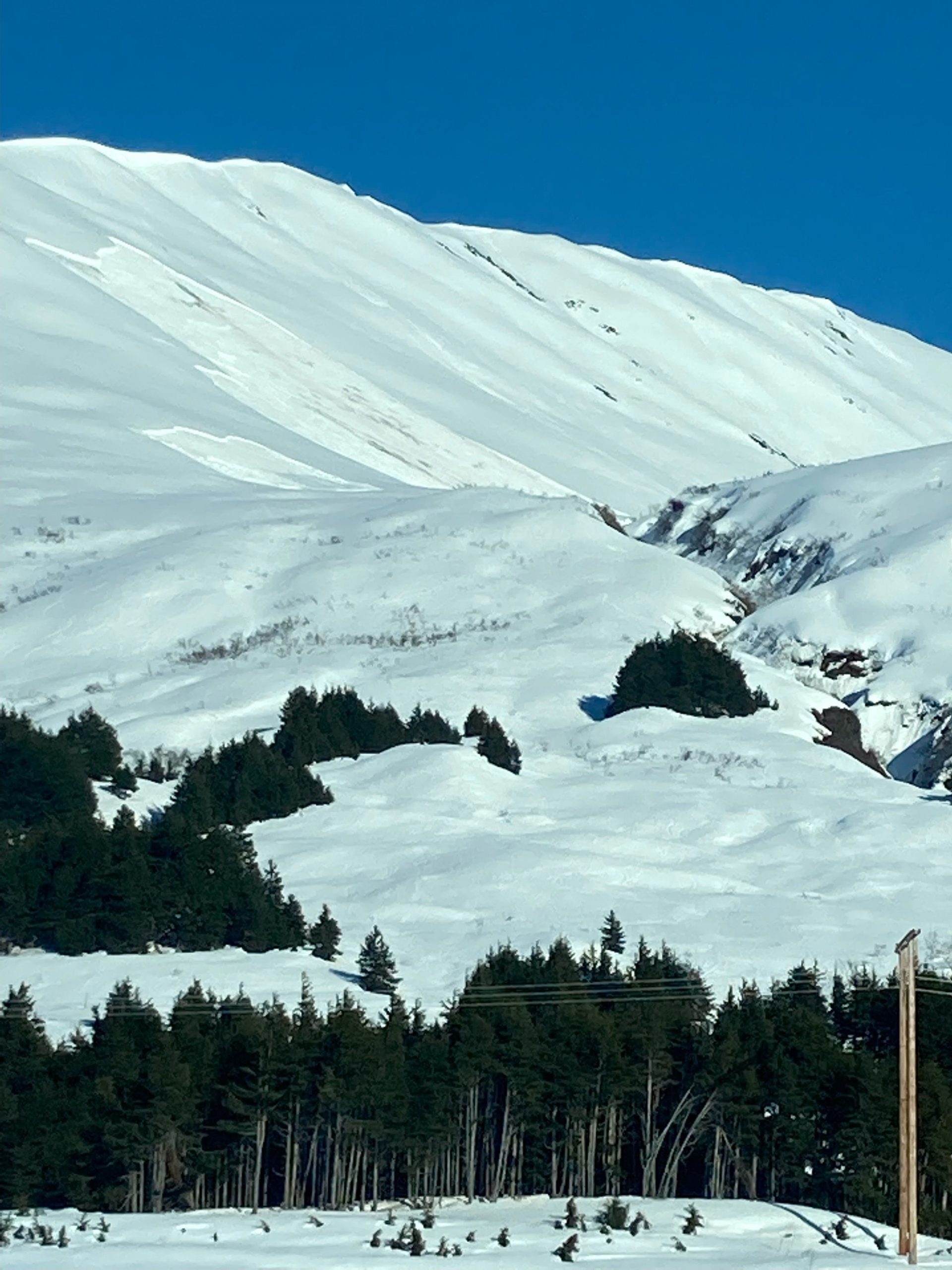
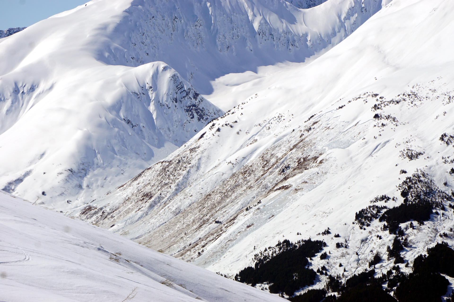
The avalanche danger will start out LOW today but will quickly rise to HIGH as the snow surface melts and springtime natural avalanches become likely on east, south, and west facing terrain. With clouds moving into the area around 4 am it is uncertain how much the snow surface refroze last night, and the timing of the surface crust melting out will drive the transition towards high danger and the onset of wet slab avalanches. Wet loose avalanches are also likely for human triggering today and can be more forceful than expected, especially on bigger slopes where they can pick up momentum. Finally, human triggered avalanches are possible on north facing terrain at higher elevations where a layer of facets exists 1-3′ deep underneath the last round of storm snow.

Summer hiking trails like the Byron Glacier Trail and Crow Pass Trail are susceptible to being in the runout of large wet avalanches coming down from above, so avoiding summer trails that travel through avalanche paths is recommended during this period of springtime natural avalanche activity.

FRIDAY AVALANCHE OUTLOOK: There will be no avalanche forecast issued tomorrow, the final forecast of the season will be issued on Saturday, April 30th. The weather conditions are expected to remain largely similar to today and the springtime cycle of wet slab avalanches will likely continue to progress onto shadier aspects and areas with a deeper snowpack. Pay attention to overnight temperatures and cloud cover to get a sense for how well the snow surface refroze. Once the sun melts the surface crust, expect the avalanche danger to rise back to HIGH tomorrow afternoon and evening.

Special Announcements
  • End of Season Operations:  This is our final week of forecasting. There will be a forecast this Saturday with our springtime tips posted on Sunday, May 1st.
  • Chugach State Park – A wet slab avalanche released on Flattop yesterday (see ob here), which is a sign that the spring shed cycle is occurring in the front range. Keep an eye out for wet snow more than ankle deep as a sign for potential wet loose and wet slab avalanches in the afternoon and evening.
Thu, April 28th, 2022
Alpine
Above 2,500'
4 - High
Avalanche risk
Treeline
1,000'-2,500'
4 - High
Avalanche risk
Below Treeline
Below 1,000'
4 - High
Avalanche risk
0 - No Rating
1 - Low
2 - Moderate
3 - Considerable
4 - High
5 - Extreme
Avalanche risk Avalanche risk Avalanche risk Avalanche risk Avalanche risk
Travel Advice Generally safe avalanche conditions. Watch for unstable snow on isolated terrain features. Heightened avalanche conditions on specific terrain features. Evaluate snow and terrain carefully; identify features of concern. Dangerous avalanche conditions. Careful snowpack evaluation, cautious route-finding, and conservative decision-making essential. Very dangerous avalanche conditions. Travel in avalanche terrain not recommended. Extraordinarily dangerous avalanche conditions. Avoid all avalanche terrain.
Likelihood of Avalanches Natural and human-triggered avalanches unlikely. Natural avalanches unlikely; human-triggered avalanches possible. Natural avalanches possible; human-triggered avalanches likely. Natural avalanches likely; human-triggered avalanches very likely. Natural and human-triggered avalanches certain.
Avalanche Size and Distribution Small avalanches in isolated areas or extreme terrain. Small avalanches in specific areas; or large avalanches in isolated areas. Small avalanches in many areas; or large avalanches in specific areas; or very large avalanches in isolated areas. Large avalanches in many areas; or very large avalanches in specific areas. Very large avalanches in many areas.
Recent Avalanches

Many new avalanches are coming down each day, to the point where it is very challenging to track how old each individual avalanche is. Here are some of the more recent observations we have seen to illustrate how active the spring shed cycle is right now.

  • Sunburst – These wet slabs occurred sometime yesterday afternoon or evening on the SW aspect of Sunburst. The lower smaller avalanche is on surprisingly low angle terrain.

Two large wet slabs on the common ski run on the SW aspect of Sunburst. Photo from anonymous 4.27.22

  • Pete’s South – Large wet slab on the southwest aspect of Pete’s South which was observed yesterday.

Large set slab on Pete’s South at about 2500′ on a SW aspect. Photo from Jim Kennedy 4.27.22

  • Lynx Creek – Very large wet slab on the east face of Lynx Creek at about 2500′.

Very large wet slab with wide propagation on the lower slopes of Lynx Creek on an east aspect. Photo 4.27.22

Avalanche Problem 1
  • Spring Conditions
    Spring Conditions
  • Certain
    Very Likely
    Likely
    Possible
    Unlikely
    Likelihood
  • Historic (D4-5)
    Very Large (D3)
    Large (D2)
    Small (D1)
    Size
Spring Conditions
Warmth has a tricky effect on snow. On the one hand it speeds up the stabilization of the snowpack (reduces the chance of slab avalanches). But a SUDDEN rise of temperature increases the chance of slab avalanches considerably. When this warm period is followed by cooling down, then the chance of slab avalanches reduces. Even more so: the more often the temperature changes, the more stable the snowpack becomes when looking at slab avalanches. Once the temperature becomes too warm we have to deal with wet snow avalanches.

Likelihood of Avalanches
Terms such as "unlikely", "likely", and "certain" are used to define the scale, with the chance of triggering or observing avalanches increasing as we move up the scale. For our purposes, "Unlikely" means that few avalanches could be triggered in avalanche terrain and natural avalanches are not expected. "Certain" means that humans will be able to trigger avalanches on many slopes, and natural avalanches are expected.

Size of Avalanches
Avalanche size is defined by the largest potential avalanche, or expected range of sizes related to the problem in question. Assigned size is a qualitative estimate based on the destructive classification system and requires specialists to estimate the harm avalanches may cause to hypothetical objects located in the avalanche track (AAA 2016, CAA 2014). Under this schema, "Small" avalanches are not large enough to bury humans and are relatively harmless unless they carry people over cliffs or through trees or rocks. Moving up the scale, avalanches become "Large" enough to bury, injure, or kill people. "Very Large" avalanches may bury or destroy vehicles or houses, and "Historic" avalanches are massive events capable of altering the landscape.

Signal Word Size (D scale) Simple Descriptor
Small 1 Unlikely to bury a person
Large 2 Can bury a person
Very Large 3 Can destroy a house
Historic 4 & 5 Can destroy part or all of a village
More info at Avalanche.org

The mountain snowpack is falling apart right now, and the best move might be to just avoid avalanche terrain and let the wet slabs have free reign. We are starting to see more active wet slab avalanches on east, south, and now west facing slopes and in areas with deeper snowpacks, such as the SW face of Sunburst. For the first time this spring the temperature did not get below freezing at the Sunburst weather stations at 3800′ on Wednesday night, which resulted in a poor overnight refreeze and not too surprisingly a large wet slab avalanche released on the SW face of Sunburst yesterday afternoon. Last night got a little colder, with an overnight low of 27 F at 3800′, but cloud cover moved in around 4 am this morning which will limit the ability for the surface snow to refreeze.

Depending on how much the snow was able to refreeze before the clouds moved in there will probably be some time this morning to take advantage of corn skiing, but yesterday the thin surface crust had unconsolidated wet snow underneath up to about 2000′ which meant the conditions changed from crusty to deep wet snow really quickly in Turnagain Pass. As the snow surface softens and melt water starts to flow into the snowpack today the avalanche danger will increase quickly and large wet slabs will become likely. If cloud cover persists throughout the day then the sun might not melt the snow surface as quickly, but the forecast is for patchy cloud cover today so those periods of sunshine combined with warm air temperatures should be enough for another cycle of wet slabs this afternoon.

Wet Loose: Creating an avalanche in the wet surface snow on steeper terrain is also likely once the crust softens today. These avalanches can be much more forceful than expected and run far down slope on bigger terrain.

Cornice: Warm temperatures and sun continue to melt away cornices and lead to large chunks of cornices breaking off spontaneously. Be careful travelling along ridgelines and give cornices plenty of space. It is also best to avoid spending time underneath cornices if the temperatures are high or they are getting direct sunlight.

Glide Avalanches: As always try to avoid spending time underneath glide cracks because they can release at anytime and cause large and destructive avalanches. Keep an eye out for glide cracks opening up throughout the day, even if they weren’t visible earlier that day they can release rapidly this time of year.

Avalanche Problem 2
  • Persistent Slabs
    Persistent Slabs
  • Certain
    Very Likely
    Likely
    Possible
    Unlikely
    Likelihood
  • Historic (D4-5)
    Very Large (D3)
    Large (D2)
    Small (D1)
    Size
Persistent Slabs
Persistent Slab avalanches are the release of a cohesive layer of snow (a slab) in the middle to upper snowpack, when the bond to an underlying persistent weak layer breaks. Persistent layers include: surface hoar, depth hoar, near-surface facets, or faceted snow. Persistent weak layers can continue to produce avalanches for days, weeks or even months, making them especially dangerous and tricky. As additional snow and wind events build a thicker slab on top of the persistent weak layer, this avalanche problem may develop into a Deep Persistent Slab.

Likelihood of Avalanches
Terms such as "unlikely", "likely", and "certain" are used to define the scale, with the chance of triggering or observing avalanches increasing as we move up the scale. For our purposes, "Unlikely" means that few avalanches could be triggered in avalanche terrain and natural avalanches are not expected. "Certain" means that humans will be able to trigger avalanches on many slopes, and natural avalanches are expected.

Size of Avalanches
Avalanche size is defined by the largest potential avalanche, or expected range of sizes related to the problem in question. Assigned size is a qualitative estimate based on the destructive classification system and requires specialists to estimate the harm avalanches may cause to hypothetical objects located in the avalanche track (AAA 2016, CAA 2014). Under this schema, "Small" avalanches are not large enough to bury humans and are relatively harmless unless they carry people over cliffs or through trees or rocks. Moving up the scale, avalanches become "Large" enough to bury, injure, or kill people. "Very Large" avalanches may bury or destroy vehicles or houses, and "Historic" avalanches are massive events capable of altering the landscape.

Signal Word Size (D scale) Simple Descriptor
Small 1 Unlikely to bury a person
Large 2 Can bury a person
Very Large 3 Can destroy a house
Historic 4 & 5 Can destroy part or all of a village
More info at Avalanche.org

On higher north facing slopes there is a layer of facets 1-3+’ deep underlying the storm snow from this past weekend that has produced some impressive avalanches with wide propagation this week. We looked for that layer at 2500′ on the north shoulder of Magnum yesterday and were not able to find it, but I am guessing we just did not get enough elevation for the layer to be an issue. If you are aiming for higher elevation north terrain today it is something to watch out for and might be difficult to assess in areas that received larger storm totals due to the weak layer being deeply buried. In Turnagain Pass the storm totals ranged from 1-3′ depending on elevation on location in the pass, but in Portage and Placer there could be well over 3′ of snow on top of the faceted layer.

Large storm or wind slab avalanche on the west face of Eddies that looks like it released at the interface of the storm snow and the old snow surface. Photo 4.27.22


Weather
Thu, April 28th, 2022

Yesterday: For the first time this season the air temperature did not get below freezing at the 3800′ Sunburst weather station yesterday, with the low temperature at 33 F at 5 am and the high temperature at 51 F at 12 pm. Wind was light out of the south and the skies stayed clear.

Today: Temperatures have cooled off slightly today, with a low of 27 F on Sunburst overnight and a high of around 40 F expected today. Cloud cover is expected to move through the area with alternating periods of clear and cloudy skies. Winds are expected to remain light out of the south east, with averages ranging from 0-10 mph and gusts up to 20 mph.

Tomorrow: Friday is expected to be a little bit cooler and less cloudy than today with the potential for increasing winds throughout the day as a low pressure system moves closer to our area. Saturday could bring an eventful end to the forecasting season as some precipitation and stronger winds are expected across the forecast area.

PRECIPITATION 24-hour data (6am – 6am)

Temp Avg (F) Snow (in) Water (in) Snow Depth (in)
Center Ridge (1880′) 42 0 0 99
Summit Lake (1400′) 41 0 0 29
Alyeska Mid (1700′) 41 0 0 NA

RIDGETOP 24-hour data (6am – 6am)

Temp Avg (F) Wind Dir Wind Avg (mph) Wind Gust (mph)
Sunburst (3812′) 38 S 2 17
Seattle Ridge (2400′) 37 SE 5 15
Observations
Recent Observations for Turnagain Pass
Date Region Location
04/16/24 Turnagain Observation: Cornbiscuit
04/15/24 Turnagain Observation: Taylor Pass
04/15/24 Turnagain Observation: Seward Highway – Tern Lake to Portage
04/14/24 Turnagain Observation: Sunburst
04/14/24 Turnagain Observation: Turnagain Pass Snomo
04/13/24 Turnagain Observation: Spokane Creek
04/11/24 Turnagain Observation: Tincan
04/10/24 Turnagain Avalanche: Seattle Ridge
04/10/24 Turnagain Observation: Cornbiscuit South Face
04/10/24 Turnagain Avalanche: Tincan
Riding Areas

The riding areas page has moved. Please click here & update your bookmarks.


Subscribe to Turnagain Pass
Avalanche Forecast by Email

This is a general backcountry avalanche advisory issued for Turnagain Arm with Turnagain Pass as the core advisory area. This advisory does not apply to highways, railroads or operating ski areas.