Turnagain Pass Avalanche Forecast RSS

Archives
ARCHIVED FORECAST - All forecasts expire after 24 hours from the posting date/time.
Issued
Thu, April 18th, 2019 - 7:00AM
Expires
Fri, April 19th, 2019 - 7:00AM
Forecaster
Aleph Johnston-Bloom
Avalanche risk The Bottom Line

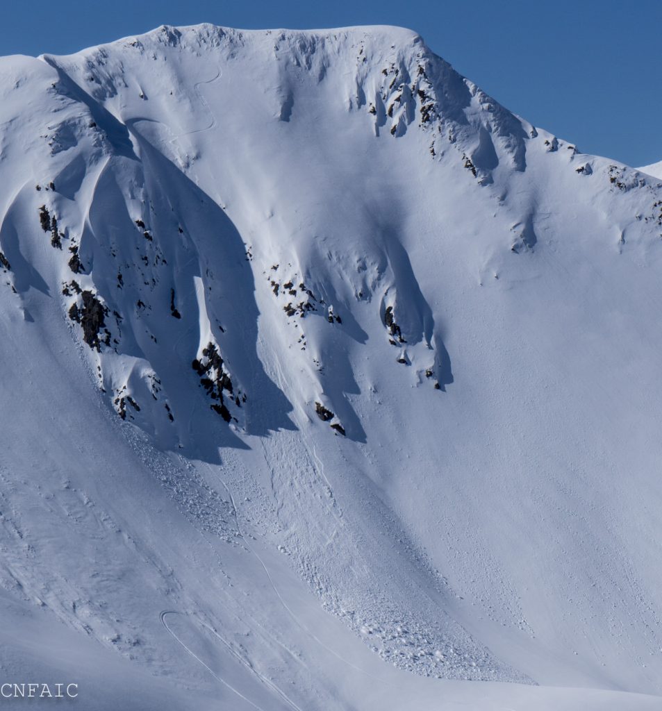
The avalanche danger is  MODERATE  on slopes above 2,500′. Triggering a slab 1-2′ deep is possible on steep Northerly slopes in the Alpine. Pay attention to changing conditions and as always, give cornices a wide berth and limit travel under glide cracks.

PORTAGE VALLEY:  Cornice fall and/or avalanches from above have the potential to send debris to valley bottoms and into snow-free zones. Traveling along hiking trails, such as the Byron Glacier Trail with steep slopes overhead is not recommended on rainy/snowy days or on sunny afternoons.

LOST LAKE / SEWARD:  Similar to Turnagain, dry slab avalanches could be a concern on high elevation northerly slopes.

FRIDAY AVALANCHE OUTLOOK:
No avalanche forecast will be issued tomorrow. Similar avalanche danger is expected Friday, Apr 19th but with the potential for more snow to fall during the day. Pay attention to changing conditions, evaluate how well the new snow is bonding to old snow surfaces and look for signs of instability.

Special Announcements

Advisories:  For the remainder of April, avalanche advisories will be posted 4 days/week (on Tues, Thur, Sat and Sun). The avalanche center will close for the season on Saturday, April 27th when we will post our springtime tips. Thank you everyone for tuning in!

Winter has returned to Hatcher Pass with elevated avalanche danger. Be sure to check out yesterday’s forecast  if you are headed that way!

Thanks to our sponsors!
Thu, April 18th, 2019
Alpine
Above 2,500'
Moderate (2)
Avalanche risk
Treeline
1,000'-2,500'
Low (1)
Avalanche risk
Below Treeline
Below 1,000'
No Rating (0)
Avalanche risk
Alpine
Above 2,500'
Avalanche risk
Moderate (2)
Treeline
1,000'-2,500'
Avalanche risk
Low (1)
Below Treeline
Below 1,000'
Avalanche risk
No Rating (0)
Danger Scale:
No Rating (0)
Low (1)
Moderate (2)
Considerable (3)
High (4)
Extreme (5)
Avalanche Problem 1
  • Persistent Slabs
    Persistent Slabs
  • Almost Certain
    Very Likely
    Likely
    Possible
    Unlikely
    Likelihood
  • Historic (D4-5)
    Very Large (D3)
    Large (D2)
    Small (D1)
    Size
Persistent Slabs
Persistent Slab avalanches are the release of a cohesive layer of snow (a slab) in the middle to upper snowpack, when the bond to an underlying persistent weak layer breaks. Persistent layers include: surface hoar, depth hoar, near-surface facets, or faceted snow. Persistent weak layers can continue to produce avalanches for days, weeks or even months, making them especially dangerous and tricky. As additional snow and wind events build a thicker slab on top of the persistent weak layer, this avalanche problem may develop into a Deep Persistent Slab.

Likelihood of Avalanches
Terms such as "unlikely", "likely", and "certain" are used to define the scale, with the chance of triggering or observing avalanches increasing as we move up the scale. For our purposes, "Unlikely" means that few avalanches could be triggered in avalanche terrain and natural avalanches are not expected. "Certain" means that humans will be able to trigger avalanches on many slopes, and natural avalanches are expected.

Size of Avalanches
Avalanche size is defined by the largest potential avalanche, or expected range of sizes related to the problem in question. Assigned size is a qualitative estimate based on the destructive classification system and requires specialists to estimate the harm avalanches may cause to hypothetical objects located in the avalanche track (AAA 2016, CAA 2014). Under this schema, "Small" avalanches are not large enough to bury humans and are relatively harmless unless they carry people over cliffs or through trees or rocks. Moving up the scale, avalanches become "Large" enough to bury, injure, or kill people. "Very Large" avalanches may bury or destroy vehicles or houses, and "Historic" avalanches are massive events capable of altering the landscape.

Signal Word Size (D scale) Simple Descriptor
Small 1 Unlikely to bury a person
Large 2 Can bury a person
Very Large 3 Can destroy a house
Historic 4 & 5 Can destroy part or all of a village
More info at Avalanche.org

Yesterday was cloudy with very light showers throughout the day and a total of an inch of snow falling in the last 24 hrs. Rain/snowline was observed to be around 1600′. Today is forecast to be slightly cooler with the potential for another inch or two of snow. The main avalanche concern continues to be shaded aspects in the Alpine above 3,000′, where a weak layer of facets and buried surface hoar exists 1-2′ below the surface. A layer of buried surface hoar was the culprit in two human triggered avalanches over the weekend in Seattle Creek. Both of these avalanches occurred at 3200’ on North aspects and released on a layer of buried surface hoar sitting on a melt freeze crust. One of these avalanches was triggered at the top of a chute. The other avalanche we suspect was remote triggered from 5-10’ away. In both incidents no one was caught.  On Monday an observer reported whumping and found a weak layer of facets in a hand pit in higher elevations above Girdwood. Approach high northerly slopes with caution. Look for signs of instability and stick to safe travel protocol: evaluate terrain for consequences, expose one person a time, watch partners and have an escape route planned.

Additional Concerns:

STORM SLABS: Tonight into tomorrow 5-10″ of snow is forecast to fall to sea level. The snow that fell yesterday covered a variety of surfaces including a new layer of surface hoar. Friday it will be important to pay attention to how much snow has fallen, how well the new snow is bonding to the old snow surfaces and look for signs of instability. More snow will = thicker storm slab!

CORNICES: There are still large cornices along ridge tops. Give them lots of space as they can break farther back than expected.

GLIDE AVALANCHES: It’s been almost two weeks since our last known glide avalanche, but keep in mind glide cracks are continuing to creep down-hill. As always identify cracks and avoid traveling under their runout. They are unpredictable and can avalanche at any time.

WET LOOSE: If the sun comes out at some point after more snow falls look for small wet loose activity.


Snowboarder triggered avalanche in Warmup/-1 Bowl that occurred on Sunday. 


Crown of the avalanche that also occurred over the weekend in Triangle/-2 Bowl. The weak layer was buried surface hoar sitting on a melt-freeze crust.  


Weather
Thu, April 18th, 2019

Yesterday: Skies were mostly cloudy with light rain/snow showers throughout the day. Rain/snowline fluctuated around 1600′. Temperatures were in the mid to high 20Fs at ridgetops and mid to high 30Fs at lower elevations. Winds were easterly 5-15 mph gusting into the 20s. Overnight temperatures dipped into the low 20Fs and 30Fs and winds became light and northerly.

Today: Mostly cloudy skies and light rain/snow showers, 1-2″ of snow throughout the day. Rain/snowline is forecast to be around 1000′. Temperatures are forecast to be in the 20Fs to low 30Fs. Winds will be northerly 5-15 mph with gusts into the 20s. Tonight temperatures will be in the 20Fs. Snow is expected to fall to sea level with 5-10″ overnight into tomorrow. Winds will remain northerly 5-15 mph with gusts into the 20s.

Tomorrow:  Snow continues into tomorrow with another few inches of snow forecast. Winds shift to the east and temperatures stay in the 20Fs. The unsettled and more wintery pattern looks to continue into the weekend.

PRECIPITATION 24-hour data (6am – 6am)

Temp Avg (F) Snow (in) Water (in) Snow Depth (in)
Center Ridge (1880′) 33 1  0.1 62
Summit Lake (1400′)  34 1   0.1  18
Alyeska Mid (1700′) 34  1   0.1  55

RIDGETOP 24-hour data (6am – 6am)

Temp Avg (F) Wind Dir Wind Avg (mph) Wind Gust (mph)
Sunburst (3812′)  28 NE 6 29
Seattle Ridge (2400′)  29 NE 5 15
Observations
Recent Observations for Turnagain Pass
Date Region Location
05/22/23 Turnagain Avalanche: Tincan
05/12/23 Turnagain Avalanche: Tincan, Sunburst, Magnum, Cornbiscuit
05/07/23 Turnagain Observation: Tincan – Bear Tracks
05/05/23 Turnagain Observation: Seattle Ridge
05/02/23 Turnagain Observation: Cornbiscuit
05/02/23 Turnagain Observation: Seward Hwy Turnagain Pass
04/30/23 Turnagain Observation: Magnum
04/29/23 Turnagain Observation: Tincan
04/28/23 Turnagain Avalanche: Taylor Pass/Pastoral
04/28/23 Turnagain Avalanche: Tincan
Riding Areas
Updated Thu, June 01st, 2023

Status of riding areas across the Chugach NF is managed by the Glacier and Seward Ranger Districts, not avalanche center staff. Riding area information is posted as a public service to our users and updated based on snow depth and snow density to prevent resource damage at trailhead locations. Riding area questions contact: mailroom_r10_chugach@fs.fed.us

Area Status Weather & Riding Conditions
Glacier District
Johnson Pass
Closed
Closed May 15.
Placer River
Closed
Closed May 15.
Skookum Drainage
Closed
Will close to motorized use on April 1, 2023 per the National Forest Plan.
Turnagain Pass
Closed
Will close on June 1.
Twentymile
Closed
Scheduled closure May 1.
Seward District
Carter Lake
Closed
Scheduled closure May 1.
Lost Lake Trail
Closed
Scheduled closure May 1.
Primrose Trail
Closed
Scheduled closure May 1.
Resurrection Pass Trail
Closed
Closed to motorized use for the 2022/23 winter season per Forest Plan. Open next season.
Snug Harbor
Closed
Extended opening until May 15.
South Fork Snow River Corridor
Closed
Scheduled closure May 1.
Summit Lake
Closed
Scheduled closure May 1.

Subscribe to Turnagain Pass
Avalanche Forecast by Email

This is a general backcountry avalanche advisory issued for Turnagain Arm with Turnagain Pass as the core advisory area. This advisory does not apply to highways, railroads or operating ski areas.