Turnagain Pass
|
![]() ![]() |
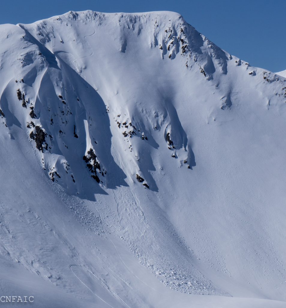
The avalanche danger is MODERATE on slopes above 2,500′. Triggering a slab 1-2′ deep is possible on steep Northern aspects in the alpine. Triggering a wet-loose avalanche is possible with daily warming on steep Southern aspects. Pay attention to surfaces conditions and if you notice the snow becoming wet and unsupportable – transition to firmer surfaces. As always, give cornices a wide berth and limit travel under glide cracks.
PORTAGE VALLEY: Cornice fall and/or avalanches from above have the potential to send debris to valley bottoms and into snow-free zones. Traveling along hiking trails, such as the Byron Glacier Trail with steep slopes overhead is not recommended in the afternoon or on rainy days.
LOST LAKE / SEWARD: Similar to Turnagain, wet loose avalanches on sunny slopes are possible with the heat of the day. Dry slab avalanches could be a concern on high elevation northerly slopes.
WEDNESDAY AVALANCHE OUTLOOK:
No avalanche forecast will be issued tomorrow. Similar avalanche conditions are expected Wednesday, Apr 17th. Overcast skies and scattered rain showers may prevent surfaces from re-freezing overnight. Evaluate surface conditions on all aspects and avoid steep terrain if your skis or machine are sinking into wet snow.
Advisories: For the remainder of April, avalanche advisories will be posted 4 days/week (on Tues, Thur, Sat and Sun). The avalanche center will close for the season on Saturday, April 27th when we will post our springtime tips. Thank you everyone for tuning in!
Please join the US and Canada in a joint survey looking into how to better serve you €“ the users!! We want to hear from all backcountry recreationalists, especially those that are just beginning to use the avalanche forecast. The survey takes about 30 minutes. Survey link: HERE. (Participants will also be entered to win $500, so don’t delay!)
![]() |
![]() |
![]() |
![]() |
![]() |
|
Travel Advice | Generally safe avalanche conditions. Watch for unstable snow on isolated terrain features. | Heightened avalanche conditions on specific terrain features. Evaluate snow and terrain carefully; identify features of concern. | Dangerous avalanche conditions. Careful snowpack evaluation, cautious route-finding, and conservative decision-making essential. | Very dangerous avalanche conditions. Travel in avalanche terrain not recommended. | Extraordinarily dangerous avalanche conditions. Avoid all avalanche terrain. |
Likelihood of Avalanches | Natural and human-triggered avalanches unlikely. | Natural avalanches unlikely; human-triggered avalanches possible. | Natural avalanches possible; human-triggered avalanches likely. | Natural avalanches likely; human-triggered avalanches very likely. | Natural and human-triggered avalanches certain. |
Avalanche Size and Distribution | Small avalanches in isolated areas or extreme terrain. | Small avalanches in specific areas; or large avalanches in isolated areas. | Small avalanches in many areas; or large avalanches in specific areas; or very large avalanches in isolated areas. | Large avalanches in many areas; or very large avalanches in specific areas. | Very large avalanches in many areas. |
Signal Word | Size (D scale) | Simple Descriptor |
Small | 1 | Unlikely to bury a person |
Large | 2 | Can bury a person |
Very Large | 3 | Can destroy a house |
Historic | 4 & 5 | Can destroy part or all of a village |
On shaded aspects in the alpine above 3,000′, a weak layer of facets and buried surface hoar exists 1-2′ below the surface. A layer of buried surface hoar was the culprit in two human triggered avalanches over the weekend in Seattle Creek. Both of these avalanches occurred at 3200’ on North aspects and released on a layer of buried surface hoar sitting on a melt freeze crust. One of these avalanches was triggered at the top of a chute. The other avalanche we suspect was remote triggered from 5-10’ away. In both incidents no one was caught. Yesterday an observer reported whumping and found a weak layer of facets in a hand pit in higher elevations above Girdwood. They also reported a recent large natural avalanche on a West aspect of Raggedtop. Listening for whumpfing and digging test pits are good ways to gather information. Sticking to safe travel protocol is also wise; evaluate terrain for consequences, expose one person a time, watch partners and have an escape route planned.
SPRINGTIME CAUTION:
WET LOOSE: The snowpack has gone through a few days of hot sunny weather and freezing overnight. Today looks like our last sunny day this week. Pay attention to surface snow melting later in the day and avoid steep South facing slopes if surfaces become saturated and punchy. The forecast tomorrow has overcast skies and scatter rain showers and a possibility of no re-freeze overnight. It will be key to monitor surface conditions as you travel – even if we don’t see any sun in the next few days.
CORNICES: There are lots of large cornices on ridge tops. These features can heat up with daily warming making them easier to trigger. Give them lots of space.
An avalanche in Seattle Creek in -2 Bowl that occurred sometime over the weekend on a NW aspect at 3200′. We suspect this avalanche remotely triggered due to the nearby tracks on the slope. The weak layer was buried surface on a melt freeze crust.
An avalanche triggered on Sunday (4/14/19) on a NE aspect at 3200′. On the back side of this ridge is the -2 Bowl avalanche. Although we couldn’t access this crown we suspect the weak layer was buried surface hoar.
It’s been 10 days since our last known glide avalanche, but keep in mind glide cracks are continuing to creep down-hill. As always identify cracks and avoid traveling under their runout. They are unpredictable and can avalanche at any time.
Yesterday: Skies were clear and sunny with a few clouds. Daytime temperatures reached the mid 50Fs at sea level, mid-40Fs at 1000′ and mid-30Fs along ridgetops. Overnight temperatures were in the upper-20Fs along ridgetops and in the mid to low-30Fs in the mid and lower elevations. Ridgetops winds were 5-15mph from the East. No precipitation fell.
Today: Partly cloudy skies becoming mostly cloudy tonight. Scattered rain showers are possible overnight. Temperature in the mid and lower elevations will be in the mid 40Fs to low 50Fs. Upper elevations will range from the upper 20Fs overnight to mid 30Fs during the day. Winds will be 5-15mph from the East. Up to 0.15″ rain is possible overnight, 1-2″ of snow above 2000′.
Tomorrow: Expect overcast skies with scattered rain showers most of the day, 0.15″ of rain possible, 1-2″ of snow above 2500′. Temperatures at sea level will be in the upper-30Fs to upper-40Fs. Upper elevation temps in upper 20Fs to low-30Fs. Rain/snow line may will be between 2000′ and 2500′. Easterly winds 5-15mph will remain.
Temp Avg (F) | Snow (in) | Water (in) | Snow Depth (in) | |
Center Ridge (1880′) | 37 | 0 | 0 | 63 |
Summit Lake (1400′) | 35 | 0 | 0 | 17 |
Alyeska Mid (1700′) | 36 | 0 | 0 | 56 |
Temp Avg (F) | Wind Dir | Wind Avg (mph) | Wind Gust (mph) | |
Sunburst (3812′) | 28 | ENE | 5 | 14 |
Seattle Ridge (2400′) | 33 | ESE | 4 | 14 |
Date | Region | Location | Observer |
---|---|---|---|
10/27/24 | Turnagain | Observation: Tincan | Michael Kerst |
10/21/24 | Turnagain | Observation: Turnagain Pass Road Observation | Trevor Clayton |
10/19/24 | Turnagain | Observation: Tincan – Below Todds Run | Andy Moderow |
10/18/24 | Turnagain | Observation: Taylor Pass | Eli Neuffer |
10/15/24 | Turnagain | Observation: Tincan Common | John Sykes Forecaster |
10/14/24 | Turnagain | Avalanche: Tincan | CNFAC Staff |
05/13/24 | Turnagain | Observation: Eddie’s, Sunburst, Seattle, Cornbiscuit, Pete’s South | H Thamm |
05/13/24 | Turnagain | Observation: Turnagain Pass non-motorized side | Amy Holman |
05/12/24 | Turnagain | Observation: Warm up Bowl | Tony Naciuk |
05/07/24 | Turnagain | Observation: Turnagain Pass Wet Slabs | A S |
The riding areas page has moved. Please click here & update your bookmarks.
Subscribe to Turnagain Pass
Avalanche Forecast by Email