Turnagain Pass RSS

Archives
ARCHIVED - Forecasts expire after 24 hours.
Issued
Thu, April 14th, 2022 - 7:00AM
Expires
Fri, April 15th, 2022 - 7:00AM
Forecaster
John Sykes
Avalanche risk The Bottom Line

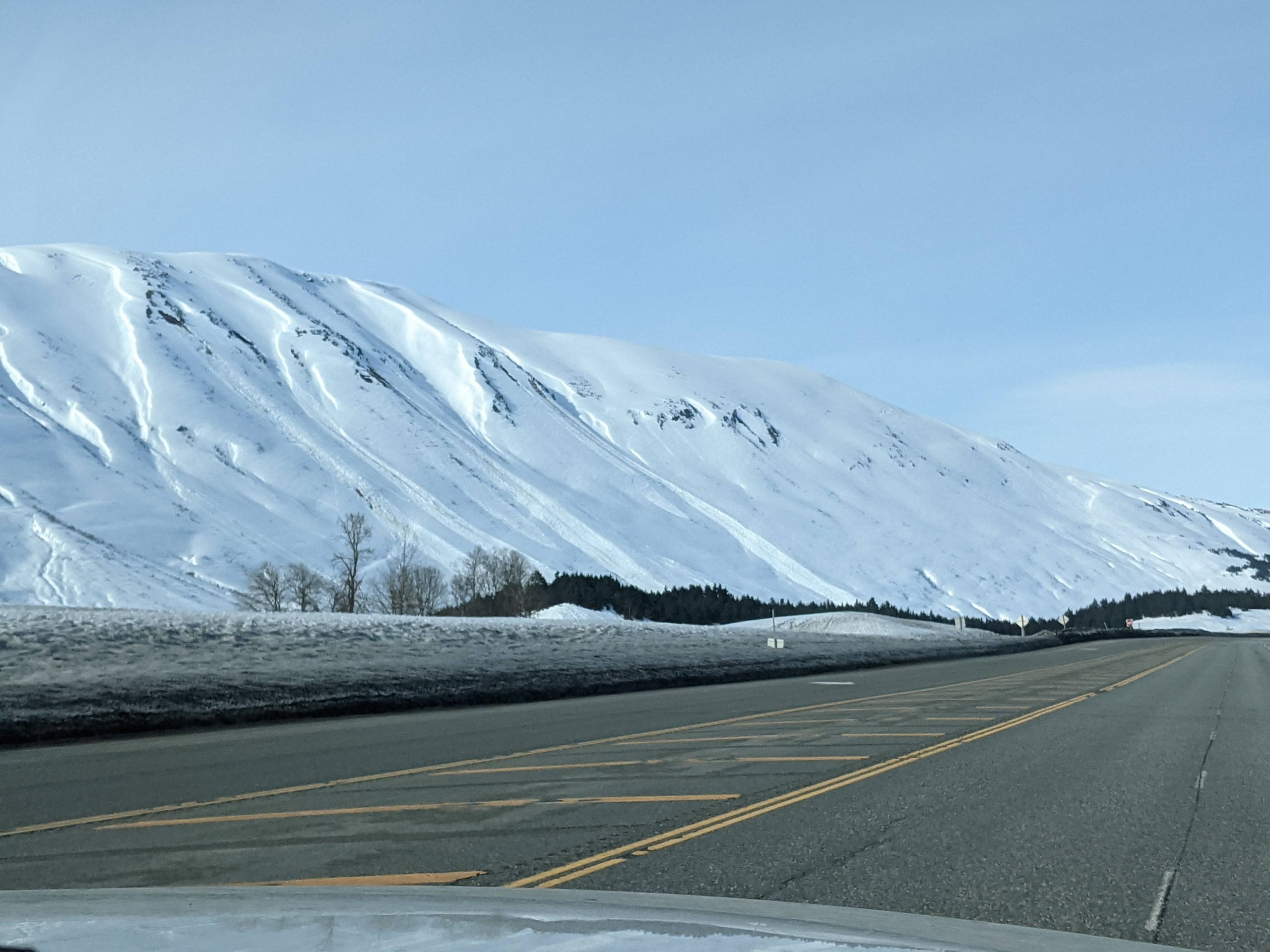
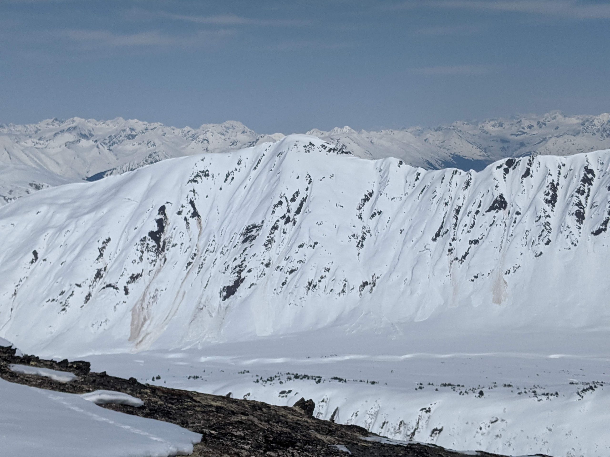
The avalanche danger remains LOW at all elevations and human triggered avalanches are unlikely. However, glide avalanches have been releasing naturally along southern aspects in Turnagain Pass this week and areas with existing glide cracks or recent debris from glide avalanches should be avoided. Other hazards to pay attention to today are cornice fall and wet loose avalanches that could become more active in the second half of the day due to solar heating. There is an outside chance of finding a small isolated slab avalanche on steep north facing terrain, so stay alert to snow surface conditions.

Special Announcements
  • End of Season Operations:  This will be the final week of 7 day/wk forecasts. Beginning Monday, April 18, we will only be issuing forecasts on Tuesday, Thursday, Saturday and Sunday. The final forecast will be on Saturday April 30th.
Thu, April 14th, 2022
Alpine
Above 2,500'
1 - Low
Avalanche risk
Treeline
1,000'-2,500'
1 - Low
Avalanche risk
Below Treeline
Below 1,000'
1 - Low
Avalanche risk
0 - No Rating
1 - Low
2 - Moderate
3 - Considerable
4 - High
5 - Extreme
Avalanche risk Avalanche risk Avalanche risk Avalanche risk Avalanche risk
Travel Advice Generally safe avalanche conditions. Watch for unstable snow on isolated terrain features. Heightened avalanche conditions on specific terrain features. Evaluate snow and terrain carefully; identify features of concern. Dangerous avalanche conditions. Careful snowpack evaluation, cautious route-finding, and conservative decision-making essential. Very dangerous avalanche conditions. Travel in avalanche terrain not recommended. Extraordinarily dangerous avalanche conditions. Avoid all avalanche terrain.
Likelihood of Avalanches Natural and human-triggered avalanches unlikely. Natural avalanches unlikely; human-triggered avalanches possible. Natural avalanches possible; human-triggered avalanches likely. Natural avalanches likely; human-triggered avalanches very likely. Natural and human-triggered avalanches certain.
Avalanche Size and Distribution Small avalanches in isolated areas or extreme terrain. Small avalanches in specific areas; or large avalanches in isolated areas. Small avalanches in many areas; or large avalanches in specific areas; or very large avalanches in isolated areas. Large avalanches in many areas; or very large avalanches in specific areas. Very large avalanches in many areas.
Recent Avalanches
  • Glide Avalanches: Glide avalanches are releasing naturally on southern aspects throughout Turnagain Pass. We observed 1 new large glide release along the SW aspect of Seattle Ridge in the first major gully south of the motorized uptrack. This happened sometime between 12 pm and 5 pm on Wednesday 4.13.22 (see ob here for before and after photos).

Another glide release along Seattle Ridge in the first major gully feature south of the motorized uptrack (lookers right debris pile in this photo). Photo 4.13.22

Avalanche Problem 1
  • Normal Caution
    Normal Caution
  • Certain
    Very Likely
    Likely
    Possible
    Unlikely
    Likelihood
  • Historic (D4-5)
    Very Large (D3)
    Large (D2)
    Small (D1)
    Size
Normal Caution
Normal Caution means triggering an avalanche is unlikely but not impossible.

Likelihood of Avalanches
Terms such as "unlikely", "likely", and "certain" are used to define the scale, with the chance of triggering or observing avalanches increasing as we move up the scale. For our purposes, "Unlikely" means that few avalanches could be triggered in avalanche terrain and natural avalanches are not expected. "Certain" means that humans will be able to trigger avalanches on many slopes, and natural avalanches are expected.

Size of Avalanches
Avalanche size is defined by the largest potential avalanche, or expected range of sizes related to the problem in question. Assigned size is a qualitative estimate based on the destructive classification system and requires specialists to estimate the harm avalanches may cause to hypothetical objects located in the avalanche track (AAA 2016, CAA 2014). Under this schema, "Small" avalanches are not large enough to bury humans and are relatively harmless unless they carry people over cliffs or through trees or rocks. Moving up the scale, avalanches become "Large" enough to bury, injure, or kill people. "Very Large" avalanches may bury or destroy vehicles or houses, and "Historic" avalanches are massive events capable of altering the landscape.

Signal Word Size (D scale) Simple Descriptor
Small 1 Unlikely to bury a person
Large 2 Can bury a person
Very Large 3 Can destroy a house
Historic 4 & 5 Can destroy part or all of a village
More info at Avalanche.org

It is another beautiful spring day with mostly clear skies and light winds expected. The sun beating down on the snowpack will be the most likely cause of any avalanches today, with an increased chance of glide avalanches, cornice failures, and wet loose avalanches on steeper terrain in the afternoon. Yesterday there was a cold breeze keeping the snow surface from melting much along the upper elevations near Sunburst and the surface just softened enough to help improve the skiing slightly in the early evening. Temperatures stayed cold enough to preserve dry snow on the surface on northern aspects above roughly 1500′.

Glide avalanche releases have been frequent this week along southern aspects in Turnagain Pass and we expect this trend to continue. It is important to recognize and avoid areas with existing glide cracks or avalanche debris from prior glide avalanches. Sometimes these can release even without an obvious crack on the snow surface. Being involved with a glide avalanche would be catastrophic due to the depth of the glide cracks and the very dense avalanche debris.

Even though this is the fifth day in a row of low danger, there is still an outside chance of finding a lingering slab avalanche on steep north facing terrain today. It is important to maintain safe travel protocols to minimize your groups exposure to an isolated and unexpected avalanche. That means trying to expose only one person at a time in avalanche terrain, spotting your partners, and grouping up in safe areas. All these practices will stack the odds in your favor and should be standard practice for mountain travel regardless of avalanche danger level.

Glide releases along the southern aspect of Tincan Proper. Photo 4.13.22

Weather
Thu, April 14th, 2022

Yesterday: Clear skies and light winds with temperatures rising into the 40’s in the afternoon at lower elevations and staying relatively cool in the upper 20’s at upper elevations.

Today: Another day of calm winds and quiet weather with a chance for clouds to start building in coastal areas in the afternoon as a low pressure system starts to move into the area tonight and tomorrow.

Tomorrow: A low pressure system currently centered in the Bearing sea will move east over the next two days, bringing increased cloud cover and wind speeds. Winds are expected to be light to moderate and start increasing Friday morning. No significant precipitation is expected in the forecast area.

PRECIPITATION 24-hour data (6am – 6am)

Temp Avg (F) Snow (in) Water (in) Snow Depth (in)
Center Ridge (1880′) 32 0 0 110
Summit Lake (1400′) 31 0 0 38
Alyeska Mid (1700′) 33 0 0 NA

RIDGETOP 24-hour data (6am – 6am)

Temp Avg (F) Wind Dir Wind Avg (mph) Wind Gust (mph)
Sunburst (3812′) 26 W 6 13
Seattle Ridge (2400′) 29 N 2 5
Observations
Recent Observations for Turnagain Pass
Date Region Location
04/16/24 Turnagain Observation: Cornbiscuit
04/15/24 Turnagain Observation: Taylor Pass
04/15/24 Turnagain Observation: Seward Highway – Tern Lake to Portage
04/14/24 Turnagain Observation: Sunburst
04/14/24 Turnagain Observation: Turnagain Pass Snomo
04/13/24 Turnagain Observation: Spokane Creek
04/11/24 Turnagain Observation: Tincan
04/10/24 Turnagain Avalanche: Seattle Ridge
04/10/24 Turnagain Observation: Cornbiscuit South Face
04/10/24 Turnagain Avalanche: Tincan
Riding Areas

The riding areas page has moved. Please click here & update your bookmarks.


Subscribe to Turnagain Pass
Avalanche Forecast by Email

This is a general backcountry avalanche advisory issued for Turnagain Arm with Turnagain Pass as the core advisory area. This advisory does not apply to highways, railroads or operating ski areas.