Turnagain Pass RSS

Archives
ARCHIVED - Forecasts expire after 24 hours.
Issued
Sun, April 11th, 2021 - 7:00AM
Expires
Mon, April 12th, 2021 - 7:00AM
Forecaster
Andrew Schauer
Avalanche risk The Bottom Line

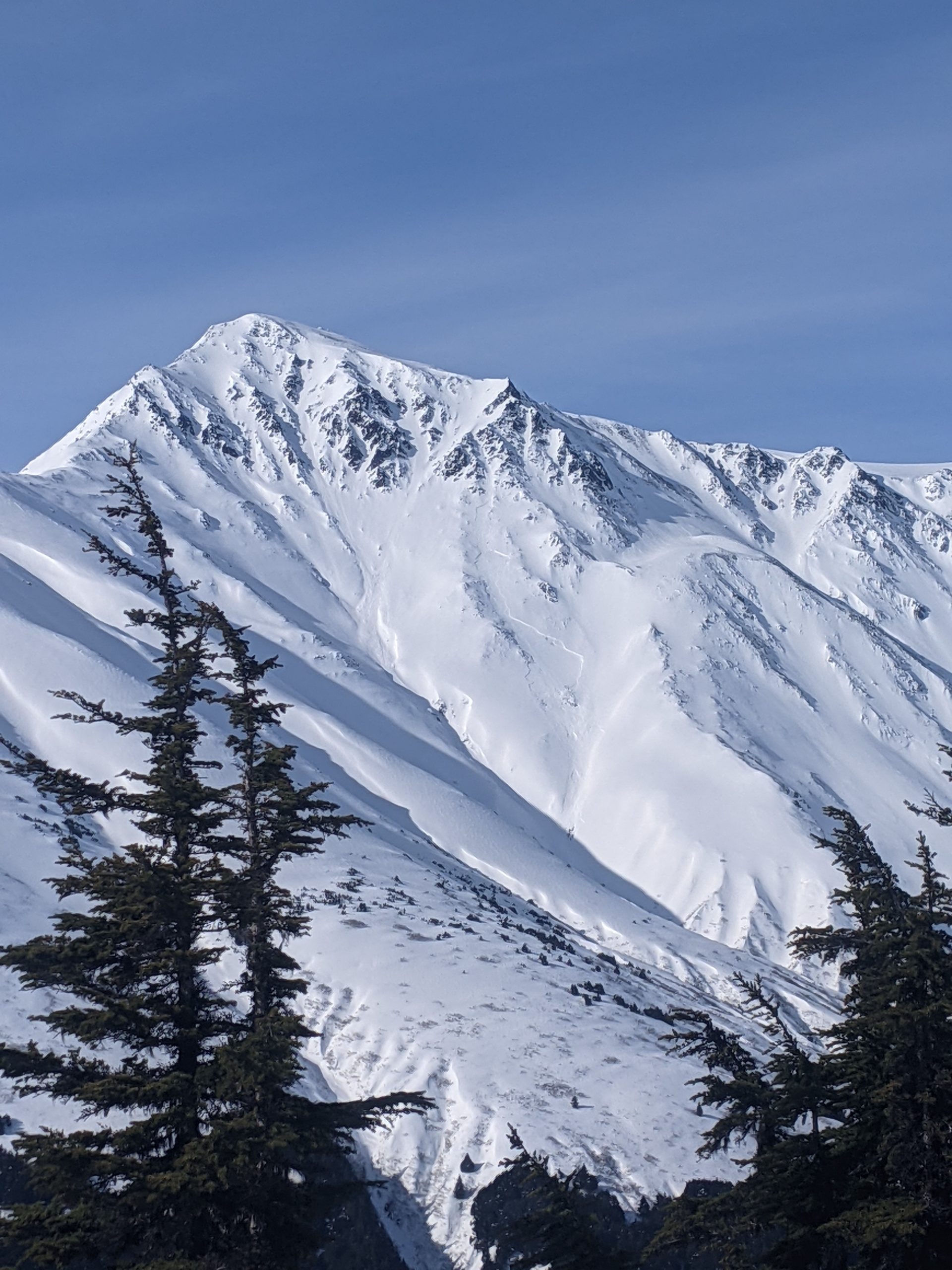
The avalanche danger is MODERATE at elevations above 1000’, but is expected to increase with strong winds and heavy snowfall later this afternoon and into tonight. The size and likelihood of triggering an avalanche will depend largely on the timing of the approaching storm. Pay attention to changing conditions during the day, and be aware of increasing danger if the storm moves in quicker than anticipated. Winds are expected to pick up ahead of the snow, so be aware of fresh wind slabs forming below ridgelines, in gullies, and on the downslope side of convexities.

The avalanche danger is LOW below 1000’, where the snowpack is capped by a crust. Again, this may change quickly with the approaching storm, so be aware of increasing danger when the snow starts to fall.

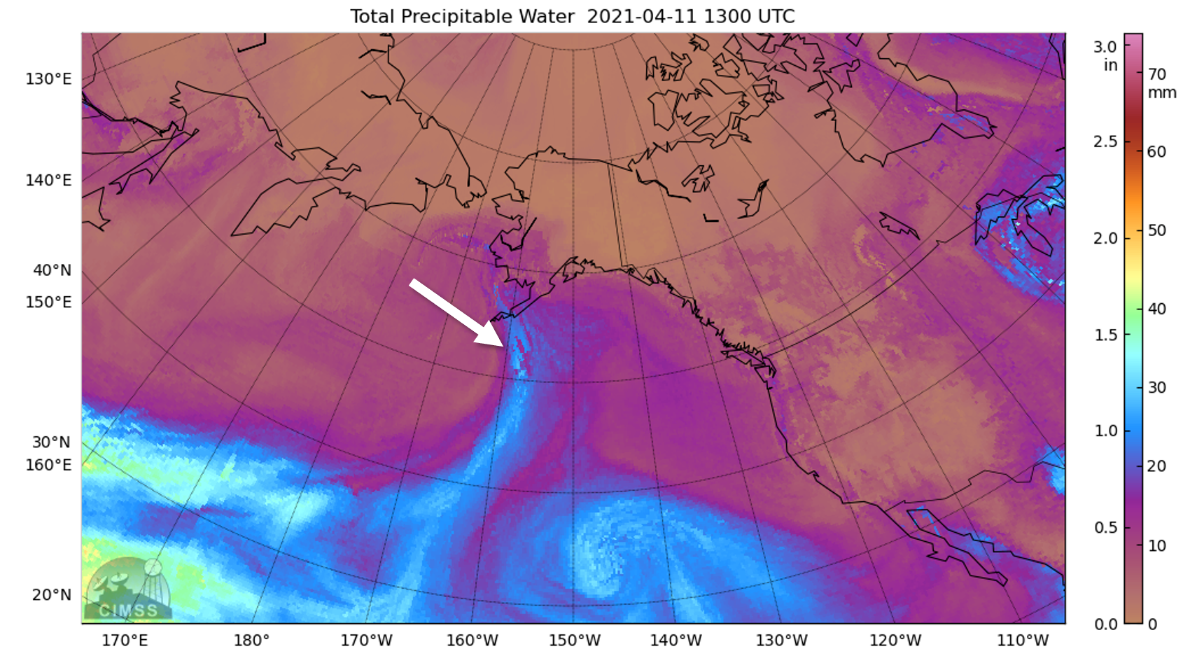
SNUG HARBOR/LOST LAKE/SEWARD: These areas are expected to see heavier snowfall and strong winds, resulting in increased avalanche danger. Extra caution is advised as the storm approaches.

Special Announcements

CNFAIC End Of Season Operations:  Daily avalanche forecasts typically transition to a 4 day/week cycle (Sat, Sun, Tues, Thur) beginning this coming week as our forecast season and funding winds down. Due to the impressively late spring and active weather coming in, we will continue to forecast on the off days if avalanche danger is rising. We plan on issuing an advisory tomorrow morning as this storm develops.

Sun, April 11th, 2021
Alpine
Above 2,500'
2 - Moderate
Avalanche risk
Treeline
1,000'-2,500'
2 - Moderate
Avalanche risk
Below Treeline
Below 1,000'
1 - Low
Avalanche risk
0 - No Rating
1 - Low
2 - Moderate
3 - Considerable
4 - High
5 - Extreme
Avalanche risk Avalanche risk Avalanche risk Avalanche risk Avalanche risk
Travel Advice Generally safe avalanche conditions. Watch for unstable snow on isolated terrain features. Heightened avalanche conditions on specific terrain features. Evaluate snow and terrain carefully; identify features of concern. Dangerous avalanche conditions. Careful snowpack evaluation, cautious route-finding, and conservative decision-making essential. Very dangerous avalanche conditions. Travel in avalanche terrain not recommended. Extraordinarily dangerous avalanche conditions. Avoid all avalanche terrain.
Likelihood of Avalanches Natural and human-triggered avalanches unlikely. Natural avalanches unlikely; human-triggered avalanches possible. Natural avalanches possible; human-triggered avalanches likely. Natural avalanches likely; human-triggered avalanches very likely. Natural and human-triggered avalanches certain.
Avalanche Size and Distribution Small avalanches in isolated areas or extreme terrain. Small avalanches in specific areas; or large avalanches in isolated areas. Small avalanches in many areas; or large avalanches in specific areas; or very large avalanches in isolated areas. Large avalanches in many areas; or very large avalanches in specific areas. Very large avalanches in many areas.
Recent Avalanches

Goat Mtn: A large natural wind slab avalanche failed sometime Friday evening or Saturday morning on a SE aspect near 4500′ on Goat.

Large natural avalanche on Goat Mtn. Photo taken 04.10.2021 by Ned Tomlinson.

Avalanche Problem 1
  • Wind Slabs
    Wind Slabs
  • Certain
    Very Likely
    Likely
    Possible
    Unlikely
    Likelihood
  • Historic (D4-5)
    Very Large (D3)
    Large (D2)
    Small (D1)
    Size
Wind Slabs
Wind Slab avalanches are the release of a cohesive layer of snow (a slab) formed by the wind. Wind typically transports snow from the upwind sides of terrain features and deposits snow on the downwind side. Wind slabs are often smooth and rounded and sometimes sound hollow, and can range from soft to hard. Wind slabs that form over a persistent weak layer (surface hoar, depth hoar, or near-surface facets) may be termed Persistent Slabs or may develop into Persistent Slabs.

Likelihood of Avalanches
Terms such as "unlikely", "likely", and "certain" are used to define the scale, with the chance of triggering or observing avalanches increasing as we move up the scale. For our purposes, "Unlikely" means that few avalanches could be triggered in avalanche terrain and natural avalanches are not expected. "Certain" means that humans will be able to trigger avalanches on many slopes, and natural avalanches are expected.

Size of Avalanches
Avalanche size is defined by the largest potential avalanche, or expected range of sizes related to the problem in question. Assigned size is a qualitative estimate based on the destructive classification system and requires specialists to estimate the harm avalanches may cause to hypothetical objects located in the avalanche track (AAA 2016, CAA 2014). Under this schema, "Small" avalanches are not large enough to bury humans and are relatively harmless unless they carry people over cliffs or through trees or rocks. Moving up the scale, avalanches become "Large" enough to bury, injure, or kill people. "Very Large" avalanches may bury or destroy vehicles or houses, and "Historic" avalanches are massive events capable of altering the landscape.

Signal Word Size (D scale) Simple Descriptor
Small 1 Unlikely to bury a person
Large 2 Can bury a person
Very Large 3 Can destroy a house
Historic 4 & 5 Can destroy part or all of a village
More info at Avalanche.org

It is looking like we are heading into an exciting week weather-wise, which is going to make things interesting as far as avalanches are concerned. Easterly winds are picking up ahead of the next round of precipitation, and are expected to rise to 30-50 mph at ridgetops with gusts above 60 mph today. Following the wind event from Thursday/Friday, most surfaces are now either scoured or firm wind slabs and crusts, but as the wind shifts directions we can expect to see previously protected pockets providing soft snow for slab-building today. It will be possible to trigger an avalanche on freshly formed wind slabs, which will have the potential to step down to buried weak layers in the upper snowpack.

The timing and amount of snowfall is the wildcard today. It is looking like the strongest part of this round of snow will arrive later in the afternoon and continue through tonight. Avalanche conditions will become more dangerous as the snowfall intensifies, so pay close attention to changing conditions during the day. Be on the lookout for clear signs of unstable snow, like cracks shooting out from your skis or snowmachine, new avalanche activity, and ‘whumpfing’ as a weak layer collapses under a slab. Any of these signs are telling you that the likelihood of triggering an avalanche is increasing and it is time to dial your terrain choices back.

This jet of atmospheric moisture is headed our way and could bring up to a foot or more of new snow by tomorrow morning.

Avalanche Problem 2
  • Persistent Slabs
    Persistent Slabs
  • Certain
    Very Likely
    Likely
    Possible
    Unlikely
    Likelihood
  • Historic (D4-5)
    Very Large (D3)
    Large (D2)
    Small (D1)
    Size
Persistent Slabs
Persistent Slab avalanches are the release of a cohesive layer of snow (a slab) in the middle to upper snowpack, when the bond to an underlying persistent weak layer breaks. Persistent layers include: surface hoar, depth hoar, near-surface facets, or faceted snow. Persistent weak layers can continue to produce avalanches for days, weeks or even months, making them especially dangerous and tricky. As additional snow and wind events build a thicker slab on top of the persistent weak layer, this avalanche problem may develop into a Deep Persistent Slab.

Likelihood of Avalanches
Terms such as "unlikely", "likely", and "certain" are used to define the scale, with the chance of triggering or observing avalanches increasing as we move up the scale. For our purposes, "Unlikely" means that few avalanches could be triggered in avalanche terrain and natural avalanches are not expected. "Certain" means that humans will be able to trigger avalanches on many slopes, and natural avalanches are expected.

Size of Avalanches
Avalanche size is defined by the largest potential avalanche, or expected range of sizes related to the problem in question. Assigned size is a qualitative estimate based on the destructive classification system and requires specialists to estimate the harm avalanches may cause to hypothetical objects located in the avalanche track (AAA 2016, CAA 2014). Under this schema, "Small" avalanches are not large enough to bury humans and are relatively harmless unless they carry people over cliffs or through trees or rocks. Moving up the scale, avalanches become "Large" enough to bury, injure, or kill people. "Very Large" avalanches may bury or destroy vehicles or houses, and "Historic" avalanches are massive events capable of altering the landscape.

Signal Word Size (D scale) Simple Descriptor
Small 1 Unlikely to bury a person
Large 2 Can bury a person
Very Large 3 Can destroy a house
Historic 4 & 5 Can destroy part or all of a village
More info at Avalanche.org

The persistent weak layers in the upper 3′ of our snowpack are still lingering just under the surface. It will be important to keep these in mind as we see loading from strong winds and potentially heavy snowfall later this afternoon. A relatively small avalanche triggered near the surface has the potential to step down to one of a myriad of buried weak layers, resulting in a larger and more dangerous avalanche.  A springtime snowpack often makes it reasonable to pursue bigger objectives, but this year is unusual and we are still dealing with mid-winter problems which continue to require wide safety margins while choosing terrain. It is still wise to avoid steep slopes with terrain traps like cliffs, trees, or rocks.

Weather
Sun, April 11th, 2021

Yesterday: Cloudy skies in the morning gave way to plenty of sunshine in the afternoon as temperatures climbed from the single digits above and below 0 F to the teens to mid 20s F. Winds were light out of the east around 5 mph for most of the day.

Today: Easterly winds are expected to increase to 30-50 mph with gusts above 60 mph as active weather returns. Temperatures are expected to rise into the mid 20s to low 30s F, with heavy precipitation likely this afternoon into tonight. We are only expecting to see a few inches of snow during the day, but totals could be around 8-12″ by tomorrow morning. Temperatures are expected to stay in the mid 20s to mid 30s tonight.

Tomorrow: Snowfall is expected to taper off tomorrow morning, with temperatures climbing into the low to upper 30s F. Strong easterly winds are expected to continue through tonight and slowly calm down during the day tomorrow. Skies will be mostly cloudy. This quick storm tonight is just a precursor for what is looking like a bigger event in the middle of the week, so be sure to stay tuned for more info.

PRECIPITATION 24-hour data (6am – 6am)

Temp Avg (F) Snow (in) Water (in) Snow Depth (in)
Center Ridge (1880′) 12 0 0 107
Summit Lake (1400′) 10 0 0 48
Alyeska Mid (1700′) 12 0 0 116

RIDGETOP 24-hour data (6am – 6am)

Temp Avg (F) Wind Dir Wind Avg (mph) Wind Gust (mph)
Sunburst (3812′) 8 WSW-ESE* 7* 25
Seattle Ridge (2400′) 10 E 7* 20

*Winds shifted directions and increased to 10-15 mph around 3:00 this morning.

Observations
Recent Observations for Turnagain Pass
Date Region Location
04/15/24 Turnagain Observation: Taylor Pass
04/14/24 Turnagain Observation: Sunburst
04/14/24 Turnagain Observation: Turnagain Pass Snomo
04/13/24 Turnagain Observation: Spokane Creek
04/11/24 Turnagain Observation: Tincan
04/10/24 Turnagain Avalanche: Seattle Ridge
04/10/24 Turnagain Observation: Cornbiscuit South Face
04/10/24 Turnagain Avalanche: Tincan
04/10/24 Turnagain Avalanche: Cornbiscuit
04/07/24 Turnagain Observation: Seattle Creek Headwall
Riding Areas

The riding areas page has moved. Please click here & update your bookmarks.


Subscribe to Turnagain Pass
Avalanche Forecast by Email

This is a general backcountry avalanche advisory issued for Turnagain Arm with Turnagain Pass as the core advisory area. This advisory does not apply to highways, railroads or operating ski areas.