The avalanche danger is MODERATE above 1000′. Northwest winds continue to build reactive wind slabs, making it possible for a person to trigger an avalanche 1-2′ deep. There is also a smaller chance of triggering a deeper avalanche on a layer that was buried last week. Carefully evaluate the snow for signs of instability before getting into steep terrain today. The danger is LOW below 1000′.
SUMMIT / SNUG HARBOR / LOST LAKE / SEWARD: These periphery zones are going to see stronger winds than the advisory area today, making natural avalanches possible and human-triggered avalanches likely. Be aware of elevated danger if you plan on getting out in any of these areas.
Sat, April 9th, 2022
Alpine
Above 2,500'
2 - Moderate
Treeline
1,000'-2,500'
2 - Moderate
Below Treeline
Below 1,000'
1 - Low
0 - No Rating
1 - Low
2 - Moderate
3 - Considerable
4 - High
5 - Extreme
Travel Advice
Generally safe avalanche conditions. Watch for unstable snow on isolated terrain features.
Heightened avalanche conditions on specific terrain features. Evaluate snow and terrain carefully; identify features of concern.
Natural avalanches likely; human-triggered avalanches very likely.
Natural and human-triggered avalanches certain.
Avalanche Size and Distribution
Small avalanches in isolated areas or extreme terrain.
Small avalanches in specific areas; or large avalanches in isolated areas.
Small avalanches in many areas; or large avalanches in specific areas; or very large avalanches in isolated areas.
Large avalanches in many areas; or very large avalanches in specific areas.
Very large avalanches in many areas.
Avalanche Problem 1
Wind Slabs
Certain
Very Likely
Likely
Possible
Unlikely
Likelihood
Historic (D4-5)
Very Large (D3)
Large (D2)
Small (D1)
Size
Wind Slabs
Wind Slab avalanches are the release of a cohesive layer of snow (a slab) formed by the wind. Wind typically transports snow from the upwind sides of terrain features and deposits snow on the downwind side. Wind slabs are often smooth and rounded and sometimes sound hollow, and can range from soft to hard. Wind slabs that form over a persistent weak layer (surface hoar, depth hoar, or near-surface facets) may be termed Persistent Slabs or may develop into Persistent Slabs.
Likelihood of Avalanches
Terms such as "unlikely", "likely", and "certain" are used to define the scale, with the chance of triggering or observing
avalanches increasing as we move up the scale. For our purposes, "Unlikely" means that few avalanches could be triggered in avalanche terrain and
natural avalanches are not expected. "Certain" means that humans will be able to trigger avalanches on many slopes, and natural avalanches are expected.
Size of Avalanches
Avalanche size is defined by the largest potential avalanche, or expected range of sizes related to the problem in question.
Assigned size is a qualitative estimate based on the destructive classification system and requires specialists to estimate the harm avalanches may cause to
hypothetical objects located in the avalanche track (AAA 2016, CAA 2014). Under this schema, "Small" avalanches are not large enough to bury humans and are
relatively harmless unless they carry people over cliffs or through trees or rocks. Moving up the scale, avalanches become "Large" enough to bury, injure,
or kill people. "Very Large" avalanches may bury or destroy vehicles or houses, and "Historic" avalanches are massive events capable of altering the landscape.
Continued northwest winds will make it possible for people to trigger avalanches in steep terrain that is getting loaded throughout the day. Luckily it is looking like the strongest of the winds are going to miss the core advisory area, which should hopefully spare us most of the wind damage and keep the avalanche danger from getting out of control. There are a few things making even a light wind event a little more likely to produce avalanches. First, there is still plenty of soft snow on shaded northerly aspects waiting to get blown into wind slabs. Second, the southern aspects that might be getting loaded today have a supportable crust with a dusting of snow on top. With clear skies and cold temperatures this morning, some of this snow is likely starting to facet. This combination is similar to the bed surface/weak layer that has made the April Fools’ day interface a lingering concern. More on this in problem 2.
These northwest winds have a reputation for being redirected through channelized terrain around Turnagain Pass, so keep an eye out for loading on all aspects today. We often see these winds moving up the Six Mile drainage from the north, then getting funneled around the south end of Turnagain Pass and moving along the skier side of the highway from south to north. At the same time, ridgetop winds may still be predominantly out of the northwest, and Seattle Ridge tends to see less of this funneling effect than the east side of the pass.
The loading patterns can be tricky to pick out, so it is important to be on the lookout for signs of recent and active wind loading. Pay attention to snow blowing off ridgelines, and avoid steep slopes with a smooth, pillowed texture on the surface. A stiff slab sitting on softer snow is another telltale sign of a wind slab. As always, watch for warning signs of unstable snow: shooting cracks, collapsing, and fresh avalanche activity.
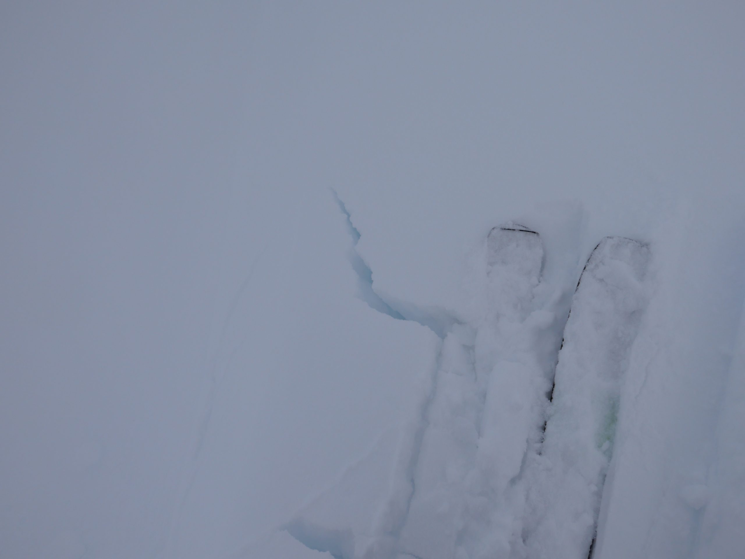
Glide avalanches: Glide cracks continue to creep open, and some of them have been releasing in the area. They are large, destructive, and unpredictable so be sure to limit time spent under cracks.
Cornices: With wind as our primary weather concern for the day, we can expect to find sensitive cornices along ridgelines. These might be forming in unusual places given the wind directions. Be careful traveling along ridgelines today, and be sure to keep plenty of space from the edge. It is always a good idea to avoid spending time under cornices, since they can release naturally.
Small rolls like this are a great way to get some feedback about how the snow is behaving. A shooting crack is a sign of unstable snow, telling you to stick to low angle terrain. 04.08.2022.
Click Here if the video below doesn’t load in your browser.
Avalanche Problem 2
Persistent Slabs
Certain
Very Likely
Likely
Possible
Unlikely
Likelihood
Historic (D4-5)
Very Large (D3)
Large (D2)
Small (D1)
Size
Persistent Slabs
Persistent Slab avalanches are the release of a cohesive layer of snow (a slab) in the middle to upper snowpack, when the bond to an underlying persistent weak layer breaks. Persistent layers include: surface hoar, depth hoar, near-surface facets, or faceted snow. Persistent weak layers can continue to produce avalanches for days, weeks or even months, making them especially dangerous and tricky. As additional snow and wind events build a thicker slab on top of the persistent weak layer, this avalanche problem may develop into a Deep Persistent Slab.
Likelihood of Avalanches
Terms such as "unlikely", "likely", and "certain" are used to define the scale, with the chance of triggering or observing
avalanches increasing as we move up the scale. For our purposes, "Unlikely" means that few avalanches could be triggered in avalanche terrain and
natural avalanches are not expected. "Certain" means that humans will be able to trigger avalanches on many slopes, and natural avalanches are expected.
Size of Avalanches
Avalanche size is defined by the largest potential avalanche, or expected range of sizes related to the problem in question.
Assigned size is a qualitative estimate based on the destructive classification system and requires specialists to estimate the harm avalanches may cause to
hypothetical objects located in the avalanche track (AAA 2016, CAA 2014). Under this schema, "Small" avalanches are not large enough to bury humans and are
relatively harmless unless they carry people over cliffs or through trees or rocks. Moving up the scale, avalanches become "Large" enough to bury, injure,
or kill people. "Very Large" avalanches may bury or destroy vehicles or houses, and "Historic" avalanches are massive events capable of altering the landscape.
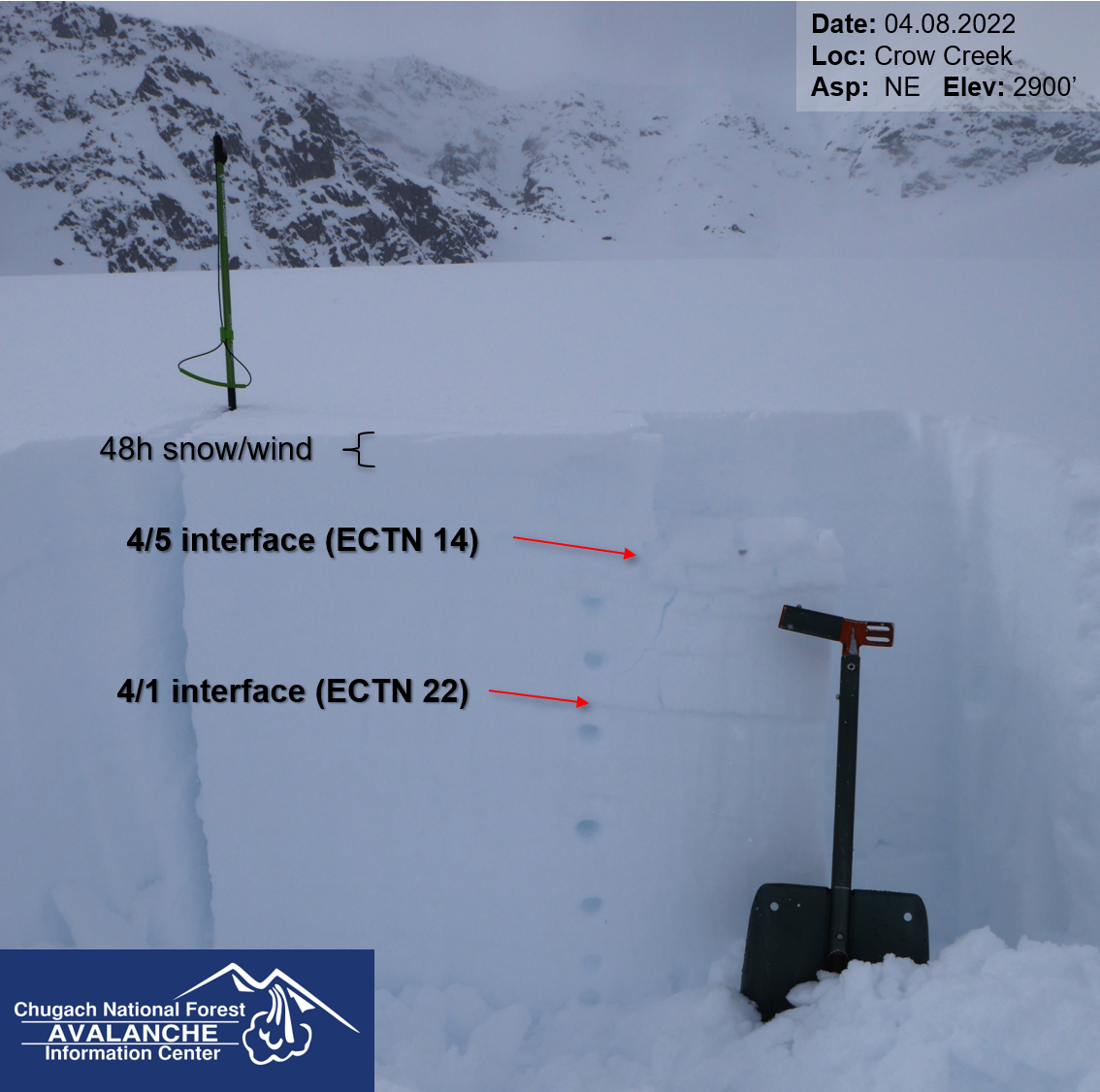
We are still paying attention to the April Fool’s interface, which is buried around a foot deep in most places and potentially still capable of producing an avalanche big enough to bury or injure a person. It has been five days since the last human-triggered avalanche on this layer, and we are finding it increasingly difficult to get this layer to fail in test pits. All of this is encouraging, and hopefully we can stop worrying about this interface sometime soon. However, the layer will see increased stress as slopes get loaded by winds today, nudging the needle towards instability. One more issue to consider while making terrain choices today.
I did not get any propagating results on the 4/1 layer yesterday when I was out near Girdwood. This layer was buried about a foot deep in my pit, which is pretty close to average for the advisory area. The more recent 4/5 crust was noticeable, but not reactive in the pit. 04.08.2022.
Weather
Sat, April 9th, 2022
Yesterday: Light snowfall and overcast skies through the day brought a trace to an inch of precipitation. Winds were light out of the west at 5-10 mph with gusts of 10-25 mph. High temperatures were in the mid 20’s to upper 30’s F, with overnight lows in the teens to high 20’s F.
Today: We should see mostly sunny skies with northwesterly winds around 10-15 mph and gusts of 15-20 mph. Winds are looking to be stronger in Summit and Seward, with lower speeds in Turnagain Pass and Girdwood. Temperatures will be cooler than normal, with highs in the upper teens to upper 20’s F and lows in the low to mid teens. No precipitation is expected today.
Tomorrow: Another clear and sunny day is on tap for tomorrow, with lighter westerly winds at 5-10 mph and gusts of 10-20 mph. Temperatures will be a little warmer, with highs in the upper 20’s to low 30’s F and lows in the mid teens to mid 20’s F. No precipitation is expected.
This is a general backcountry avalanche advisory issued for Turnagain Arm with Turnagain Pass as the core advisory area.
This advisory does not apply to highways, railroads or operating ski areas.