Turnagain Pass Avalanche Forecast
|
![]() ![]() |
The avalanche danger is MODERATE above 1000′ today. Light snowfall with increasing northwesterly winds through the day will build fresh wind slabs, making it possible to trigger avalanches up to a foot deep on wind loaded slopes. There is a smaller chance of triggering an avalanche on deeper weak layers buried 1-2′ deep. The danger is LOW below 1000′, where it is unlikely a person will trigger an avalanche.
SEWARD/LOST LAKE/SNUG HARBOR: These areas will see northwest outflow winds pick up earlier today than our core advisory area. Be aware of increasing avalanche danger as strong winds move snow around, especially at higher elevations.
Crews from Chugach Electric will be checking the power lines along the non-motorized side of Turnagain Pass on snowmachines today. They will be riding along the power lines between the Center Ridge parking lot and the Johnson Pass trailhead.
Signal Word | Size (D scale) | Simple Descriptor |
Small | 1 | Unlikely to bury a person |
Large | 2 | Can bury a person |
Very Large | 3 | Can destroy a house |
Historic | 4 & 5 | Can destroy part or all of a village |
A low pressure system sitting over Prince William sound is expected to bring light snowfall to the area today, with increasing northwesterly winds as the system passes and outflow winds pick up behind it. Snow totals are looking to be around 1-3″ for most areas, with winds around 15-20 mph at upper elevations by this afternoon. The combination of a few new inches of snow on top of last week’s storm snow will provide plenty of ammunition for the winds to build reactive wind slabs. Since the winds will be coming out of the northwest, they will be more efficient at picking up snow from cold and shaded slopes with dry snow at the surface, and load it on southerly slopes with crusts at the surface. This will most likely mean fresh wind slabs may be more reactive than usual, and they may hang around a little bit longer than usual.
Wind slabs forming today might not be huge, but they may be approaching sizes large enough to bury or injure a person. Keep in mind even small avalanches can have serious consequences in big terrain, and choose your terrain accordingly. Be on the lookout for telltale signs of unstable snow– shooting cracks, collapsing, and fresh avalanche activity. Because of the way local terrain channels winds, these northwest wind events can have some funky wind patterns in the Turnagain Pass area. This pattern commonly results in northern winds along the motorized side of the highway with southerly winds along the skier side, and winds can switch directions as you gain elevation. Be on the lookout for wind slabs potentially forming on all aspects today, and take the time time to assess stability before getting into steep terrain.
Glide Avalanches: We are continuing to see glide avalanches release in the area, with the most recent activity along the Seward Highway yesterday just north of Girdwood. These avalanches are very large and unpredictable, so limit the amount of time you spend under them.
Dry Loose Avalanches: For slopes that stay protected from the winds, pay attention to sluffing in steep terrain. These may be easy to trigger and fast-moving on southerly slopes where new snow is falling on firm surfaces.
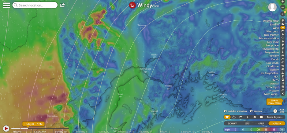
Northwest outflow winds are on the way. Winds should start picking up this afternoon, with sustained speeds of 15-20 mph by the end of the day. Source: NAM model on Windy.com.
Signal Word | Size (D scale) | Simple Descriptor |
Small | 1 | Unlikely to bury a person |
Large | 2 | Can bury a person |
Very Large | 3 | Can destroy a house |
Historic | 4 & 5 | Can destroy part or all of a village |
The weak interface that was buried on April Fool’s day is becoming less likely to produce avalanches, but should still be on the radar today. The most recent avalanche activity on this interface was a skier-triggered avalanche on a northeast-facing slope in the Seattle Creek drainage on Monday. Keep this layer in mind while navigating the mountains today, and play the terrain in your favor by avoiding slopes with exposure to terrain traps that increase the consequences of getting caught in an avalanche. This includes things like cliffs, trees, rocks, and gullies. This layer is becoming more difficult to trigger, but it is still worth considering today.
Unstable test result on the 4/1 interface on a s-facing slope at around 2000′ in the Squirrel Flats area. 04.05.2022
Yesterday: Skies were mostly sunny with light winds out of the east for most of the day before switching westerly overnight. Sustained speeds were around 5 mph with gusts of 5-10 mph. High temperatures were in the upper 30’s to low 40’s F, with overnight lows in the upper teens to upper 20’s F.
Today: Light snowfall is expected through the day, with 1-3″ accumulation by the end of the day. Winds will be light to moderate out of the northwest, with sustained speeds of 5-10 mph for most of the day, increasing to 15-20 this evening. Snow is expected to stay down at sea level, with high temperatures in the low 30’s at low elevations and upper teens at ridgetops.
Tomorrow: Northwest outflow winds continue tomorrow, bringing mostly sunny skies and cooler temperatures than normal. High temperatures should be in the 20’s F, with lows dropping to the single digits to low teens tomorrow night. Winds are expected to be blowing 10-20 mph out of the northwest with gusts of 25-30 mph. We might see a trace of snow overnight tonight, but no precipitation is expected during the day tomorrow.
PRECIPITATION 24-hour data (6am – 6am)
Temp Avg (F) | Snow (in) | Water (in) | Snow Depth (in) | |
---|---|---|---|---|
Center Ridge (1880′) | 30 | 0 | 0 | 114 |
Summit Lake (1400′) | 28 | 0 | 0 | 40 |
Alyeska Mid (1700′) | 34 | 0 | 0 | N/A |
RIDGETOP 24-hour data (6am – 6am)
Temp Avg (F) | Wind Dir | Wind Avg (mph) | Wind Gust (mph) | |
---|---|---|---|---|
Sunburst (3812′) | 24 | W | 4 | 16 |
Seattle Ridge (2400′) | 27 | var | 1 | 6 |
Date | Region | Location | Observer |
---|---|---|---|
05/22/23 | Turnagain | Avalanche: Tincan | Nick D'Alessio |
05/12/23 | Turnagain | Avalanche: Tincan, Sunburst, Magnum, Cornbiscuit | Heather Thamm |
05/07/23 | Turnagain | Observation: Tincan – Bear Tracks | CNFAIC Staff |
05/05/23 | Turnagain | Observation: Seattle Ridge | AS/ WW Forecaster |
05/02/23 | Turnagain | Observation: Cornbiscuit | Schauer/ Sturgess Forecaster |
05/02/23 | Turnagain | Observation: Seward Hwy Turnagain Pass | Joel Curtis |
04/30/23 | Turnagain | Observation: Magnum | Ayla, Kit Crosby, Barton |
04/29/23 | Turnagain | Observation: Tincan | John Sykes |
04/28/23 | Turnagain | Avalanche: Taylor Pass/Pastoral | Schauer/ Creighton Forecaster |
04/28/23 | Turnagain | Avalanche: Tincan | Andy Moderow |
Status of riding areas across the Chugach NF is managed by the Glacier and Seward Ranger Districts, not avalanche center staff. Riding area information is posted as a public service to our users and updated based on snow depth and snow density to prevent resource damage at trailhead locations. Riding area questions contact: mailroom_r10_chugach@fs.fed.us
Area | Status | Weather & Riding Conditions |
---|---|---|
Glacier District |
Subscribe to Turnagain Pass
Avalanche Forecast by Email
This is a general backcountry avalanche advisory issued for Turnagain Arm with Turnagain Pass as the core advisory area. This advisory does not apply to highways, railroads or operating ski areas.