The avalanche danger is MODERATE. After 6-10″ of new snow yesterday, sluffs and shallow storm slabs, 4-10″ deep, will be possible to trigger on all aspects and elevations. In the Alpine, above 2,500′, wind slab avalanches up to a foot deep will also be possible to trigger. Sunshine today may dampen surface snow, increase the likelihood for triggering an avalanche, and create small natural wet loose avalanches on steep southerly slopes. Lastly, there is still a chance of triggering a larger avalanche that fails in buried weak layers in the top 3 feet of the snowpack.
Be sure to assess the snowpack as you travel, watch for signs of unstable snow, and evaluate terrain and potential consequences.
Fri, March 26th, 2021
Alpine
Above 2,500'
2 - Moderate
Treeline
1,000'-2,500'
2 - Moderate
Below Treeline
Below 1,000'
2 - Moderate
0 - No Rating
1 - Low
2 - Moderate
3 - Considerable
4 - High
5 - Extreme
Travel Advice
Generally safe avalanche conditions. Watch for unstable snow on isolated terrain features.
Heightened avalanche conditions on specific terrain features. Evaluate snow and terrain carefully; identify features of concern.
Natural avalanches likely; human-triggered avalanches very likely.
Natural and human-triggered avalanches certain.
Avalanche Size and Distribution
Small avalanches in isolated areas or extreme terrain.
Small avalanches in specific areas; or large avalanches in isolated areas.
Small avalanches in many areas; or large avalanches in specific areas; or very large avalanches in isolated areas.
Large avalanches in many areas; or very large avalanches in specific areas.
Very large avalanches in many areas.
Recent Avalanches
Both sluffs and shallow soft slabs were triggered yesterday by skiers and snowmachiners. These were easy to initiate, low volume due to smaller terrain features, and composed of the new 6-8″ of snow from early yesterday morning.
Shallow soft slabs, skier triggered, in the Summit area (SW aspect around 2000′). 3.25.21.
Sluffs that took the top 3-4″ of new snow in the Johnson Pass area (N aspect around 1,600′). 3.35.21.
Avalanche Problem 1
Storm Slabs
Certain
Very Likely
Likely
Possible
Unlikely
Likelihood
Historic (D4-5)
Very Large (D3)
Large (D2)
Small (D1)
Size
Storm Slabs
Storm Slab avalanches are the release of a cohesive layer (a slab) of new snow that breaks within new snow or on the old snow surface. Storm-slabs typically last between a few hours and few days (following snowfall). Storm-slabs that form over a persistent weak layer (surface hoar, depth hoar, or near-surface facets) may be termed Persistent Slabs or may develop into Persistent Slabs.
Likelihood of Avalanches
Terms such as "unlikely", "likely", and "certain" are used to define the scale, with the chance of triggering or observing
avalanches increasing as we move up the scale. For our purposes, "Unlikely" means that few avalanches could be triggered in avalanche terrain and
natural avalanches are not expected. "Certain" means that humans will be able to trigger avalanches on many slopes, and natural avalanches are expected.
Size of Avalanches
Avalanche size is defined by the largest potential avalanche, or expected range of sizes related to the problem in question.
Assigned size is a qualitative estimate based on the destructive classification system and requires specialists to estimate the harm avalanches may cause to
hypothetical objects located in the avalanche track (AAA 2016, CAA 2014). Under this schema, "Small" avalanches are not large enough to bury humans and are
relatively harmless unless they carry people over cliffs or through trees or rocks. Moving up the scale, avalanches become "Large" enough to bury, injure,
or kill people. "Very Large" avalanches may bury or destroy vehicles or houses, and "Historic" avalanches are massive events capable of altering the landscape.
It was a welcome return to winter yesterday with around 10″ of new snow in upper Girdwood Valley and 6-8″ at Turnagain Pass and down through Summit Lake. The new snow was quite light and even though the warm temperatures below 2,000′ dampened it, chances are it remained dry in the higher terrain. That said, there could be somewhat of a surface crust present this morning as skies have cleared and frozen any damp snow at these mid and lower elevations.
Avalanches associated within yesterday’s storm snow will be the main concern today. These will be in the form of sluffs, shallow storm slabs and wind slabs. Despite the cold temperatures streaming in, winds are light and that means sunshine could heat up the surface snow today. Any sun effect will exacerbate these avalanche problems. It’s that time of year when the spring sun hits freshly fallen snow and boom, the snow dampens, becomes ‘slabby’ and can increase avalanche activity. Because there is not a whole lot of storm snow to work with, these types of avalanches should be on the smaller side. However, it’s good to know that longer sustained steep slopes could entrain a lot of surface snow, even if a small avalanche is triggered, and create a dangerous situation with large amounts of debris.
Sluffs (Loose Snow Avalanches): Any steep slope with soft surface snow will likely sluff easily over the harder surfaces underneath. If southerly slopes warm enough with today’s sunshine, watch for moist/wet sluffs to occur. These moister (or wet) sluffs can be very heavy and difficult to escape from. We also could see some natural wet loose slides today off rocks/trees on steep slopes.
Storm Slabs: In areas without wind effect, watch for stiffer/damper snow over softer/drier snow. This will most likely be the case in the mid elevations and on southerly aspects where daytime warming is able to dampen the surface snow. Any storm slab found should be shallow, 4-10″ thick, and composed of the new snow.
Wind Slabs: Although the winds did not blow very hard during the snowfall event, Sunburst did gust to 26mph with averages steady from 10-15mph from 6am to 6pm yesterday. Additionally, winds were more southerly as opposed to the typical east flow with snow. Due to this, watch for wind slabs in the higher terrain and watch for them in unusual places. They could be up to a foot thick and sitting on weak snow over a hard surface, making them more likely to trigger today. Warming later today can also increase likelihood of triggering.
Be sure to pay attention to signs of instability, cracks that shoot out from you, collapsing in the snowpack under you and any signs of recent avalanches. Also keep an eye on how the snow is heating up through the day. If needed, change your aspect as to not trigger a large moist sluff on southerly slopes.
Damp new snow yesterday was easily pushed along creating small cracks in the top 3-4″ of new snow. These cracks are essentially a very shallow storm slab because the top of the new snow is sticky and ‘slabby’ while the bottom few inches is still loose and dry, acting as the weak layer. This is what could happen today with daytime heating and sun effect in higher elevation terrain.
Avalanche Problem 2
Persistent Slabs
Certain
Very Likely
Likely
Possible
Unlikely
Likelihood
Historic (D4-5)
Very Large (D3)
Large (D2)
Small (D1)
Size
Persistent Slabs
Persistent Slab avalanches are the release of a cohesive layer of snow (a slab) in the middle to upper snowpack, when the bond to an underlying persistent weak layer breaks. Persistent layers include: surface hoar, depth hoar, near-surface facets, or faceted snow. Persistent weak layers can continue to produce avalanches for days, weeks or even months, making them especially dangerous and tricky. As additional snow and wind events build a thicker slab on top of the persistent weak layer, this avalanche problem may develop into a Deep Persistent Slab.
Likelihood of Avalanches
Terms such as "unlikely", "likely", and "certain" are used to define the scale, with the chance of triggering or observing
avalanches increasing as we move up the scale. For our purposes, "Unlikely" means that few avalanches could be triggered in avalanche terrain and
natural avalanches are not expected. "Certain" means that humans will be able to trigger avalanches on many slopes, and natural avalanches are expected.
Size of Avalanches
Avalanche size is defined by the largest potential avalanche, or expected range of sizes related to the problem in question.
Assigned size is a qualitative estimate based on the destructive classification system and requires specialists to estimate the harm avalanches may cause to
hypothetical objects located in the avalanche track (AAA 2016, CAA 2014). Under this schema, "Small" avalanches are not large enough to bury humans and are
relatively harmless unless they carry people over cliffs or through trees or rocks. Moving up the scale, avalanches become "Large" enough to bury, injure,
or kill people. "Very Large" avalanches may bury or destroy vehicles or houses, and "Historic" avalanches are massive events capable of altering the landscape.
There is still a concern of finding a slope where old buried weak layers (facets and buried surface hoar) may still be reactive. These layers remain in the top three feet of the snowpack. After a bit of a new snow load yesterday, we feel there is still a chance a person could trigger a larger persistent slab avalanche breaking in one of these layers.
The most recent human triggered avalanches were before yesterday’s storm snow and on steep slopes with hard wind affected snow. Although these buried layers are widespread across the forecast area, it is the slab on top that is what we should watch for. Be on the lookout for areas that likely were previously wind-loaded and those that had any wind loading from yesterday. The most suspect terrain will likely be at upper elevations, especially immediately below ridgelines, in cross-loaded gullies, and below convexities. As always, watch for signs of instability, use good travel protocol, and think about terrain consequences. This type of avalanche issue might allow you to get well out on the slope before the avalanche releases and it might not be the first person that triggers the avalanche.
Weather
Fri, March 26th, 2021
Yesterday: Light snowfall and cloudy skies were over the region. Around 6-8″ of new snow fell is most areas by the time skies began to break in the evening. The rain/snow line fluctuated between sea level and 500′. Winds were light and southerly. Sunburst weather station reported southwest winds during the snowfall (~10mph with a gust to 26), which is an unusual direction.
Today: Skies are clearing this morning and a mostly sunny day should be on tap with possible valley fog. Ridgetop winds are forecast to remain light from the northwest, averaging 5-10mph. Temperatures should rise from the 20’sF to the 30’s at the lower elevations today while upper elevations will be in the teens.
Tomorrow: Mostly clear skies with a few clouds are expected tomorrow. The northwest winds look to increase through the day and by the afternoon could be averaging 20-30mph along ridgelines. Temperatures should remain in the 20’sF at lower elevations and the teens in the higher elevations.
This is a general backcountry avalanche advisory issued for Turnagain Arm with Turnagain Pass as the core advisory area.
This advisory does not apply to highways, railroads or operating ski areas.
 Shallow soft slabs, skier triggered, in the Summit area (SW aspect around 2000′). 3.25.21.
 Sluffs that took the top 3-4″ of new snow in the Johnson Pass area (N aspect around 1,600′). 3.35.21.
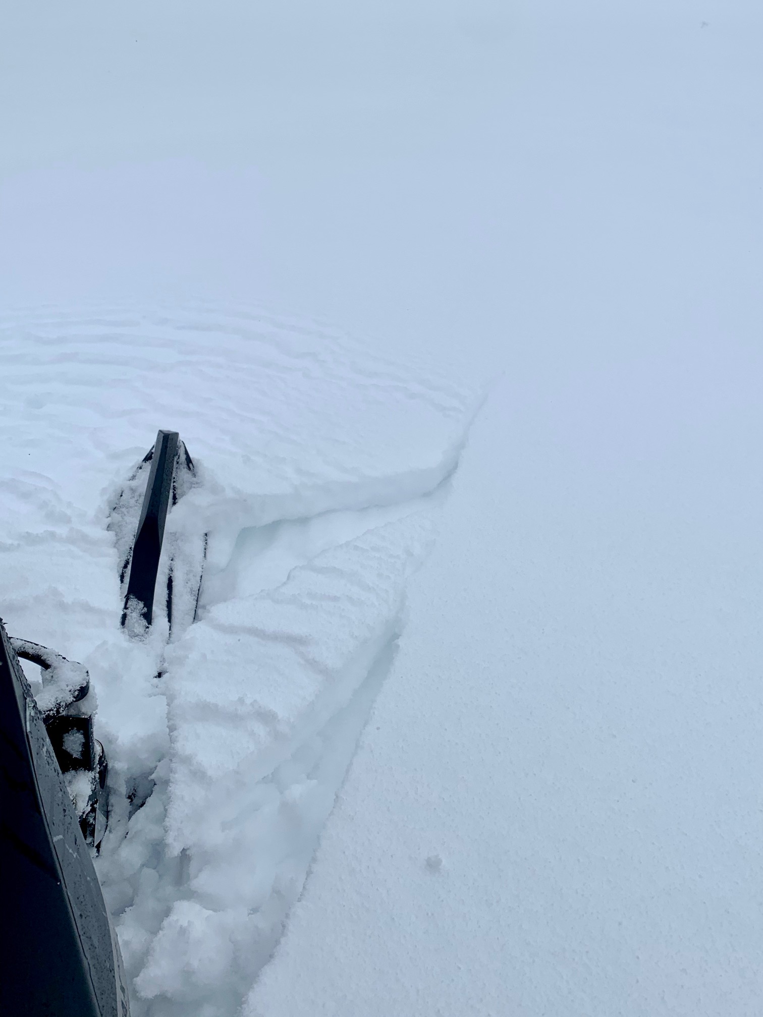 Damp new snow yesterday was easily pushed along creating small cracks in the top 3-4″ of new snow. These cracks are essentially a very shallow storm slab because the top of the new snow is sticky and ‘slabby’ while the bottom few inches is still loose and dry, acting as the weak layer. This is what could happen today with daytime heating and sun effect in higher elevation terrain.