Turnagain Pass RSS

Archives
ARCHIVED - Forecasts expire after 24 hours.
Issued
Sat, March 21st, 2020 - 7:00AM
Expires
Sun, March 22nd, 2020 - 7:00AM
Forecaster
Wendy Wagner
Avalanche risk The Bottom Line

The avalanche danger will increase to MODERATE today due to several inches of new snow and increased easterly winds. Watch for shallow fresh wind slabs to form on wind loaded slopes at the higher elevations. Small sluffs in the new snow are also expected. In the lower elevations, wet loose avalanches will be possible to trigger due to wet and saturated surface snow.

SUMMIT LAKE:  A much shallower snowpack exists from the Johnson Pass and Silvertip trailheads south to Summit Lake. In this area, there remains a chance a person could still trigger a larger slab avalanche due to weak snow in the mid and base of the pack. Extra caution is advised.

PORTAGE VALLEY/Byron Glacier Trail: Strong wind and additional precipitation will increase the avalanche danger in this zone. Avoid avalanche runout zones such as the Byron Glacier hiking trail up to the ice caves.

*Roof Avalanches:  Heads up, roofs may still shed remaining snow with the cloudy, wet and warm weather.

Special Announcements

We are so grateful for all those who have been submitting observations! Let us know what you see this weekend if you are getting out in the mountains. You can submit on our website HERE or shoot us an email at staff@chugachavalanche.org. Thank you!!

Sat, March 21st, 2020
Alpine
Above 2,500'
2 - Moderate
Avalanche risk
Treeline
1,000'-2,500'
2 - Moderate
Avalanche risk
Below Treeline
Below 1,000'
2 - Moderate
Avalanche risk
0 - No Rating
1 - Low
2 - Moderate
3 - Considerable
4 - High
5 - Extreme
Avalanche risk Avalanche risk Avalanche risk Avalanche risk Avalanche risk
Travel Advice Generally safe avalanche conditions. Watch for unstable snow on isolated terrain features. Heightened avalanche conditions on specific terrain features. Evaluate snow and terrain carefully; identify features of concern. Dangerous avalanche conditions. Careful snowpack evaluation, cautious route-finding, and conservative decision-making essential. Very dangerous avalanche conditions. Travel in avalanche terrain not recommended. Extraordinarily dangerous avalanche conditions. Avoid all avalanche terrain.
Likelihood of Avalanches Natural and human-triggered avalanches unlikely. Natural avalanches unlikely; human-triggered avalanches possible. Natural avalanches possible; human-triggered avalanches likely. Natural avalanches likely; human-triggered avalanches very likely. Natural and human-triggered avalanches certain.
Avalanche Size and Distribution Small avalanches in isolated areas or extreme terrain. Small avalanches in specific areas; or large avalanches in isolated areas. Small avalanches in many areas; or large avalanches in specific areas; or very large avalanches in isolated areas. Large avalanches in many areas; or very large avalanches in specific areas. Very large avalanches in many areas.
Avalanche Problem 1
  • Wind Slabs
    Wind Slabs
  • Certain
    Very Likely
    Likely
    Possible
    Unlikely
    Likelihood
  • Historic (D4-5)
    Very Large (D3)
    Large (D2)
    Small (D1)
    Size
Wind Slabs
Wind Slab avalanches are the release of a cohesive layer of snow (a slab) formed by the wind. Wind typically transports snow from the upwind sides of terrain features and deposits snow on the downwind side. Wind slabs are often smooth and rounded and sometimes sound hollow, and can range from soft to hard. Wind slabs that form over a persistent weak layer (surface hoar, depth hoar, or near-surface facets) may be termed Persistent Slabs or may develop into Persistent Slabs.

Likelihood of Avalanches
Terms such as "unlikely", "likely", and "certain" are used to define the scale, with the chance of triggering or observing avalanches increasing as we move up the scale. For our purposes, "Unlikely" means that few avalanches could be triggered in avalanche terrain and natural avalanches are not expected. "Certain" means that humans will be able to trigger avalanches on many slopes, and natural avalanches are expected.

Size of Avalanches
Avalanche size is defined by the largest potential avalanche, or expected range of sizes related to the problem in question. Assigned size is a qualitative estimate based on the destructive classification system and requires specialists to estimate the harm avalanches may cause to hypothetical objects located in the avalanche track (AAA 2016, CAA 2014). Under this schema, "Small" avalanches are not large enough to bury humans and are relatively harmless unless they carry people over cliffs or through trees or rocks. Moving up the scale, avalanches become "Large" enough to bury, injure, or kill people. "Very Large" avalanches may bury or destroy vehicles or houses, and "Historic" avalanches are massive events capable of altering the landscape.

Signal Word Size (D scale) Simple Descriptor
Small 1 Unlikely to bury a person
Large 2 Can bury a person
Very Large 3 Can destroy a house
Historic 4 & 5 Can destroy part or all of a village
More info at Avalanche.org

Despite spring being officially underway, there is a cold(ish) winter storm headed in this morning. A wintery mix is expected below 1,000′ with a couple inches of warm snow accumulating. At the higher elevations, roughly 3-5″ of colder snow is expected. This isn’t too much of re-fresh for powder lovers, but it may improve some riding conditions. This is also not too much to drastically change the avalanche conditions, but it is likely to form some shallow wind slabs and create some sluffs in steep terrain.

Ridgetop winds have just picked up from the east and forecast to remain in the 15-25mph range with stronger gusts. That said, wind slabs are likely to form today. These should be on the shallow side, from 6″ to a foot thick. On northerly aspects they could be sitting on a layer of buried surface hoar. Slopes that do not have a sun crust may have a layer of buried surface hoar around 2-6″ below the surface. This was found on Eddies yesterday and suspect to exist in other areas. Wind slabs that form over the buried surface hoar could be a bit larger and propagate wider than expected. Quick hand pits, looking for small ‘feathers’ and easy shears is a good way to suss this out. Wind slabs on southerly aspects may be touchy as well as they will be sitting on a sun crust.

In short: The big issues to watch for are how much new snow falls and if the strong winds are blowing it (or older loose surface snow) into fresh slabs. Additionally, older small wind slabs formed a day ago could be found, as was seen on Eddies yesterday (photo below).

Dry Loose Snow avalanches:  Sluffs in the drier new snow at the higher elevations will be likely. These should be on the smaller side and composed of the few inches of storm snow.

Cornices:  Cornices should grow a bit today with the sticky new snow and strong winds. As always, give them a wide berth and limit exposure underneath them.

Storm Slabs:  There is not quite enough snow forecast for storm slabs to form. However, if the snowfall intensifies more than predicted and over 6″ fall, watch for storm slabs on all aspects due to rapid loading.

Cracking in the snow due to a small wind slab found on Eddies ridge yesterday. 3.20.20. Photo: Joe Stock

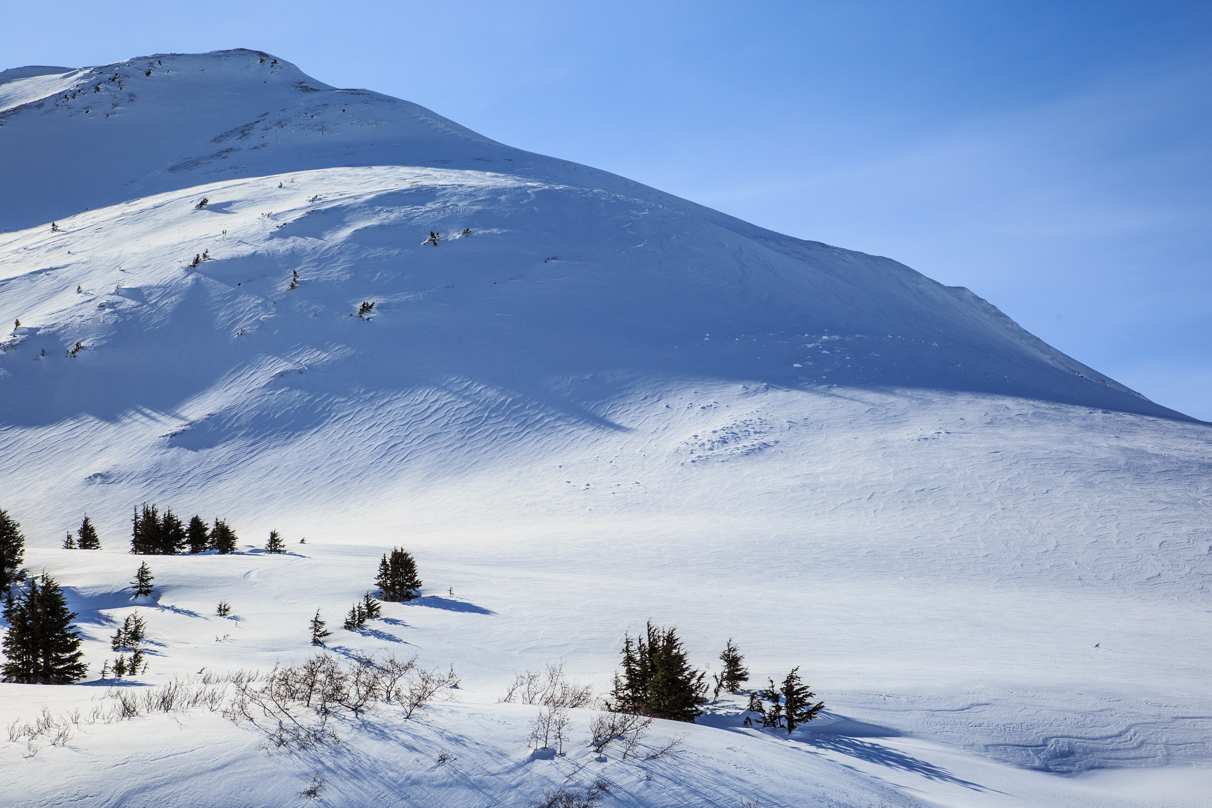
The NW should of Magnum Ridge. This is yesterday’s surface and what any new snow will fall on today. Take a look at more images from Turnagain Pass HERE. 3.20.20. Photo: Heather Thamm

Avalanche Problem 2
  • Wet Loose
    Wet Loose
  • Certain
    Very Likely
    Likely
    Possible
    Unlikely
    Likelihood
  • Historic (D4-5)
    Very Large (D3)
    Large (D2)
    Small (D1)
    Size
Wet Loose
Wet Loose avalanches are the release of wet unconsolidated snow or slush. These avalanches typically occur within layers of wet snow near the surface of the snowpack, but they may quickly gouge into lower snowpack layers. Like Loose Dry Avalanches, they start at a point and entrain snow as they move downhill, forming a fan-shaped avalanche. Other names for loose-wet avalanches include point-release avalanches or sluffs. Loose Wet avalanches can trigger slab avalanches that break into deeper snow layers.

Likelihood of Avalanches
Terms such as "unlikely", "likely", and "certain" are used to define the scale, with the chance of triggering or observing avalanches increasing as we move up the scale. For our purposes, "Unlikely" means that few avalanches could be triggered in avalanche terrain and natural avalanches are not expected. "Certain" means that humans will be able to trigger avalanches on many slopes, and natural avalanches are expected.

Size of Avalanches
Avalanche size is defined by the largest potential avalanche, or expected range of sizes related to the problem in question. Assigned size is a qualitative estimate based on the destructive classification system and requires specialists to estimate the harm avalanches may cause to hypothetical objects located in the avalanche track (AAA 2016, CAA 2014). Under this schema, "Small" avalanches are not large enough to bury humans and are relatively harmless unless they carry people over cliffs or through trees or rocks. Moving up the scale, avalanches become "Large" enough to bury, injure, or kill people. "Very Large" avalanches may bury or destroy vehicles or houses, and "Historic" avalanches are massive events capable of altering the landscape.

Signal Word Size (D scale) Simple Descriptor
Small 1 Unlikely to bury a person
Large 2 Can bury a person
Very Large 3 Can destroy a house
Historic 4 & 5 Can destroy part or all of a village
More info at Avalanche.org

Cloud cover overnight has trapped in the daytime warmth from yesterday. This has kept the snowpack at the lower elevations from completely re-freezing. If temperatures remain above freezing today, triggering a wet loose avalanche on these wet and saturated lower slopes will be possible. Keep this in mind in small creek beds and terrain traps in the trees.

Small wet loose avalanche triggered by a snowmachiner descending a lower elevation slope under Seattle Ridge yesterday. Note the saturated surface snow and large roller balls. 3.20.20.

Additional Concern
  • Persistent Slabs
    Persistent Slabs
Persistent Slabs
Persistent Slab avalanches are the release of a cohesive layer of snow (a slab) in the middle to upper snowpack, when the bond to an underlying persistent weak layer breaks. Persistent layers include: surface hoar, depth hoar, near-surface facets, or faceted snow. Persistent weak layers can continue to produce avalanches for days, weeks or even months, making them especially dangerous and tricky. As additional snow and wind events build a thicker slab on top of the persistent weak layer, this avalanche problem may develop into a Deep Persistent Slab.
More info at Avalanche.org

Triggering a large slab avalanche that breaks in weak old faceted snow deeper in the snowpack remains a concern in areas that have a shallow overall snow depth. These areas are south of Turnagain Pass and include Johnson Pass to Silvertip area, Summit Lake and Palmer Creek. Watch for areas that have a harder wind packed layer of snow over weak sugary snow. Although it has been almost a week since the last known avalanche breaking in these weak layers, this lingering issue remains a concern.

Weather
Sat, March 21st, 2020

Yesterday:  Mostly sunny skies with high clouds moving in late in the day. Ridgetop winds were light and westerly. Temperatures reached 40°F at the lower elevations and 30°F along the ridgelines.

Today:  Light to moderate snowfall is forecast today as a colder storm system pushes through. This flow direction favors Cook inlet through Anchorage and to Hatcher Pass, but we should squeak out 3-4″ of new snow by this evening. Up to 5-7″ could be seen at the higher elevation in favored areas. Ridgetop winds switched to easterly early this morning and will remain easterly in the 15-25mph range. Temperatures should stay in the mid 20’s°F at the higher elevations and the mid 30’s°F at sea level.

Tomorrow:  The storm is expected to move out tonight and skies are on a clearing trend for Sunday through Tuesday. Another strong NW outflow wind event looks to be taking shape for Sunday and Monday. Stay tuned.

PRECIPITATION 24-hour data (6am – 6am)

Temp Avg (F) Snow (in) Water (in) Snow Depth (in)
Center Ridge (1880′) 34 0 0 65
Summit Lake (1400′) 32 0 0 30
Alyeska Mid (1700′) 32 0 0 75

RIDGETOP 24-hour data (6am – 6am)

Temp Avg (F) Wind Dir Wind Avg (mph) Wind Gust (mph)
Sunburst (3812′) 23 W 7 34
Seattle Ridge (2400′) 27 NW 10 24
Observations
Recent Observations for Turnagain Pass
Date Region Location
04/23/24 Turnagain Observation: Turnagain Sunny Side
04/21/24 Turnagain Observation: Bertha Creek
04/20/24 Turnagain Avalanche: Spokane Creek
04/16/24 Turnagain Observation: Cornbiscuit
04/15/24 Turnagain Observation: Taylor Pass
04/15/24 Turnagain Observation: Seward Highway – Tern Lake to Portage
04/14/24 Turnagain Observation: Sunburst
04/14/24 Turnagain Observation: Turnagain Pass Snomo
04/13/24 Turnagain Observation: Spokane Creek
04/11/24 Turnagain Observation: Tincan
Riding Areas

The riding areas page has moved. Please click here & update your bookmarks.


Subscribe to Turnagain Pass
Avalanche Forecast by Email

This is a general backcountry avalanche advisory issued for Turnagain Arm with Turnagain Pass as the core advisory area. This advisory does not apply to highways, railroads or operating ski areas.