Turnagain Pass Avalanche Forecast RSS

Archives
ARCHIVED FORECAST - All forecasts expire after 24 hours from the posting date/time.
Issued
Fri, February 14th, 2020 - 7:00AM
Expires
Sat, February 15th, 2020 - 7:00AM
Forecaster
Wendy Wagner
Avalanche risk The Bottom Line

The avalanche danger remains CONSIDERABLE above 1,000′. Triggering a large and deadly slab avalanche 2-4′ thick remains possible along with triggering smaller avalanches such as wind slabs 1-2′ thick and cornice falls. Due to the size and destructive nature of triggering a large slab, we need to be on guard, be conservative and consider the consequences if a slope releases.

SUMMIT LAKE and LOST LAKE/SNUG HARBOR regions:  In addition to the above possibility for triggering a large slab, watch for touchy hard wind slabs on the surface created by the strong winds yesterday.

Special Announcements

TONIGHT!!!
Please join us for the 6th Annual Snowball!  7-11 pm tonight (Feb 14th) at 49th State Brewing Co. in Anchorage. I Like Robots will be rockin’ our favorite 80’s tunes! Awesome silent auction and costume contest, so break out your best 80’s fashion and snow gear! $35 tickets on sale HERE. Proceeds support Friends of the Chugach Avalanche Center and the Alaska Avalanche School.

Thanks to our sponsors!
Fri, February 14th, 2020
Alpine
Above 2,500'
Considerable (3)
Avalanche risk
Treeline
1,000'-2,500'
Considerable (3)
Avalanche risk
Below Treeline
Below 1,000'
Moderate (2)
Avalanche risk
Alpine
Above 2,500'
Avalanche risk
Considerable (3)
Treeline
1,000'-2,500'
Avalanche risk
Considerable (3)
Below Treeline
Below 1,000'
Avalanche risk
Moderate (2)
Danger Scale:
No Rating (0)
Low (1)
Moderate (2)
Considerable (3)
High (4)
Extreme (5)
Recent Avalanches

Sunny skies yesterday provided a good look around at any recent avalanches that occurred during Wednesday’s snowfall event (Feb 12) and also yesterday’s wind event (Feb 13th). The winds spared much of Turnagain Pass, but did create plumes and at least four natural avalanches in the Summit Lake and Lost Lake areas. We also received a report of a possible human triggered avalanche on the backside of Seattle Ridge.

Natural large wind slab occurring yesterday on Roaring Ridge in the Summit Lake Area. 2.13.20. Photo: Alex McLain


Two natural wind slabs were triggered by winds cross-loading slopes on the SE face of Seattle Ridge sometime on Wednesday, Feb 12th. This photo was taken Feb 13th  from the motorized parking lot at Turnagain Pass.


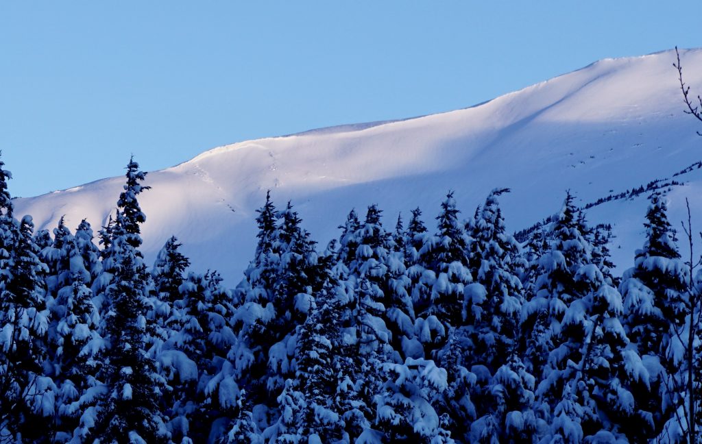
Natural slab avalanche on the lower norther ridge of Wolverine (SW facing)  that appears to have released early in the storm on Feb 12th. Likely triggered by a cornice fall. 

Avalanche Problem 1
  • Persistent Slabs
    Persistent Slabs
  • Almost Certain
    Very Likely
    Likely
    Possible
    Unlikely
    Likelihood
  • Historic (D4-5)
    Very Large (D3)
    Large (D2)
    Small (D1)
    Size
Persistent Slabs
Persistent Slab avalanches are the release of a cohesive layer of snow (a slab) in the middle to upper snowpack, when the bond to an underlying persistent weak layer breaks. Persistent layers include: surface hoar, depth hoar, near-surface facets, or faceted snow. Persistent weak layers can continue to produce avalanches for days, weeks or even months, making them especially dangerous and tricky. As additional snow and wind events build a thicker slab on top of the persistent weak layer, this avalanche problem may develop into a Deep Persistent Slab.

Likelihood of Avalanches
Terms such as "unlikely", "likely", and "certain" are used to define the scale, with the chance of triggering or observing avalanches increasing as we move up the scale. For our purposes, "Unlikely" means that few avalanches could be triggered in avalanche terrain and natural avalanches are not expected. "Certain" means that humans will be able to trigger avalanches on many slopes, and natural avalanches are expected.

Size of Avalanches
Avalanche size is defined by the largest potential avalanche, or expected range of sizes related to the problem in question. Assigned size is a qualitative estimate based on the destructive classification system and requires specialists to estimate the harm avalanches may cause to hypothetical objects located in the avalanche track (AAA 2016, CAA 2014). Under this schema, "Small" avalanches are not large enough to bury humans and are relatively harmless unless they carry people over cliffs or through trees or rocks. Moving up the scale, avalanches become "Large" enough to bury, injure, or kill people. "Very Large" avalanches may bury or destroy vehicles or houses, and "Historic" avalanches are massive events capable of altering the landscape.

Signal Word Size (D scale) Simple Descriptor
Small 1 Unlikely to bury a person
Large 2 Can bury a person
Very Large 3 Can destroy a house
Historic 4 & 5 Can destroy part or all of a village
More info at Avalanche.org

After a dose of 10-18″ of new snow and wind over the past two days, today’s partly cloudy skies and light winds are not expected to affect the snowpack. As the pack slowly adjusts, we are trending into a ‘SCARY MODERATE’ avalanche danger. What this means is there is still a chance a person could trigger a large and dangerous avalanche, but that likelihood is decreasing. We are heading into a Low Probability / High Consequence situation (click HERE for more insight into this).

We can’t forget that 2-4′ below the snow surface lies weak faceted snow and in places buried surface hoar. These layers caused several avalanches over the past two weeks and with small snowfall events incrementally adding to the slab, the size of these potential avalanches is growing. What can we do? We know the snowpack isn’t likely to give us signs of instability until it’s too late. It could be the 10th person on the slope that triggers the slab and it could even be triggered remotely, from below or the top. We can choose to stick to lower angle terrain and avoid slopes ending in terrain traps. We can think to ourselves, ‘where will I end up if the slope slides?’ Approaching the backcountry with a conservative mindset is key now and will be for the foreseeable future.


Video link HERE.

Avalanche Problem 2
  • Wind Slabs
    Wind Slabs
  • Almost Certain
    Very Likely
    Likely
    Possible
    Unlikely
    Likelihood
  • Historic (D4-5)
    Very Large (D3)
    Large (D2)
    Small (D1)
    Size
Wind Slabs
Wind Slab avalanches are the release of a cohesive layer of snow (a slab) formed by the wind. Wind typically transports snow from the upwind sides of terrain features and deposits snow on the downwind side. Wind slabs are often smooth and rounded and sometimes sound hollow, and can range from soft to hard. Wind slabs that form over a persistent weak layer (surface hoar, depth hoar, or near-surface facets) may be termed Persistent Slabs or may develop into Persistent Slabs.

Likelihood of Avalanches
Terms such as "unlikely", "likely", and "certain" are used to define the scale, with the chance of triggering or observing avalanches increasing as we move up the scale. For our purposes, "Unlikely" means that few avalanches could be triggered in avalanche terrain and natural avalanches are not expected. "Certain" means that humans will be able to trigger avalanches on many slopes, and natural avalanches are expected.

Size of Avalanches
Avalanche size is defined by the largest potential avalanche, or expected range of sizes related to the problem in question. Assigned size is a qualitative estimate based on the destructive classification system and requires specialists to estimate the harm avalanches may cause to hypothetical objects located in the avalanche track (AAA 2016, CAA 2014). Under this schema, "Small" avalanches are not large enough to bury humans and are relatively harmless unless they carry people over cliffs or through trees or rocks. Moving up the scale, avalanches become "Large" enough to bury, injure, or kill people. "Very Large" avalanches may bury or destroy vehicles or houses, and "Historic" avalanches are massive events capable of altering the landscape.

Signal Word Size (D scale) Simple Descriptor
Small 1 Unlikely to bury a person
Large 2 Can bury a person
Very Large 3 Can destroy a house
Historic 4 & 5 Can destroy part or all of a village
More info at Avalanche.org

For today, triggering a wind slab, or soft slab composed of the new snow from Wednesday is still possible. Watch for slopes that have been previously wind loaded or steep gullies that have been cross-loaded. These slabs could be anywhere from 6″ thick to 2′ and quite hard in places the wind was strong and softer where winds were more moderate. Cracking in the snow around you, a hollow/drum like feel of the snow surface and a generally stiffer layer of snow over softer snow are all signs of a wind slab. Heads up that a wind slab avalanche may overload deeper weak layers and initiate a much larger slab.

Cornices:  These have grown over the past 36 hours and we can’t forget to give them a wide berth from above and limit time under them from below.

Plumes in the Summit Lake and Seward areas of the Kenai Mtns. 2.13.20. Photo: Alex McLain

Weather
Fri, February 14th, 2020

Yesterday:  Sunny skies with cold northerly winds were over the region.  Weather stations at Turnagain Pass were reporting ~10mph averages, but much stronger wind was noted further south on the Kenai. Temperatures were in the teens to single digits at all elevations.

Today:  Partly cloudy skies with some periods of blue sky are forecast as a band of high clouds is moving over Southcentral AK. Ridgetop winds turned easterly last night and expected to remain light from the east today (5-10mph). Temperatures should remain in the teens at most locations. No precipitation is forecast.

Tomorrow:  Again, partly cloudy skies should be over the region tomorrow with a chance for a few snow flurries at times. Winds look to swing around back to the west and remain light. A storm system is expected to push in Sunday night with snowfall slated for early next week.

PRECIPITATION 24-hour data (6am – 6am)

Temp Avg (F) Snow (in) Water (in) Snow Depth (in)
Center Ridge (1880′) 15 0 0 67
Summit Lake (1400′) 9 0 0 25
Alyeska Mid (1700′) 14 0 0 63

RIDGETOP 24-hour data (6am – 6am)

Temp Avg (F) Wind Dir Wind Avg (mph) Wind Gust (mph)
Sunburst (3812′) 10 W 7 28
Seattle Ridge (2400′) 12 Variable 5 17
Observations
Recent Observations for Turnagain Pass
Date Region Location
05/22/23 Turnagain Avalanche: Tincan
05/12/23 Turnagain Avalanche: Tincan, Sunburst, Magnum, Cornbiscuit
05/07/23 Turnagain Observation: Tincan – Bear Tracks
05/05/23 Turnagain Observation: Seattle Ridge
05/02/23 Turnagain Observation: Cornbiscuit
05/02/23 Turnagain Observation: Seward Hwy Turnagain Pass
04/30/23 Turnagain Observation: Magnum
04/29/23 Turnagain Observation: Tincan
04/28/23 Turnagain Avalanche: Taylor Pass/Pastoral
04/28/23 Turnagain Avalanche: Tincan
Riding Areas
Updated Thu, June 01st, 2023

Status of riding areas across the Chugach NF is managed by the Glacier and Seward Ranger Districts, not avalanche center staff. Riding area information is posted as a public service to our users and updated based on snow depth and snow density to prevent resource damage at trailhead locations. Riding area questions contact: mailroom_r10_chugach@fs.fed.us

Area Status Weather & Riding Conditions
Glacier District
Johnson Pass
Closed
Closed May 15.
Placer River
Closed
Closed May 15.
Skookum Drainage
Closed
Will close to motorized use on April 1, 2023 per the National Forest Plan.
Turnagain Pass
Closed
Will close on June 1.
Twentymile
Closed
Scheduled closure May 1.
Seward District
Carter Lake
Closed
Scheduled closure May 1.
Lost Lake Trail
Closed
Scheduled closure May 1.
Primrose Trail
Closed
Scheduled closure May 1.
Resurrection Pass Trail
Closed
Closed to motorized use for the 2022/23 winter season per Forest Plan. Open next season.
Snug Harbor
Closed
Extended opening until May 15.
South Fork Snow River Corridor
Closed
Scheduled closure May 1.
Summit Lake
Closed
Scheduled closure May 1.

Subscribe to Turnagain Pass
Avalanche Forecast by Email

This is a general backcountry avalanche advisory issued for Turnagain Arm with Turnagain Pass as the core advisory area. This advisory does not apply to highways, railroads or operating ski areas.