Turnagain Pass RSS

Archives
ARCHIVED - Forecasts expire after 24 hours.
Issued
Sun, February 6th, 2022 - 7:00AM
Expires
Mon, February 7th, 2022 - 7:00AM
Forecaster
John Sykes
Avalanche risk The Bottom Line

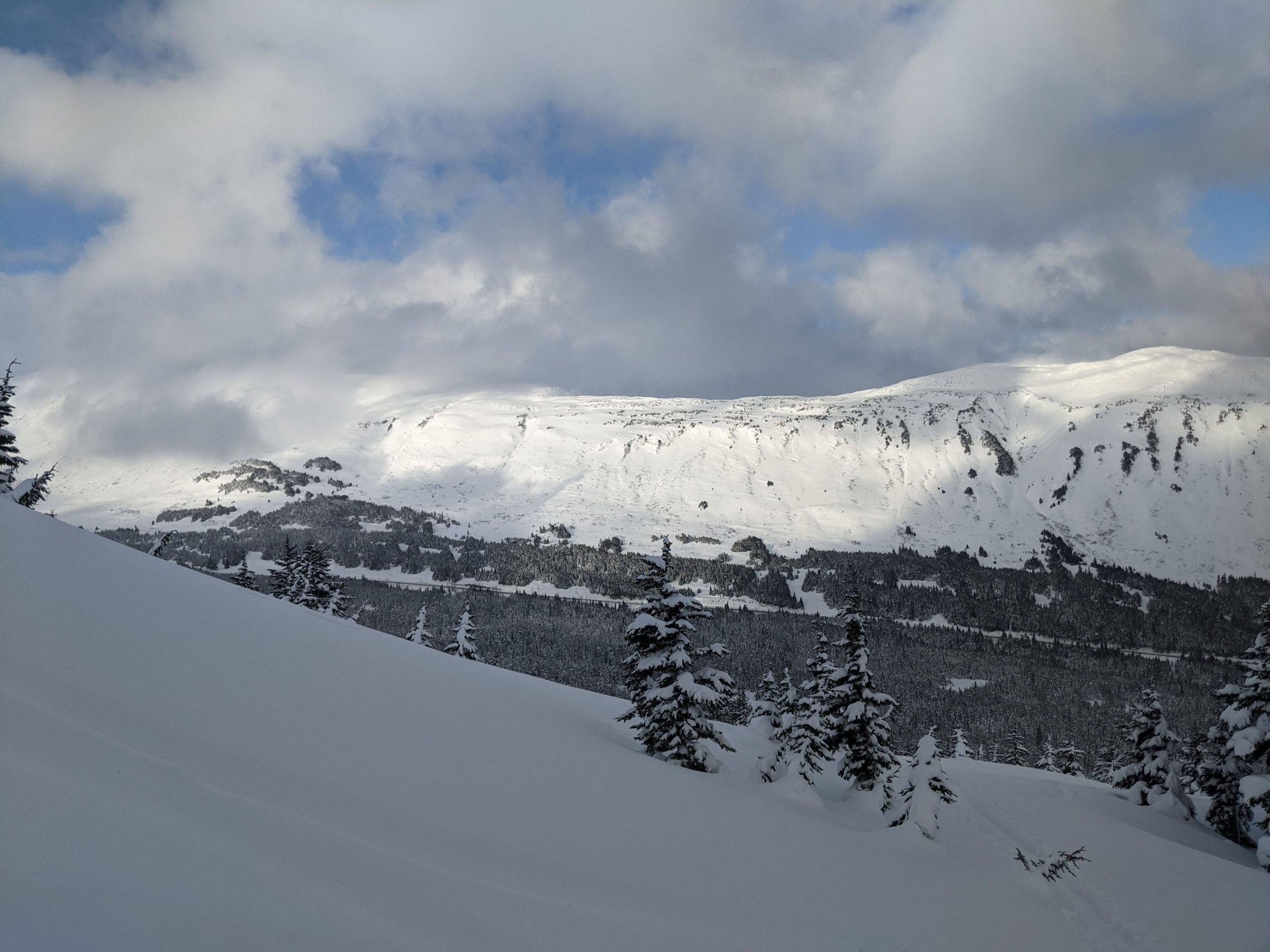
The avalanche danger is MODERATE above 1000′ today. Human triggered avalanches up to 2′ deep in areas with lingering wind slabs from yesterday’s strong winds are possible. We recommend identifying and evaluating wind loaded features by looking for signs of wind transport on the snow surface, pillows of freshly deposited snow on leeward aspects, and shooting cracks or hollow feeling snow.

Below 1000′ the avalanche danger is LOW. Warm temperatures yesterday created wet snow conditions on the surface which will likely freeze into a crust and make avalanches unlikely as temperatures start to drop today.

Special Announcements
  • Chugach State Park: The recent winds created touchy avalanche conditions in the front range, check out this observation for a report of a large remote triggered wind slab from Saturday, February 5th.
  • Hatcher Pass: Several reports of natural and human triggered avalanches during yesterday’s wind event from Hatcher Pass. Check out the Hatcher Pass Avalanche Center fore more information.
  • The recording from Andrew’s Fireside Chat #2 with US Air Force Major Kevin Kelly of the Alaska Rescue Coordination Center is available here, check it out to learn more about how rescue works in Alaska and get some tips on backcountry communication devices.
Sun, February 6th, 2022
Alpine
Above 2,500'
2 - Moderate
Avalanche risk
Treeline
1,000'-2,500'
2 - Moderate
Avalanche risk
Below Treeline
Below 1,000'
1 - Low
Avalanche risk
0 - No Rating
1 - Low
2 - Moderate
3 - Considerable
4 - High
5 - Extreme
Avalanche risk Avalanche risk Avalanche risk Avalanche risk Avalanche risk
Travel Advice Generally safe avalanche conditions. Watch for unstable snow on isolated terrain features. Heightened avalanche conditions on specific terrain features. Evaluate snow and terrain carefully; identify features of concern. Dangerous avalanche conditions. Careful snowpack evaluation, cautious route-finding, and conservative decision-making essential. Very dangerous avalanche conditions. Travel in avalanche terrain not recommended. Extraordinarily dangerous avalanche conditions. Avoid all avalanche terrain.
Likelihood of Avalanches Natural and human-triggered avalanches unlikely. Natural avalanches unlikely; human-triggered avalanches possible. Natural avalanches possible; human-triggered avalanches likely. Natural avalanches likely; human-triggered avalanches very likely. Natural and human-triggered avalanches certain.
Avalanche Size and Distribution Small avalanches in isolated areas or extreme terrain. Small avalanches in specific areas; or large avalanches in isolated areas. Small avalanches in many areas; or large avalanches in specific areas; or very large avalanches in isolated areas. Large avalanches in many areas; or very large avalanches in specific areas. Very large avalanches in many areas.
Recent Avalanches
  • Observations from yesterday reported small wind slabs and cornice fall avalanches in the core zone of Turnagain Pass but overall the fresh wind slabs were not too touchy in the areas we have reports from (Eddies, Tincan Common). Girdwood was a different story, with touchy wind slabs 6-12″ deep and up to 100′ wide releasing at the interface between the new wind transported snow and the old snow surface. One of those wind slabs was remote triggered and another was large enough to bury a person.

Example of small wind slabs and cornice fall avalanches from Tincan Common. Very similar avalanche activity along the steeper parts of the ridgeline leading to the upper face of Eddies. Photo from Andy Moderow 2.5.22

Wind affected snow and a small wind slab release from Notch Peak in Girdwood. Photo 2.5.22

Avalanche Problem 1
  • Wind Slabs
    Wind Slabs
  • Certain
    Very Likely
    Likely
    Possible
    Unlikely
    Likelihood
  • Historic (D4-5)
    Very Large (D3)
    Large (D2)
    Small (D1)
    Size
Wind Slabs
Wind Slab avalanches are the release of a cohesive layer of snow (a slab) formed by the wind. Wind typically transports snow from the upwind sides of terrain features and deposits snow on the downwind side. Wind slabs are often smooth and rounded and sometimes sound hollow, and can range from soft to hard. Wind slabs that form over a persistent weak layer (surface hoar, depth hoar, or near-surface facets) may be termed Persistent Slabs or may develop into Persistent Slabs.

Likelihood of Avalanches
Terms such as "unlikely", "likely", and "certain" are used to define the scale, with the chance of triggering or observing avalanches increasing as we move up the scale. For our purposes, "Unlikely" means that few avalanches could be triggered in avalanche terrain and natural avalanches are not expected. "Certain" means that humans will be able to trigger avalanches on many slopes, and natural avalanches are expected.

Size of Avalanches
Avalanche size is defined by the largest potential avalanche, or expected range of sizes related to the problem in question. Assigned size is a qualitative estimate based on the destructive classification system and requires specialists to estimate the harm avalanches may cause to hypothetical objects located in the avalanche track (AAA 2016, CAA 2014). Under this schema, "Small" avalanches are not large enough to bury humans and are relatively harmless unless they carry people over cliffs or through trees or rocks. Moving up the scale, avalanches become "Large" enough to bury, injure, or kill people. "Very Large" avalanches may bury or destroy vehicles or houses, and "Historic" avalanches are massive events capable of altering the landscape.

Signal Word Size (D scale) Simple Descriptor
Small 1 Unlikely to bury a person
Large 2 Can bury a person
Very Large 3 Can destroy a house
Historic 4 & 5 Can destroy part or all of a village
More info at Avalanche.org

There is currently a low pressure system hanging out in the Gulf of Alaska but it is located too far east and the snowfall is mostly impacting the big mountains of the St Elias and Fairweather ranges and leaving us out of the fire hose for the time being. Unfortunately, it looks like that low pressure system will still provide a source for low level clouds which could make visibility the main weather challenge today. That said, the cloud cover was patchy yesterday and we had periods of good visibility mixed in with overcast and obscured conditions in Turnagain Pass. Winds are expected to be light out of the NW at 0-10 mph with a trace of snowfall possible. The main concern for avalanches will be lingering wind slabs up to 2′ deep from yesterdays winds, which blew for about 24 hours with averages from 15-25 mph and gusts up to 40-50 mph at ridgetops.

Human triggered avalanches are possible today so we recommend being on the lookout for shooting cracks, hollow feeling snow, and wind eroded snow or cornice buildup to identify locations with fresh wind slabs. Small test slopes can be a great way to suss out whether wind slabs are reactive in your area before entering larger terrain features. As mentioned in the ‘recent avalanches’ section above, wind slabs were much more reactive in the Girdwood area yesterday compared to Turnagain Pass. With avalanches propagating up to 100′ wide, one avalanche that was remote triggered, and anther one that was big enough to fully bury a person. Conditions will likely be less reactive today as the wind slabs have had some time to adjust, but it is worth being on guard until you test how sensitive the conditions are in the area you are travelling. Finally, there are a few layers of buried crusts in the top 2-3′ of the snowpack that we have been monitoring as potential weak layers but we have not seen activity on either layer since last weekend.

Cornices: Strong winds yesterday will have added a new load to the already large cornices along upper ridgelines and could be sensitive to human triggers today.

The Hippy Bowl cornice on Tincan Common was growing during the strong winds yesterday, along with the rest of the large cornices lurking on upper ridgelines. Photo Andy Moderow 2.5.22 

Periods of good light revealed some dry loose avalanches along the lower face of Seattle Creek. Photo 2.5.22


Weather
Sun, February 6th, 2022

Yesterday: Moderate to strong winds throughout the day yesterday which started to taper off after midnight. Snowfall started consistently in the afternoon in Turnagain Pass with 0.2″ of water, Girdwood had just 0.1″ of water. Temperatures were in the 30s at lower elevations and 20s at ridgetop elevations.

Today: A calm day as far as winds and snowfall today with a trace of snow accumulation possible. Temperatures started to drop overnight and should be in the 20s today. Visibility may be the most challenging thing today, with mostly cloudy conditions expected.

Tomorrow: Monday looks similar to Sunday, with slightly stronger winds and cooler temperatures. Starting on Tuesday through Thursday morning we could get back into a flow with more snowfall coming to our area, but we will have to wait and see what the weather models say when we get closer.

PRECIPITATION 24-hour data (6am – 6am)

Temp Avg (F) Snow (in) Water (in) Snow Depth (in)
Center Ridge (1880′) 31 1 0.2 90
Summit Lake (1400′) 27 0 0 37
Alyeska Mid (1700′) 30 tr 0.1 N/A

RIDGETOP 24-hour data (6am – 6am)

Temp Avg (F) Wind Dir Wind Avg (mph) Wind Gust (mph)
Sunburst (3812′) 22 ENE 15 58
Seattle Ridge (2400′) 25 E 10 28
Observations
Recent Observations for Turnagain Pass
Date Region Location
04/16/24 Turnagain Observation: Cornbiscuit
04/15/24 Turnagain Observation: Taylor Pass
04/15/24 Turnagain Observation: Seward Highway – Tern Lake to Portage
04/14/24 Turnagain Observation: Sunburst
04/14/24 Turnagain Observation: Turnagain Pass Snomo
04/13/24 Turnagain Observation: Spokane Creek
04/11/24 Turnagain Observation: Tincan
04/10/24 Turnagain Avalanche: Seattle Ridge
04/10/24 Turnagain Observation: Cornbiscuit South Face
04/10/24 Turnagain Avalanche: Tincan
Riding Areas

The riding areas page has moved. Please click here & update your bookmarks.


Subscribe to Turnagain Pass
Avalanche Forecast by Email

This is a general backcountry avalanche advisory issued for Turnagain Arm with Turnagain Pass as the core advisory area. This advisory does not apply to highways, railroads or operating ski areas.