The avalanche danger remains CONSIDERABLE above 2500′. Large human triggered avalanches are possible on a layer of buried surface hoar 1-3′ deep above 2000′. This weak layer is gradually becoming less reactive, but has been responsible for many human triggered avalanches and near misses over the past few weeks. We recommend continuing to travel on low angle slopes and giving this layer time to continue gaining strength.
From 1000 – 2500′ the avalanche danger is MODERATE. A warm storm earlier this week formed a crust up to 2000′ that seems to have added some strength to the snowpack at these elevations and made triggering an avalanche on buried surface hoar much less likely. Below 1000′ the avalanche danger is LOW.
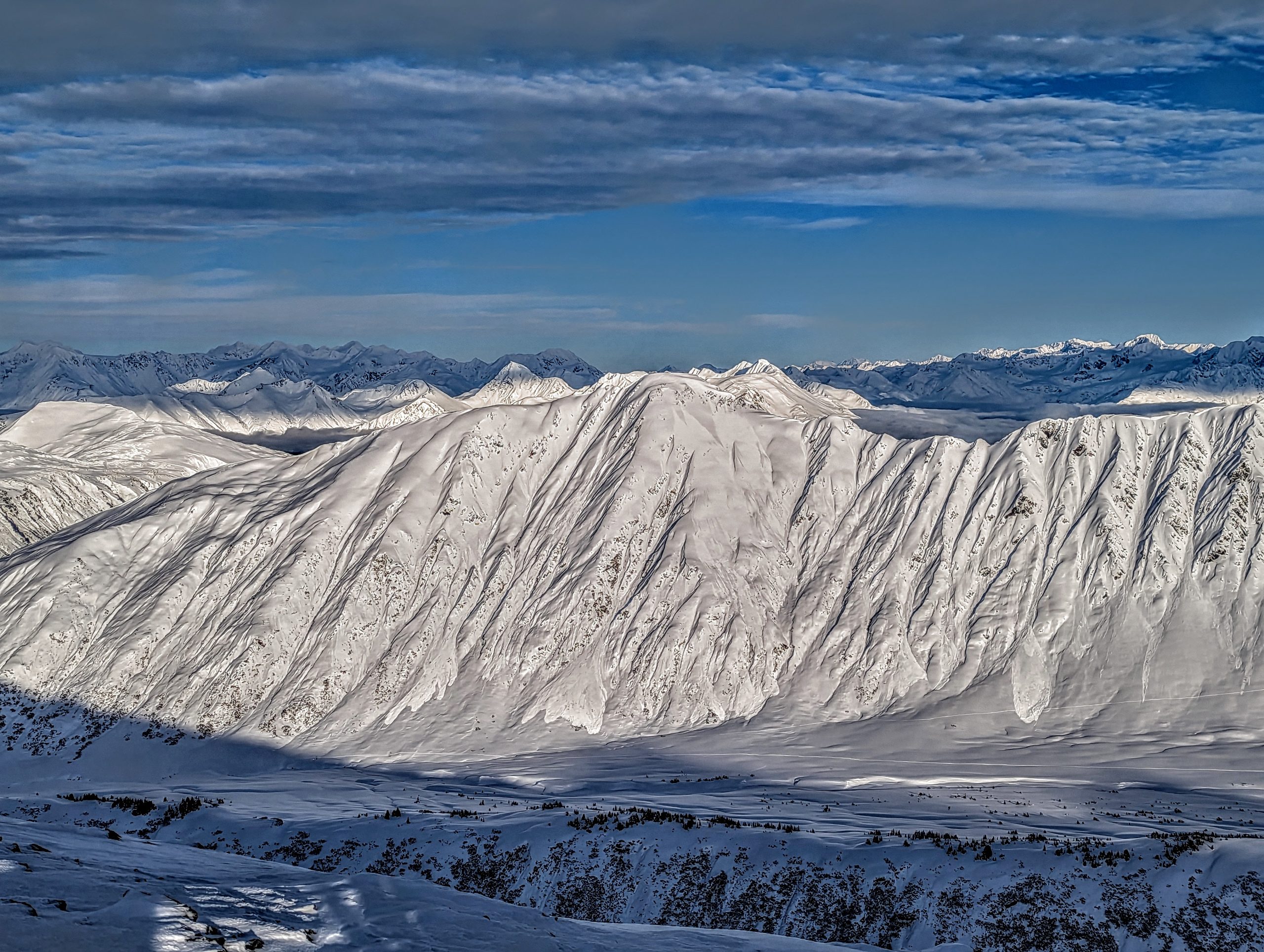
SUMMIT LAKE/LOST LAKE/SNUG HARBOR: Unusually warm temperatures in the mid 30s at upper elevations today could cause loose snow avalanches,cornice fall, and glide avalanches to be more likely. Be aware of steep slopes and cornices above you that are receiving direct sunlight. The temperature increase could also cause the snowpack to be more sensitive to triggering buried weak layers.
Sat, January 28th, 2023
Alpine
Above 2,500'
3 - Considerable
Treeline
1,000'-2,500'
2 - Moderate
Below Treeline
Below 1,000'
1 - Low
0 - No Rating
1 - Low
2 - Moderate
3 - Considerable
4 - High
5 - Extreme
Travel Advice
Generally safe avalanche conditions. Watch for unstable snow on isolated terrain features.
Heightened avalanche conditions on specific terrain features. Evaluate snow and terrain carefully; identify features of concern.
Natural avalanches likely; human-triggered avalanches very likely.
Natural and human-triggered avalanches certain.
Avalanche Size and Distribution
Small avalanches in isolated areas or extreme terrain.
Small avalanches in specific areas; or large avalanches in isolated areas.
Small avalanches in many areas; or large avalanches in specific areas; or very large avalanches in isolated areas.
Large avalanches in many areas; or very large avalanches in specific areas.
Very large avalanches in many areas.
Recent Avalanches
No recent avalanches were reported yesterday. We saw some older loose snow avalanches that were able to build up quite a bit of volume in steeper terrain on Tincan Proper and the Library. The last known avalanche on the 1/10 buried surface hoar was on Sunday Jan 22nd. The last known avalanche on the Thanksgiving facet/crust layer was on Saturday Jan 7th.
Loose snow avalanches that built up pretty large debris piles on the steep S face of Tincan Proper. Photo 1.27.23
Avalanche Problem 1
Persistent Slabs
Aspect/Elevation
Certain
Very Likely
Likely
Possible
Unlikely
Likelihood
Historic (D4-5)
Very Large (D3)
Large (D2)
Small (D1)
Size
Persistent Slabs
Persistent Slab avalanches are the release of a cohesive layer of snow (a slab) in the middle to upper snowpack, when the bond to an underlying persistent weak layer breaks. Persistent layers include: surface hoar, depth hoar, near-surface facets, or faceted snow. Persistent weak layers can continue to produce avalanches for days, weeks or even months, making them especially dangerous and tricky. As additional snow and wind events build a thicker slab on top of the persistent weak layer, this avalanche problem may develop into a Deep Persistent Slab.
Aspect/Elevation of the Avalanche Problem
Specialists develop a graphic representation of the potential distribution of a particular avalanche problem across the topography.
This aspect/elevation rose is used to indicate where the particular avalanche problem is thought to exist on all elevation aspects.
Areas where the avalanche problem is thought to exist are colored grey, and it is less likely to be encountered in areas colored white.
Likelihood of Avalanches
Terms such as "unlikely", "likely", and "certain" are used to define the scale, with the chance of triggering or observing
avalanches increasing as we move up the scale. For our purposes, "Unlikely" means that few avalanches could be triggered in avalanche terrain and
natural avalanches are not expected. "Certain" means that humans will be able to trigger avalanches on many slopes, and natural avalanches are expected.
Size of Avalanches
Avalanche size is defined by the largest potential avalanche, or expected range of sizes related to the problem in question.
Assigned size is a qualitative estimate based on the destructive classification system and requires specialists to estimate the harm avalanches may cause to
hypothetical objects located in the avalanche track (AAA 2016, CAA 2014). Under this schema, "Small" avalanches are not large enough to bury humans and are
relatively harmless unless they carry people over cliffs or through trees or rocks. Moving up the scale, avalanches become "Large" enough to bury, injure,
or kill people. "Very Large" avalanches may bury or destroy vehicles or houses, and "Historic" avalanches are massive events capable of altering the landscape.
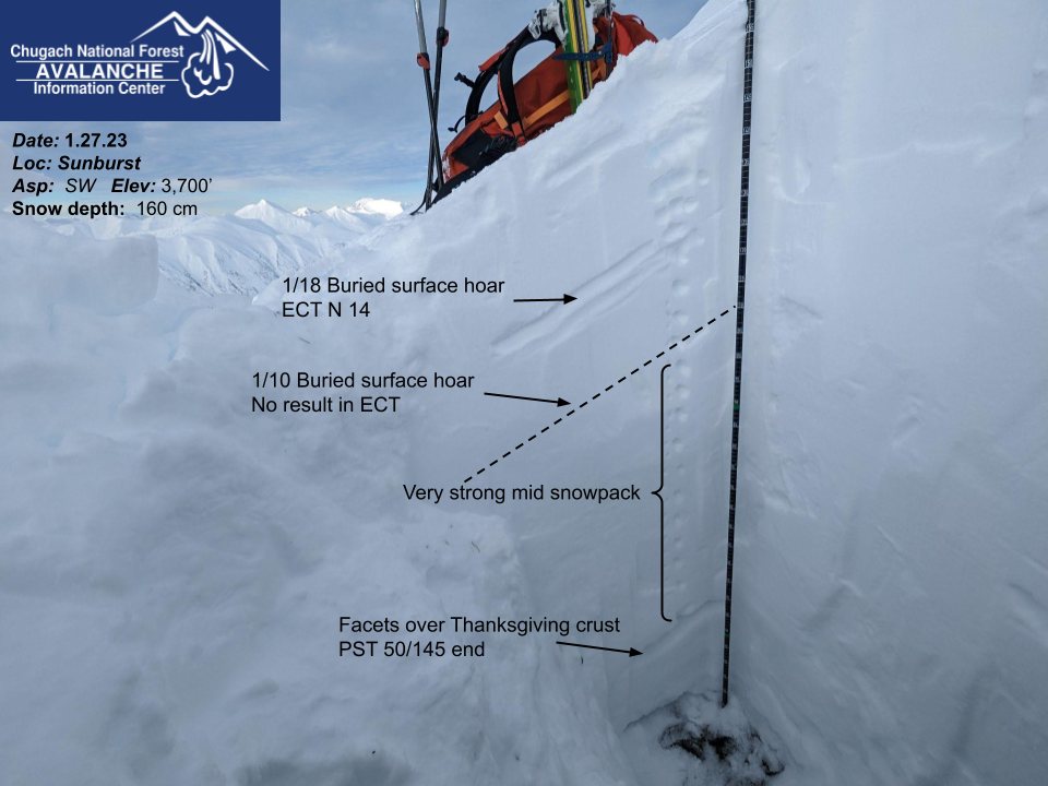
It has been almost a week since the last known avalanche was triggered on the 1/10 buried surface hoar layer. This layer has caused a ton of human triggered and natural avalanches since it was buried and is widespread across the forecast area. It is encouraging that we are starting to see this layer gain strength and be less reactive in snow pit tests, but the potential for triggering an avalanche on it still exists above 2000′ and could result in a large 1-3′ deep avalanche with wide propagation. Based on the tracks in Turnagain Pass it looks like most folks have been keeping their terrain conservative over the past week, which is great, but also means we have limited information on how reactive this weak layer is. Due to the potential consequences of triggering an avalanche on this weak layer we are taking a very gradual approach to assessing it and just starting to tip toe into low angle alpine terrain.
To avoid this avalanche problem we recommend sticking to low angle slopes and being aware of the potential for remote triggering an avalanche onto adjacent steeper terrain. Any signs of collapsing or shooting cracks are a strong indication that the weak layer is still reactive in the area you are travelling, which is what Andrew found in upper Lynx Creek on Thursday. Snow pit tests, like a compression test or extended column test, are a good way to identify and test the weak layer. The unusually warm temperatures at upper elevations today could cause this layer to become more reactive, but there is a lot of uncertainty about whether the warm weather will make triggering an avalanche more likely.
Lingering wind slabs, loose snow avalanches (aka sluffs), and cornice fall are all additional concerns at upper elevations today. The combination of warm temperatures and hopefully sunshine will make loose snow avalanches and cornice fall more likely. Cornices have been steadily growing and are quite large along many upper elevation ridgelines. Be aware of the potential for cornice fall if you are travelling underneath a cornice receiving direct sun. Glide avalanches were observed in the Summit Lake area recently and the warm temperatures and sunshine could make them more likely to start popping up in our forecast area as well.
All our weak layers still exist in the snowpack but are gradually becoming less reactive in snow pit tests. Photo 1.27.23
Avalanche Problem 2
Deep Persistent Slabs
Aspect/Elevation
Certain
Very Likely
Likely
Possible
Unlikely
Likelihood
Historic (D4-5)
Very Large (D3)
Large (D2)
Small (D1)
Size
Deep Persistent Slabs
Deep Persistent Slab avalanches are the release of a thick cohesive layer of hard snow (a slab), when the bond breaks between the slab and an underlying persistent weak layer deep in the snowpack. The most common persistent weak layers involved in deep, persistent slabs are depth hoar or facets surrounding a deeply buried crust. Deep Persistent Slabs are typically hard to trigger, are very destructive and dangerous due to the large mass of snow involved, and can persist for months once developed. They are often triggered from areas where the snow is shallow and weak, and are particularly difficult to forecast for and manage.
Aspect/Elevation of the Avalanche Problem
Specialists develop a graphic representation of the potential distribution of a particular avalanche problem across the topography.
This aspect/elevation rose is used to indicate where the particular avalanche problem is thought to exist on all elevation aspects.
Areas where the avalanche problem is thought to exist are colored grey, and it is less likely to be encountered in areas colored white.
Likelihood of Avalanches
Terms such as "unlikely", "likely", and "certain" are used to define the scale, with the chance of triggering or observing
avalanches increasing as we move up the scale. For our purposes, "Unlikely" means that few avalanches could be triggered in avalanche terrain and
natural avalanches are not expected. "Certain" means that humans will be able to trigger avalanches on many slopes, and natural avalanches are expected.
Size of Avalanches
Avalanche size is defined by the largest potential avalanche, or expected range of sizes related to the problem in question.
Assigned size is a qualitative estimate based on the destructive classification system and requires specialists to estimate the harm avalanches may cause to
hypothetical objects located in the avalanche track (AAA 2016, CAA 2014). Under this schema, "Small" avalanches are not large enough to bury humans and are
relatively harmless unless they carry people over cliffs or through trees or rocks. Moving up the scale, avalanches become "Large" enough to bury, injure,
or kill people. "Very Large" avalanches may bury or destroy vehicles or houses, and "Historic" avalanches are massive events capable of altering the landscape.
Yup, very large avalanches 4-8′ deep on a layer of facets around the Thanksgiving crust are still the worst case scenario for our snowpack. At upper elevations on Sunburst yesterday this weak layer and crust combination was still very prominent in the snowpack and our snow pit tests indicate that it can still propagate to cause a very large avalanche. However, we had to hunt to find a thin area where we could dig down to this layer and the snowpack on top of the weak layer was very strong even in this thin spot. The most likely place to trigger an avalanche on this weak layer is from a thin spot in the snowpack, like where wind has scoured away most of the snow or where rocky outcrops are sticking through the snowpack. The above freezing temps at upper elevations today could cause this layer to be more sensitive.
Weather
Sat, January 28th, 2023
Yesterday: Valley fog in the morning with light snowfall but no real accumulation. Mostly clear skies at upper elevations. Calm to light winds averaging 0-10 mph. Temperatures increased from the low 20s into the mid 30s at upper elevations in the afternoon and remained elevated overnight.
Today: A temperature inversion is in place this morning, causing temperatures to reach into the mid 30s at upper elevations. This is expected to persist through Sunday. Calm to light winds in the 0-10 mph range are expected and a chance of snow or rain showers but no real accumulation. Cloud cover is expected to be mostly sunny.
Tomorrow: Sunday cloud cover is expected to increase along with light to moderate winds out of the south. Temperatures at upper elevations should gradually transition back to the 20s as the inversion dissipates. Light precipitation is also expected to start on Sunday afternoon with snow level around 500-800′.
This is a general backcountry avalanche advisory issued for Turnagain Arm with Turnagain Pass as the core advisory area.
This advisory does not apply to highways, railroads or operating ski areas.