Turnagain Pass RSS

Archives
ARCHIVED - Forecasts expire after 24 hours.
Issued
Thu, January 27th, 2022 - 7:00AM
Expires
Fri, January 28th, 2022 - 7:00AM
Forecaster
John Sykes
Avalanche risk The Bottom Line

The avalanche danger is CONSIDERABLE above 1000′ today. Snowfall and moderate winds will build wind slabs up to 2′ deep that are likely to be triggered by a person and possible to produce natural avalanches. In protected areas the 8-16″ of new snow forecast from last night through tonight could produce storm snow avalanches at the interface with the old snow surface. These storm slabs may become more likely to trigger later in the day as the new snow starts to pile up.

Below 1000′ the avalanche danger is MODERATE. The snowline was at sea level overnight but could rise up to 700′ during the day today.

Thu, January 27th, 2022
Alpine
Above 2,500'
3 - Considerable
Avalanche risk
Treeline
1,000'-2,500'
3 - Considerable
Avalanche risk
Below Treeline
Below 1,000'
2 - Moderate
Avalanche risk
0 - No Rating
1 - Low
2 - Moderate
3 - Considerable
4 - High
5 - Extreme
Avalanche risk Avalanche risk Avalanche risk Avalanche risk Avalanche risk
Travel Advice Generally safe avalanche conditions. Watch for unstable snow on isolated terrain features. Heightened avalanche conditions on specific terrain features. Evaluate snow and terrain carefully; identify features of concern. Dangerous avalanche conditions. Careful snowpack evaluation, cautious route-finding, and conservative decision-making essential. Very dangerous avalanche conditions. Travel in avalanche terrain not recommended. Extraordinarily dangerous avalanche conditions. Avoid all avalanche terrain.
Likelihood of Avalanches Natural and human-triggered avalanches unlikely. Natural avalanches unlikely; human-triggered avalanches possible. Natural avalanches possible; human-triggered avalanches likely. Natural avalanches likely; human-triggered avalanches very likely. Natural and human-triggered avalanches certain.
Avalanche Size and Distribution Small avalanches in isolated areas or extreme terrain. Small avalanches in specific areas; or large avalanches in isolated areas. Small avalanches in many areas; or large avalanches in specific areas; or very large avalanches in isolated areas. Large avalanches in many areas; or very large avalanches in specific areas. Very large avalanches in many areas.
Avalanche Problem 1
  • Storm Slabs
    Storm Slabs
  • Certain
    Very Likely
    Likely
    Possible
    Unlikely
    Likelihood
  • Historic (D4-5)
    Very Large (D3)
    Large (D2)
    Small (D1)
    Size
Storm Slabs
Storm Slab avalanches are the release of a cohesive layer (a slab) of new snow that breaks within new snow or on the old snow surface. Storm-slabs typically last between a few hours and few days (following snowfall). Storm-slabs that form over a persistent weak layer (surface hoar, depth hoar, or near-surface facets) may be termed Persistent Slabs or may develop into Persistent Slabs.

Likelihood of Avalanches
Terms such as "unlikely", "likely", and "certain" are used to define the scale, with the chance of triggering or observing avalanches increasing as we move up the scale. For our purposes, "Unlikely" means that few avalanches could be triggered in avalanche terrain and natural avalanches are not expected. "Certain" means that humans will be able to trigger avalanches on many slopes, and natural avalanches are expected.

Size of Avalanches
Avalanche size is defined by the largest potential avalanche, or expected range of sizes related to the problem in question. Assigned size is a qualitative estimate based on the destructive classification system and requires specialists to estimate the harm avalanches may cause to hypothetical objects located in the avalanche track (AAA 2016, CAA 2014). Under this schema, "Small" avalanches are not large enough to bury humans and are relatively harmless unless they carry people over cliffs or through trees or rocks. Moving up the scale, avalanches become "Large" enough to bury, injure, or kill people. "Very Large" avalanches may bury or destroy vehicles or houses, and "Historic" avalanches are massive events capable of altering the landscape.

Signal Word Size (D scale) Simple Descriptor
Small 1 Unlikely to bury a person
Large 2 Can bury a person
Very Large 3 Can destroy a house
Historic 4 & 5 Can destroy part or all of a village
More info at Avalanche.org

Today will be yet another storm day, with moderate rates of snowfall throughout the day and light to moderate winds. The forecast is for 8-16″ of snowfall from last night through tonight with another 8-16″ on tap from tonight through Friday night. As of early Thursday morning the snowfall seems to be favoring Girdwood, with 8″ of new snow at 1700′ on Alyeska at 6am. If Turnagain Pass doesn’t get as much snowfall as is forecast then the depth of winds slabs will be lower and potential for storm slabs will be less likely. Snowline could get up to about 700′ during the day, but so far snow has been falling to sea level. This relatively tame storm will be a welcome change from the high winds and heavy wet snowfall we have received over the past week.

Wind Slabs: Despite the calmer winds in comparison to recent storms, we still expect wind slabs are forming in exposed areas especially at upper elevations. Human triggered avalanches up to 2′ deep will be likely and natural avalanches will be possible in areas with active wind loading. To identify areas with fresh wind slabs watch for shooting cracks, pillows of wind loaded snow on leeward aspects, and signs of wind transport on the snow surface. Likely areas with wind slabs will be near ridgelines, cross loaded gullies, and along convex features at and above treeline.

Storm Slabs: In protected areas the new snow could also produce smaller avalanches up to 1′ deep at the interface between the new snow and the old snow surface. Thanks to the slow and steady rates of precipitation with this storm it may not be an issue until more snowfall accumulates, like later today and into Friday. Hand pits and test slopes are a great way to determine how well the new snow is bonding with the existing snow surface before entering avalanche terrain.

Persistent Slabs: We are still concerned with the potential for triggering a deeper avalanche that could release on a faceted layer above the New Years crust, which is buried 2-6′ deep. The distribution of the facets and the New Years crust is highly variable, so evaluating the potential for an avalanche on this layer is quite tricky. Most of our recent observations have shown that this layer is not a major concern at and below treeline but we haven’t been able to get many observations from the alpine recently. Our best estimate is that it is more likely to trigger an avalanche on this layer at upper elevations due to a thicker and stronger New Years crust and in areas with a thinner overall snowpack like the southern portion of Turnagain Pass. The consistent stormy weather this week has prevented us from seeing avalanche activity in the alpine so there is a lot of uncertainty around the likelihood of triggering an avalanche on this layer.

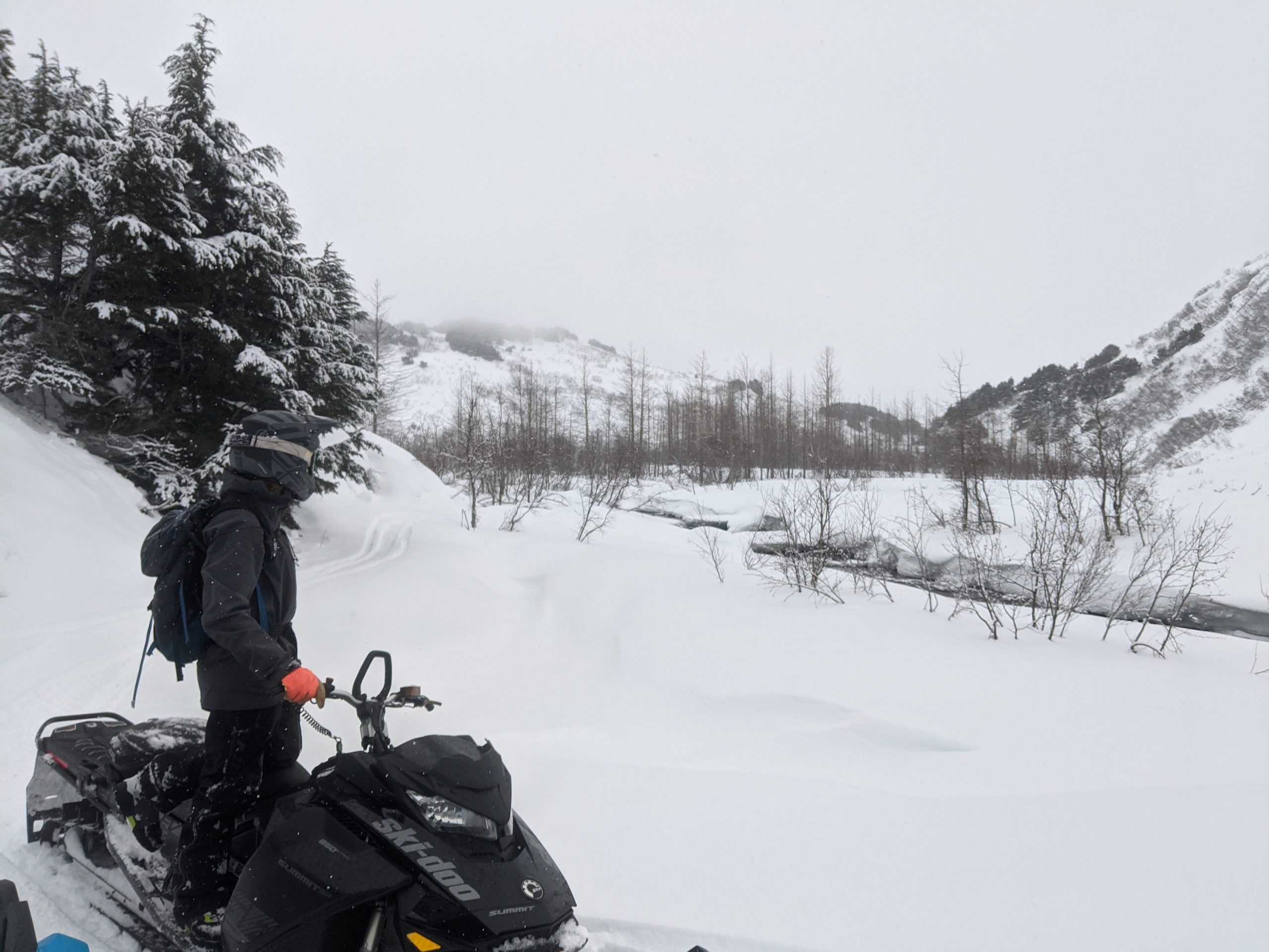
Low visibility and snowfall throughout the day yesterday, which will continue through Friday evening. Photo 1.26.22

Updated snowfall totals from Wednesday night through Saturday morning, showing 24-30″ of total snowfall for Turnagain Pass and Girdwood and more for Placer, Portage, and Twentymile. Graphic courtesy of NWS Anchorage 1.26.22

Weather
Thu, January 27th, 2022

Yesterday: Light snow throughout the day with minimal accumulation during the daylight hours. Heavier snowfall overnight with totals of 0.4″ of water so far in Turnagain and 0.7″ water in Girdwood. Winds were light to moderate, picking up overnight with speeds of 5-20 mph and gusts into the 30s on Sunburst. Temperatures remained below freezing to sea level overnight.

Today: Consistent moderate intensity snowfall throughout the day, with less than an inch an hour of accumulation. Total snow fall from overnight and during the day today should be in the 8-16″ range. Snow line is forecast to move up to about 700′ today. Winds should be out of the E in the 10-30 mph range with gusts possible up to 50 mph.

Tomorrow: Friday looks like a carbon copy of Thursday’s weather, with moderate intensity snowfall and moderate winds. Another 8-16″ of snowfall is forecast from Thursday evening through Friday evening. Snow line should remain between sea level and about 500′ on Friday. The weekend looks like it could provide some clearing skies and light winds to get out and enjoy the fresh shot of snow.

PRECIPITATION 24-hour data (6am – 6am)

Temp Avg (F) Snow (in) Water (in) Snow Depth (in)
Center Ridge (1880′) 26 5* 0.4 86
Summit Lake (1400′) 20 2 0.1 35
Alyeska Mid (1700′) 24 8 0.7 76

*Estimate based on SWE and temperatures

RIDGETOP 24-hour data (6am – 6am)

Temp Avg (F) Wind Dir Wind Avg (mph) Wind Gust (mph)
Sunburst (3812′) 19 NE 13 33
Seattle Ridge (2400′) 22 SE 6 17
Observations
Recent Observations for Turnagain Pass
Date Region Location
03/28/24 Turnagain Observation: Sunburst
03/27/24 Turnagain Observation: Tincan Trees
03/26/24 Turnagain Observation: Cornbiscuit
03/25/24 Turnagain Observation: Tincan
03/22/24 Turnagain Avalanche: Magnum Northwest Aspect
03/21/24 Turnagain Observation: Sunburst
03/21/24 Turnagain Observation: Tincan Proper North Aspect
03/20/24 Turnagain Avalanche: Seattle Creek Drainage
03/19/24 Turnagain Observation: Tincan CFR
03/18/24 Turnagain Avalanche: Tincan – Eddies – Seattle Ridge
Riding Areas

The riding areas page has moved. Please click here & update your bookmarks.


Subscribe to Turnagain Pass
Avalanche Forecast by Email

This is a general backcountry avalanche advisory issued for Turnagain Arm with Turnagain Pass as the core advisory area. This advisory does not apply to highways, railroads or operating ski areas.