Turnagain Pass Avalanche Forecast RSS

Archives
ARCHIVED FORECAST - All forecasts expire after 24 hours from the posting date/time.
Issued
Thu, January 23rd, 2020 - 7:00AM
Expires
Fri, January 24th, 2020 - 7:00AM
Forecaster
Ryan Van Luit
Avalanche risk The Bottom Line

Today the avalanche danger is MODERATE in the Alpine.  An increase in winds are forecast and triggering a fresh wind slab avalanche, composed of the loose snow from the storm on 1/20, is possible.  Where wind has not had an affect, and below 2500′, the danger is LOW where concerns for human triggered loose sluff slides remain predictable in steep terrain.  Any loose dry snow could quickly gain momentum and volume to take a rider off their feet, or potentially trigger a layer deeper within the snowpack.

SUMMIT LAKE: This region is just out of our advisory area to the south. The snowpack is shallow and extra caution is advised for triggering a slab avalanche in buried weak layers.

Thanks to our sponsors!
Thu, January 23rd, 2020
Alpine
Above 2,500'
Moderate (2)
Avalanche risk
Treeline
1,000'-2,500'
Low (1)
Avalanche risk
Below Treeline
Below 1,000'
Low (1)
Avalanche risk
Alpine
Above 2,500'
Avalanche risk
Moderate (2)
Treeline
1,000'-2,500'
Avalanche risk
Low (1)
Below Treeline
Below 1,000'
Avalanche risk
Low (1)
Danger Scale:
No Rating (0)
Low (1)
Moderate (2)
Considerable (3)
High (4)
Extreme (5)
Avalanche Problem 1
  • Wind Slabs
    Wind Slabs
  • Almost Certain
    Very Likely
    Likely
    Possible
    Unlikely
    Likelihood
  • Historic (D4-5)
    Very Large (D3)
    Large (D2)
    Small (D1)
    Size
Wind Slabs
Wind Slab avalanches are the release of a cohesive layer of snow (a slab) formed by the wind. Wind typically transports snow from the upwind sides of terrain features and deposits snow on the downwind side. Wind slabs are often smooth and rounded and sometimes sound hollow, and can range from soft to hard. Wind slabs that form over a persistent weak layer (surface hoar, depth hoar, or near-surface facets) may be termed Persistent Slabs or may develop into Persistent Slabs.

Likelihood of Avalanches
Terms such as "unlikely", "likely", and "certain" are used to define the scale, with the chance of triggering or observing avalanches increasing as we move up the scale. For our purposes, "Unlikely" means that few avalanches could be triggered in avalanche terrain and natural avalanches are not expected. "Certain" means that humans will be able to trigger avalanches on many slopes, and natural avalanches are expected.

Size of Avalanches
Avalanche size is defined by the largest potential avalanche, or expected range of sizes related to the problem in question. Assigned size is a qualitative estimate based on the destructive classification system and requires specialists to estimate the harm avalanches may cause to hypothetical objects located in the avalanche track (AAA 2016, CAA 2014). Under this schema, "Small" avalanches are not large enough to bury humans and are relatively harmless unless they carry people over cliffs or through trees or rocks. Moving up the scale, avalanches become "Large" enough to bury, injure, or kill people. "Very Large" avalanches may bury or destroy vehicles or houses, and "Historic" avalanches are massive events capable of altering the landscape.

Signal Word Size (D scale) Simple Descriptor
Small 1 Unlikely to bury a person
Large 2 Can bury a person
Very Large 3 Can destroy a house
Historic 4 & 5 Can destroy part or all of a village
More info at Avalanche.org

Weather models suggest that parts of the advisory will see a rise in wind from the northwest today with moderate speed, 15-20mph.  Continued cold temperatures have kept Monday’s 10″ of dry snow very loose, which can easily be blown around by these winds, creating wind slabs in the lee of ridges and gullies.  Winds slabs may form rapidly.  Where these conditions align, it’s possible for a human to trigger a wind slab.

Remain alert for signs of wind slab formation: watch for active wind loading, firmer surface conditions, cracking or drum-like sounds in the snow,  sometimes texture that appears rippled or wavy, and pillow-like features on the leeward side of wind exposed terrain.  And as always, if you see cracking in the snowpack or hear whumpfing sensations, it’s time to reassess your plan.

Persistent Slab:  Although unlikely, a loose dry avalanche or wind slab avalanche could step down and pull out a deeper slab. This is most suspect in Alpine elevation steep terrain.

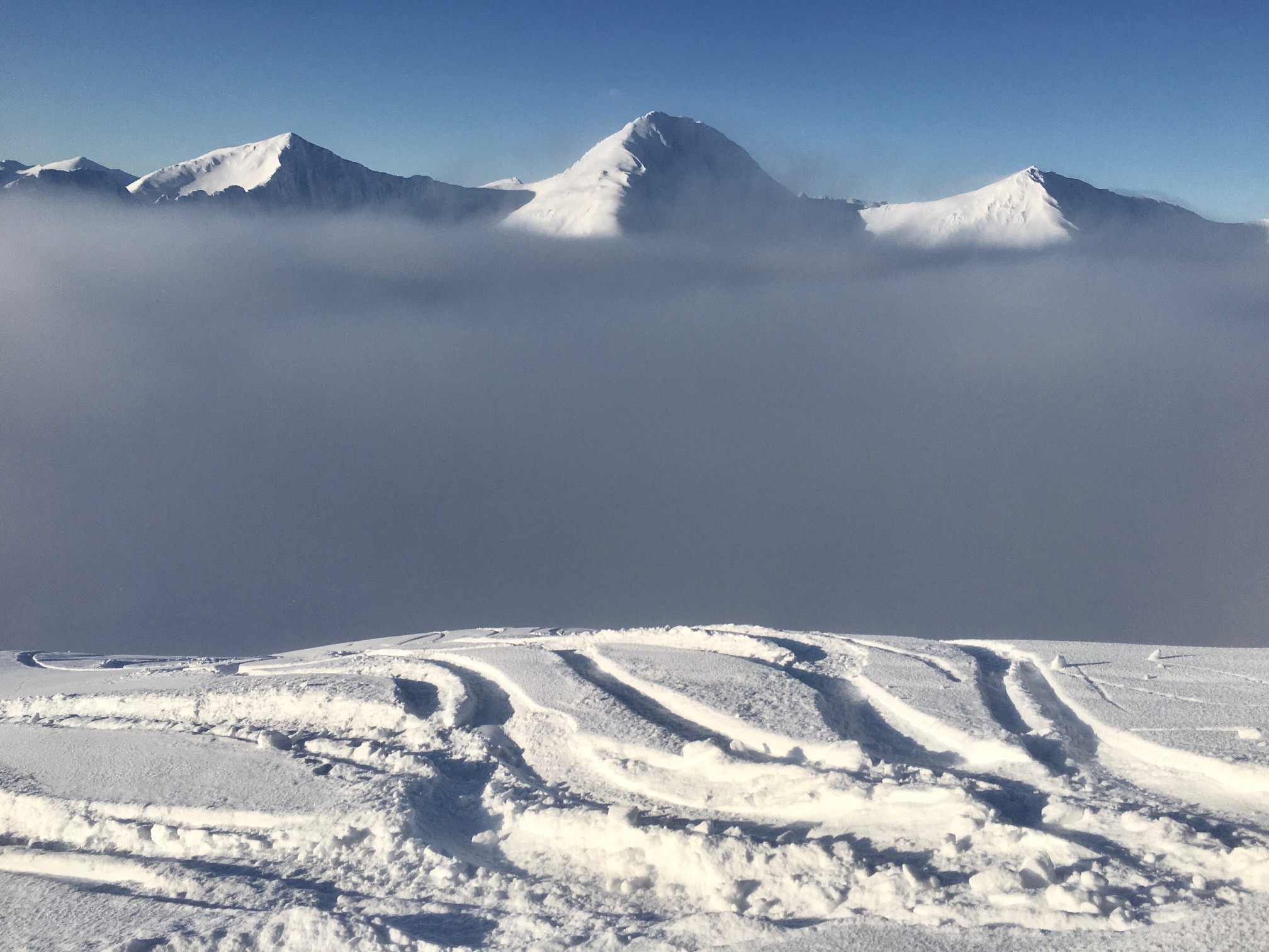
Thick valley fog was over Turnagain Pass yesterday that extended from around 2,000′ to 3,000′. This photo was taken on Seattle Ridge and looking west toward Big Chief. 1.22.20.

Avalanche Problem 2
  • Dry Loose
    Dry Loose
  • Almost Certain
    Very Likely
    Likely
    Possible
    Unlikely
    Likelihood
  • Historic (D4-5)
    Very Large (D3)
    Large (D2)
    Small (D1)
    Size
Dry Loose
Dry Loose avalanches are the release of dry unconsolidated snow and typically occur within layers of soft snow near the surface of the snowpack. These avalanches start at a point and entrain snow as they move downhill, forming a fan-shaped avalanche. Other names for loose-dry avalanches include point-release avalanches or sluffs.

Likelihood of Avalanches
Terms such as "unlikely", "likely", and "certain" are used to define the scale, with the chance of triggering or observing avalanches increasing as we move up the scale. For our purposes, "Unlikely" means that few avalanches could be triggered in avalanche terrain and natural avalanches are not expected. "Certain" means that humans will be able to trigger avalanches on many slopes, and natural avalanches are expected.

Size of Avalanches
Avalanche size is defined by the largest potential avalanche, or expected range of sizes related to the problem in question. Assigned size is a qualitative estimate based on the destructive classification system and requires specialists to estimate the harm avalanches may cause to hypothetical objects located in the avalanche track (AAA 2016, CAA 2014). Under this schema, "Small" avalanches are not large enough to bury humans and are relatively harmless unless they carry people over cliffs or through trees or rocks. Moving up the scale, avalanches become "Large" enough to bury, injure, or kill people. "Very Large" avalanches may bury or destroy vehicles or houses, and "Historic" avalanches are massive events capable of altering the landscape.

Signal Word Size (D scale) Simple Descriptor
Small 1 Unlikely to bury a person
Large 2 Can bury a person
Very Large 3 Can destroy a house
Historic 4 & 5 Can destroy part or all of a village
More info at Avalanche.org

Although the models predict wind, many areas have stayed calm since Mondays storm where 10″ of snow sits atop a 8″-12″ layer of loose facets.  We’ve not seen or heard reports of Mondays storm gaining any slab character, but it is settling over time.  As temperatures remain cold, the character of the recent surface snow is unlikely to create a slab unless it becomes wind effected.  Prior to Mondays storm, it remained easy for a rider in steep terrain to trigger sluff of loose facets.  Now, a relatively dry 10″ of snow adds to the volume of loose snow.  Triggering this loose snow is predictable and may be managed with forethought.  With that said,  20″ of loose snow could rapidly gain volume and momentum taking a rider through the fall line.

We’ve had a week with calm winds with light gusts at the Sunburst Weather Station.


Seattle Ridge weather station – relatively calm winds before and since the 1/20 storm


Cornices and Glide Cracks:  As always, limit exposure under glide cracks and give cornices a wide margin.


.

Weather
Thu, January 23rd, 2020

Yesterday:  Thick valley fog remained in the 2000′-3000′ range for most of the day.  Temperatures were in the single digits above 3,500′.  At the lower elevations, temperatures remained in the teens trending into the single digits. Ridgetop winds were calm to light.

Today:  Mostly sunny skies with a high near 7°F, with a low around -5°F. No chance of precipitation today.  Winds will be out of the northwest from 15 to 20 mph and taper to light this evening.

Tomorrow:  Mostly sunny trending to cloudy into afternoon and evening with a high near 1°F and a low around -5°F. Light to calm winds around 5 mph.  No precip.

PRECIPITATION 24-hour data (6am – 6am)

Temp Avg (F) Snow (in) Water (in) Snow Depth (in)
Center Ridge (1880′) 9 0 0 44
Summit Lake (1400′) 8 0 0 16
Alyeska Mid (1700′) 11 0 0 46

RIDGETOP 24-hour data (6am – 6am)

Temp Avg (F) Wind Dir Wind Avg (mph) Wind Gust (mph)
Sunburst (3812′) 4 W 2 5
Seattle Ridge (2400′) 5 NNE 2 6
Observations
Recent Observations for Turnagain Pass
Date Region Location
05/22/23 Turnagain Avalanche: Tincan
05/12/23 Turnagain Avalanche: Tincan, Sunburst, Magnum, Cornbiscuit
05/07/23 Turnagain Observation: Tincan – Bear Tracks
05/05/23 Turnagain Observation: Seattle Ridge
05/02/23 Turnagain Observation: Cornbiscuit
05/02/23 Turnagain Observation: Seward Hwy Turnagain Pass
04/30/23 Turnagain Observation: Magnum
04/29/23 Turnagain Observation: Tincan
04/28/23 Turnagain Avalanche: Taylor Pass/Pastoral
04/28/23 Turnagain Avalanche: Tincan
Riding Areas
Updated Thu, June 01st, 2023

Status of riding areas across the Chugach NF is managed by the Glacier and Seward Ranger Districts, not avalanche center staff. Riding area information is posted as a public service to our users and updated based on snow depth and snow density to prevent resource damage at trailhead locations. Riding area questions contact: mailroom_r10_chugach@fs.fed.us

Area Status Weather & Riding Conditions
Glacier District
Johnson Pass
Closed
Closed May 15.
Placer River
Closed
Closed May 15.
Skookum Drainage
Closed
Will close to motorized use on April 1, 2023 per the National Forest Plan.
Turnagain Pass
Closed
Will close on June 1.
Twentymile
Closed
Scheduled closure May 1.
Seward District
Carter Lake
Closed
Scheduled closure May 1.
Lost Lake Trail
Closed
Scheduled closure May 1.
Primrose Trail
Closed
Scheduled closure May 1.
Resurrection Pass Trail
Closed
Closed to motorized use for the 2022/23 winter season per Forest Plan. Open next season.
Snug Harbor
Closed
Extended opening until May 15.
South Fork Snow River Corridor
Closed
Scheduled closure May 1.
Summit Lake
Closed
Scheduled closure May 1.

Subscribe to Turnagain Pass
Avalanche Forecast by Email

This is a general backcountry avalanche advisory issued for Turnagain Arm with Turnagain Pass as the core advisory area. This advisory does not apply to highways, railroads or operating ski areas.