We didn't see any red flags today. The sun was in and out, but it didn't get warm enough to cause any problems while we were out. It's possible there may have been some more solar activity after we left; we were back at the truck by 3 p.m.
Observation: Turnagain
Location: Twin Peaks Meadows
We toured up to about 2100′ on Twin Peaks to take a look at the snowpack in the Silvertip Creek area. We did not see any concerning buried weak layers in the upper 3-4′ of the snowpack. We did find about 6″ of very low-density snow from the past 24 hours, which was sitting on top of crusts on solar aspects and facets on shaded slopes. It is looking like the next round of heavy snow could make for some very touchy conditions.
Observer Comments
Weather
Intermittent sun and clouds, with some periods of snow mixed in there. For a little while it was bright and sunny and also snowing hard- my personal favorite kind of weather. Winds were mostly calm, with some light easterly gusts. Temperatures were in the mid 20's F.
Snow surface
There was around 6" very light snow on the surface. We could feel the crust under the new snow on southerly aspects, and were actually finding it on some northeasterly slopes too. Shaded slopes had another ~6" faceted snow under the new snow. Overall ski quality was good.
Snowpack
We did not find any concerning layers in either of our two snowpits (E and NE aspects, 2160'). There were several layers of older faceted snow that have been gaining strength and did not propagate in any stability tests (that's good news). We found one impressive layer of buried surface hoar that was 2.5-3' deep in our pits, but it too did not show any concerning results in our tests. This is most likely the layer that was buried back in January and has been unreactive for some time now.
The biggest concern will be once we start loading more snow on top of the snow that fell yesterday. It is looking like we may have a setup for some touchy storm slabs heading into the weekend. Time will tell.

That is some low-density fluff on the surface. This new snow is sitting on a mixed bag of crusts on solar aspects and facets on shaded slopes. That will be a concern if we get another good round of snow on top of it. 03.16.2023
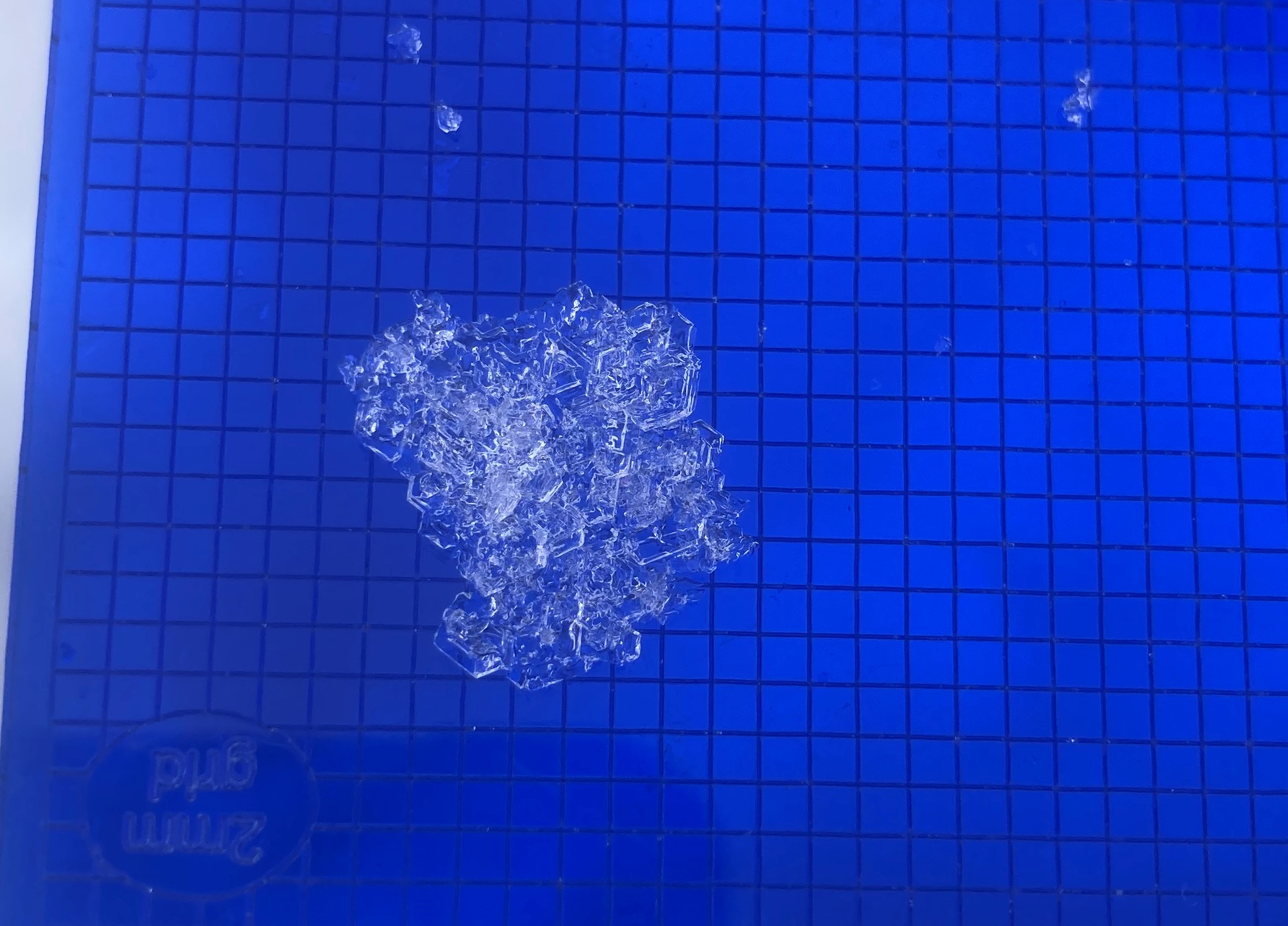
A trophy specimen of buried surface hoar. This layer did not show any unstable results in our pits. 03.16.2023
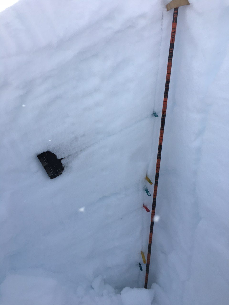
The black card is marking where that layer of surface hoar was buried. Photo: Nancy Pfeiffer. 03.16.2023
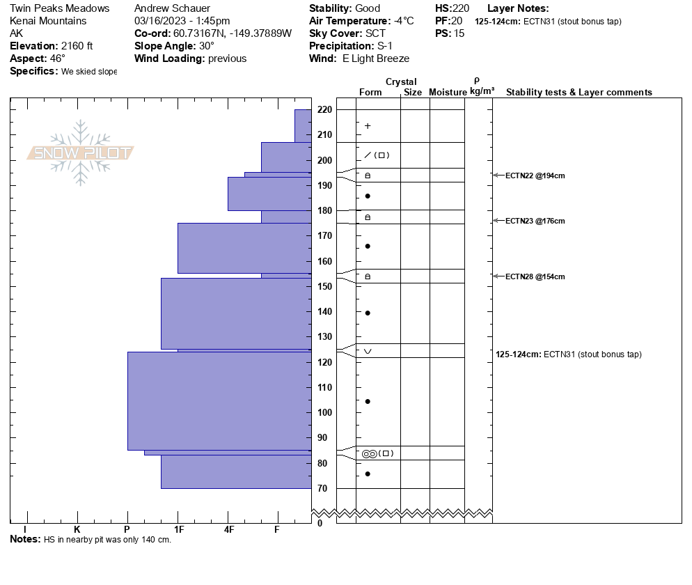
Snowpit profile from a NE aspect at 2160 ft elevation. 03.16.2023
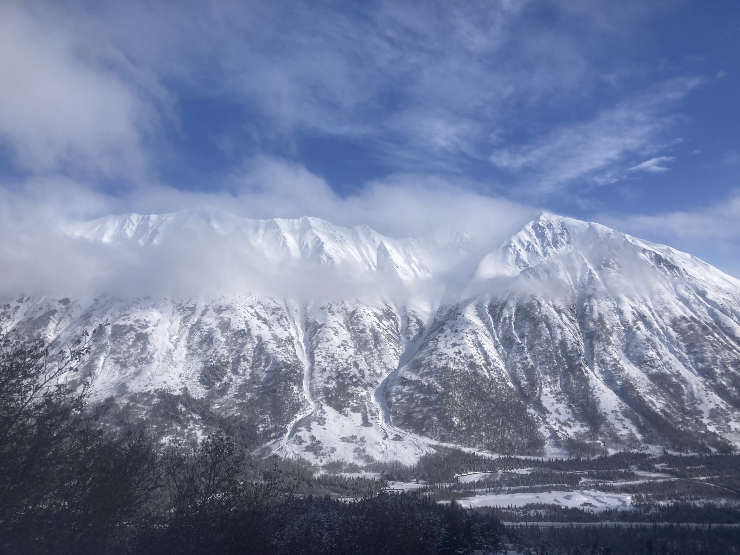
Looking across the highway at Fiddlehead/Peak 4940. 03.16.2023
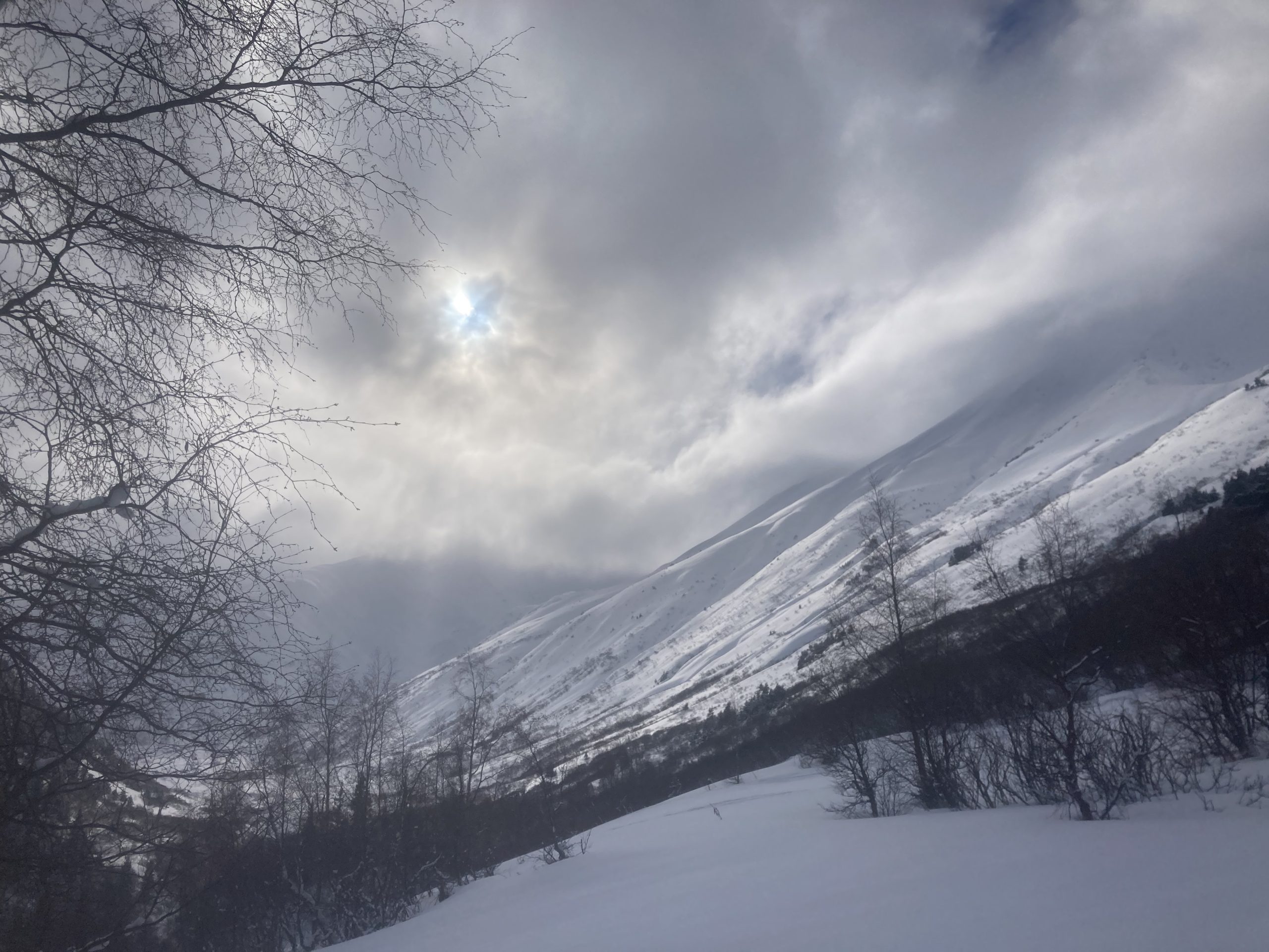
Looking up the Silvertip Creek valley. 03.16.2023

Looking east towards the south end of Turnagain Pass. 03.16.2023