| Recent Avalanches? | No |
| Collapsing (Whumphing)? | No |
| Cracking (Shooting cracks)? | Yes |
Observation: Turnagain
Location: Tincan Trees
Tincan Trees to 2300′
Obvious signs of instability
Observer Comments
One instance of cracking, ~10' in front of ski tips, on a steep unsupported corniced NW rollover (photo below) just below treeline. The soft slab was 10-12" of snow over the 3/2 buried surface hoar, which sat on a thin crust at this location.
No cracking on other previously - before today - wind loaded slopes below treeline, nor any other observed red flags... though visibility was extremely limited throughout the day. We could hardly see CFR ridge while standing on the base of it...
Weather
Obscured skies and snow - varying from less than to 1cm per hour - throughout the day
Light winds from the north or northeast, occasionally gusting moderate above 2000'
WARM - 36f at the parking lot, and right around freezing throughout the day to treeline
Snow surface
1-2" of new snow overnight through 10 AM, with an additional 1-2" falling from 10-3 PM.
Below 1400' on all aspects, 2-4" of soft snow on top of a 1cm thick breakable melt freeze crust from prior days. Above this, the snow sat on a progressively firmer base, with the exception of steep solar aspects, where it sat on a sun crust. This included the very bottom part of CFR ridge on the north end of the Tincan Trees.
Ski penetration of 2-4", with the exception of at treeline where it was occasionally 1" from recent winds transporting snow.
We saw no signs of fresh wind slabs formed by today's winds, but gusts capable of transport were occurring well below treeline, so the alpine is likely another story. That said, the new snow was fairly warm and not moving too much at treeline in the moderate gusts. There was also active snow transport on the highway flats by placer river in the mid-afternoon, with snow drifting a little on the shoulder.
Snowpack
We did a few shallow pits at and below treeline, looking for the 3/2 surface hoar and/or layers of facets. We generally found a crust at the 3/2 interface since we stayed low elevation and/or dug on a solar aspect.
Results for the 3/2 interface were:
Pit #1. 2300', South aspect, 20 degree slope at treeline. ECTX; CT and Shovel Tilt Test failed under hard force down 10" on a stout crust, which I'm guessing was formed by the sun. NO 3/2 BSH at this location. The snow above the crust was 2" of fist hard new snow on top of 4 finger -> 1 finger wind packed rounds.
Pit #2. 1600', flat, protected slope at the bottom of tree runs. ECTN 12 down 10" failing in the 3/2 BSH, which sat on a 1/2cm thick, fragile melt freeze crust. The snow above the 3/2 BSH was fist -> 4 finger hardness.
Pit #3. 2100' just below CFR ridge, NW aspect, 30 degrees. ECTN 12 down 10" failing in the 3/2 BSH, which sat on a very thin melt freeze crust. The snow above the 3/2 BSH was fist -> 4 finger hardness.
Pit #4. 2100' just below CFR ridge, on a N aspect, 25 degrees, and adjacent to the pit above but in a wind loaded location. ECTP 30 down 18" failing in the 3/2 BSH on a very thin melt freeze crust. The snow above the 3/2 BSH was 2" of fist hard new snow at the surface, transitioning to 4 finger -> 1 finger wind packed rounds.

One instance of cracking on an unsupported, corniced spot near treeline. These cracks extended ~10' and broke fairly easily, but I wouldn't describe them as 'touchy'!
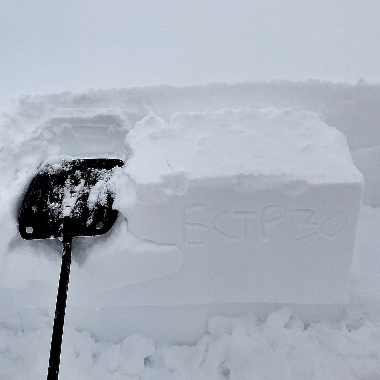
The one ECT that propagated, referenced above.
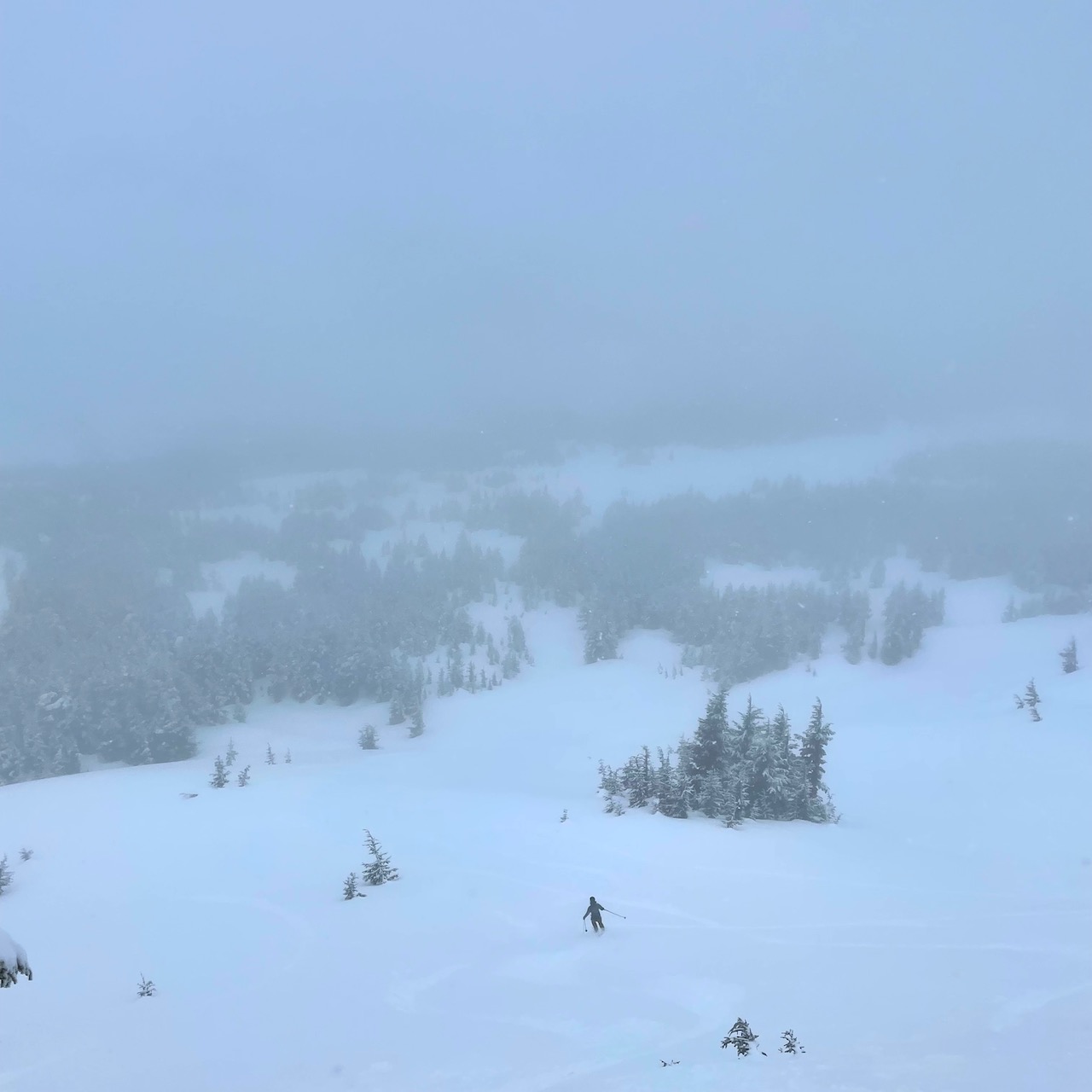
This photo shows maybe the best moment of visibility during the day...

Snowing up to 1cm/hour midday, with ski penetration 2-4"

While it was still snowing to sea level at 3 Pm, the road - even at the pass - was wet from melting. The snow surface, though, was hardly moist even to 1000'!