
Wind carrying snow off the eastern ridge of Sunburst
Rollerballs and micro point releases on the SW aspect of Tincan
Route: Up to Tincan common from the Tincan Lot via the standard, west facing uptrack. Down to the
skiers right of the uptrack, on a northwest aspect.
Time: 1030 AM to 430 PM
Weather: Temperature was 18f at the parking lot when leaving and returning, cooling to 11f above
treeline. Mostly sunny all day. Winds were generally from the southwest – light until above treeline, then
just strong enough to move some snow at the surface (saltation). Near the top of Tincan common, winds
shifted abruptly and became highly variable, blowing generally from the North or West. Gusts were strong
enough to suspend and carry snow, but the frequency of these strong gusts was low.
Snowpack: One fist-hardness layer until treeline, ~10″ deep. A layer of freeze melt grains was present just
above the ground – below the fist hard layer – starting several hundred feet in elevation above treeline.
Along the ridge approaching the top of common, previous wind transport had caused a variable snowpack,
with the surface layer ranging from fist hard powder through a pencil hard wind crust up to several inches
thick. Just shy of the top, quick probing in a small area showed a variable snow depth, ranging from 5cm
to 60cm.
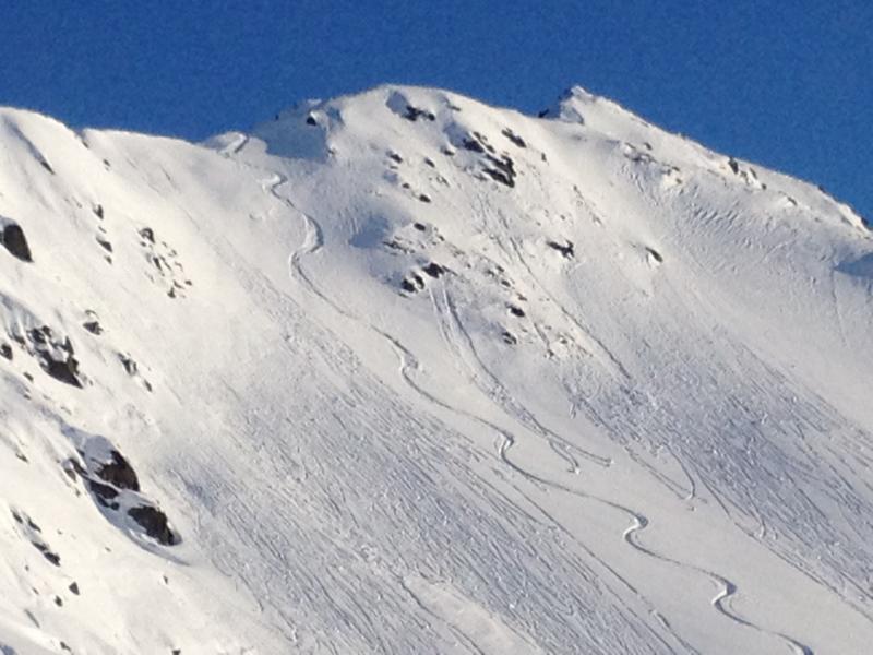
Instability: Rollerballs and some very small point releases were seen on the SW aspect of Tincan – a photo
is attached. Additionally, wind transport has formed some small wind slabs above treeline, but these broke
just under foot with no propagation.
Snow was seen blowing from the ridge just east of the peak of Sunburst throughout the mid-afternoon –
photo is attached.
No whumphing or collapsing – cracking limited to what is mentioned above.
Wind carrying snow off the eastern ridge of Sunburst
Rollerballs and micro point releases on the SW aspect of Tincan