| Trigger | Natural | Remote Trigger | Unknown |
| Avalanche Type | Unknown | Aspect | Unknown |
| Elevation | unknown | Slope Angle | unknown |
| Crown Depth | unknown | Width | unknown |
| Vertical Run | unknown |
Avalanche: Turnagain
Location: Tincan
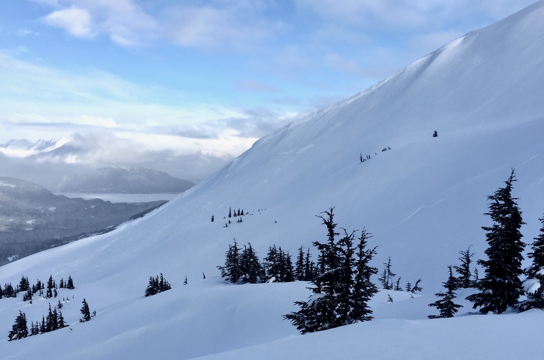
Toured up to the Tincan ridgeline to a high point around 3,400′. Observed several natural avalanches. Some were shallow wind slabs, from last night’s wind event, and others were 2′ deep slabs, suspected to have broke in weaker layers deeper in the snowpack. This activity occurred since Wednesday morning.
Avalanche Details
The evidence of several natural avalanches were seen today when skies opened just enough for the sun to poke out.
-Three winds slabs around a foot thick that were partly covered up by winds.
-Tincan's CFR ridgeline, SW facing, 2,200'.
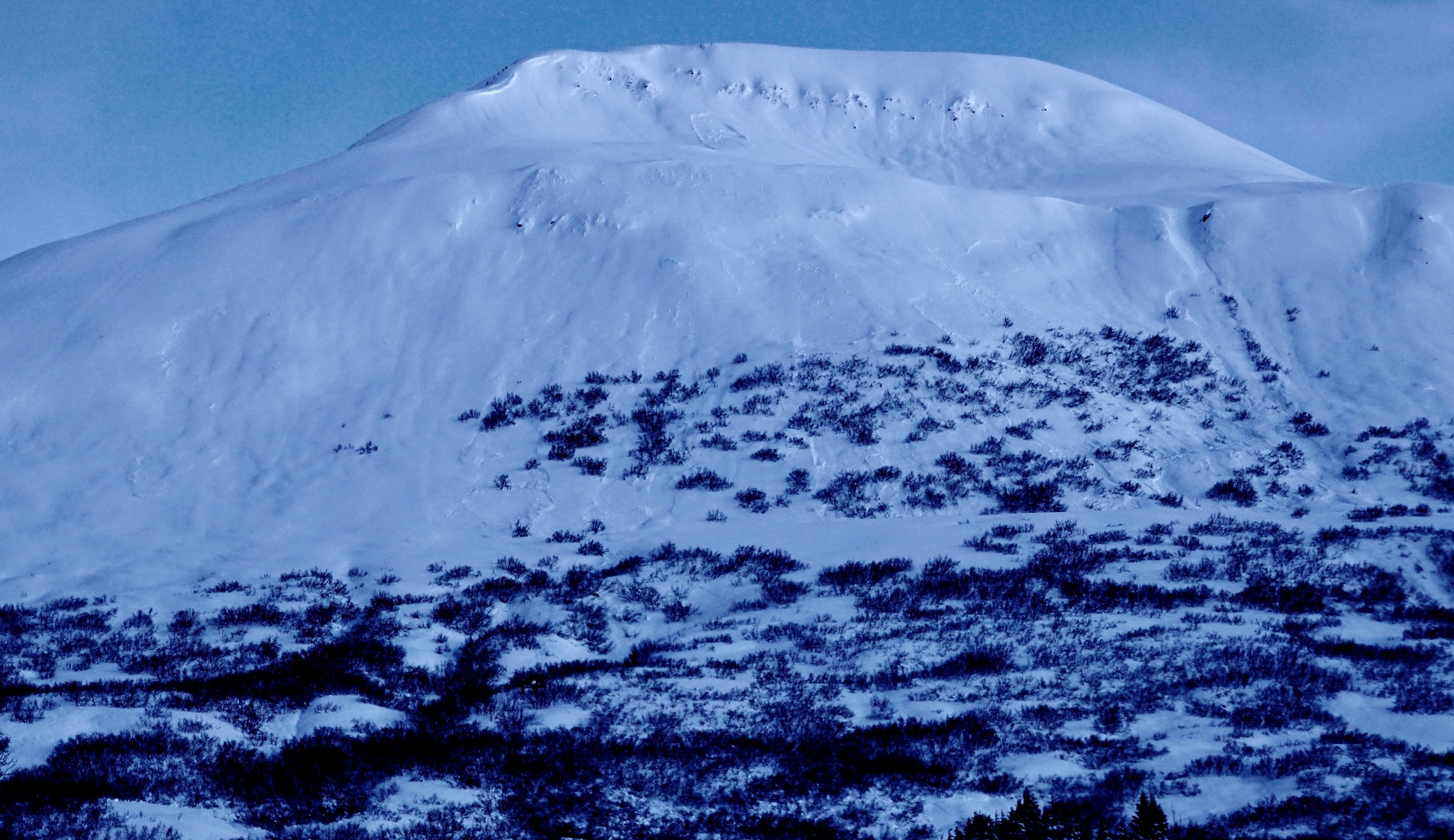
- Tincan's Hippy Bowl, SW facing around 3,400'.
- Magnum West face, around 2,200'.
- Storm slabs, releasing in deeper layers (slabs around 2 feet thick).
- Sunburst's lower N shoulder, 2,200'
- Tincan's north chutes, 3,400'
- Magnum's west upper west face, 3,300'
There were also several small slabs and sluffs that fain the steep Seattle ridge chutes to the south of the up-track.
Observer Comments
We had several large whumpfs near 1,700'.
Weather
Light snowfall and obscured skies till around 1pm. Sun slowly made an appearance in the afternoon and snowfall ceased.
Winds were light from the north (and cold).
Temperatures were near 20F in the parking lot and in the single digits along the ridgetop.
Snow surface
Very soft powder snow in areas not affected by last night's winds.
Wind effect was very prevalent near treeline and above treeline. Skiing was challenging as a variable wind crust (1 to 8") covered many of the exposed slopes.
Roughly 6-8" of new snow since Wednesday morning.
Snowpack
There were two issues of concern today in the snowpack. The first was how the wind affected the new snow and the second was the reactivity of the buried weak layers.
New snow issues: The new snow had distinct wind effect above treeline. Although a few natural wind slabs occurred last night, we could not get any wind slabs to crack out on us today.
Deeper in the pack issues: We dug two pits at 2,200' and one at 3,300'. We found the layers of facets and buried surface hoar around 20-30" below the surface. In some tests the buried surface hoar and facets reacted and in others they didn't. Worthy of note is much of the terrain had prior tracks and does not represent areas that have seen less travel this month. The storm snow from the past 10 days is still so loose that it is not acting like a slab and crumbles under the shovel.
3,300', SW, 180cm snow depth: ECTP 30 down 65cm on buried surface hoar/facets.
2,200' SE, 140cm snow depth: ECTP 21 down 14" on a hardness change (the top of the 1/20 storm snow). ECTN 17 at the same layer.

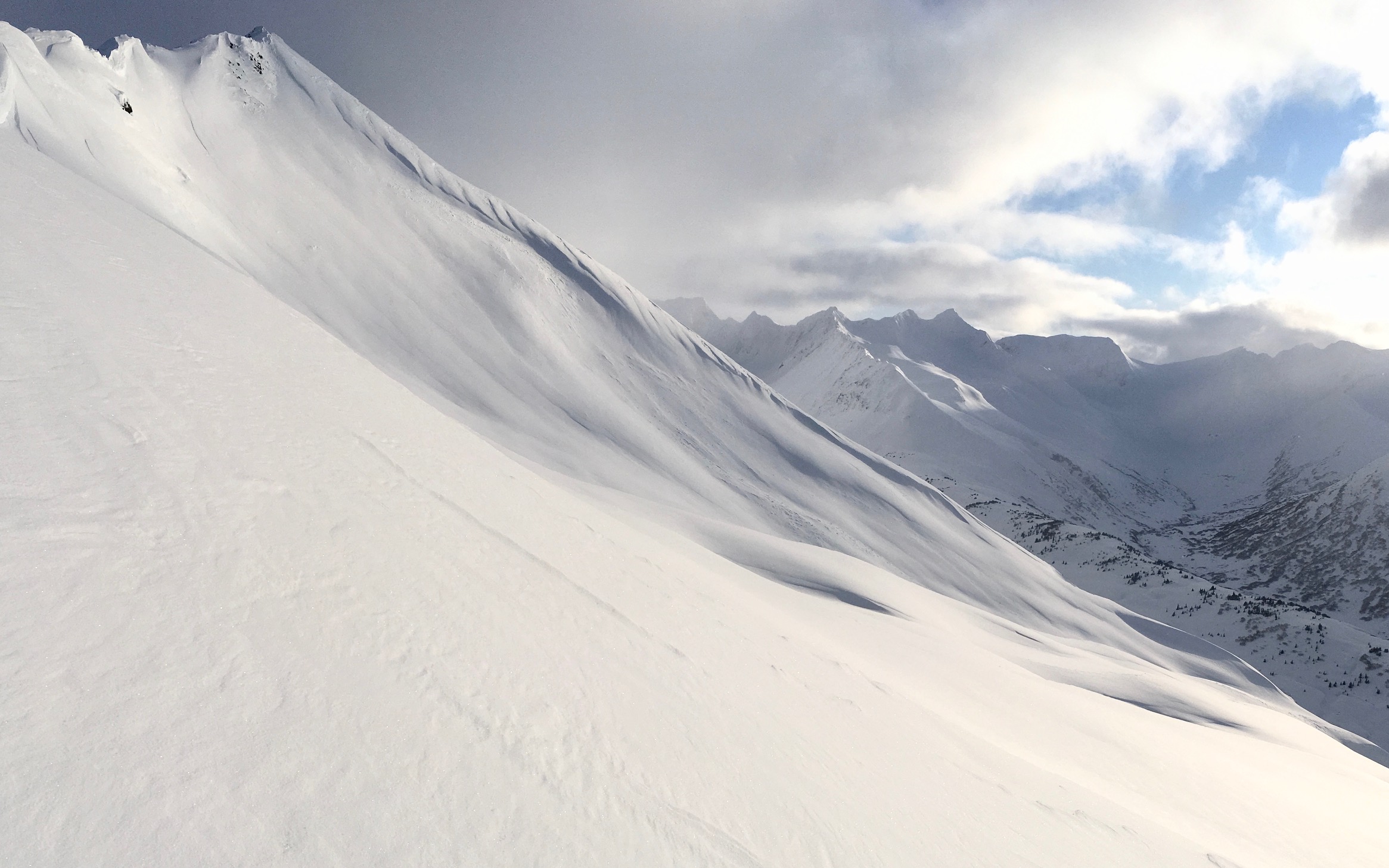
Wide propagating natural slab avalanche on Sunburst's lower north shoulder.
Several wind slabs on the west face of Magnum along with one deeper slab (pocket) on the upper face of Magnum.
Wind slab off the CFR ridge on Tincan, possibly triggered by a chunk of cornice that fell during the wind last night
Hippy Bowl on Tincan - another wind slab naturally triggered by cross-loading winds along the subridge. Slab is now mostly filled in and difficult to see.

Slab avalanche (1-2' thick) on the north side of Tincan (Tincan chutes). This slab looked to have taken out more than one chute and was likely triggered naturally.

One of several snow stability tests. The slab is roughly 2-3' thick in most areas outside of significant wind loading.