| Recent Avalanches? | No |
| Collapsing (Whumphing)? | No |
| Cracking (Shooting cracks)? | Yes |
Observation: Turnagain
Location: Tincan
Standard uptrack to 2500′ checking out snow depth and structure every 500′ ft. Between 1000′- 1500′ there is a lot of vegetation and not much snow coverage.
Obvious signs of instability
Observer Comments
Cracking in wind loaded areas above treeline, obvious wind transport
Weather
Snowfall throughout the day heavier at times. (S-1 to S2) 3" new during tour
NE winds 20-30 mph gusts into the 40s
Temps: 20Fs
31F at the parking lot
37F at Ingram and raining on drive back to Girdwood
Snow surface
New snow 1-3"
Snowpack
1000': HS:10 cm. Soft snow over a thin crust with faceting melt freeze grains below
1500': HS 30 cm. Soft snow over melt freeze layer on the ground (see image)
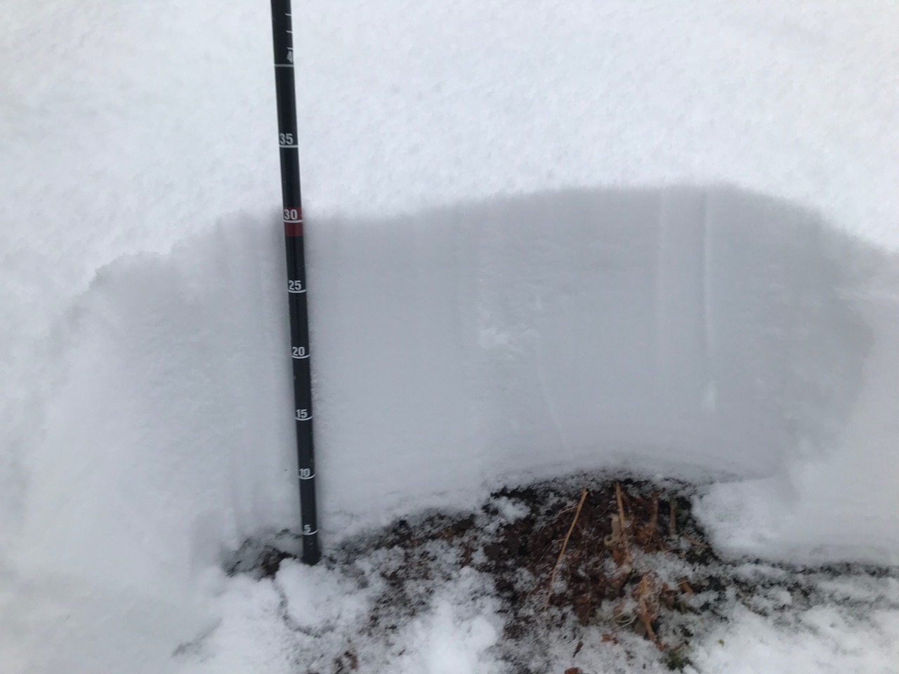
2000': HS 35 cm. Top 5 cm slightly stiffer with light wind effect, 25 cm of soft snow over melt freeze layer on the ground (see image). CT 13 x2 on melt freeze interface.
2500': HS: 85 cm. See image (mostly right side up) Top 15 cm slightly stiffer. Down 50 cm a thin layer of F hardness snow (small facets) in between a layer of 4F snow and 1F snow (CT 24 x 2, ECTN 24). There is 20 cm thick Pencil hard melt freeze layer on the ground.
Snow depth varied at this elevation from 10 cm to 100 cm depending on wind loading. Some areas were scoured down to the melt freeze layer on the ground. Areas with most wind effect were stiffer, snow was starting to crack away from skis and hand pits were failing on isolation.
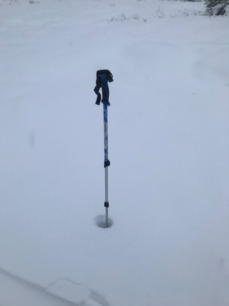
Snow depth 1000'
Snow depth 1500'

Snow depth 2000'

Snow depth 2500'
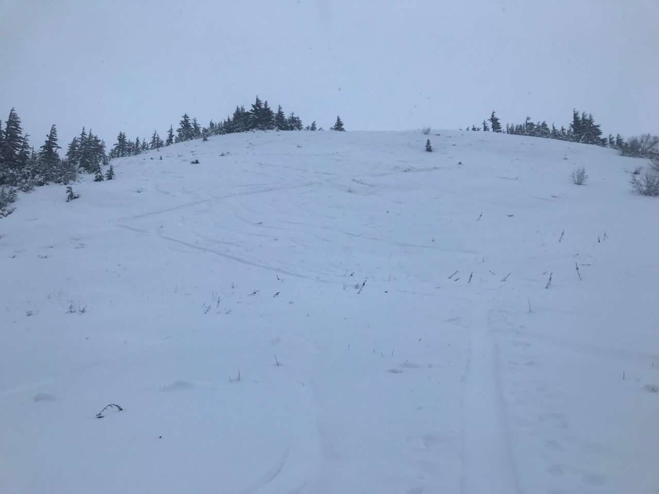
Hamburger Hill

Scoured slope at 2200'
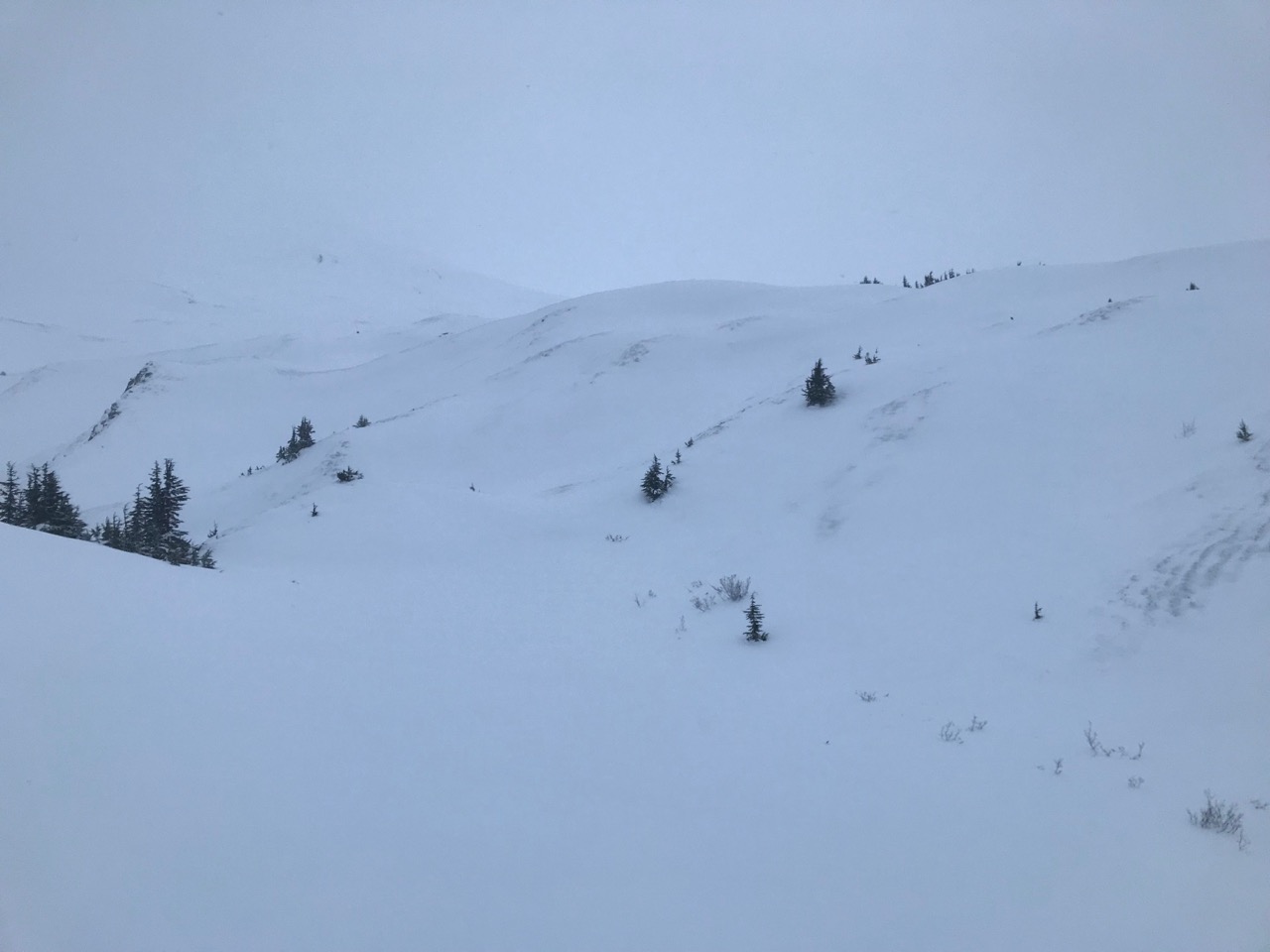
Cross loaded slopes

Wind slab in the snow pit
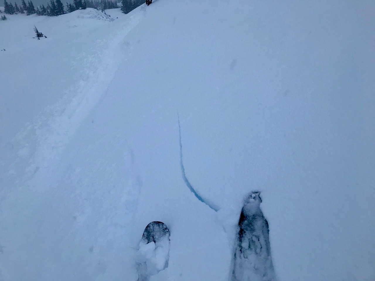
Cracking