| Recent Avalanches? | Yes |
| Collapsing (Whumphing)? | No |
| Cracking (Shooting cracks)? | No |
Observation: Summit
Location: Tenderfoot to 2400'
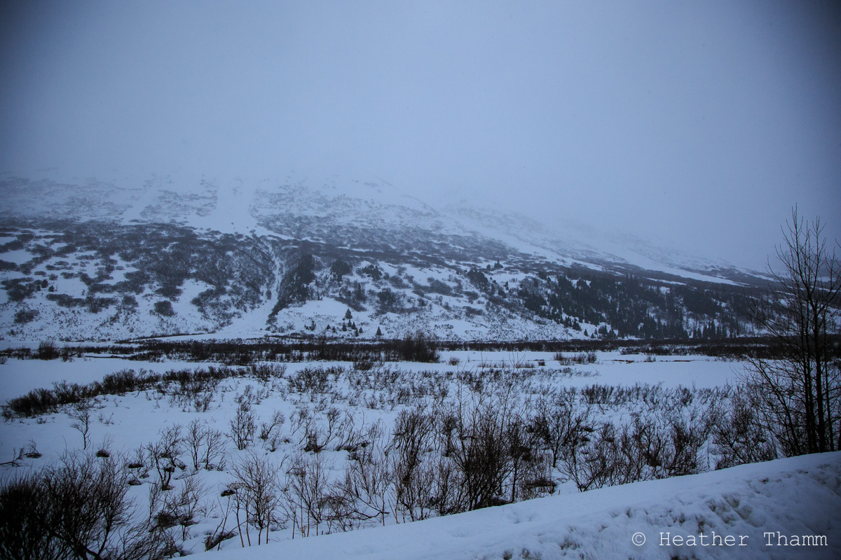
Normal West up-track through low meadows
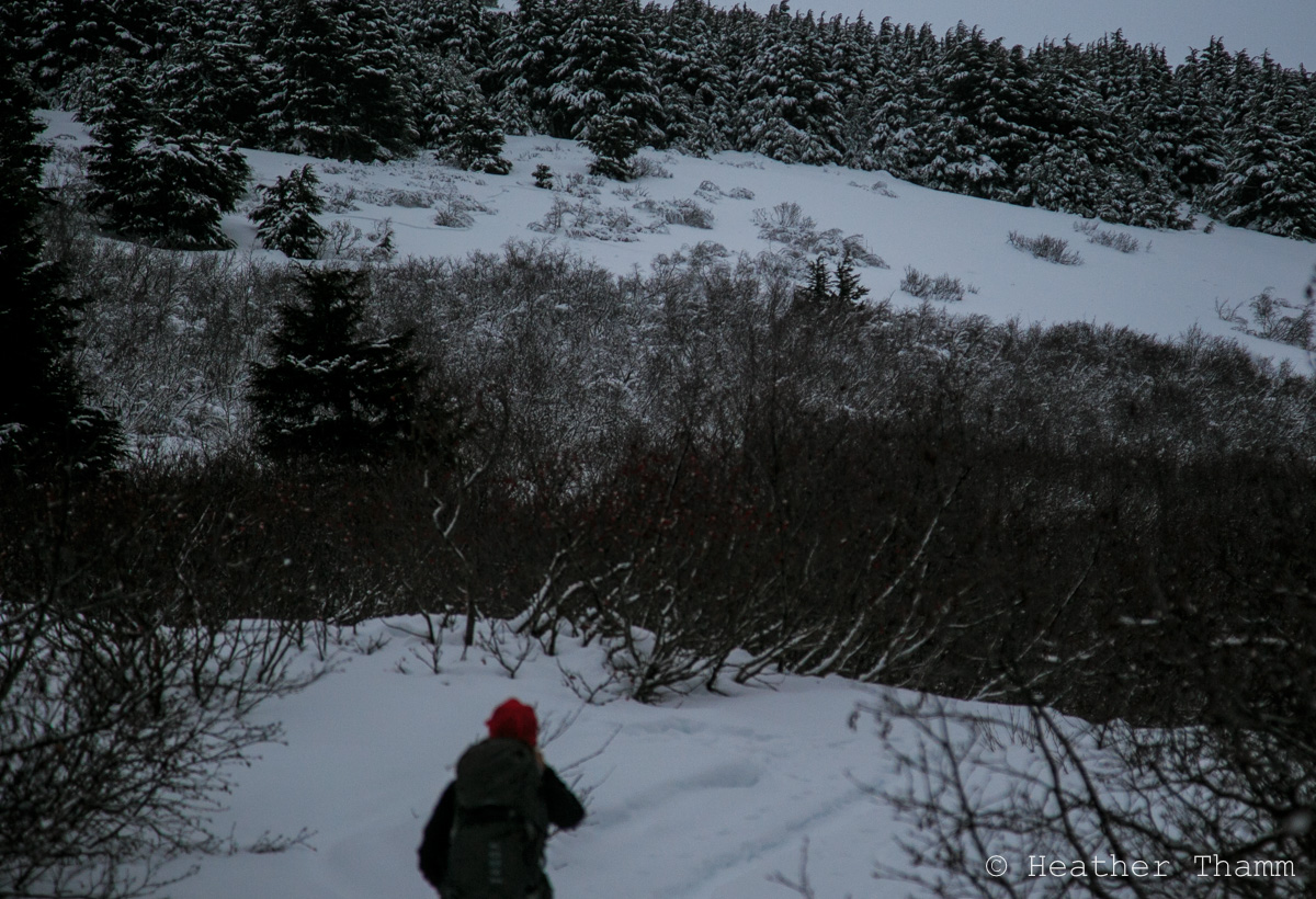
Visibility was limited to about 2000′. Along the drive we could see a lot of recent avalanche debris in steep channeled terrain from Silvertip Creek to Summit Lake along both sides of the road. Investigated a small D1 slab on Tenderfoot in the low meadows above weather station. This was likely triggered naturally on Tuesday or Wednesday when rain saturated the snowpack to 2000′. Did not hear any collapsing or see shooting cracks.
Obvious signs of instability
Observer Comments
Recent debris in:
Twin Peaks slide path in Silvertip Creek drainage ENE aspect
Across the road on a SW aspect several large debris piles
Moose Mountain W aspect
Butch W aspect
Weather
Obscure
Snowing/raining
rain/snow line ~ 1400'
Temps at 1200' 34F at 11am and 36F at 2pm
winds - 20-30 gusts 40mph
Snow surface
melt/freeze crust forming to 2000' with pockets of wind blown new snow on top 2-5"
2000'-2400' ~ Pockets of wind blown new snow 12-20"
Snowpack
See pit photos/diagrams for specifics:
Crown profile at 1800' - 34* slope, NW aspect, HS~55cm, CT12 SC, 8mm buried surface hoar layer failed on a melt/freeze crust with 12" slab on top. Slab was mostly wet and saturated with a light melt/freeze crust starting to form near surface.
Pit @ 2400' - HS=122cm, 30* slope, NNW aspect, Tests: ECTX x2, CT25 SC - failed on Buried surface hoar layer w/ a 25" slab on top. There were two surface hoar layers very visible in pit wall, but did demonstrate propagation potential in tests. The area in which we dug had vegetation growing through Thanksgiving rain crust layer near ground. This crust layer was rough and not uniform, but has 2mm rounding facets/loose melt/freeze grains on top of it.
View of D1 avalanche just above weather station on Tenderfoot

View of D1 avalanche at 1800', standing above crown looking at small debris piles in alders below
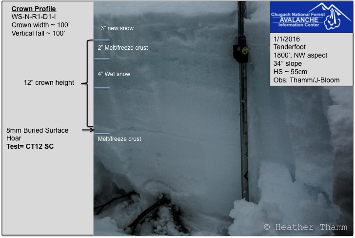
Crown profile at 1800'
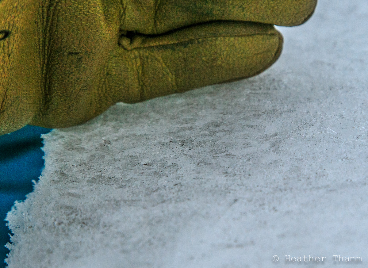
8mm buried surface hoar layer found on a melt/freeze crust at 1800'
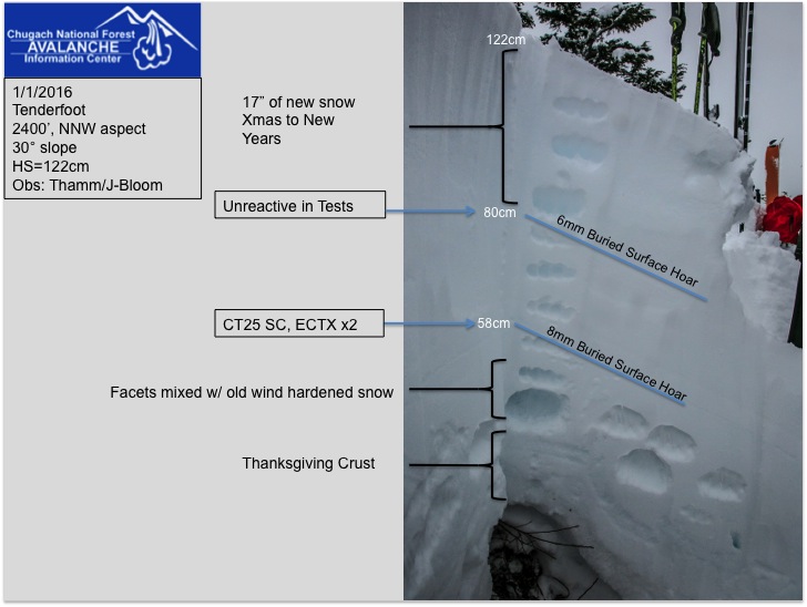
Pit at 2400'

One of two buried surface hoar flayers found in pit at 2400' - (8mm)

Snowing at 2000' today, but rain/snow line was near 1400'
Debris piles on Butch - West aspect