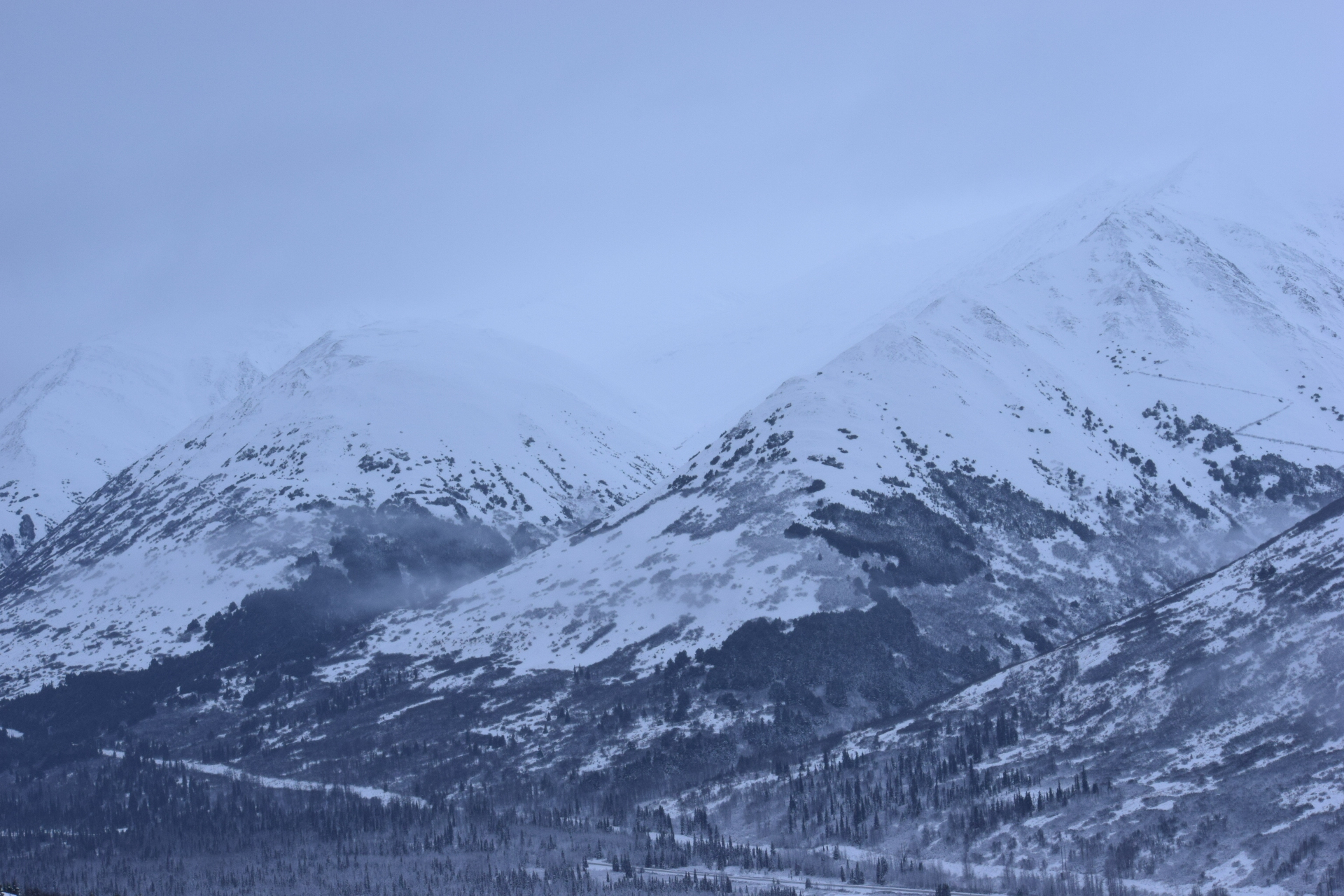
No recent avalanches, collapsing, or cracking observed. Moderate wind loading was taking place on leeward aspects in the alpine (south aspect where we were).
Observation: Summit
Location: Tenderfoot Ridge
Toured up Tenderfoot Ridge to 2644′. Very thin snow coverage below ~2000′. Decent skiing above that, though “early season conditions” still persist, with a depth of 70 cm (27 in) at 2600′. We were interested in 1) depth and distribution of snow and melt / freeze crusts following the recent storm cycle, 2) how well the new snow is bonding to the old snow, and 3) the distribution and reactivity of the Thanksgiving facets.
Observer Comments
Weather
0900: Summit Snotel at 1400', 26* F, snowing lightly, calm wind.
0900: Summit MP 45 station at 3800', 23* F, moderate winds from the south.
1130: Tenderfoot trailhead, 1400', 28* F (from truck dash), snowing ~1 cm/hour, calm wind
1400: Tenderfoot ridge, 2600', mid 20's, snowing <1 cm/hour, calm wind with light gusts from the north
1500: Tenderfoot trailhead, 1400', 30* F (from truck dash), snowing <1 cm/hour, calm wind
1530: Seward highway between Hope Junction and Johnson Pass next to 6 mile river, 32*F (from dash of truck), lightly sleeting
1600: Seward highway coming down Turnagain Pass ~ 500', 33* F, light snow transitioning to drizzle
Snow surface
1-2" of fresh snow on hard ice crusts of variable thickness (the vegetation is hardly covered) below ~2000'.
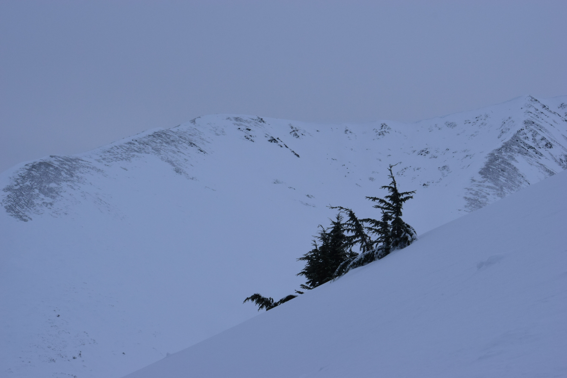
The surface snow was not bonding well to the surface, as indicated by shovel tilt tests, hand pits, and the "pick up a chunk of ice crust and tilt it" test. The new snow slid very easily on a planar interface of laid-over surface hoar and small near surface facets, sliding either upon tilting without tapping, or upon a single tap. The surface snow was also sliding easily on sidehills in the skin track, making for difficult skinning. As temps increased in the afternoon, the new precip particles were heavily rimed. Above ~2500', the surface snow was becoming wind affected in places and forming a thin wind crust. By about 1430, the rising temps and light wind compaction were making the new snow increasingly "cakey" and slabby.
Snowpack
We dug 3 formal pits and did small "quick pits" and hand pits on the ascent.
Snow depth at the trailhead was 30 cm with the following structure:
7 cm of dry new snow
Melt freeze crust
Moist basal facets
Ground
The pits above ~2000', where there is a snowpack, all showed similar structure:
Surface
~10cm new precip particles
3cm melt freeze crust
2-3cm of <1mm facets
20-40cm of alternating melt freeze crusts and moist wind-packed snow
"Thanksgiving Facet" structure (3-4mm depth hoar capped with a ~5cm melt freeze crust, dusted with 1.5-2mm almost-moist facets)
Ground
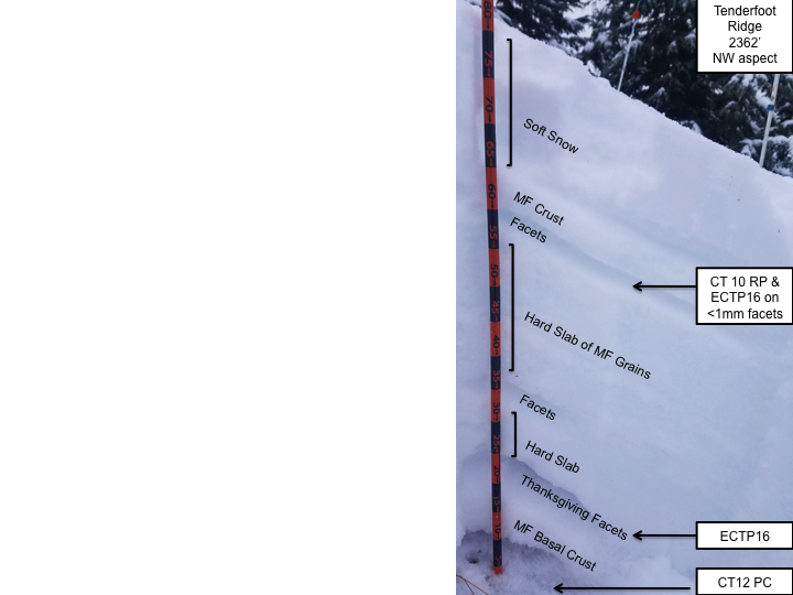
At 2362' on a NW aspect, we got CT10 RP on the <1mm facets under the upper crust, CT12 PC on the basal facets / depth hoar, and ECTP16 on the 2mm Thanksgiving Facets and the <1mm facets under the upper crust simultaneously.
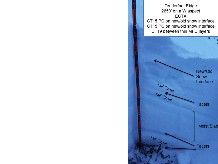
At 2650' on a W aspect, we got ECTX, CT15 PC on new/old snow interface and CT19 between thin melt freeze crust layers.
At 2650' on a NW aspect 100 ft from the previous pit, we got ECTP24 on the 2mm Thanksgiving Facets layer over a melt freeze basal crust and CT21 x 2 SP on dry Thanksgiving facets over a melt freeze basal crust, CT8 SP and CT9 SC on new/old snow interface.
The pit results at 2650' speak to the spatial variability on Tenderfoot Ridge.

Sparse conditions down low
Wind Stripping and Cross Loading on the Gilpatricks
Wind Stripping and Cross Loading on Hale Bop
Slide1
Slide2