| Trigger | Natural | Remote Trigger | 0 |
| Avalanche Type | Unknown | Aspect | Unknown |
| Elevation | unknown | Slope Angle | unknown |
| Crown Depth | unknown | Width | unknown |
| Vertical Run | unknown |
Avalanche: Summit
Location: Tenderfoot
Ascended to 2400 feet on the standard Tenderfoot up-track. Above ~1700 feet on this tour we experienced a very unstable snowpack and what we’d deem considerable avalanche danger. Both our party and another party experienced significant whumpfing. Previous natural avalanches were observed on Tri Tip, Tenderfoot, Fresno Ridge, and Butch.
Avalanche Details
Several natural avalanches occurring most likely on Friday, Dec 8th, were observed including:
Fresno Ridge: Small loose snow - D1
Butch: Several paths have run with several piles of debris seen in gullies (One of these noted by Alex McLain Friday Dec 8th).
Tri Tip: D1.5 on the NW shoulder mid slope, D1-D2's on Northerly aspects
Tenderfoot: 1-2' slab that fractured but did not fully release on lower standard descent route at 2400 ft
Obvious signs of instability
| Recent Avalanches? | Yes |
| Collapsing (Whumphing)? | Yes |
| Cracking (Shooting cracks)? | Yes |
Observer Comments
Significant and visible collapsing/whumpfing in clearings on ascent that resulted in a wave in the snow surface as trees shook off snow. Abundant whumpfing reported by another party.
Weather
1230 @ trailhead: OCT, 37 F @ 1300 ft, no precip, calm winds
1500 @ snow pit: OCT, mid 30s @ 2300 ft, S-1 rain, light winds
1600 @ trailhead: OCT, 38 F @ 1300 ft, no precip, calm winds
Snow surface
Melt freeze crust that transitioned to moist new precip particles around 2200 ft. Melt freeze crust was 3 cm thick near trailhead (rain Friday) growing to softer 5 cm thick higher up (wet snow/rain Friday). This melt freeze crust made for challenging skiing conditions. Grass poked through in clearings in patches. Early season conditions persist. The rain/snow line from Friday's precip was above our high point and estimated at 2,600', possibly higher.
Snowpack
Numerous hand pits failed on isolation on faceted snow sitting over a melt freeze crust near the ground.
ECTP 11 down 40 cm on 1-2 mm facets (facet layer was 10 cm thick) over a melt freeze crust. Elevation 2300 ft, WNW, 22 degrees
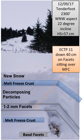
Tenderfoot Snow Pit at 2300'

Avalanche that fractured but did not release on Tenderfoot Ridge at 2400'
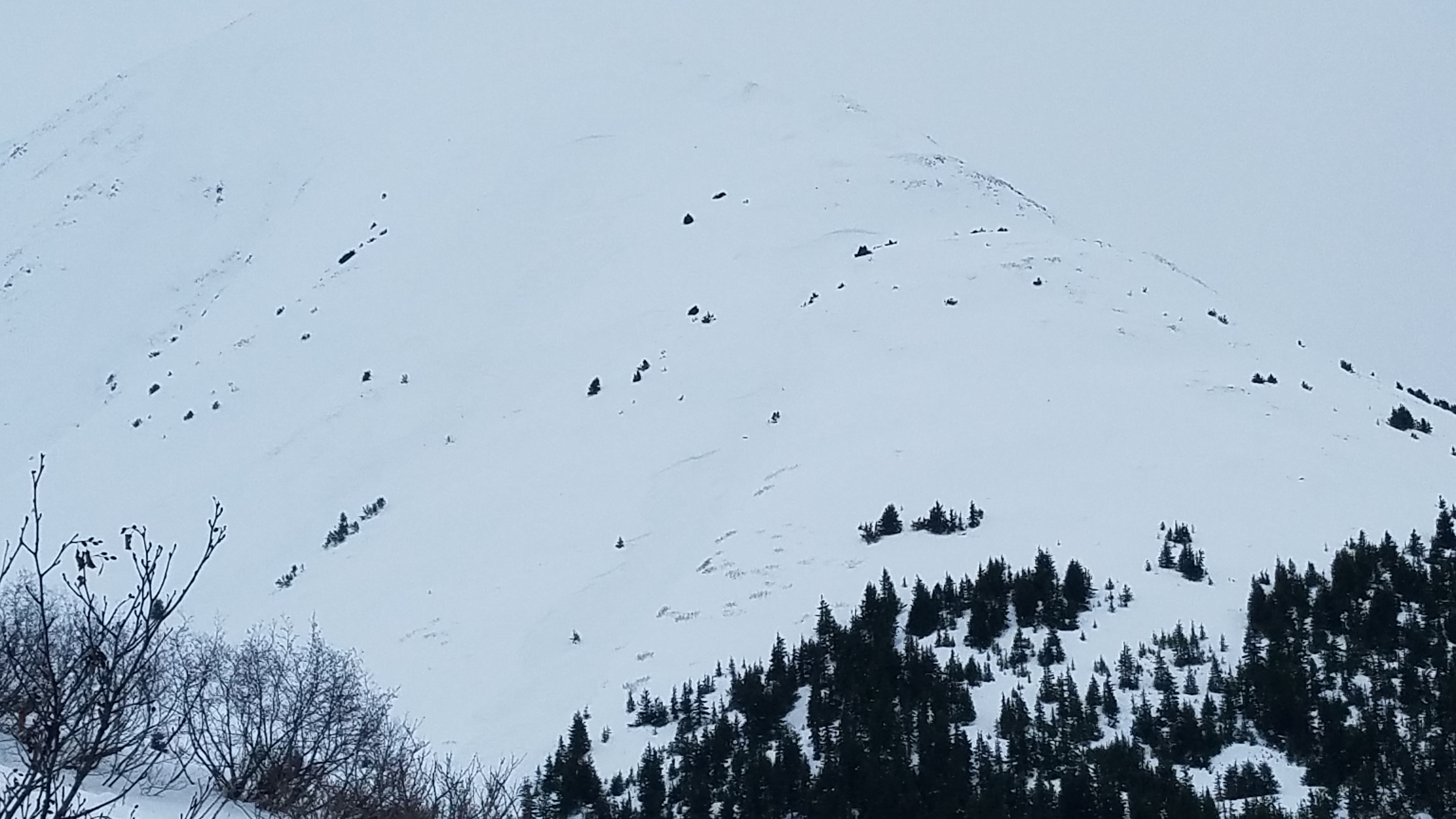
Natural avalanches on Tri Tip