| Trigger | Natural | Remote Trigger | 0 |
| Avalanche Type | Wet Loose Snow | Aspect | Southeast |
| Elevation | 2500ft | Slope Angle | unknown |
| Crown Depth | unknown | Width | 150ft |
| Vertical Run | 200ft |
Avalanche: Summit
Location: Tenderfoot
Toured back on Tenderfoot ridge to the saddle before 4790. Descended up track.
Snowpack tests generally showed high strength, low energy, and poor structure. Saw our first snow depth greater than 2 meters today!
Avalanche Details
Saw two wet loose avalanche debris piles on the southeast aspect of Colorado ridge originating from rock outcroppings.
Obvious signs of instability
| Recent Avalanches? | Yes |
| Collapsing (Whumphing)? | No |
| Cracking (Shooting cracks)? | No |
Observer Comments
Avalanche carnage! Most notably, crowns from the 26th / 27th spanned the entire southwest face of Tenderfoot, the Northeast face of Tri-Tip, and the entire West bowl and Southwest bowl of Hale-Bop propagating all the way over to the Butcher Creek headwall. There was another large slide on the N aspect of Tenderfoot, at around 3500 ft elevation, that looked newer (the blocks and crown were very angular and well defined).
Weather
Calm to light wind from variable directions. Very strong inversion.
Snow surface
2 cm surface hoar "leaves" up to about 1800 ft. 10 cm ski pen.
9 mm square, striated surface hoar from 1800 ft to treeline. 10 cm ski pen.
Above treeline surface conditions ranged from creamy, sun-affected powder to sastrugi to breakable wind crust and wind-exposed ice crusts.
Snowpack
Hand pits at 1800 ft failed very easy on basal facets.
Hand pits around 2500 ft failed easy/medium on basal facets.
Highly spatially variable snow depths, ranging from 0 on ridge tops to HS = 200 cm in wind loaded areas.
Dug 2 pits:
Pit 1:
Tenderfoot Ridge
2673 ft (treeline)
West Aspect
27 degree slope
CTN, ECTX
HS = 125 cm
20 cm of F to 4F settled snow on surface.
40 cm of 1F to P hard wind slab
40 cm of 4F to 1F small facets
25 cm of depth hoar
(Continued beyond SWAG test parameters for stability tests. CT33 SP on depth hoar using both arms from the shoulder.)
Pit 2:
Saddle below 4790
4268 ft
West Aspect
20 degree slope
CTN, shovel tilt 4 taps top 15 cm failed sudden planar
HS = 200 cm
200
F powder
185
4F settled powder
180
1F wind slab
175
P wind slab
160
P+ wind slab
115 (thin stripe, BSH?)
P
107
P small facets
90
P slightly larger facets
80
1F+ --> P slightly larger facets
25
1F
24
K crust
15
P facets
10
4F 3mm depth hoar
G
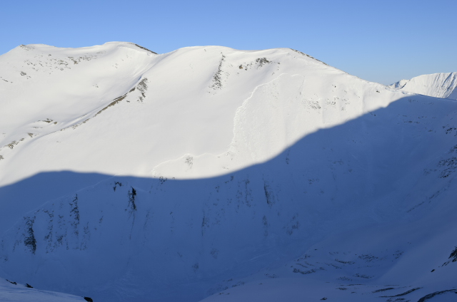
Avalanche spanning SW bowl of Hale-Bop
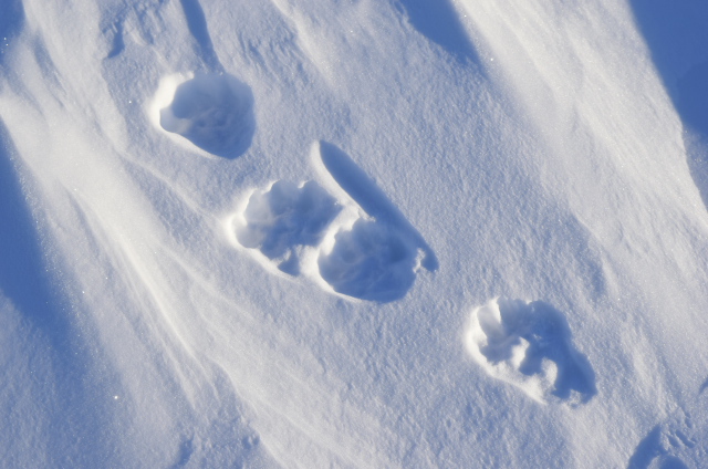
Wildlife Obs: Wolverine (?) tracks at 4200 ft!

Avalanche on N aspect of Tenderfoot
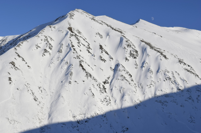
Cross loading and avalanche crowns on Hale-Bop

Avalanche on W aspect of Hale-Bop