Overcast, no precipitation
Mostly light winds with a few gusty periods throughout the day from the N-NE
Temps in the mid-20Fs
Observation: Summit
Location: Tenderfoot
Toured from 1200′ parking to 3400′ on the Tenderfoot Ridge.
Weather
Snow surface
1200'-2000': 2-4" of settled storm snow over a supportable melt-freeze crust
2000'-3400': 2-4" of settled storm snow in protected areas over stiffer snow, wind crust and scouring along the ridge
Snowpack
Pit # 1: 2300', West aspect, 28 degree slope, HS=150. We found two layers of buried surface hoar (BSH). Layer 1 was 20 cm below the surface just below a thin melt freeze crust. BSH was small 2-4mm. CT 18 SC on this layer x 2. Layer 2 of BSH was 110 cm below the surface. 8-10mm grains, laid over. It was non reactive in stability tests. CTN x2, ECTX, PST (layer was too uneven and thin to be effective).
Pit #2: 3400', South aspect 22 degree slope, HS=80-135, multiple layers of hard wind compacted snow over
10-20 cms of facets, 1-2mm, ECTX, CTN
Probed along S starting zones HS varied from 40 cm-240 cm. Soft snow in places, cornice formation and small sticky pockets of wind slab.
N starting zones, very scoured, wind harden snow.
Overall variability of depth and presence of persistent layers under hard snow still warrants caution. Thin spots/trigger points are still suspect. Fairly typical Summit Lake snowpack structure.

Large cornice in the South facing Alpine terrain
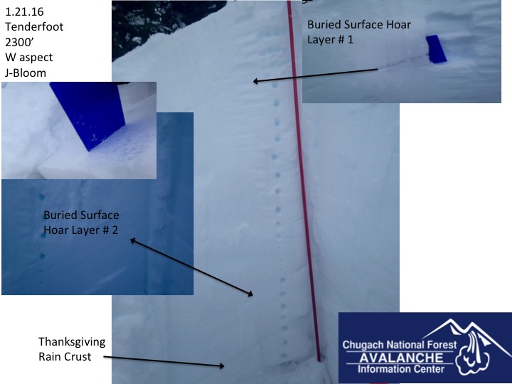
Pit # 1 Tenderfoot 2300'
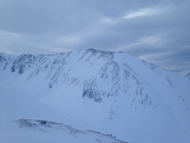
Scoured North facing Alpine terrain

Varied snowpack distribution on the South side of Tenderfoot

Stubborn cracking in the wind effected snow on Tenderfoot ridge