We went up to look at this avalanche on Mar 21, the day after it was triggered. Report updated Mar 22.
Avalanche: Summit
Location: Templeton
Standard up route hugging the S side of the trees. skiff of new snow over unsupportable 1″ MF crust until 1700′.
Forecaster Comments
| Trigger | Skier | Remote Trigger | Yes |
| Avalanche Type | Hard Slab | Aspect | West |
| Elevation | 3400ft | Slope Angle | 29deg |
| Crown Depth | 3ft | Width | 1000ft |
| Vertical Run | 1500ft |
Avalanche Details
HS-ASr-R4-D3-O
Remote triggered from ~200' away to nearest part of fracture while skinning on a 29* slope. Deep, sharper sounding collapse and dropped perceptibly; ~ 10 seconds later saw debris moving above and just enough to our right. Avalanche stepped down in a few spots including to the ground lower in the track where total snow depth was less.
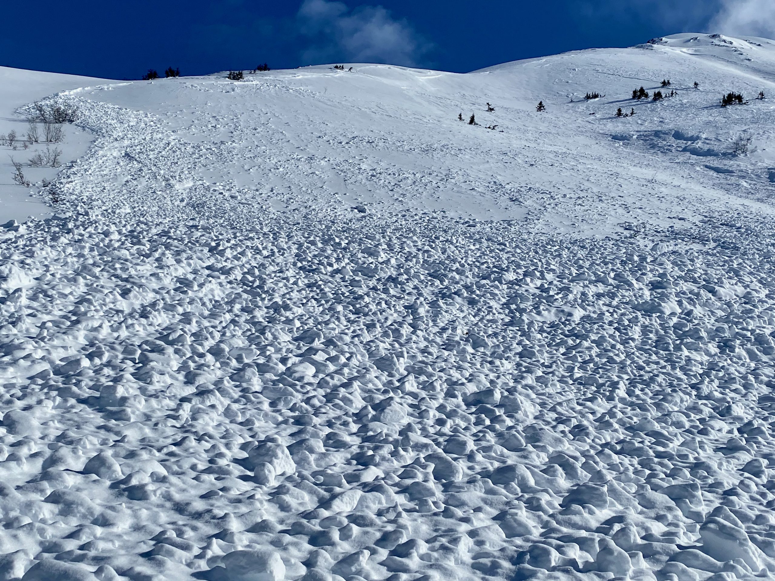
Occurred near tree line and above; Fracture depth was 2-5' in start zones. Slope angles mid-30*s to 40* in spots; debris was soft with harder chunks up to refrigerator size. Debris depth averaged 2-5' maximum, it crossed 15' of our uptrack ~ approximately 70' vertical below the trigger spot. The weak layer was 1-1.5mm facets under the sun crust that formed during the first 2 weeks of March.
A steeper slope 250’ above us, in the low, mid 30*s, did not pull out but could have been a trigger spot had we decided to descend that pitch.
Observer Comments
24 hours since major loading event. Locally leeward to cross loading by winds in the alpine. Discontinuity in new snow seemed moderate to somewhat resistant to hand shears (no big red flags there).
Collapse that triggered avalanche was our first direct signal of instability.
Weather
Sunny @ 1230h, 22*, calm. wind picked up 0-5 mph SSE @ 1400h as clouds moved in w/ brief snow showers, S1- (light snow).
Overcast, 29*ceiling @ 4500-5000' by 1730h
Snow surface
1cm of new snow over 1" unsupportable crust 1400-1700, ski penetration 35cm. similar @ 2500' although snow depth from past 4 days increased w/ elevation
Snowpack
21" new snow in past 48 hrs. Traveling tests only, no pits.
March 21 (day after avalanche) snowpack assessment:
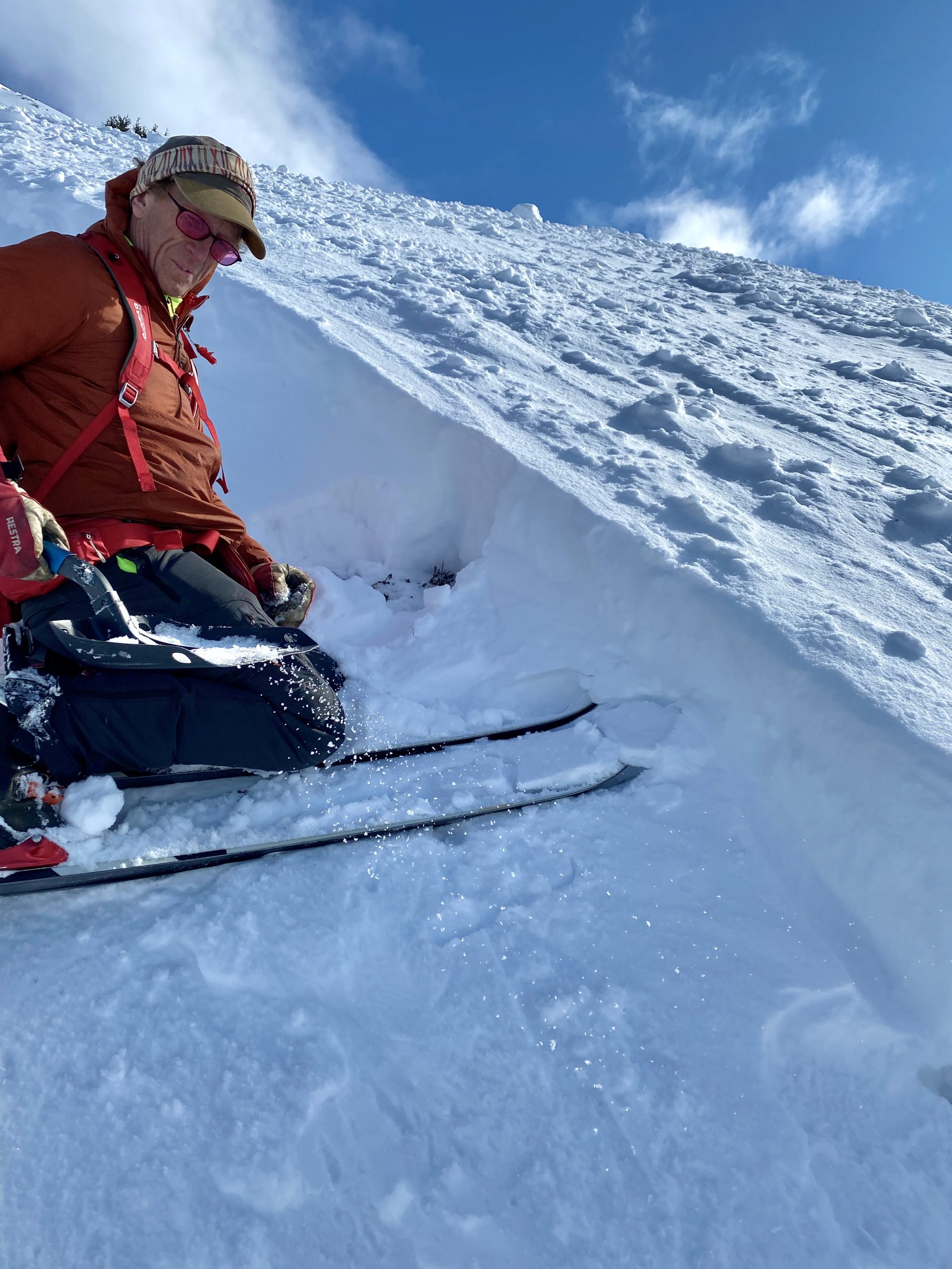
One pit dug near trigger point (2,600', W aspect).
Total snow depth 170-190cm.
Top 60cm was the new snow from March 15-20.
Under this was an old sun crust from the 2 week dry spell from March 1 to 14.
Under the crust was 5-10cm of 1 finger hard small (1-1.5) facets. This was the Weak Layer that collapsed and triggered the avalanche.
We did not dig further down but know from looking at the slide several deeper layers of faceted snow failed under the force of the slide. Some areas broke to the basal facets just above the ground.
IMG_7132
IMG_7116

Templeton remote w debris toe marked
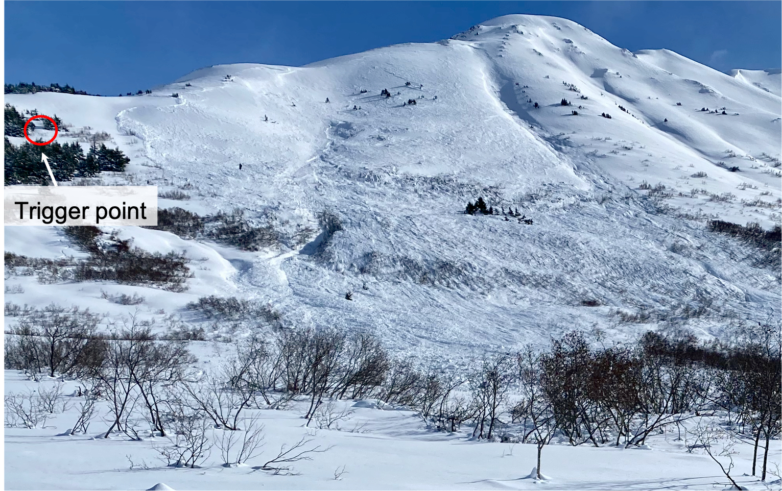
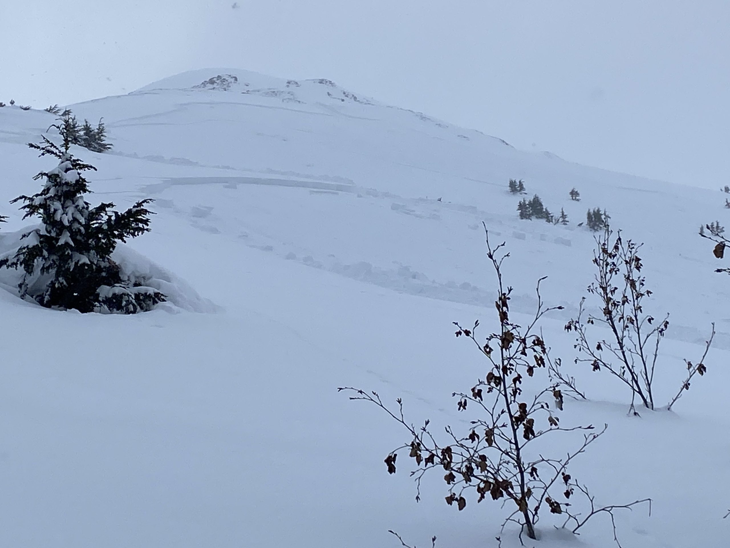
Overview of avalanche and the trigger point when 2 skiers were ascending near the dense trees on lower angle terrain.
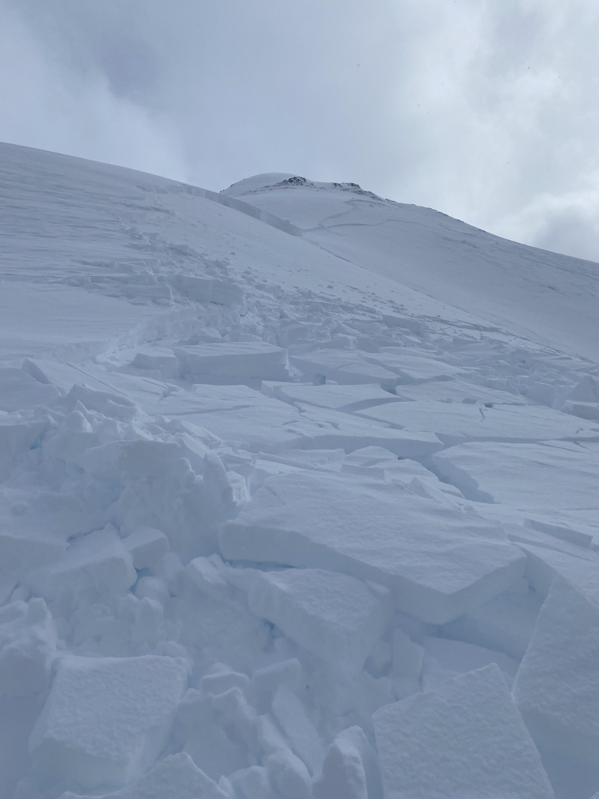
Looking up the top portion of the avalanche path. Note the step down portions in the bed surface.

Crown profile - in one of the thinnest sections of the crown.
Basal facets in a portion of the path that stepped down