| Trigger | Natural | Remote Trigger | Unknown |
| Avalanche Type | Soft Slab | Aspect | Northwest |
| Elevation | unknown | Slope Angle | unknown |
| Crown Depth | unknown | Width | unknown |
| Vertical Run | unknown |
Avalanche: Turnagain
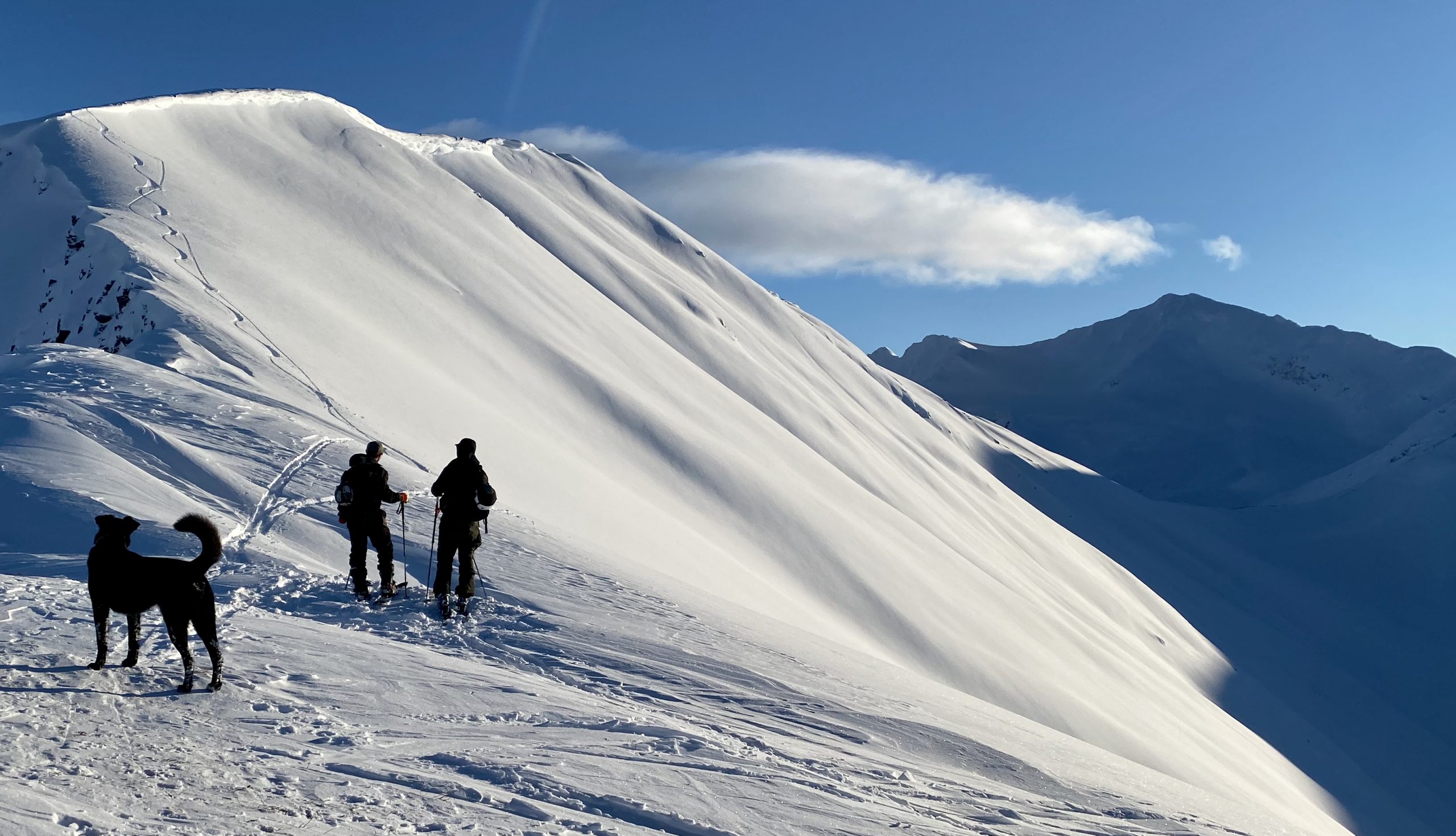
Location: Sunburst Ridge
We traveled up the Sunburst Ridge keeping special attention on above hazards and slope angles. When we broke off from the established skin track a few times, we did not initiate any whumpfing in the snowpack. Near our high point on the ridge, 3,400′, we dug a snow pit (view snowpack observations) to look for the buried surface hoar at the upper elevations.
Avalanche Details
We saw a handful of recent natural avalanches from the past 24 hours.
For the second time this year Todd's run (northerly bowl on Tincan) released taking a large portion of the bowl, wide propagation. Slab depth estimated 1-3' deep. It is likely the weak layer was the 1/10 buried surface hoar. The avalanche ran the full slope, into the low angle terrain, and looked to be about a D3 or D3.5 in scale.
We also saw a large slab across from the motorized parking lot on SE Seattle Ridge with debris running full path. This slab also looked to be in the 1-3' deep realm and had wide propagation, indicative of buried surface hoar.
Photos below, additional photos in other reports from today 1/21.
Obvious signs of instability
| Recent Avalanches? | Yes |
| Collapsing (Whumphing)? | No |
| Cracking (Shooting cracks)? | No |
Observer Comments
Multiple avalanche crowns where spotted from the highway ranging from D1.5 to D3.5 (Todds Run).
Weather
Clear skies. Temperatures starting in the low to mid twenties and declining to the mid teens with elevation. Winds were light and southerly along the ridge.
Snow surface
Around 4-5" of new snow from late last night and early this morning providing light cold snow on the snowpack surface. The new snow was light and readily transportable. Winds had effected the ridgeline with harder wind crusts and some non-reactive windslabs.
Snowpack
We dug a snow pit about 3 ft deep in an attempt to find the 1/10 buried surface hoar. However, because of the scary snowpack, it was challenging to find a spot to dig that would be far enough off the ridge to find the buried surface hoar ( that was low angle enough to not put ourselves at risk). Our snow pit ended up being too close to the ridge and no buried surface hoar was found. Test results were unremarkable: ECTN13 and 15 about 20 cm and 25 cm from the top of the snowpack respectively. Since we were unable to get into areas that are more representative of the buried surface hoar's presence it's challenging to make any finite conclusions with out pit. Instead, we stuck to low angle pow turns at the end of the day.

Snow Profile
Turning away from the luring steeper slopes and sticking to the more mellow slopes
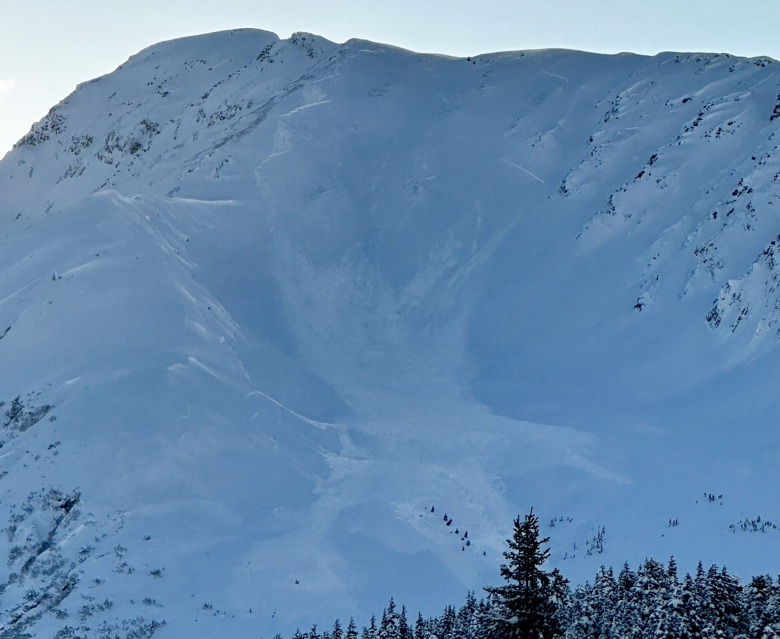
Todd's Bowl, photo by Corbin Huxley
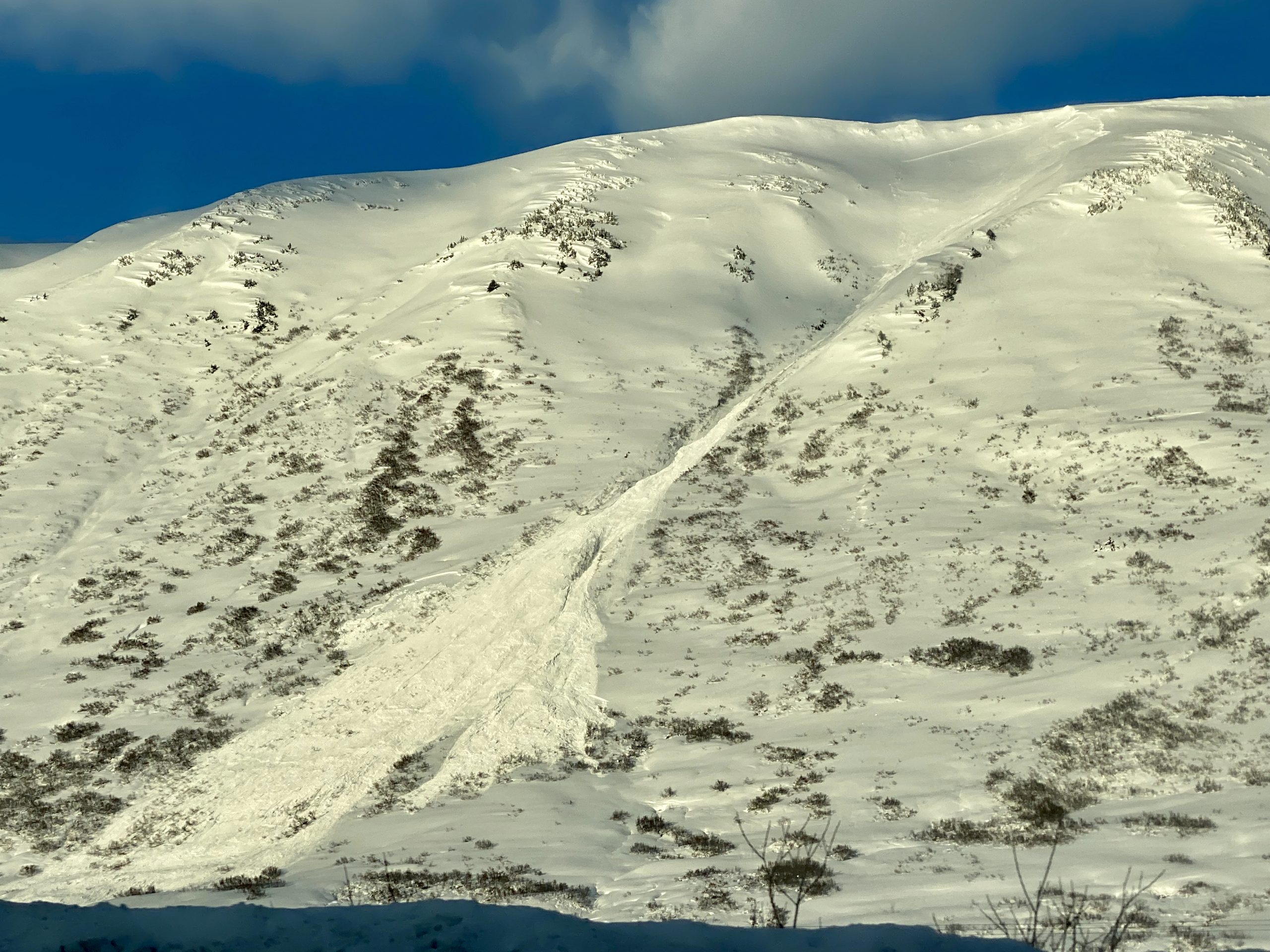
Natural on SE Seattle Ridge across from moto lot
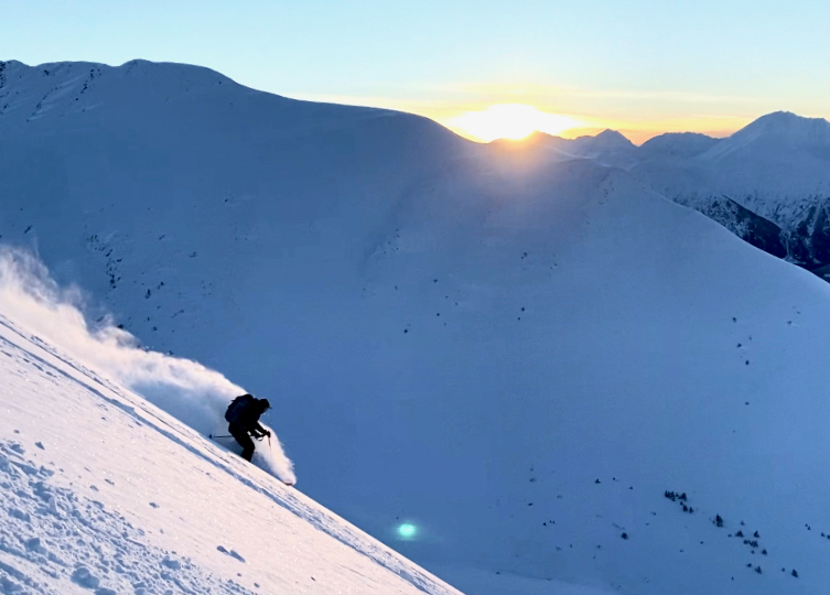
CNFAIC Intern Megan Guinn enjoying the lower angle powder on the west face of Sunburst