Lots of activity from a few days ago, but didn't see anything recent from today.
Observation: Turnagain
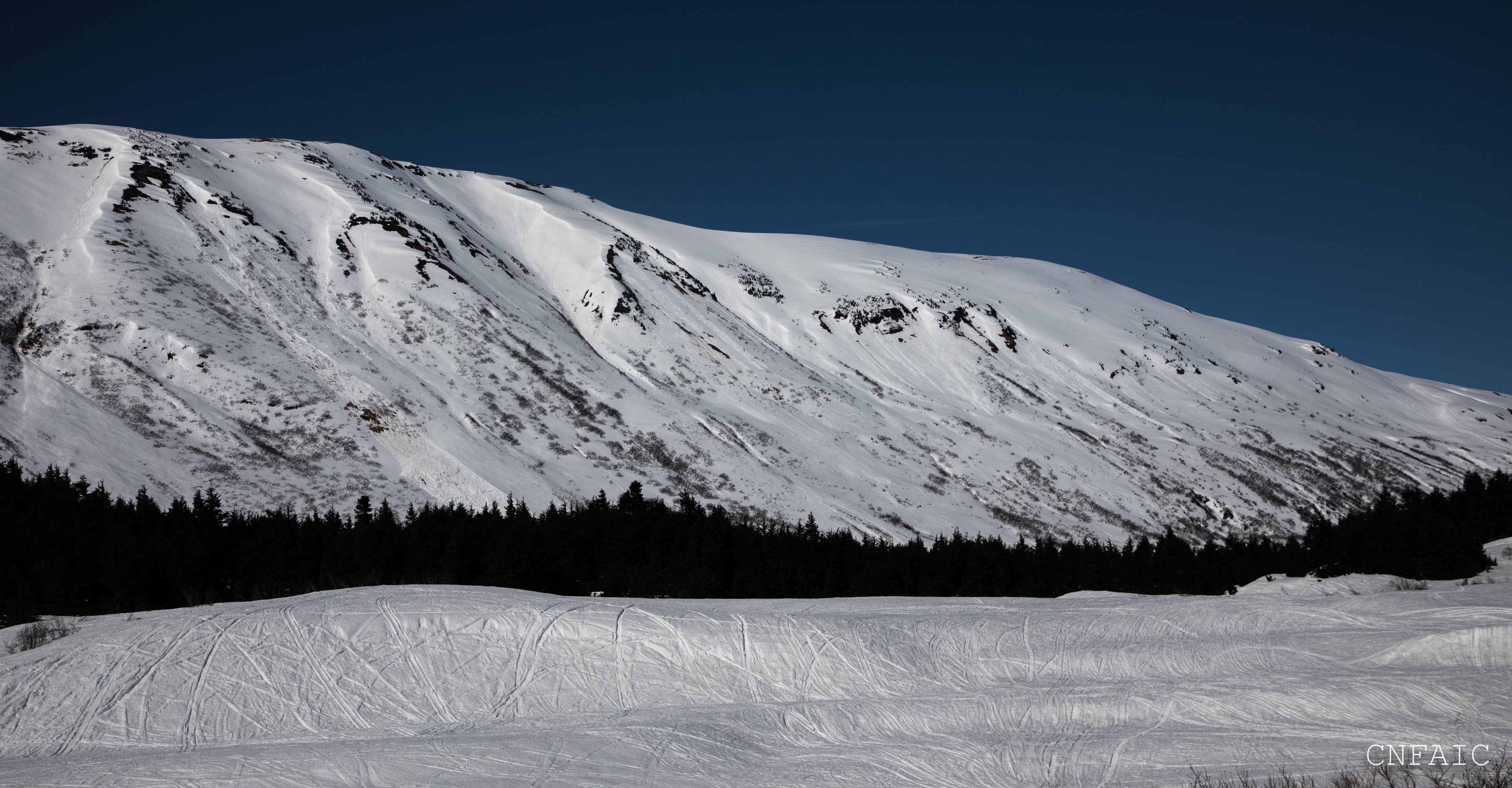
Location: Sunburst and photos of Seattle Ridge and Tinca
We did a quick tour to 2500′ on W and SW slopes of Sunburst between 4pm and 6pm to look at how wet and saturated the snowpack was in the late afternoon sun. The evening prior was the first clear night with temps dipping below freezing following several days of rainy weather. We also took more photos of the natural wet avalanche cycle that occurred Tues and Wed (4/10-4/11) on Seattle Ridge and Tincan. Also see the “Turnagain Pass Road Obs” from 4/12 for more photos and details of this cycle.
Observer Comments
Weather
Sunny
45F at the road
33F at 3800' (Sunburst Wx station)
5-10mph NW winds
No new precip
Snow surface
West and SW aspects:
800' - Boot pen = thigh high wet snow on flats,
1500' - Boot pen = waist deep wet snow on low angle SW aspect.
2000' - Boot pen = chin deep wet snow on low angle SW aspect.
2500' - Boot pen = ankle deep wet snow on low angle SW aspect.
Aspects with a slightly Northern aspect were forming a very light superficial crust to about 2000'. In the alpine North aspects had a more stout supportable crust to 2500' where we turned around. Could see re-frozen roller balls to about 3000' on North aspect of Magnum.
*On a steep (40+ degrees) South facing features skis sunk 12" deep at 2200' at 6pm.
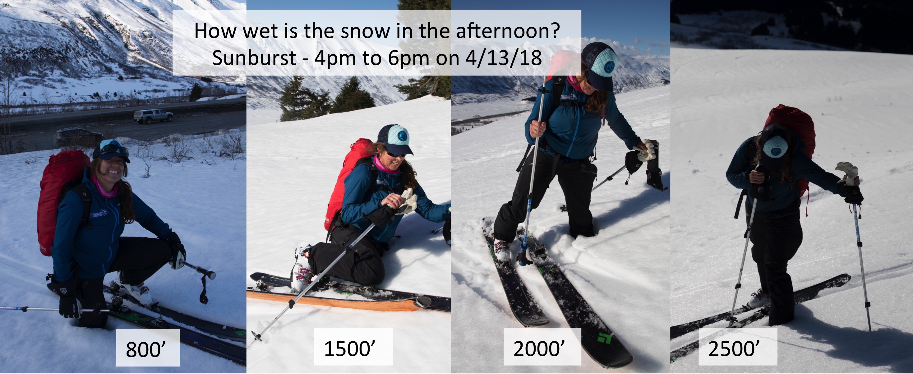
Hot sunny days in the spring, its important to pay attention to how wet the snow is getting in the afternoon.
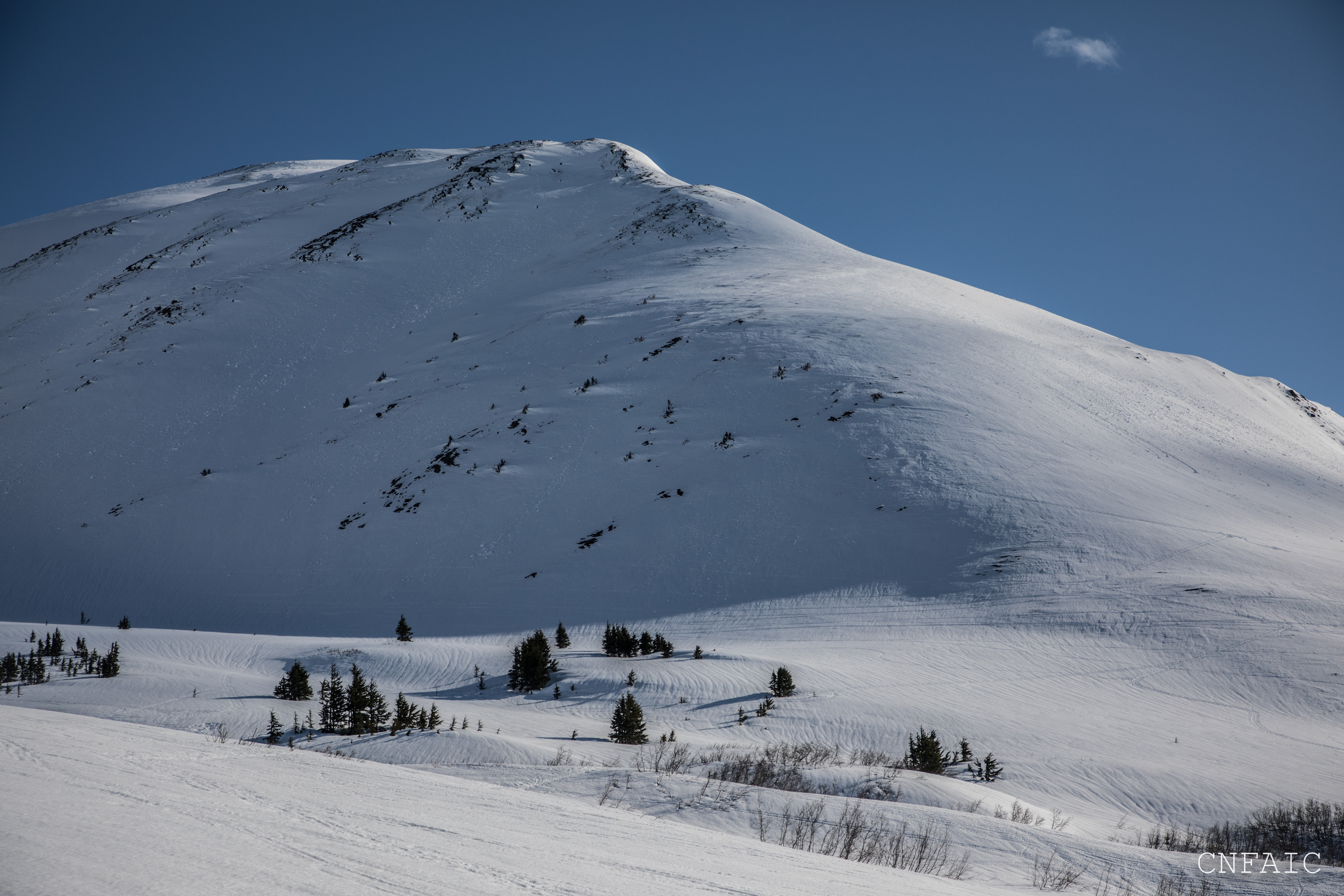
NW shoulder of Magnum. Note the old rain runnels below 2500' and the re-frozen roller balls below 3000' on the North facing slopes

Corn cycle has begun below 3000' on Southerly aspects
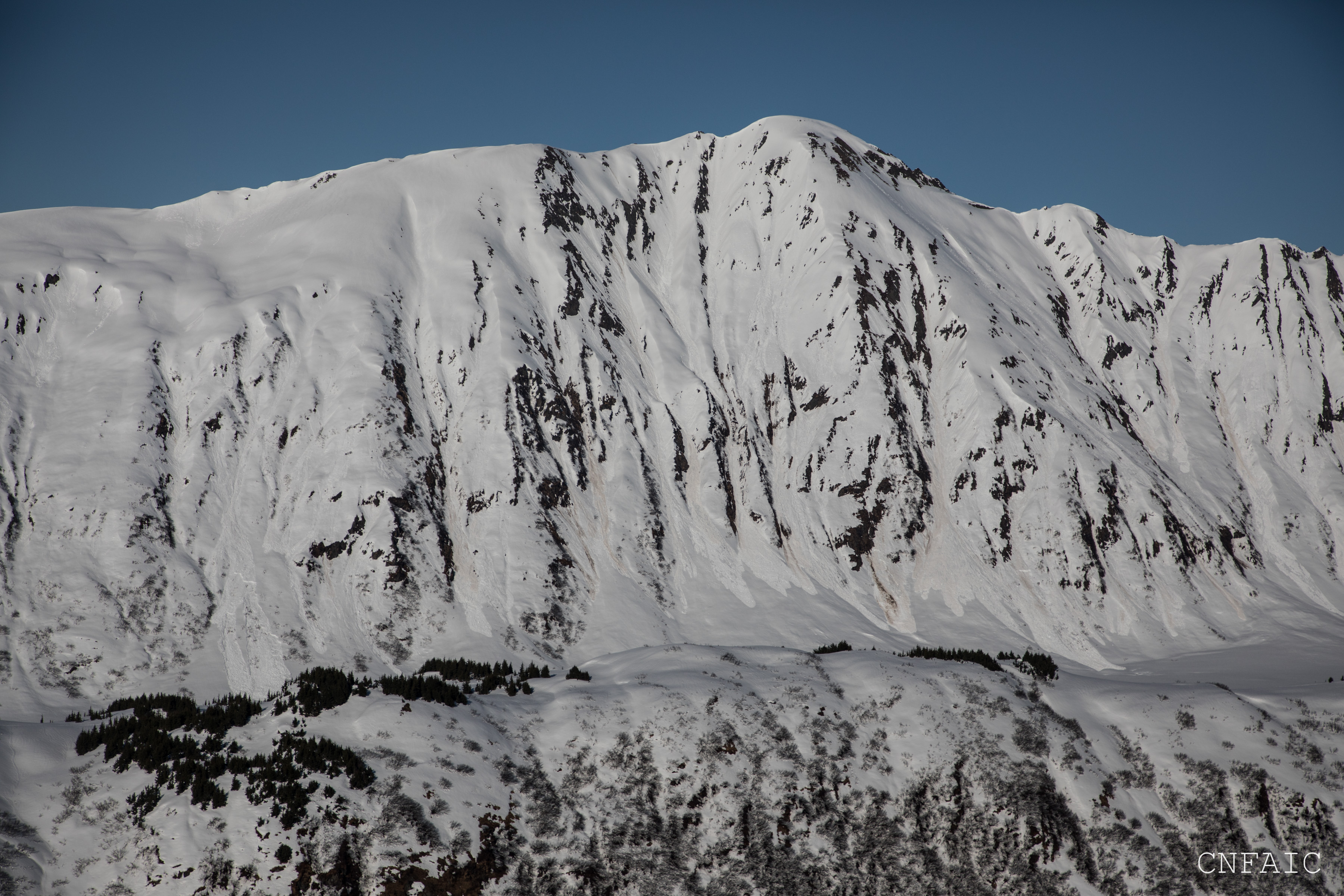
Wet loose and wet slabs on S face of Tincan from the wet cycle earlier in the week
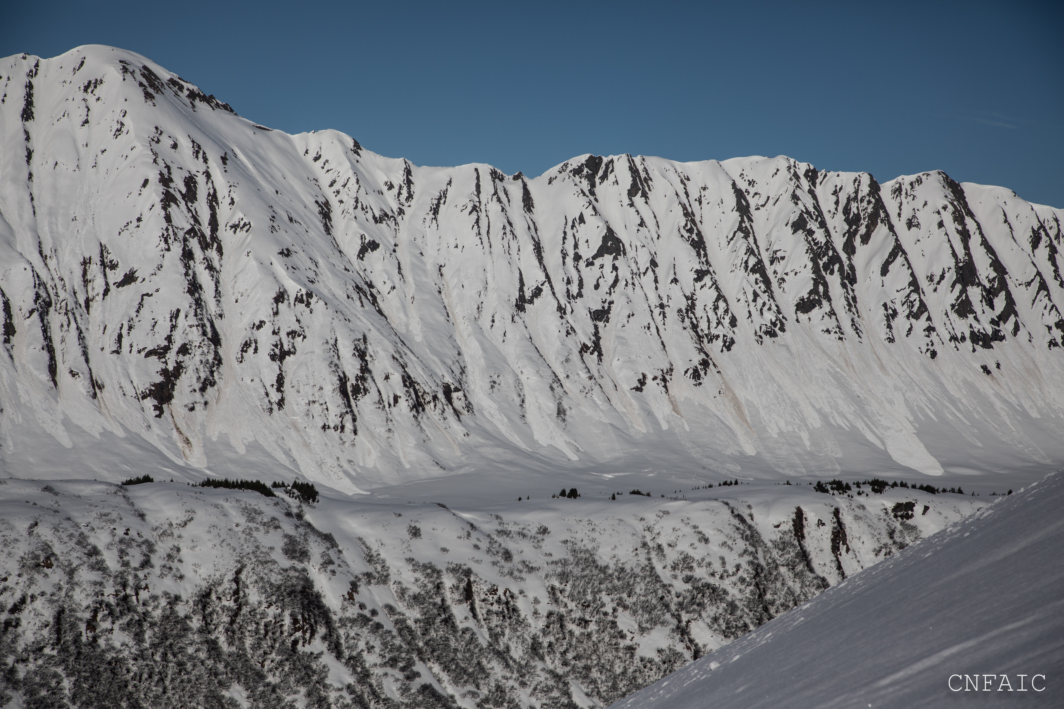
Southern terrain of the Library

Wet avalanche activity from two days ago on the South end of Seattle Ridge (SE facing terrain)

Wet avalanche activity from two days ago on Seattle Ridge (photo taken from Center Ridge parking area (SE facing terrain)
Repeat Offender on Seattle Ridge had the least amount of avalanche activity from two days ago.

Wet avalanches on Tincan from two days ago