Avalanche on the Seattle Ridgeline seen from Sunburst - slide noted in other observations from today 1/14/18.
Observation: Turnagain
Location: Sunburst - and Road Observations
Quick tour up to Sunburst to take a look at how the storm snow is bonding. Also looking at how the underlying weak layers are holding up.
Observer Comments
Weather
Partly sunny. Temperatures around 32F at 1,000' and the upper 20'sF at 3,000'. Winds were light from the East.
Snow surface
Wind affected powder... wind crust over soft snow above treeline, made for challenging skiing.
Snowpack
Above 1,600': 15-20" of new snow from the Jan 10-13th storm cycles. Bonding between the new/old snow surface seems to be occurring - good sign. However, the buried surface hoar from New Year's is still reacting - see video. This is concern moving forward.
Below 1,600': a thin crust sits over moist to wet snow from the warm rain/wet snow the past several days.
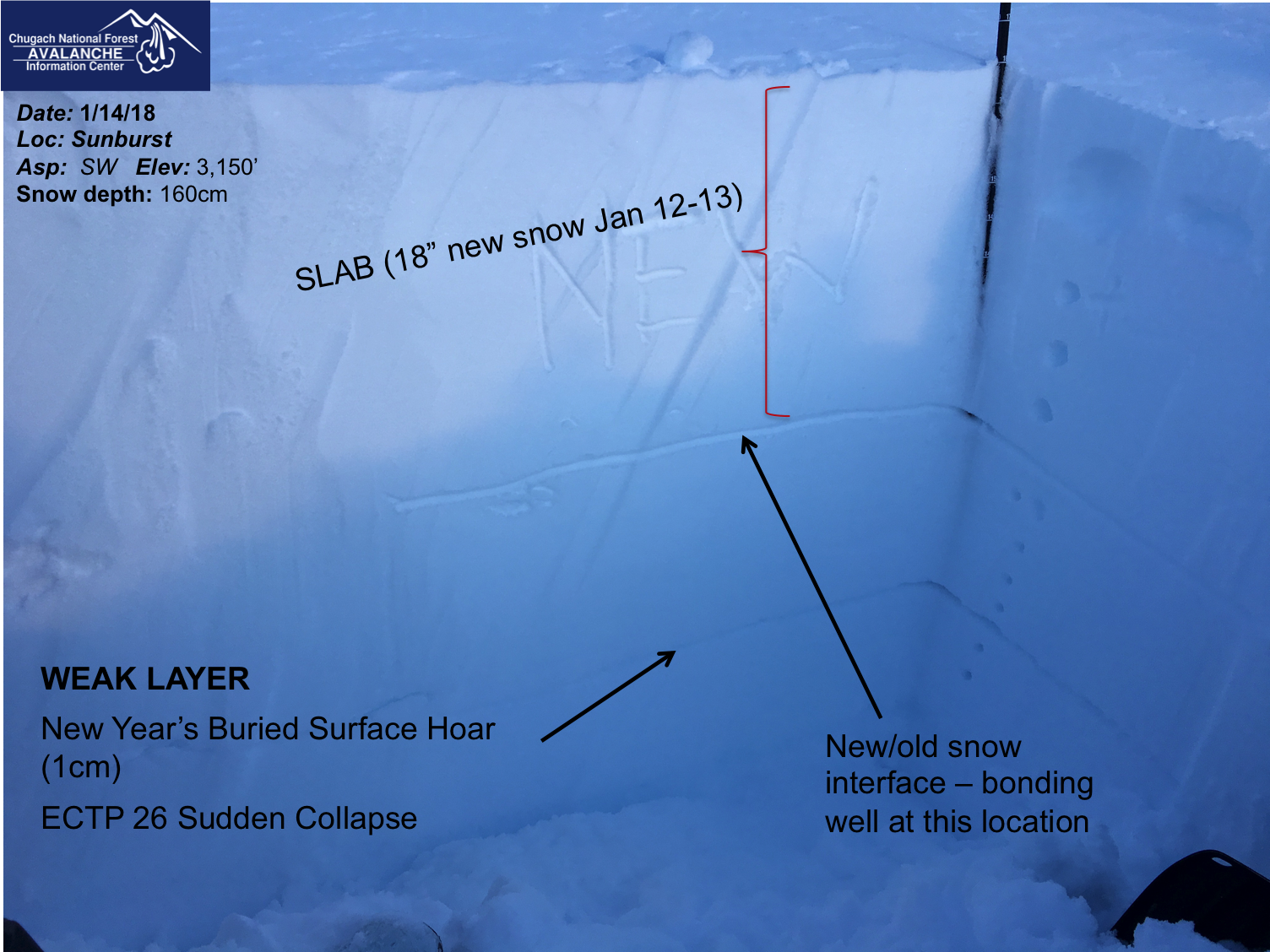
Snow pit at 3,150'
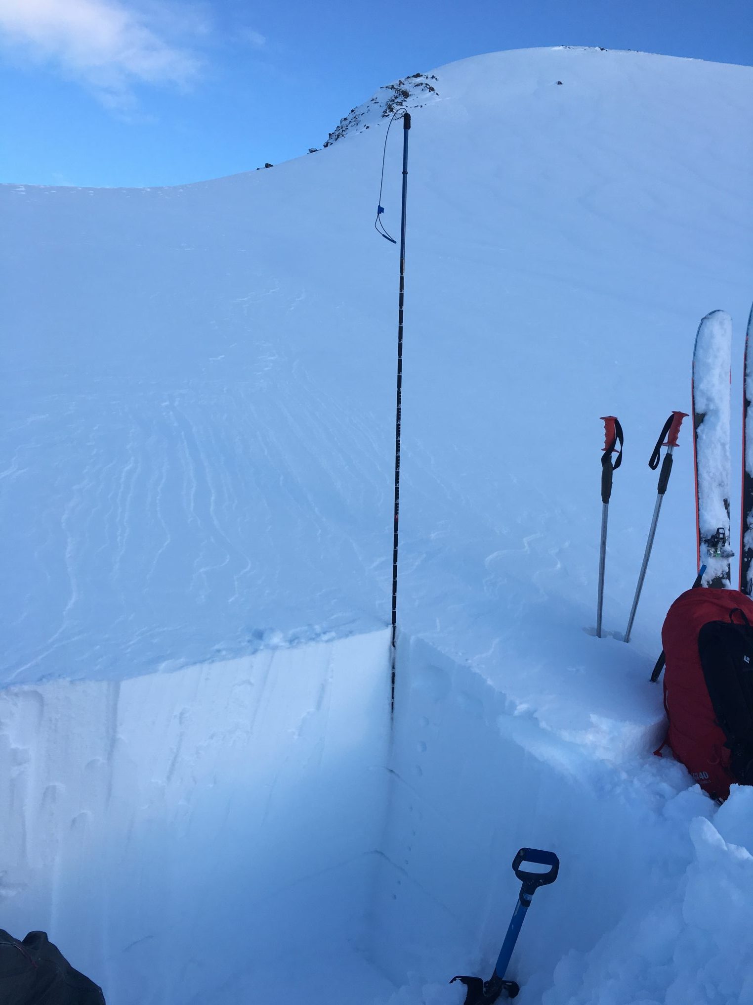
A look at the wider view of pit along with wind affected surfaces...
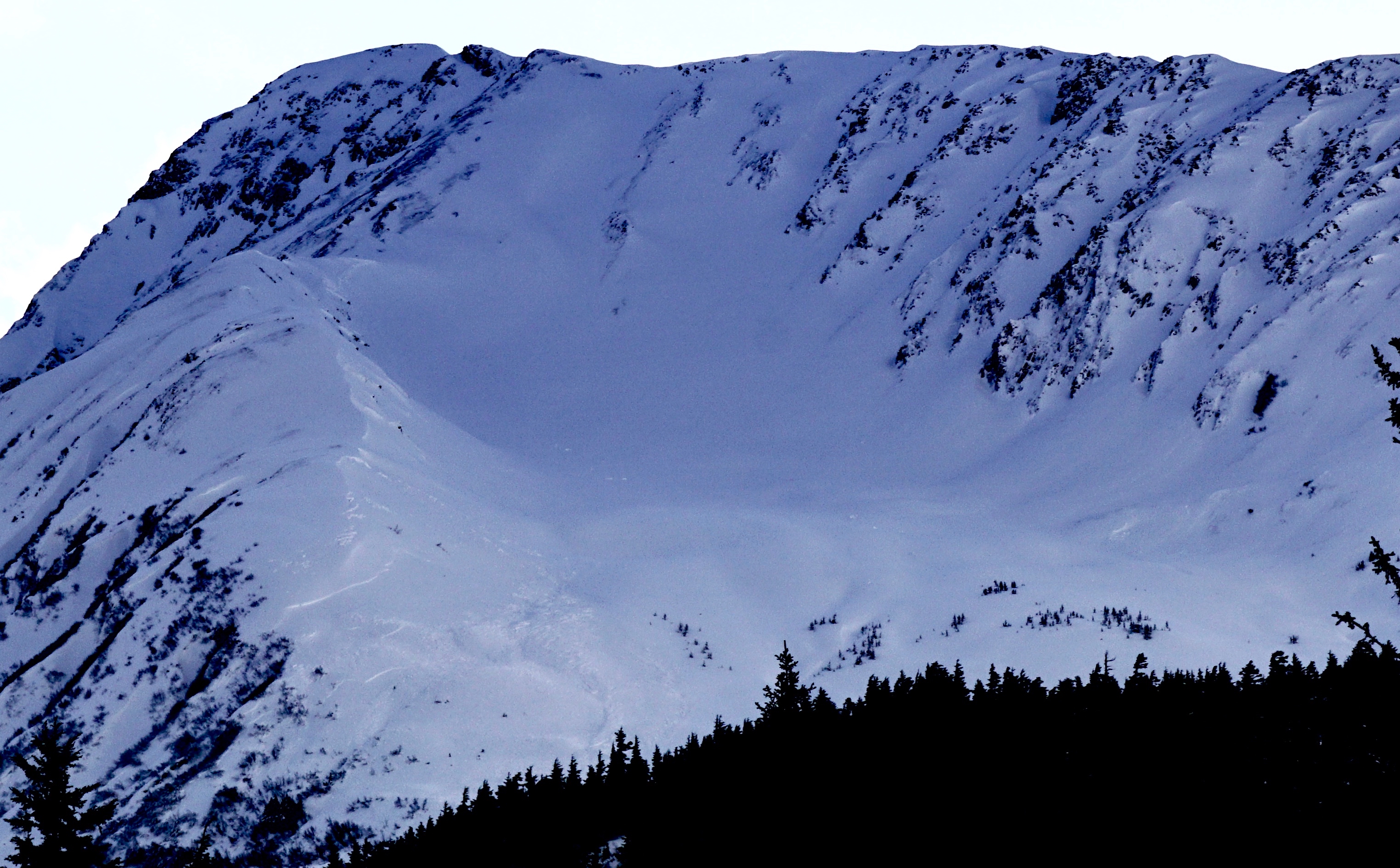
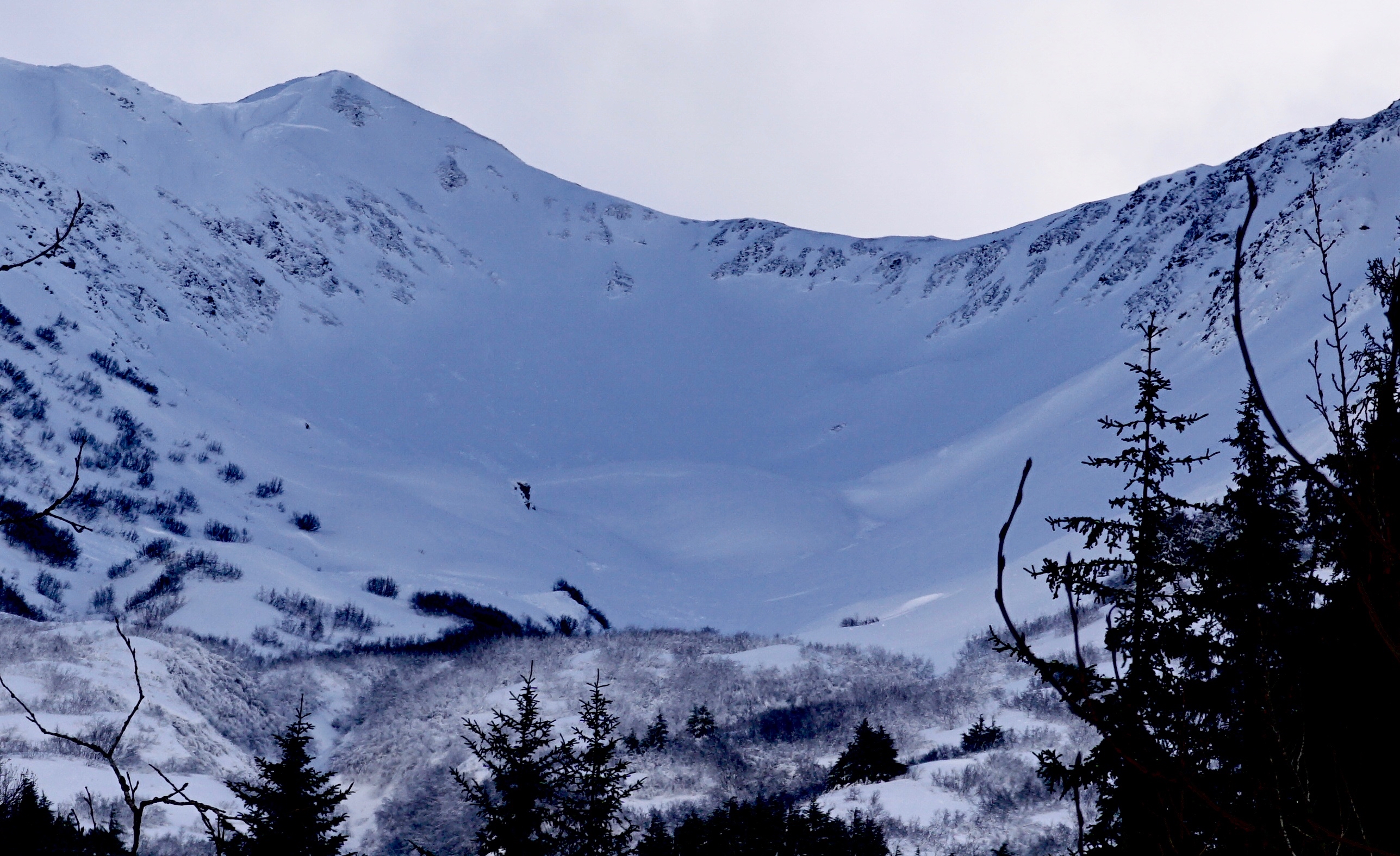
Tincan - see the natural avalanches along the left side of the ridge - occurred 1/13 during rapid loading event (heavy snowfall)
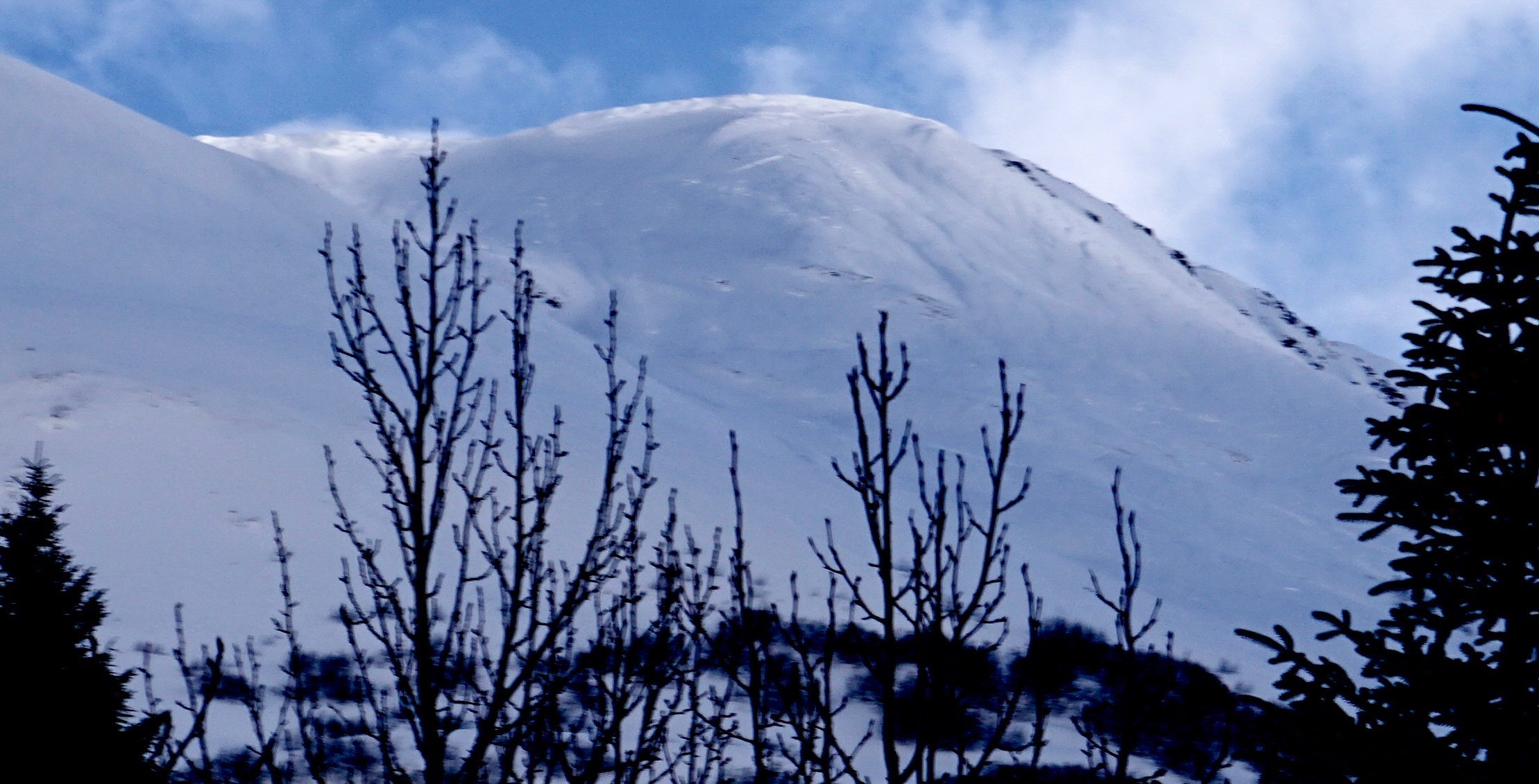
Magnum PMS Bowl avalanches from storm cycle on 1/13
More natural avalanches in Superbowl (between Magnum and Cornbiscuit) - look close for the crowns just below the rock bands