Weather:
Warm springlike day with mostly sunny skies. Temperatures in the mid 20’s and calm winds.
Obvious Signs of Instability:
Recent Avalanche – YES (no activity seen today but several human triggered avalanches yesterday 2/17)
Collapsing – YES, one large collapse ~2,400′ on Sunburst’s Westerly ridge – common up-route
This collapse occurred in faceted snow below the storm slab from 2/11 and 2/16
Cracking – NO (except associated with collapse)
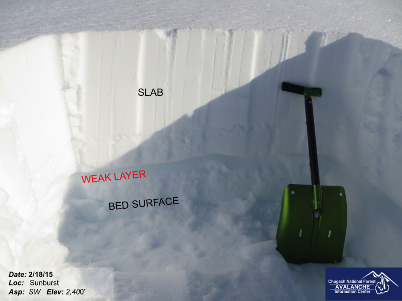
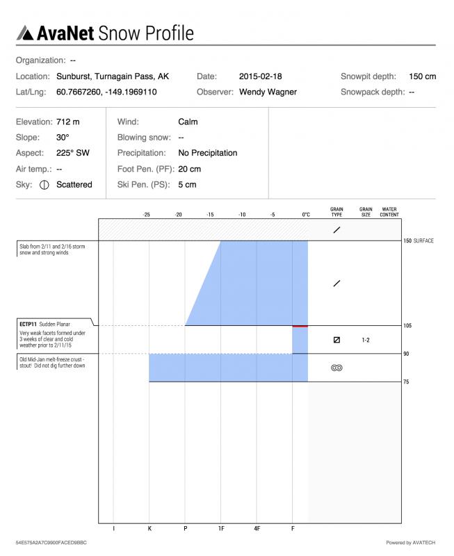
Snowpack Observations:
See video – it says it all!
The snowpack has a VERY poor structure right now that is simply a dense slab over very weak faceted snow
on top of a stout melt-freeze crust. Slab depths ranged from 5-20″ thick and likely much thicker in other
zones prone to significant wind loading. Weak layer depths were in the 5-15cm range and faceted grains
were 1-2mm. The strong winds during the 2/16 storm did a number on the snow and areas of thick slabs are
present in between scoured areas with anti-tracks.
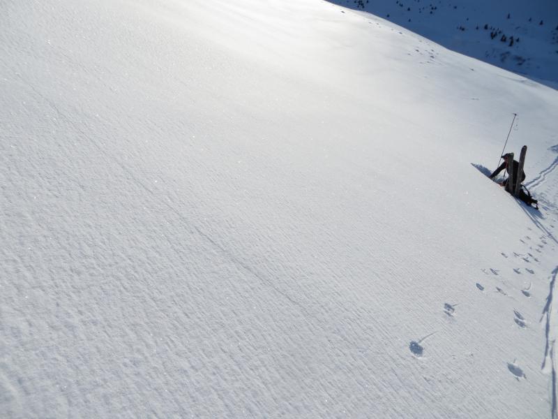
Snow Surface Conditions:
Stiff carve-able snow can be found above 2,000′ while icy conditions exist below this. See photo of
overflow on the Sunburst up-route.