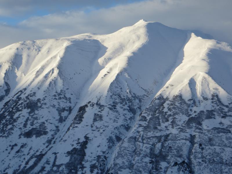
Crowns are widespread on the East side of Seattle Ridge. Crown is just barely visible on the sunny slope just below the highest peak in this photo

Alders are slowly but surely getting buried
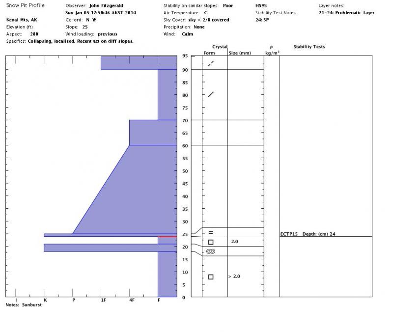
Basic pit profile
Sunburst
High Hazard Day-Avalanche Warning issued
Obvious Signs of Instability
Recent Avalanches-YES-see below
Shooting Cracks-none observed
Collapsing/Whoompfing-YES-a few at the upper end of treeline elevation, avg
radius ~40’
Weather
Calm winds
Partly cloudy skies
Mild temps, in the high 20s/low 30s F
No precip
Surface Obs
~ 6” of settled new snow in the lower elevations
~10-12” of settled new snow in the higher elevations (max elevation today was
2,800’)
~3-20” stiff wind slab between 2,500-2,800’, likely present in the higher elevations
Recent Avalanche Activity
Widespread activity occurred likely during heavy precip/wind late on Jan 4th or
early on Jan 5th. Most crowns & many debris piles have been wind blasted so
actual depths are hard to estimate.
Todd’s Run (see photo)
Seattle ridge- a dozen or so on E facing upper and mid elevation terrain (see photo)
Lipps S side
Pete’s North (majority of S side- see photo)
Magnum (N side)
Pit info:
#1 @ 2,500’, SW aspect, 20 degrees
HS=80-120 (variable depths across several pits)
ECTPV
ECTP 18
ECTP 23 SP-see VIDEO
PST 35/100 end
Layer of Concern is facets below the drizzle crust and above the late November
crust, 70-90cm down
#2 @ 2,800’, SW aspect, 25 degrees
HS=95
ECTP 15 SP 75cm down on 2mm facets below crust. Drizzle crust was stuck onto
bottom of slab.
(see pit profile)
We dug near these locations on 1/2. The fracture character was notably
different today. The main difference was that columns were popping into pits
(Sudden Planar), even on low angle slopes.
Winds have created highly variable snow depths at and above treeline. We are
moving closer to having a deep slab (1 meter +) problem throughout the forecast
area but are not quite there yet. Slab depths sitting on the Dec 8th drizzle
crust seem to be averaging around 80cm. SNOTEL info shows a total 4.7″ of H20/56″ of snowfall (not settled) sitting on the drizzle crust. We will get a better handle on average
depth in the coming days.
We stuck to very low angle slopes today. Recent natural avalanches within the
previous 12 hours was reason enough to stick to slopes under 30 degrees.
Testing the snow below the surface showed high propagation potential.
Crowns are widespread on the East side of Seattle Ridge. Crown is just barely visible on the sunny slope just below the highest peak in this photo
Alders are slowly but surely getting buried
Basic pit profile