Route
Sunburst up to 3,300’
Weather
Showery precip, with Rain/Snow line around 1,500’. Precip ended by 2pm.
Temps mild, 37 deg F at 1,000’ @ 12pm, 36 deg F at 1,000’ @ 4pm
Winds light to moderate out of the East with plumes visible on Magnum Ridge,
loading SW starting zones
Obvious Signs Of Instability
Recent Avalanches-NO
Shooting Cracks-NO
Collapsing-NO
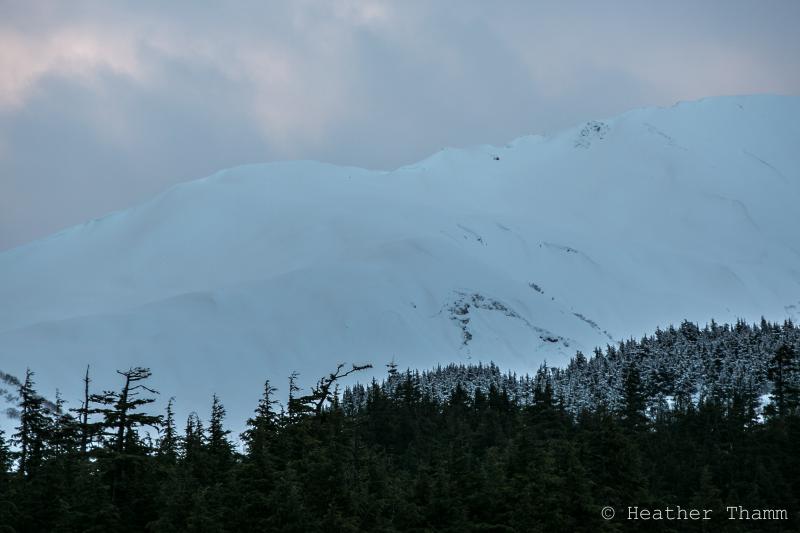
We observed several new glide cracks in areas that had been obscured by cloud
cover over the last 3 days. The largest one was on Tincan, S Facing around
2,300’ (see photo). Several smaller glides have formed or released on E facing
Seattle ridge and 1 on lower Wolverine Ridge, SW facing around 2,000’.
Surface Obs
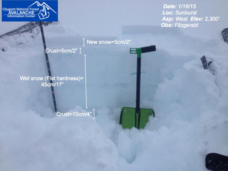
Shallow refreezing has occurred between 1,500-2,500’. Yesterday this elevation
band had consistent isothermal snow. Today there was 2” of new snow sitting on
a crust that was mostly supportable and ranged from 2-4” thick. Wet snow and
large melt freeze grains exists below the crust.
Above 2,500’ 2-6” of new snow sits on generally right side up snow.
Snow Below the surface
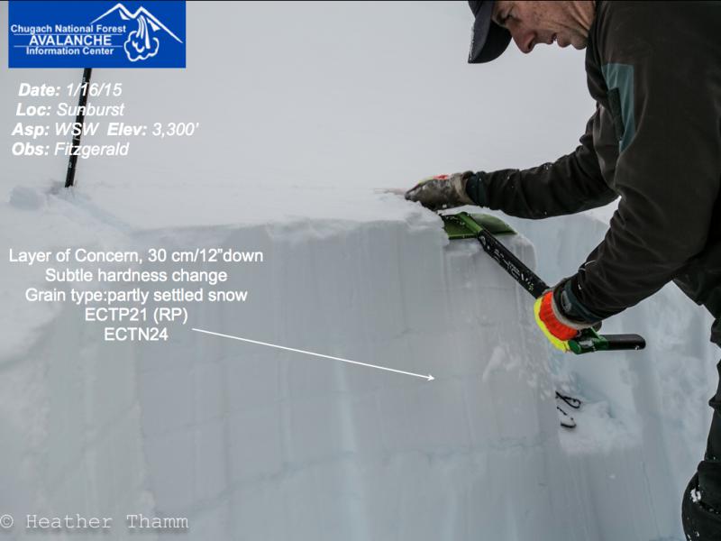
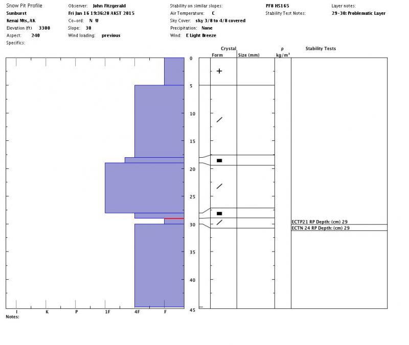
Pit at 3,300’ showed similar results to yesterday. High strength, propagation
potential on the lower end of the scale. Layer of concern is at 30 cm down on a
hardness change on partly settled snow grain. See photos.