| Recent Avalanches? | Yes |
| Collapsing (Whumphing)? | No |
| Cracking (Shooting cracks)? | No |
Observation: Turnagain
Location: Sunburst
Quick tour up Sunburst to get a look at new snow totals and check moisture content in the snowpack. Long story short, the snowpack is very slow in its transition to a warmer springtime setup this year. There is mostly moist snow in the upper 4′ of the pack on southerly slopes, with a fully dry snowpack on northerlies. The new snow from yesterday had consolidated to about 4″ soft snow on the surface, and it is very poorly bonded to the old snow.
Obvious signs of instability
Observer Comments
I kicked off a small chunk of a wind lip along the ridgeline to test how well the new snow was sticking to the old snow and was surprised at the size of the loose snow avalanche it made. It ran about 1000' vertical down the north side of the ridge and entrained enough snow to bury a person. In hindsight, that was a poor choice for a test slope...
Weather
Skies were mostly cloudy, with a mid-level cloud obscuring most of the ridgelines as I was driving up the pass around 2:00 p.m. The clouds quickly broke up shortly thereafter, with mostly sunny skies by around 3:00. Temps were just above freezing at 3100' around 4:00, and with full sun and no wind it was feeling quite hot this afternoon.
Snow surface
The new snow from yesterday has settled to about 4". Surfaces were heating up through the day, and there was a thin saturated layer of snow just barely below the snow surface. The process is a little complicated, but the very surface of the snow is able to stay a little colder during clear days because it can radiate some of the energy from the sun back out into the atmosphere. That's how you can see dry snow right on the snow skin, with a saturated layer just under the surface.
Snowpack
Northern aspects are still totally dry, with a melt/freeze crust just under the new snow up to about 2800'. I dug one pit on a southerly slope at 3100' and found wet snow in the upper foot or so of the snowpack, with moist snow and multiple crusts in the upper 4'.

Debris from an intentionally triggered avalanche on the north side of the ridge. This ran about 1000' vertical and entrained much more snow than I expected. 04.24.2023
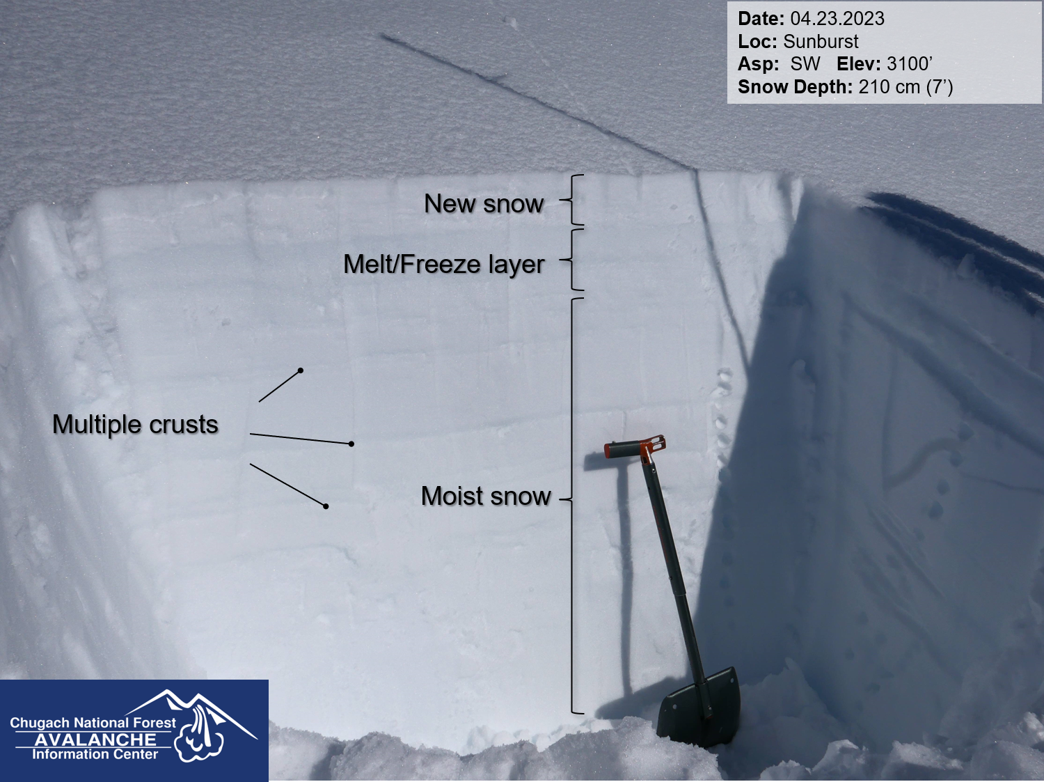
Snowpit from a southerly aspect at 3100'. 04.24.2023

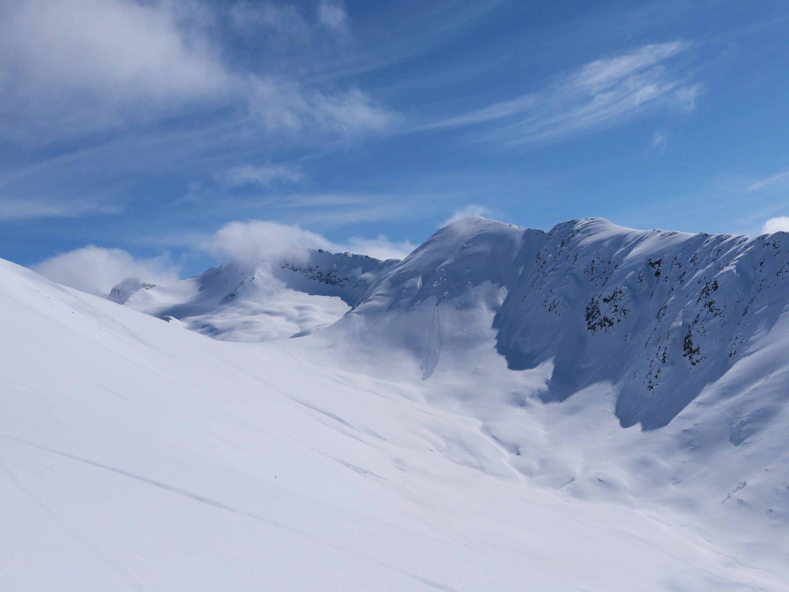
Looking towards Magnum just as the clouds lifted. 04.24.2023
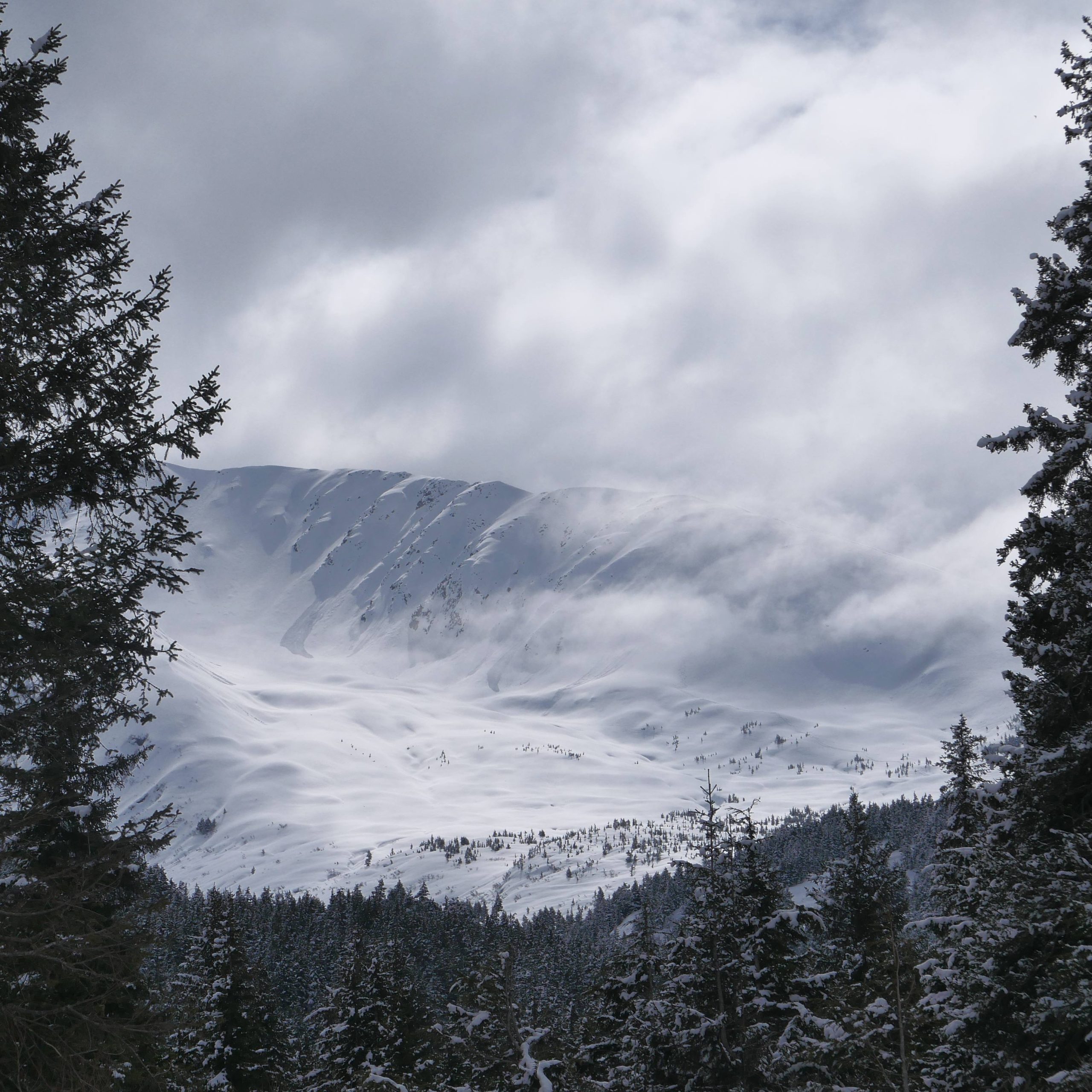
Looking up valley towards Taylor Pass and Pastoral. 04.24.2023
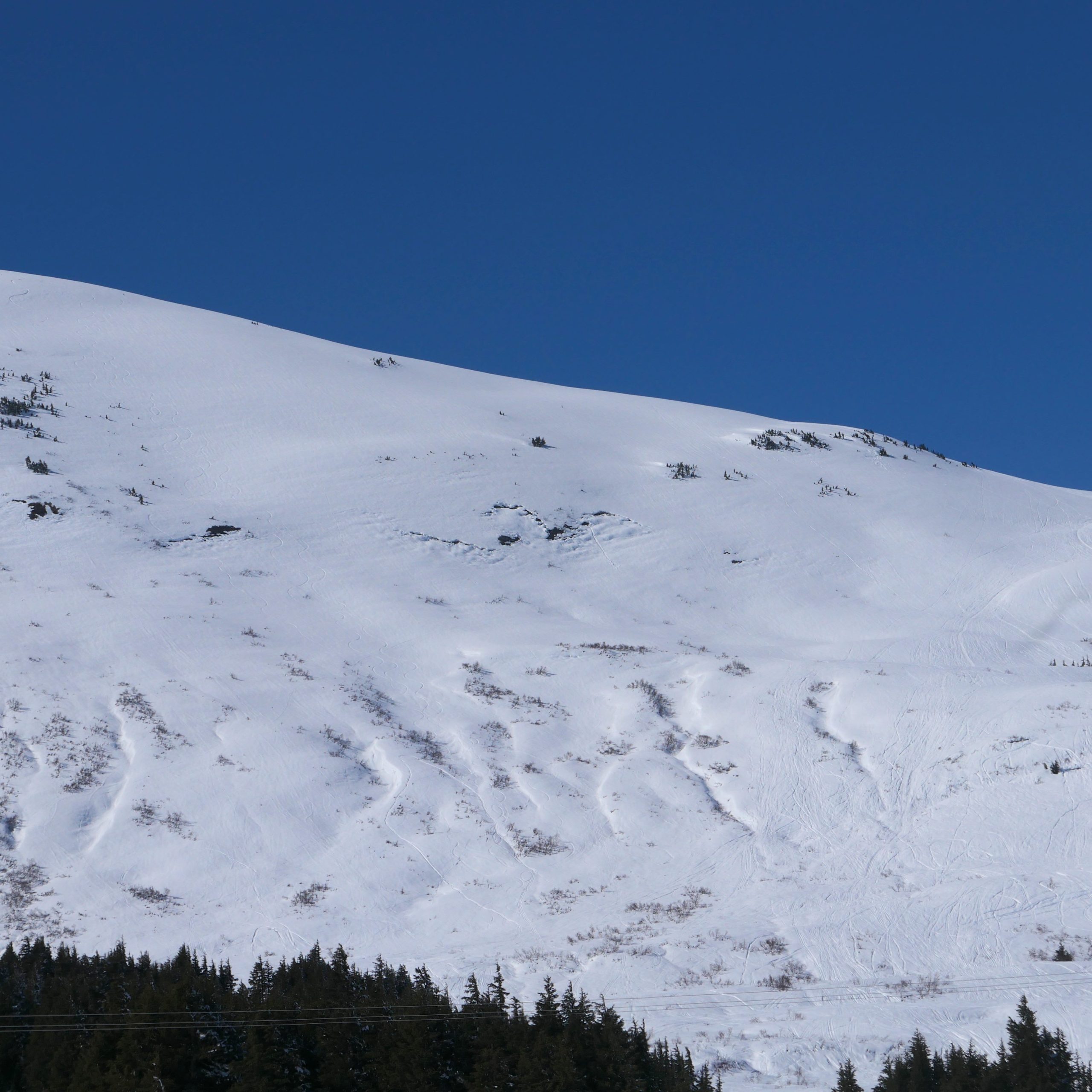
Debris from loose snow avalanches in Todd's Bowl. 04.24.2023
Glide crack on Repeat Offender, immediately above the Seattle Ridge uptrack. 04.24.2023
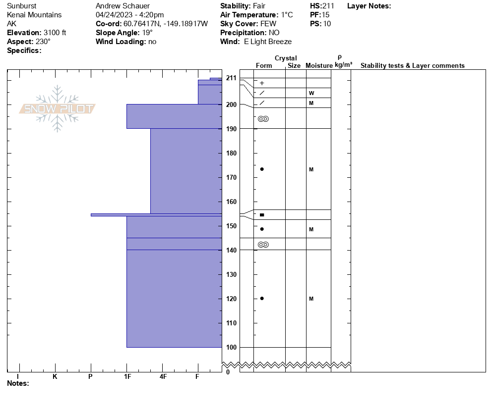
Detailed snowpit information. 04.24.2023