| Recent Avalanches? | Yes |
| Collapsing (Whumphing)? | No |
| Cracking (Shooting cracks)? | No |
Observation: Turnagain
Location: Sunburst
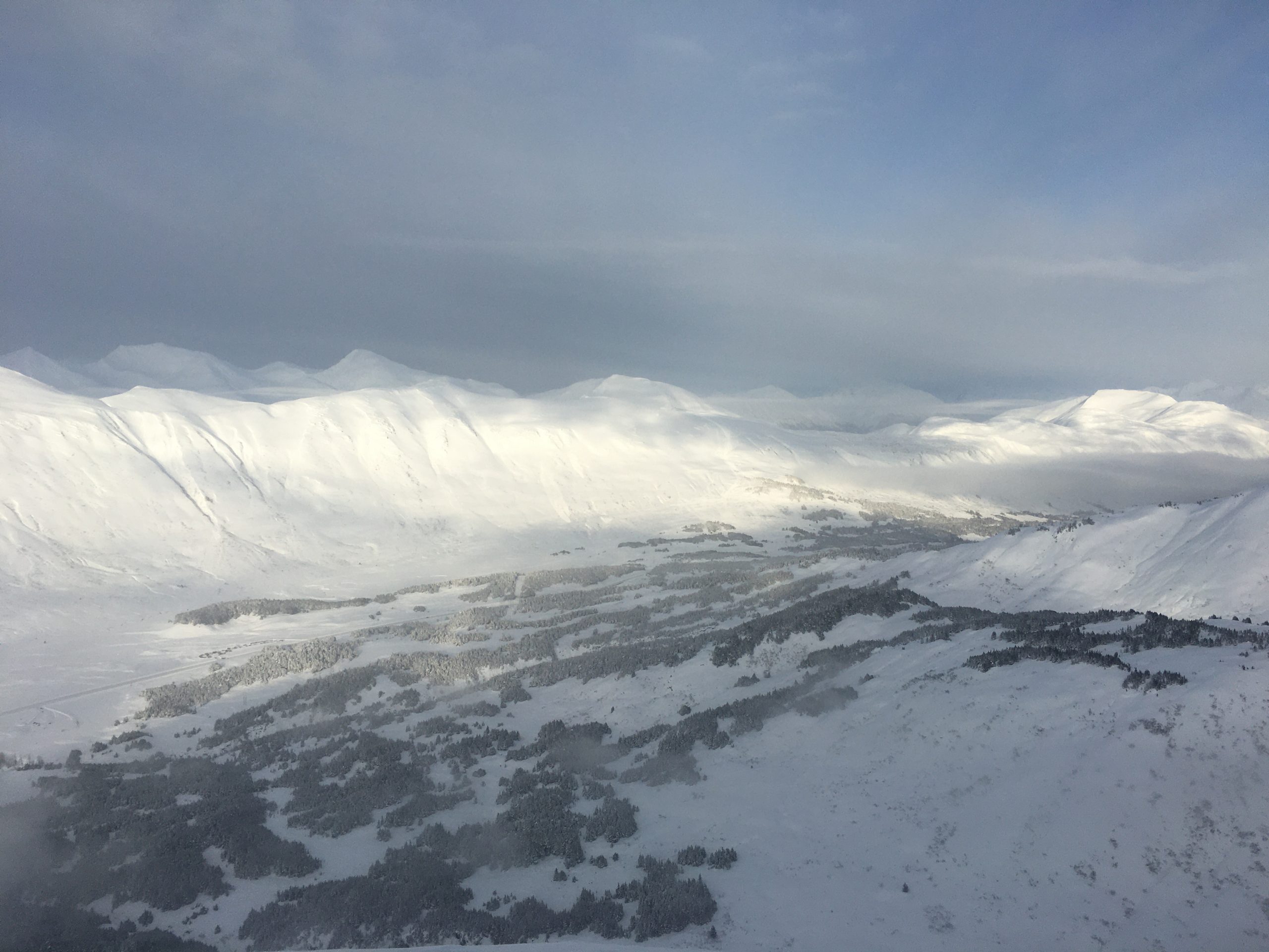
Toured up to 3100′ to get an eye on recent and mid-storm avalanche activity, and to try to collect some more info concerning the New Year’s crust. We saw the aftermath of a lot of avalanches that had released sometime during the middle of the storm over the past two days. This included multiple natural avalanches on Seattle Ridge, a very large avalanche that covered most of the west face of Magnum, and multiple avalanches ocurring on slope angles in the low 30’s on Sunburst and Taylor Pass. All of this seemed to occur mid-storm, with debris piles and crowns covered by a few inches of new and wind-drifted snow. All of the activity appeared to be within the storm snow or at the interface between new and old snow.
Obvious signs of instability
Observer Comments
Widespread natural cycle with large avalanches on Seattle Ridge, Tincan Proper, the Library, Sunburst, Taylor Pass, and Magnum. The slide on Magnum was probably 800' wide, 1000' vertical, and debris was over 10' deep in some places. One of the avalanches on Sunburst had parts of the start zone with slope angles at 32 degrees, and it is a slope that a lot of folks tend to think of as a safer slope. All of the activity appeared to fail on storm snow interfaces.
Weather
Clouds were in and out, with some periods of sun in the middle of the day. A low cloud in the valleys began to move in around noon. Winds were calm with the occasional light breeze.
Snow surface
Breakable crust up to 1" thick at elevations up to just above 1000'. Storm snow totals were 1-1.5', with wind loaded areas in the range of 2-3' deep.
Snowpack
For most of the area, the only noteworthy layer in the upper 2-3' of the snowpack was a very thin (~2mm) and brittle crust that formed when temperatures were warm on Wednesday afternoon. This was anywhere from 6-18" deep, depending on whether slopes had been scoured by wind or not. The New Year's crust was as shallow as 2' deep on a wind-scoured ridge, and upwards of 6' deep where winds had been loading snow. This layer gave mixed results in our pit tests, and none of the recent avalanches looked to have stepped down to this layer. More snowpit info in attached snow profile.

Wind-textured surface with a shooting crack from a natural avalanche just out of view. Photo: Brooke Edwards. 01.29.2022

Wind-textured surface in the foreground, with a natural avalanche in the background. 01.29.2022
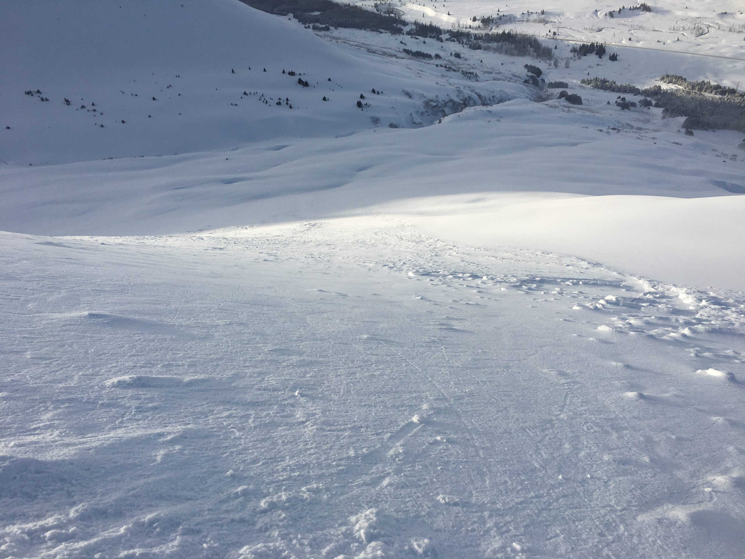
Looking down the path of a natural avalanche that ran far on a fairly low-angle slope (low 30's). 01.29.2022

A little sample of the brittle 1/26 crust in the upper snowpack, with decomposing stellars on either side of it. The stellars above the crust were the weak layer in the avalanches we saw up close on Magnum and Sunburst. 01.29.2022
Fresh natural debris on Seattle Ridge in the gullies just to the south of the motorized uptrack and Repeat Offender. 01.29.2022
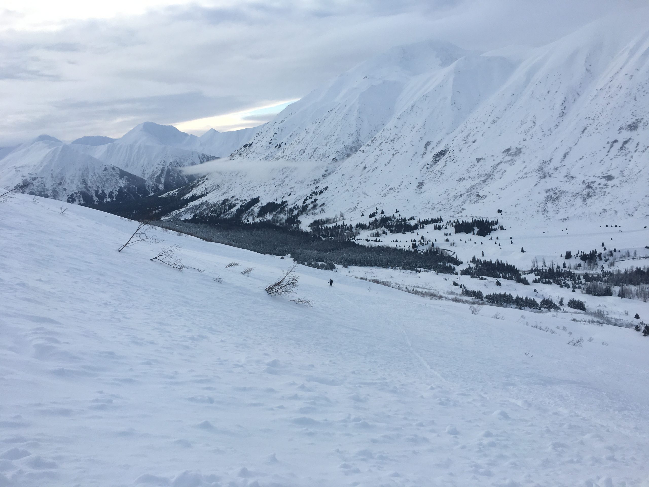
Brooke skiing across part of the debris pile from a large avalanche on the west face of Magnum. 01.29.2022

Natural avalanche on Taylor Pass, taken by another group. Thanks for helping us put in the skin track! 01.29.2022
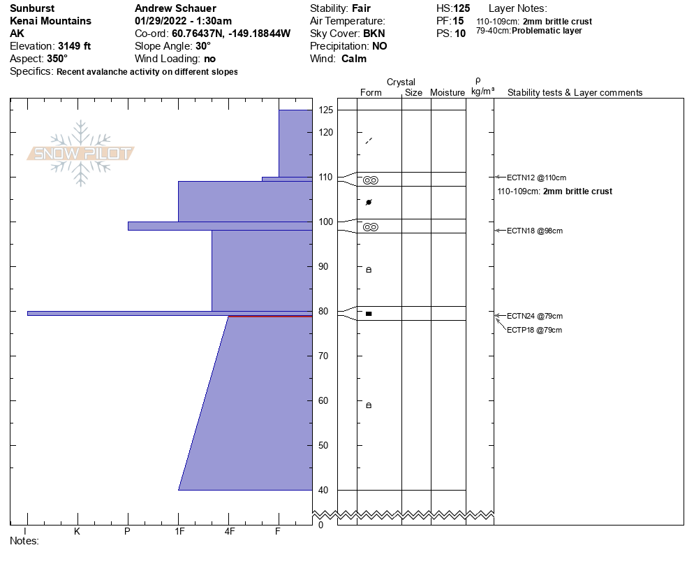
Snowpit profile from a N aspect at 3100'. 01.29.2022