| Recent Avalanches? | Yes |
| Collapsing (Whumphing)? | No |
| Cracking (Shooting cracks)? | No |
Observation: Turnagain
Location: Sunburst
Sunburst to 2700′
Obvious signs of instability
Observer Comments
Midday winds transported snow off the Magnum ridgeline.
A thin slab - ~9-12" - and crown was visible on Magnum's NW shoulder around 2000' in elevation, which was slightly blown in. Guessing this was from the past few days, but hard to see in the shadows...
Debris from a recent avalanche was also seen from the Girdwood gas station off Raggedtop, with a barely visible crown on a S aspect at ~2500'.
Weather
COLD. Zero to single digits below zero.
Few clouds in the morning, transitioning to clear by afternoon
Light but steady winds from the NW above 2000', occasionally coming from the SE (perhaps due to terrain)
Snow surface
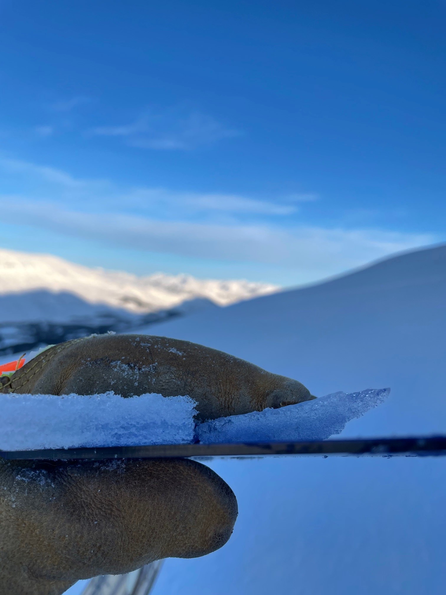
2-4" of soft snow sat over the layers of crust that froze around 12/28. A thin wind skin and some wind redistribution of this snow was present above 2000' on the route, which went up a more sheltered SW aspect than usual. The winds had clearly scoured the standard route that takes the ridgeline up from ~2200', and wind affect was obvious from across valley on the Seattle Ridge ridgeline (see photos below).
Snowpack
Under those 2-4" of soft snow along the route, the crusts - almost always plural - changed by elevation, and were thicker/more stout as we gained elevation. Photos and a description of each is below, but generally we found the top of these crusts to be breakable, and ski penetration to be just below the top crust from the Dec 26-28 meltdown. Boot penetration was deeper, down 6-8" except for at the parking lot where it was 18".
We stopped at 2700', where a previously wind loaded location had a crust that was so stout it was difficult to kick into with ski boots... but this was a rare exception up to this point.
As a final note, digging quick pits revealed a great amount of variability in crust thickness and the distance between crusts, even in locations just a few feet apart. Rain and water from the surface clearly had a creative time finding old layers in snow that was present before 12/26, particularly where we turned around.
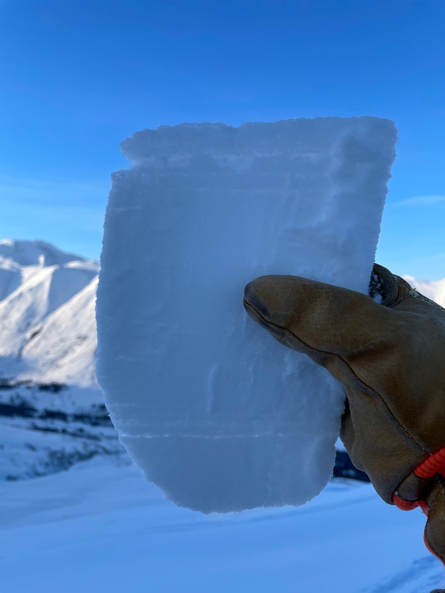
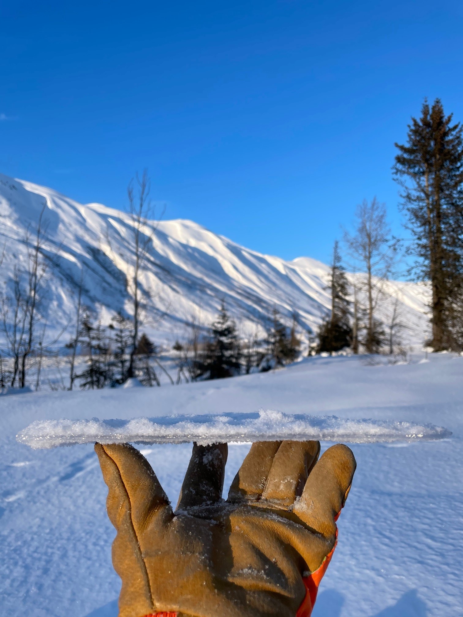
2700’ – previously wind loaded location: This block was cut from where we had trouble kicking in with ski boots. The entire sample pictured was generally knife hard, with the occasional softer layer between thin clear crusts.

2500’ – At this elevation, in a semi-sheltered location for the elevation, 2-3 melt freeze layers were present with large (1mm+) grains in the top 50cm of the snowpack, and occasionally a melt freeze layer would include several thinner crusts that would separate with gentle handling. The snow removed in this photo (to show layer location) was 1 finger + hardness. While there were some pockets of softer snow in our quick pit, these layers didn’t seem to be continuous.
2000’ – semi-sheltered location: Two thicker crusts, close together but with some variation in distance between. The thicker crust was on the surface, with the thinner one below it. These generally sat on 1 finger hardness snow.
1500’ – sheltered location: Very similar crusts to 1000’, except ~3cm of soft snow separating the two crusts.
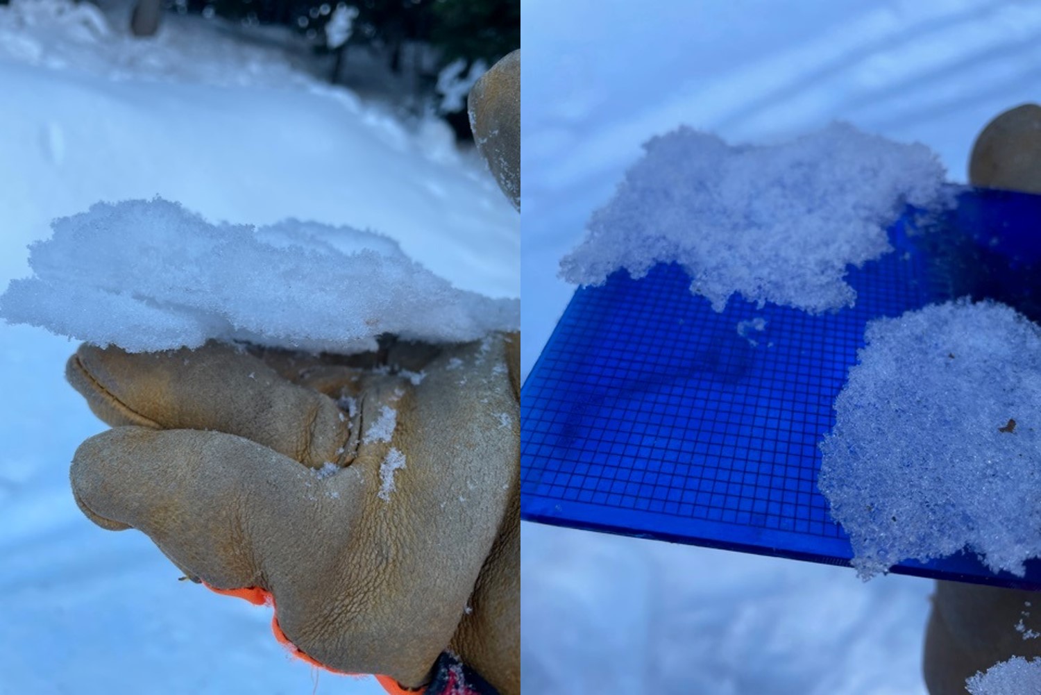
1000' - sheltered location - Generally, two thin (~2mm) melt freeze crusts, separated by <1cm of soft snow. The crusts here and at 1500’ appeared to have some space between grains, as pictured on the crystal card.
600' - parking lot elevation - 1-2 thin, clear, and fragile 2mm crusts, generally 2-4" from the surface. Occasionally the deeper of these crusts would be found down 8-10", and they were surrounded by soft, 4 finger or fist snow.

The winds scoured the NE aspect on Seattle Ridge directly across from Sunburst, but left some soft snow on this SE aspect. Other SE aspects showed clear wind affect even from the road further north on the ridge.
Wind transport off Magnum midday, for ~30 minutes.

Day(s) old slide on Magnum, as referenced above.
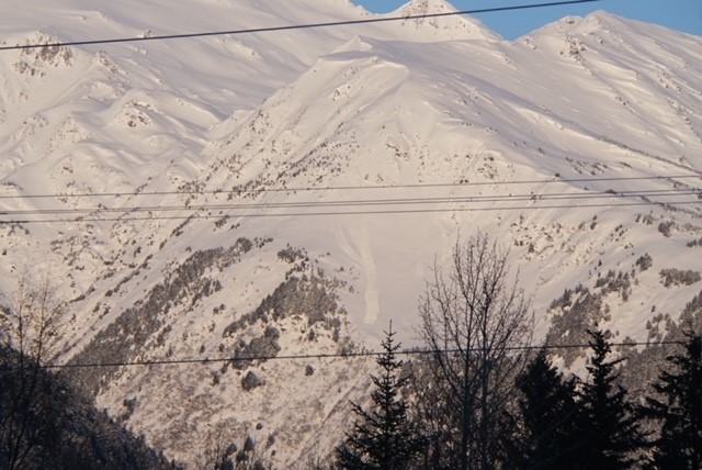
Recent slide on Raggedtop - a S aspect, ~2500' on the ridge extending towards the highway - as referenced above.