| Trigger | Natural | Remote Trigger | 0 |
| Avalanche Type | Unknown | Aspect | Unknown |
| Elevation | unknown | Slope Angle | unknown |
| Crown Depth | unknown | Width | unknown |
| Vertical Run | unknown |
Avalanche: Turnagain
Location: Sunburst
Standard route to 3200′. Overall freeze was more significant than expected. Melt-freeze crust was supportable to around 2500′. Clouds in the am and light winds helped surfaces stay cooler than forecast. Alpine temps also stayed cooler than forecast. Cornices are the largest they have been all season… Other observers in the area reported small wet loose activity on steep solar aspects late in the afternoon in the Alpine
No new wet slab or deep slab avalanche activity observed. A couple new glide avalanches observed that may have been from Sunday or early Monday.
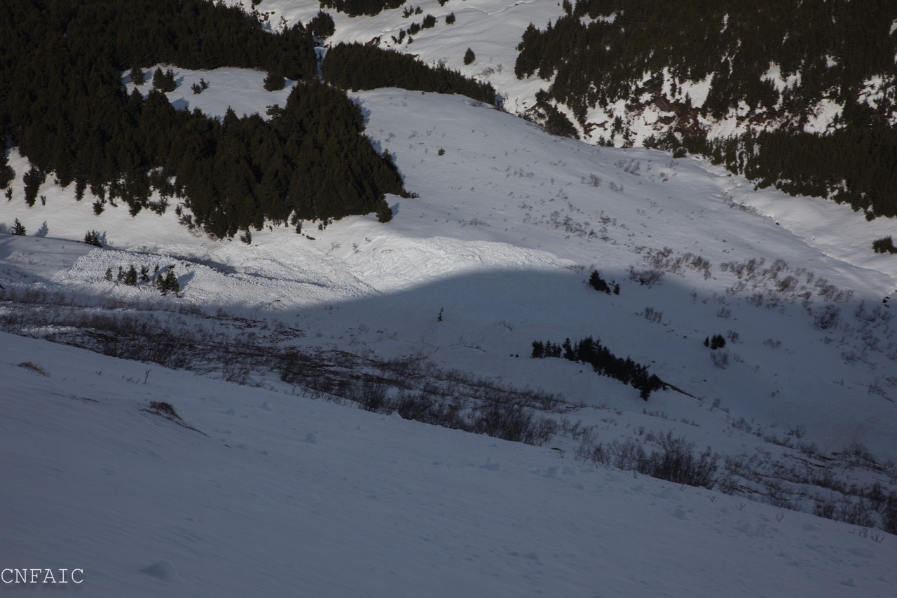
Of note: During road obs back to Girdwood there was a very deep crown from the avalanche cycle observed on peak just north of Boggs Peak. (See image)
Obvious signs of instability
| Recent Avalanches? | Yes |
| Collapsing (Whumphing)? | No |
| Cracking (Shooting cracks)? | No |
Observer Comments
Avalanches from the wet slab and glide cycle of the past few days
Weather
Partly sunny with some high overcast
Light SE winds
Temps in the 30Fs at 1000', 20Fs in the Alpine
Snow surface
Supportable melt-freeze crust to 1500' at 11:00 am. Underneath crust boot pen to knee. Soft saturated snow at 4:30 pm no crust. Boot pen to thigh
Supportable melt-freeze crust with a trace of snow to 2000', punchy crust at 4:30 on anything with a slight southerly tilt, distinct runnels to 2500'. Roller balls across slope
Supportable melt-freezeCrust with a couple of cms of new snow to 2700' softening on southerly slopes at 4:00 pm
Breakable melt-freeze crust with 1-2" of new snow to 2900', new snow starting to get moist on southerly tilted steeper slopes
2900'-3200' 1-2" of new snow on dense snow, new starting to get moist on southerly tilted steeper slopes. Large roller balls from storm across upper slope. New small roller balls from skis on descent.
See crust images.
Snowpack
HS: 900', 90 cc very moist snow below crust
HS: 1500', 100 cm very moist snow below crust
HS: 2000', 130 cm moist snow below crust
Snowpits: Dug down just over 1 M in both
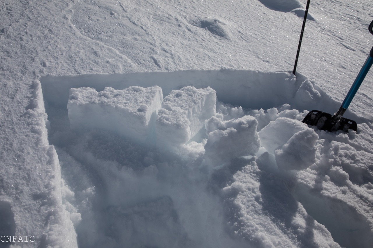
HS: 2700', 160 cm to deeper than 280 cm probe (See pit image) HS @ pit: 190 cm March 8th interface 80 cm down. MLK bsh 100cm down, DT 23 SC, STM. Layers of very moist to moist snow between crusts, water percolation evident in upper snowpack
HS: 3100': 190 cm to deeper than 280 cm probe (See pit image) HS @ pit: 305 cm March 8th interface 100 cm down (no test results), very moist snow 30 cm down from surface under most recent snow.

Crust @ 900' at 11 am. Punchy underneath by 4:00 full leg boot penetration at same location

Crust @ 1500'

Crust @ 2000'
Crust at 2700'

Pit @ 2700'

Pit @ 3100'

Slides off of Tincan Ridge, Tincan Proper and in the Library

Avalanches in the Library
Looking towards Taylor Pass
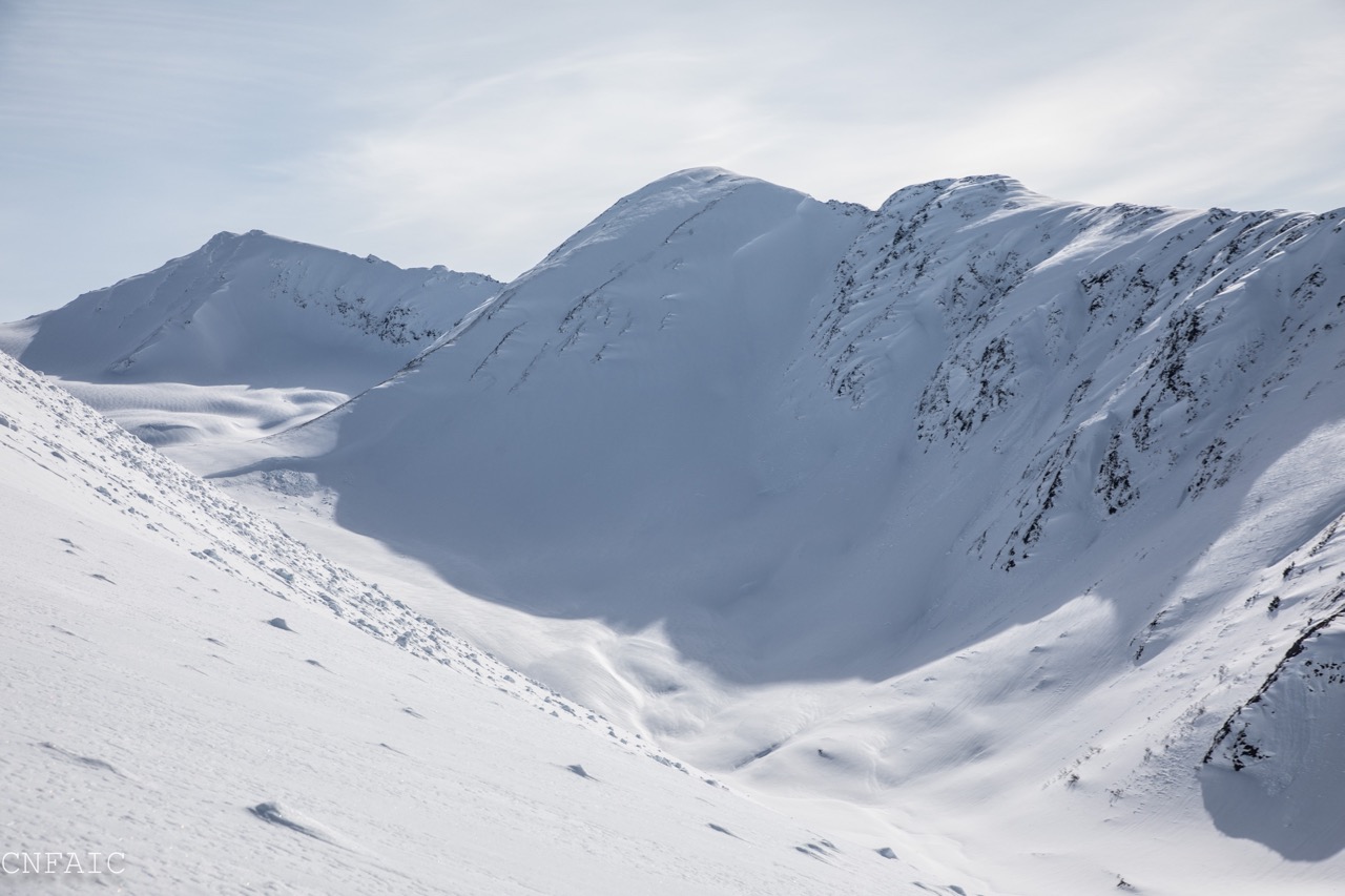
Avalanche debris below the north side of Sunburst

20 Mile deep crown on peak north of Boggs Peak