| Recent Avalanches? | Yes |
| Collapsing (Whumphing)? | No |
| Cracking (Shooting cracks)? | No |
Observation: Turnagain
Location: Sunburst
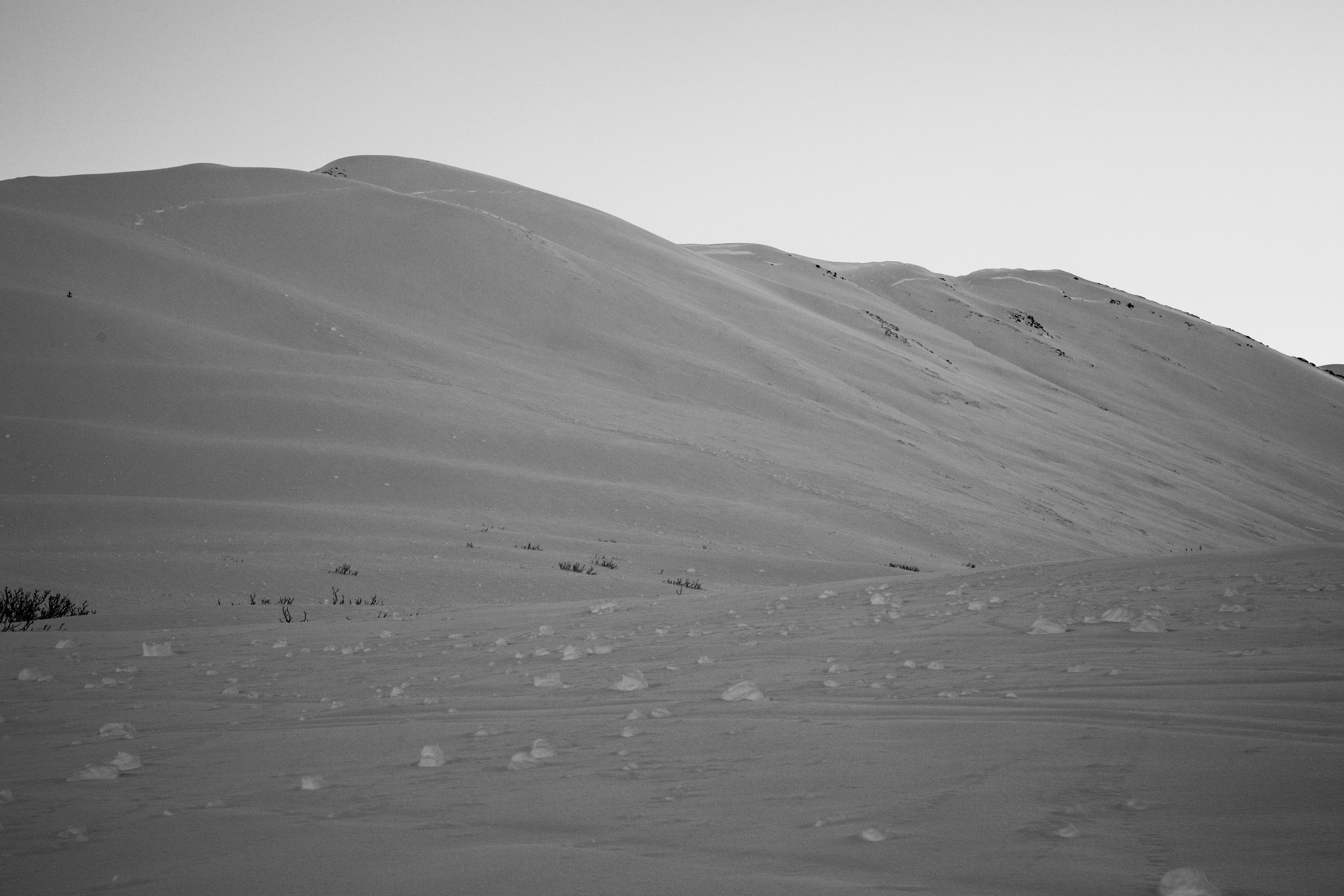
Ascended Sunburst, standard route, West Ridge to investigate a very large (D3) natural avalanche on the SW face of Sunburst that occurred mid-storm (1/15 -1/17.) This avalanche wraps around the Western upper shoulder all the way to the gully below the weather station with debris filling up Taylor Creek. We found the New Year’s buried surface ~3′ below the surface to be intact and reactive in stability tests. This was the only layer of concern we found in the top 120cm of the snowpack.
Above freezing temperatures accompanied the 1/15-1//17 storm and rain was estimated to have reached around 3000′ mid storm. Near the end of the storm temps cooled and rain/snow line dropped to about 1500′ yesterday morning. We also wanted to see how this wet layer is freezing into a crust as we ascended.
Obvious signs of instability
Observer Comments
The natural avalanche on Sunburst was largest avalanche and crown observed in Turnagain. Seattle Ridge SE face had debris in most gullies, as noted 1/16 and several of the crowns were visible today with good light. There was a storm slab on S face of Tincan proper as well as many small debris piles at the bottom of these chutes.
Weather
Clear skies
20-25F
light winds
No precip
Snow surface
*New surface hoar found at all elevations and more developed in the alpine (~4mm)
1000'-1500 - supportable 3" melt freeze crust with moist snow below
2200' - 6" new snow on 2" melt/freeze crust with moist snow below
2700' - 12" new snow on wet layer, when exposed to air became a 1" crust.
3300' - Did not find any crusts in top 120cm of snowpack
Snowpack
We dug a pit at 3300', just above the crown face. HS=203cm, W aspect, 37* slope. Test failed on a layer of 1cm buried surface hoar that was buried by the New Years storm. This layer was standing up in pit wall and was between two dense layers (pencil below and 1 finger above) Tests results on this layer: CT28, CTN, CT9, ECTX, PST 35/100 End. Old ski tracks on the BSH layer may have factored into our varying test results. We also had moderate CT scores on density changes within the new storm snow between 30 and 50 cm below the surface w/ no propagation within these layers.
*We also tried to dig into the crown face, but were unable identify the BSH layer and couldn't tell if we were actually digging into the new snow that had filled the crown area. Our best guess is that the avalanche occurred on the New Years BSH layer.
Sunburst Natural avalanche D3 from 1/15-1/17 storm

Debris in Taylor Creek
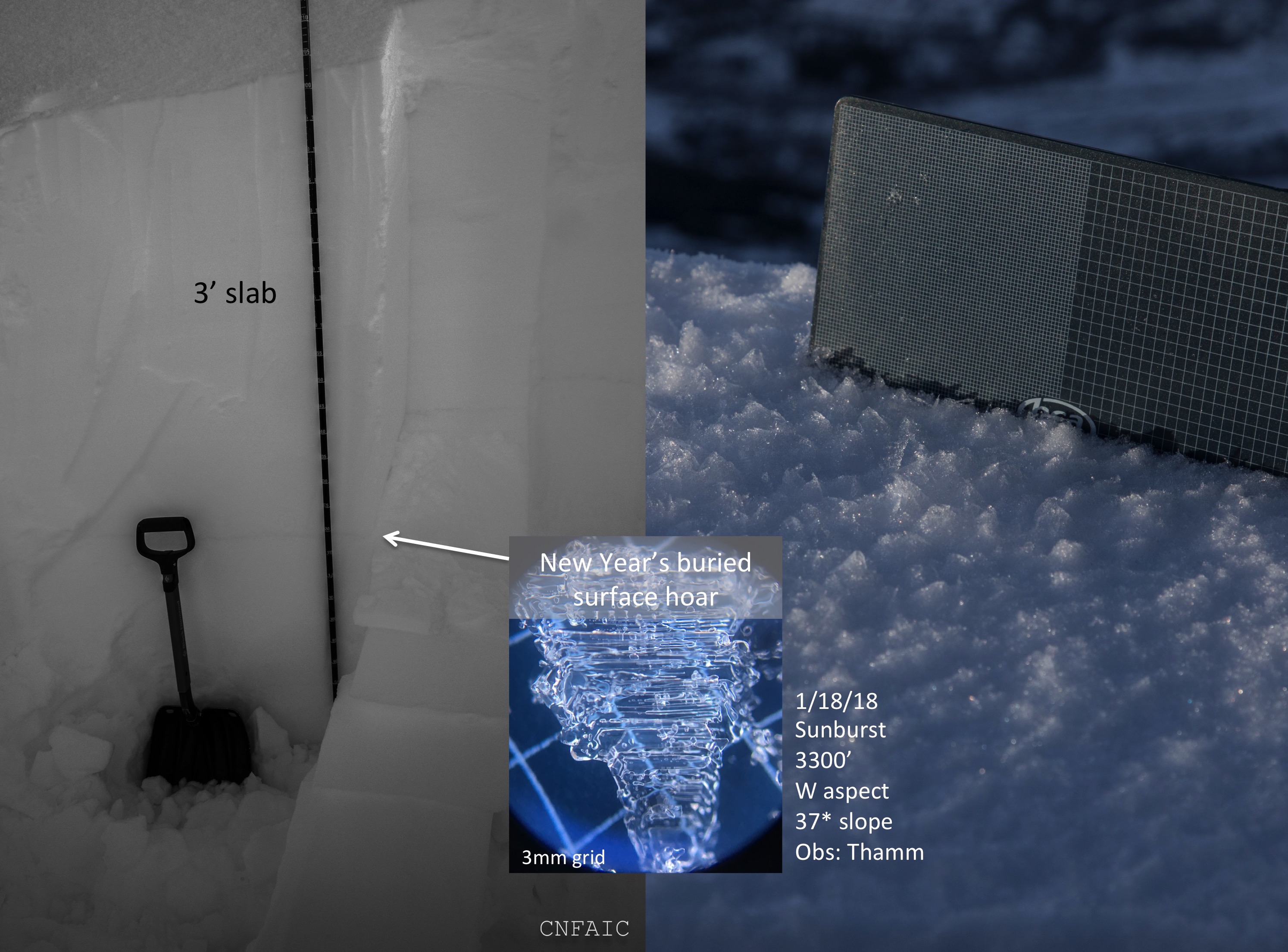
Layer of suspect in this avalanche is the New Years buried surface hoar

Pit location near a crown that wraps around the West Ridge to where the normal skin track usually
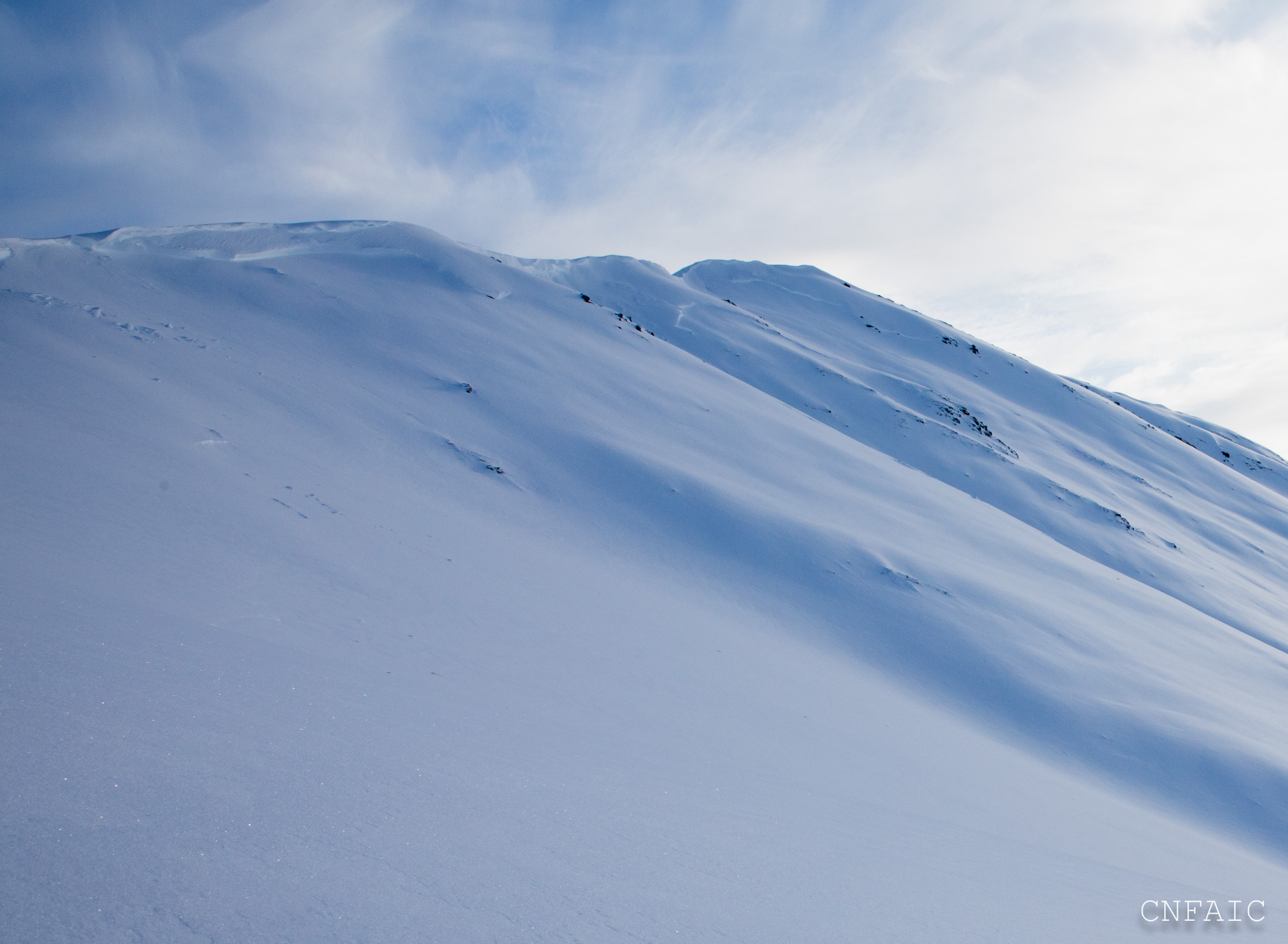
Crown along the upper part of the Sunburst Ridge just below the cornice.
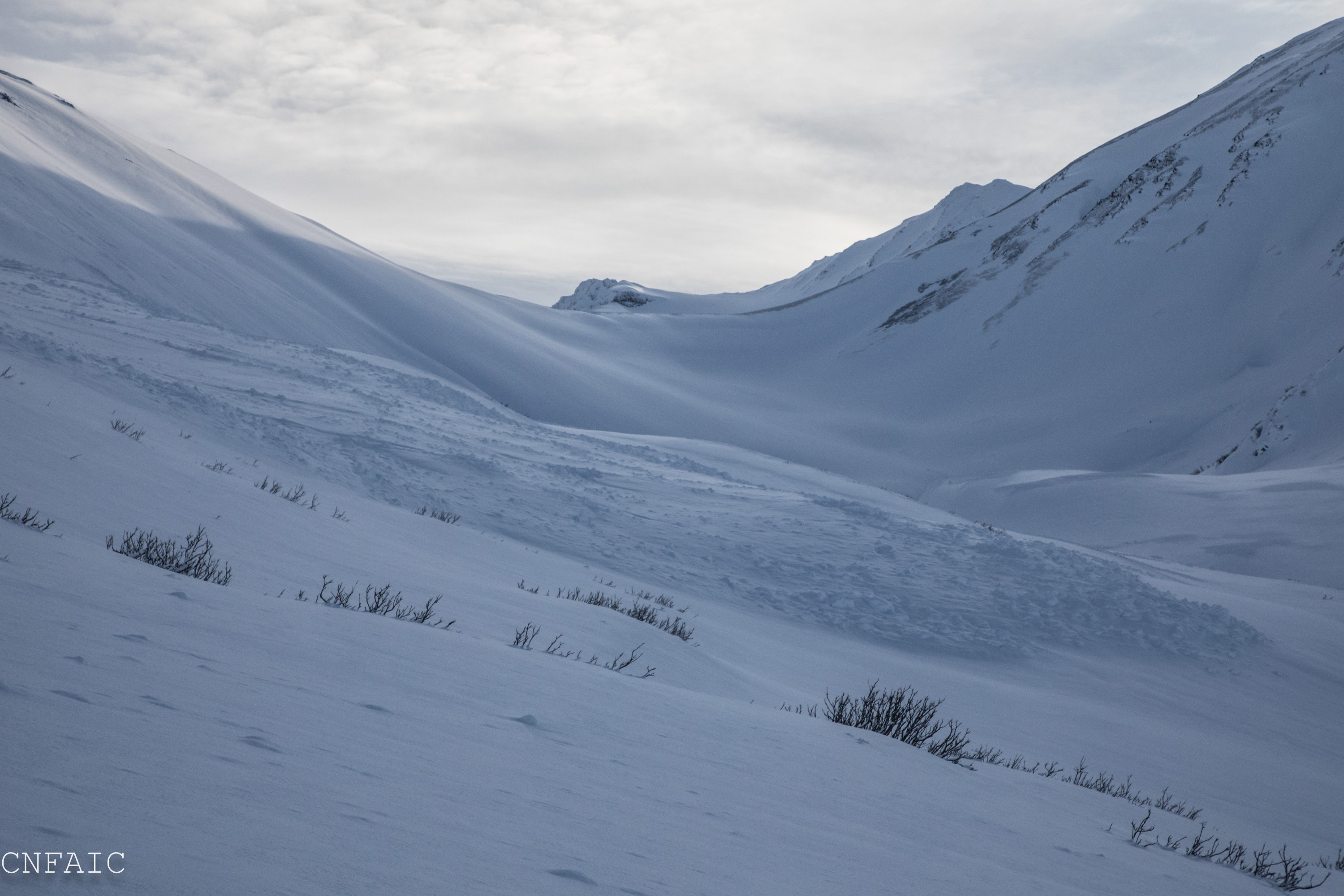
Debris looking back towards Taylor Pass

Crust with new snow from the end of storm cycle

Crown seen in prominent shaded gully on Tincan Proper with small debris piles at the bottom of most of the gullies

Recent avalanches on Seattle Ridge observed originally on 1/16