| Recent Avalanches? | Yes |
| Collapsing (Whumphing)? | No |
| Cracking (Shooting cracks)? | No |
Observation: Summit
Location: Summit Peak, Butch Peak, Tri Tip
Summit Lake Area (Summit Peak, Butch Peak, Tri Tip) -Natural avalanches and possible human triggered avalanches past 24hours….Widespread avalanche activity due to wind loading mid to upper elevations on all Aspects.
Obvious signs of instability
Observer Comments
Natural Avalanches over the past 24hours due to wind loading on East, Southeast and Southwest aspects...isolated areas of wind loading still going on.
Possible human triggered avalanches on Summit Peak...small shallow slab D-1 -elevation 2800-3000', East aspect recently wind loaded. A fresh skin track and ski tracks were observed just below these small wind slabs.
Wind slabs are proving to be reactive due to active wind loading and could be triggered by skier/riders who venture into avalanche terrain (slopes steeper than 30 degrees.) Avalanches range from D-1 to D2.5 depending on location and amount of loading that has occurred on specific slopes. Many of the avalanches are failing on existing weak layers within the older snowpack including near the ground on basal facets/depth hoar layer.
Weather
Clear, Cold, and Winds still out of the Northwest
Snow surface
Upper Elevations are wind affected with areas of newly formed sensitive wind slab.
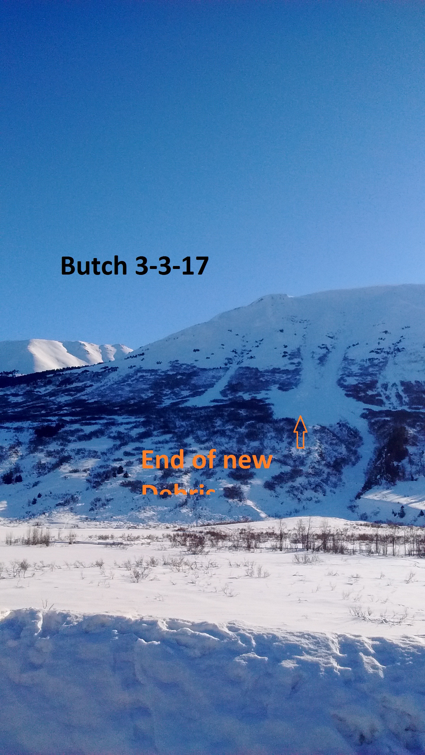
Butch Peak Avalanche....observed by people in the area avalanching at 1600-1630 March 2nd
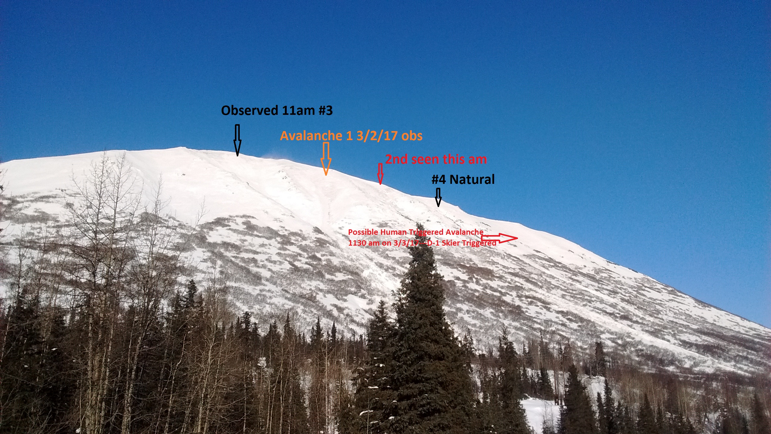
Numerous natural avalanche activity on Summit Peak due to windloading past 24 hours with one avalanche occuring earlier during wind event.

Tri Tip ...SW aspect recently avalanched past 24 hours during wind event.