| Trigger | Natural | Remote Trigger | 0 |
| Avalanche Type | Wet Slab | Aspect | West |
| Elevation | 3000ft | Slope Angle | unknown |
| Crown Depth | unknown | Width | unknown |
| Vertical Run | 1000ft |
Avalanche: Summit
Location: Summit Lake Road Obs
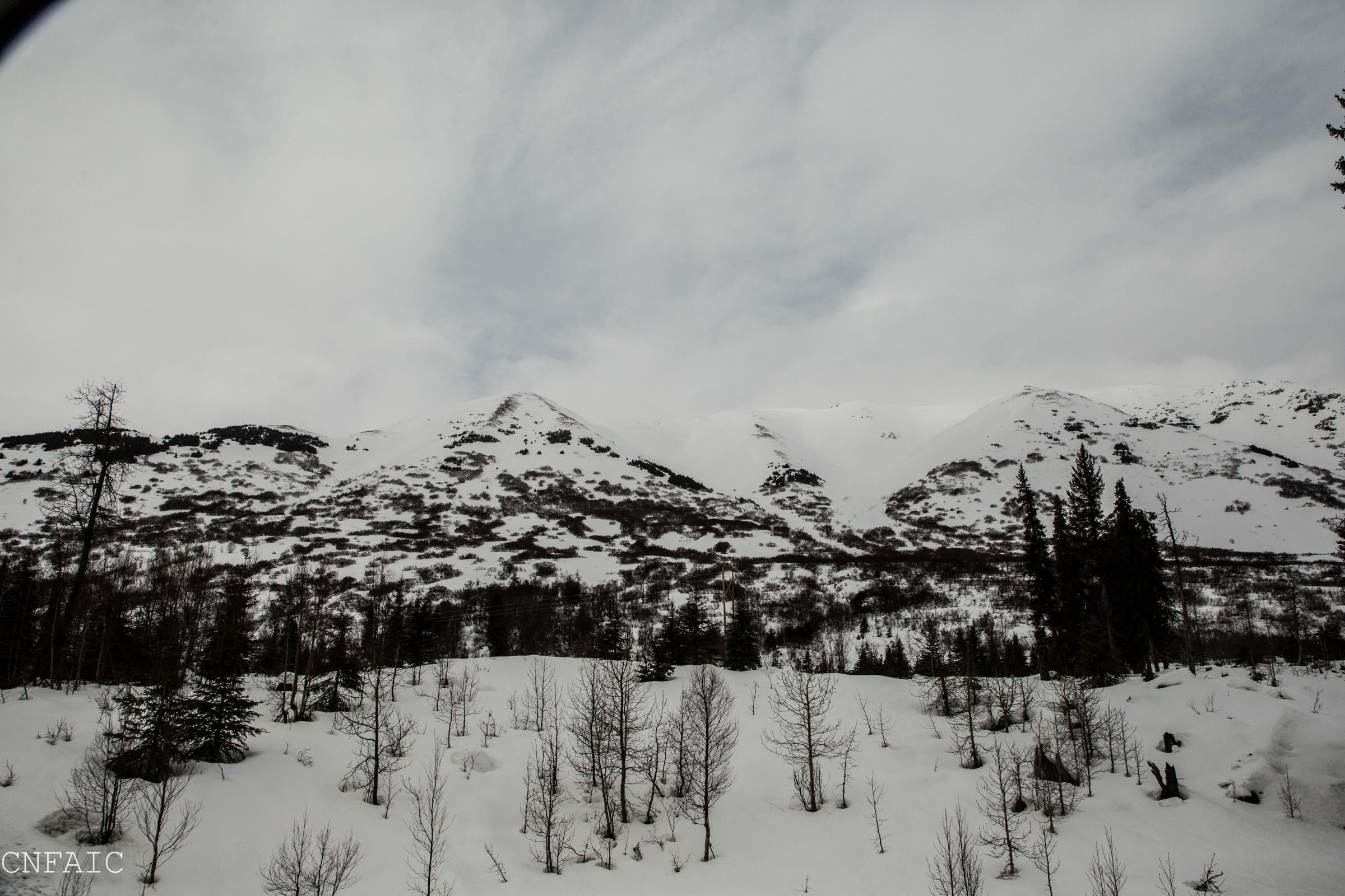
Drove through Summit Lake between 12pm and 12:45pm. We witnessed a natural avalanche in motion on the West face of Tri-Tip, debris came to a stop ~200 vertical feet above the lake elevation. There was evidence of wide spread avalanche activity on Moose Mountain West, North aspects and South face, Tenderfoot SW face. Visibility was descent, and couldn’t see any new activity on East facing aspects of Fresno, Colorado, and Summit.
Avalanche Details
See photos below. Witnessed Natural in motion on Tri-Tip West aspect. Debris ran on top of older debris, but stopped 200' above the lake.
Obvious signs of instability
| Recent Avalanches? | Yes |
| Collapsing (Whumphing)? | No |
| Cracking (Shooting cracks)? | No |
Observer Comments
Recent avalanches
Above freezing temperatures (44F at Summit Snotel)
Raining
Weather
Temps at 12pm were 44F at Summit Snowtel (1400') and 30F at Summit Mile 45 (3800')
Winds were light from the NE
Sun was poking through cloud cover at times, but skies were mostly obscured
Lightly raining
Snow surface
Wet snow at road level
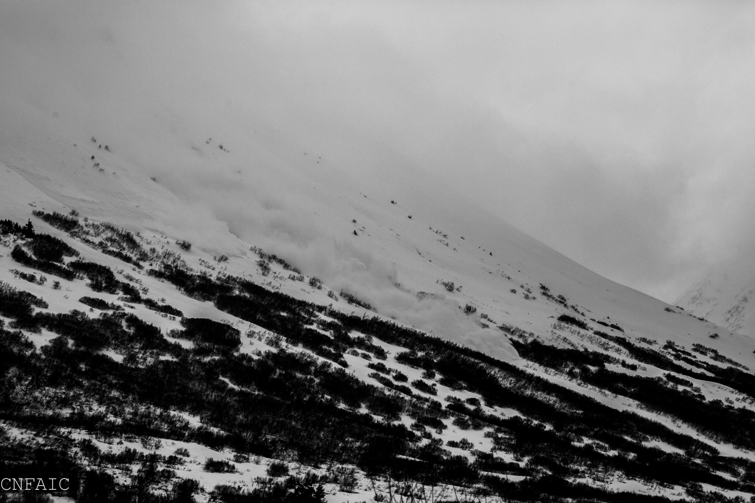
Avalanche in motion on West Face of Tri-Tip
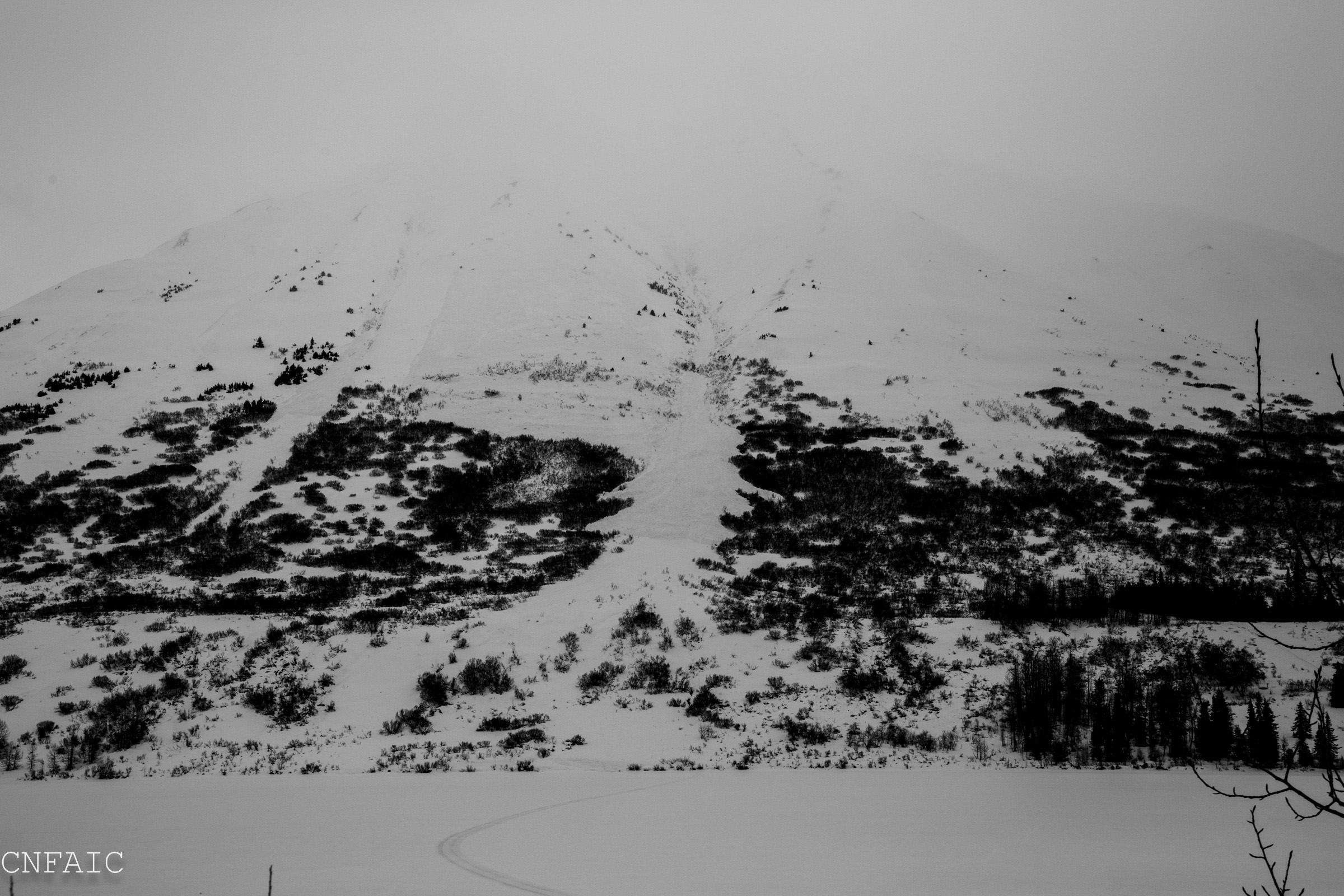
Debris from witnessed avalanche on Tri-Tip came to a stop above Lake

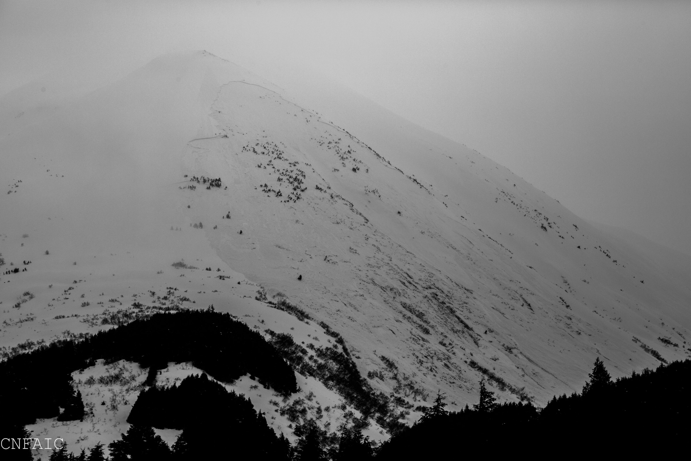
Close up of debris from Tri-Tip avalanche.

Natural avalanche on SW face of Tenderfoot
Natural on S face of Moose Mtn

Widespread crowns and debris on W face of Moose Mountain

Close up of crowns on SW shoulder of Moose Mountain

Widespread crowns and debris on North aspect of Moose Mountain.
East face of Fresno didn't have any new activity, but could see older crown/debris from an avalanche from last Sunday.