Recent Avalanche Activity: None in the Past 24 hours
Avalanche Activity over the past week: Yes.
Wind loading: None observed today. Previous Wind Loading on 2-16-2015.
Mountain weather:
Fresno (elev.3440): Temperatures 21-27F
Winds: Calm 1-6mph Gust to 11 MPH N-NW
Summit Lake: Temperatures Low 14F High 34F (As of 2Pm)
Snow Depth: 8″
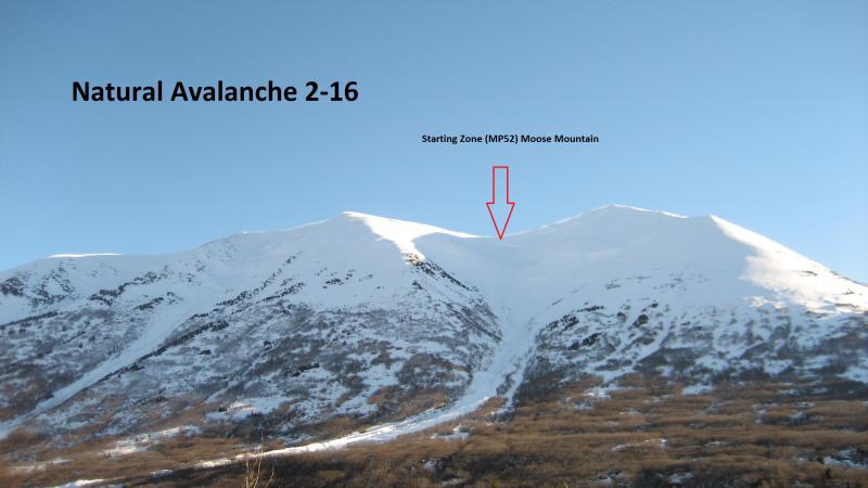
Today has clear conditions giving a good view of avalanche activity over the
past week with the majority of the avalanches happening on or before 2-16
(South and West aspects). Earlier in the week Summit Received 0.4″ of
precipitation as rain at lower elevation and snow at higher elevations. High
winds earlier in the week transported snow at upper elevations and natural
avalanche activity was seen then.
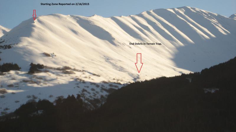
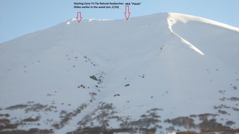
Overall very thin snowpack at lower elevations with grass and brush still
showing. At higher elevation new thin slabs formed on top of crust layer
and/or facet crust layer. See pictures below for avalanche activity earlier in
the week. Most of these avalanches travelled into lower angle terrain and the
one on Tenderfoot this week ran into a terrain trap as well.