| Trigger | Natural | Remote Trigger | Unknown |
| Avalanche Type | Unknown | Aspect | South |
| Elevation | 3500ft | Slope Angle | unknown |
| Crown Depth | unknown | Width | 500ft |
| Vertical Run | 1000ft |
Avalanche: Summit
Location: Summit Area
Colorado to 2300′ on a generally SE aspect
Avalanche Details
See photos below for examples and the largest slides, including:
Moose: Numerous D2-3 on south to west aspects.
Lodestar: D3 on west aspect from ridgeline, with a deep crown
Areawide: D1.5 - D2 slabs generally well below ridgeline or at treeline - small debris piles evident up valleys to the west of Colorado under slopes where we couldn't see the start zones. Examples from Spirit Walker and Wilson South below.
Obvious signs of instability
| Recent Avalanches? | No |
| Collapsing (Whumphing)? | Yes |
| Cracking (Shooting cracks)? | No |
Observer Comments
Some world class, deep sounding whumphs at 2300' as we approached trees at the top of our route. For one where I was standing still - triggered as my partner was at a shallow spot near trees - I felt the snowpack drop a solid inch under foot! Willows would move 100+ yards away... these ones went a long distance. No formal stability tests, but a quick dig revealed large facets/depth hoar at the bottom of the snowpack, under about 100-120cm of snow at this elevation, along with some fairly subtle density changes above that... so I'm guessing we found thinner spots that reached the facets at the ground for these whumphs.
Weather
Clear, temps in the teens, light occasional winds from the north
Snow surface
4-6" of ski penetration along the entire route, with 3-6mm surface hoar in areas not sheltered by trees. Boot penetration of your waist at transition points at 2300' and 1800'. A thin crust from the New Years storm was ~3" below the surface up to 1500' but dissipated after that!
Snowpack
No formal stability tests.

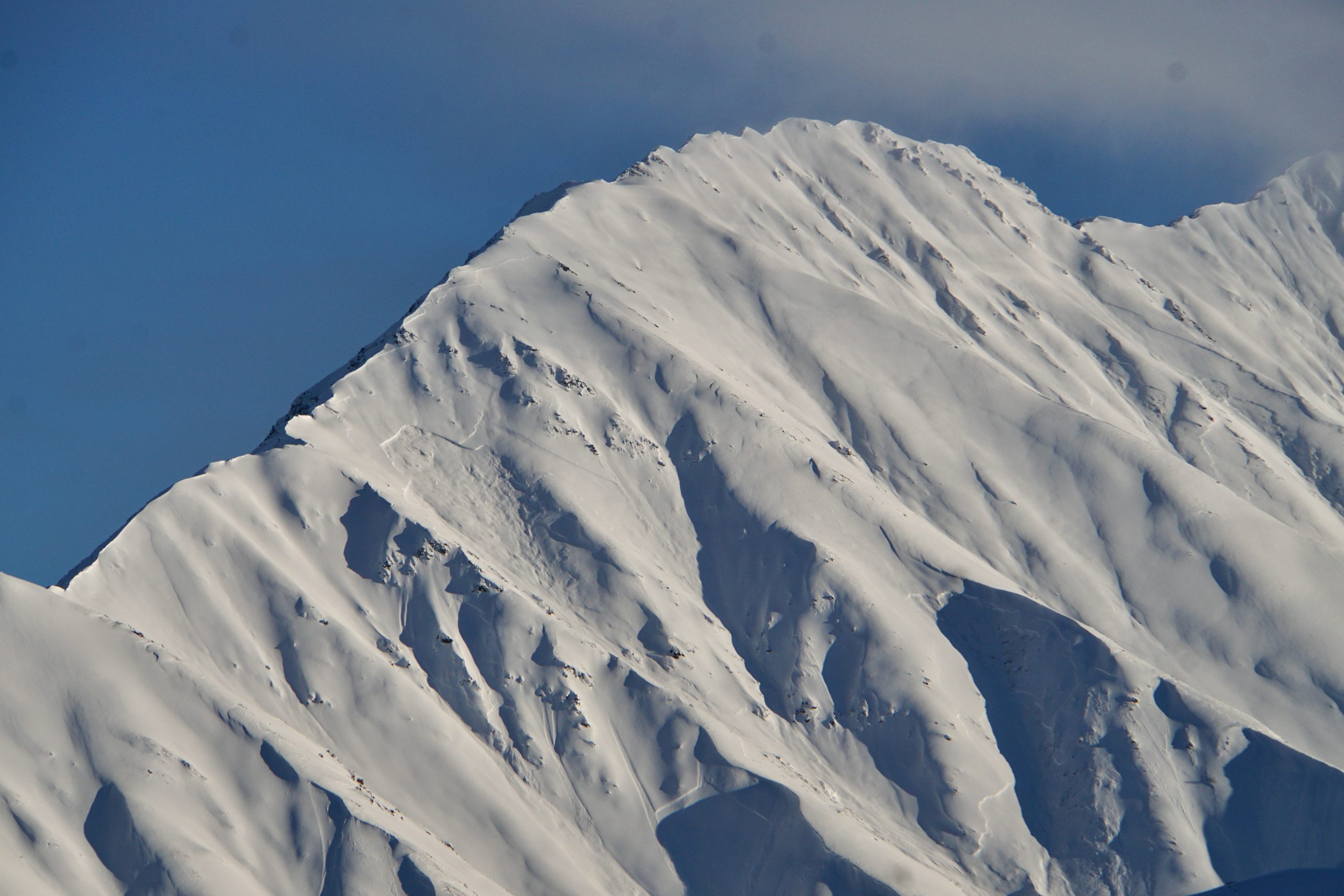
West aspect very large slab on Lonestar

While most avalanches appeared to be failing within the snowpack, this slab on a NW aspect of Butch appeared to run deeper, exposing the ground.
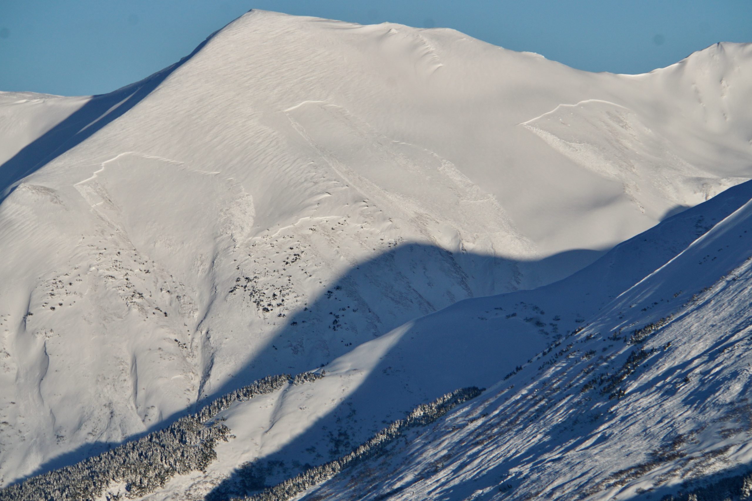
A cluster of D2.5 - D3 slabs on the south aspect of Moose, as seen from Colorado, five miles away

Slabs along a good chunk of Roaring Ridge above treeline, along with another large crown back in the drainage between Moose and Roaring Ridge
... continuing our pictoral tour of Moose Mountain, we now go to the north of the repeater site for some more large to very large crowns!
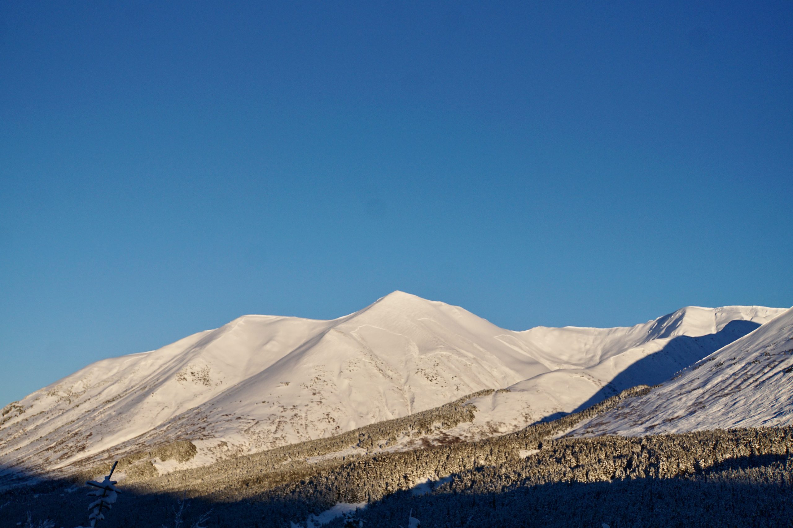
And if you haven't seen enough of Moose yet, this zoomed out photo shows you the extent of slabs as viewed from Colorado
Several smaller crowns on the SW aspect of Spirit Walker
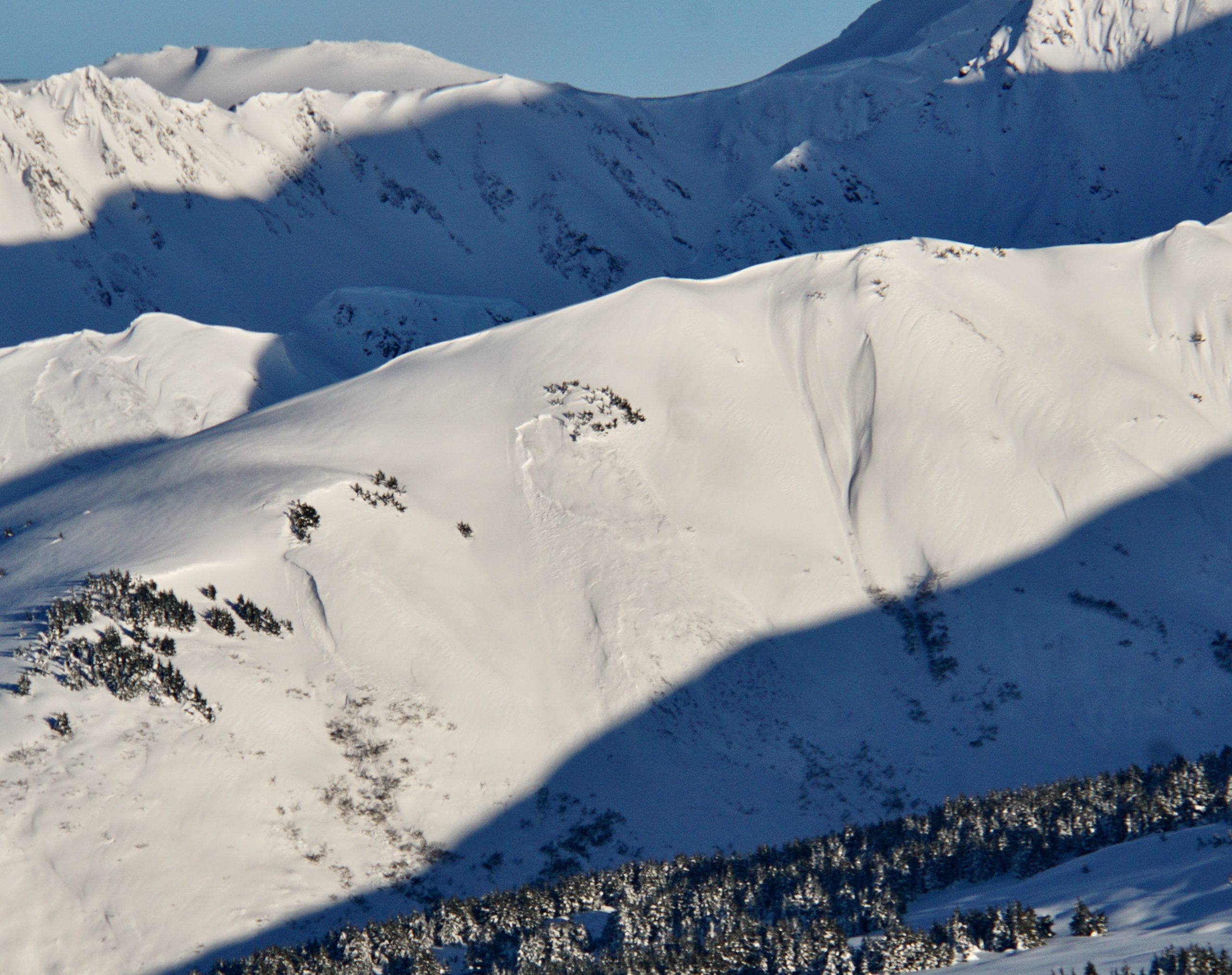
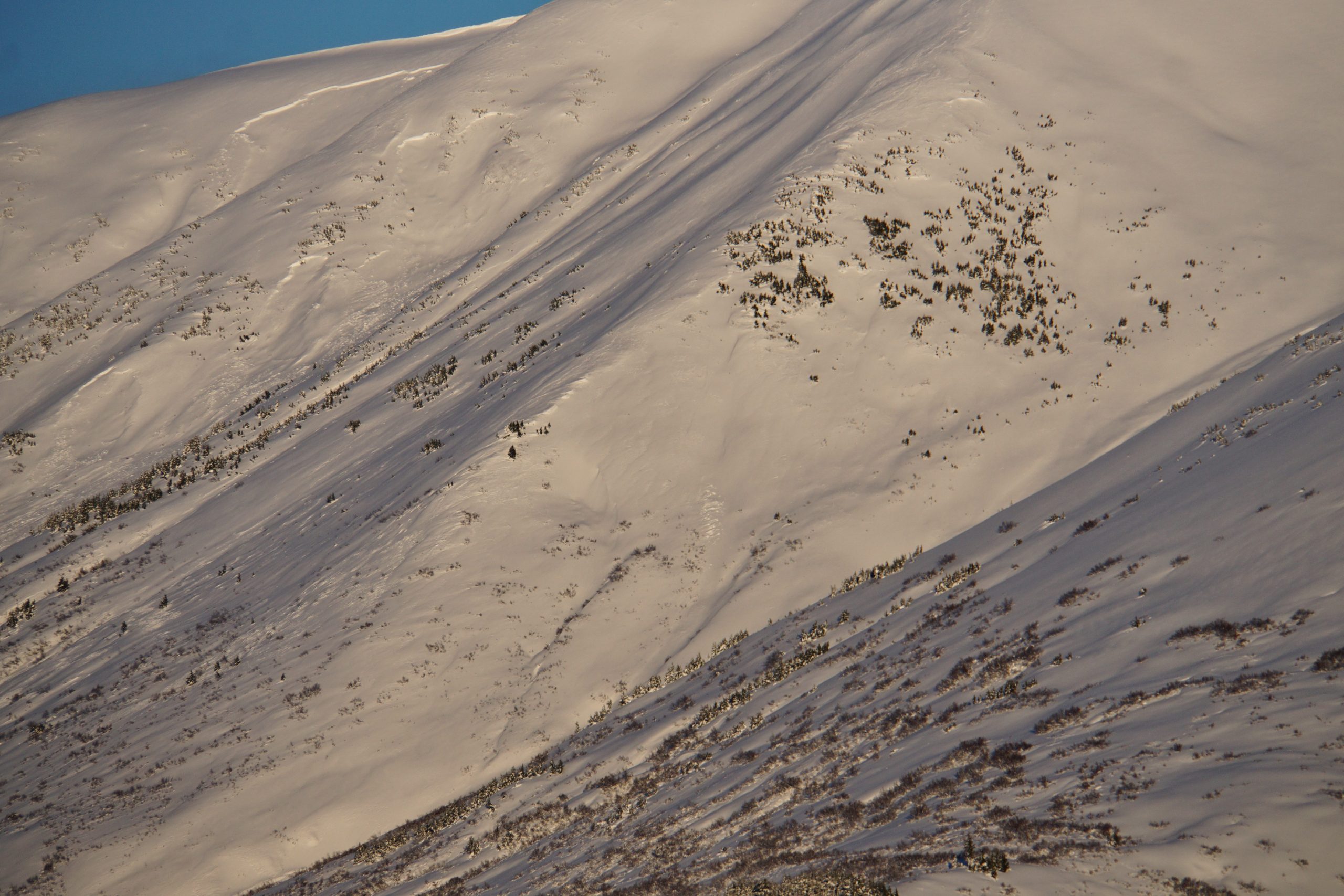
This is a good example of a treeline-ish D1.5 - D2, which were present on a lot of the mountains/variety of aspects on the eastern side of the highway.